
This page is the day by day forecast
page for the Okie-TX Star Party
constructed and forecasted by John Ensworth
(Meteorologist and Astronomer)
The event runs from September 21st - September 28 , 2003 with details at www.okie-tex.com .
Updated : 08/05/2006 17:25:25 (CDT - 24hr clock)
Click
Refresh to get the latest Forecast.
![]()
NOTE: I am recording a nightly forecast at my cell phone # 405-250-4250 ending Sept 27th.
The Discussion:
TONIGHT! The increasing clouds overnight is holding in the forecast. The early evening (after the winds calm down right after sunset) could be very nice. You may get some good observing in through midnight (through holes and the like). The seeing will be pretty good and the winds very calm.
If it clouds up after midnight, then you can get some sleep before the big drive home.
THE DRIVE HOME: Expect a good chance of storms as the day progresses on Sunday. The showers will extend mainly from SE Colorado, NW New Mexico and the entire Texas and Oklahoma panhandles.
Please email me your observing conditions logs. I'd like to compare what really happened to what was forecast so I can make it even more accurate next year. Thanks! johnensworth@startrek.net .
Have FUN out there!
The
Forecast for the next 1.5 days (cloud cover, seeing, and transparency)
Black
Mesa Oklahoma (Kenton, OK)
Click ON the picture below, then the HOUR and PROPERTY
(Cloud Cover, Transparency, Seeing) to see a FUTURE map of the property in
question.

The above forecast is provided by www.pobox.com/~clearskyclock
| Which Night (that PM to next morning) |
In Brief | Forecast (Cloud Cover, Seeing, Transparency are on a 10 pt scale ---> 10= GREAT, 1 = AWFUL ) |
Excellent, Great, Good, Fair, Poor | Winds (where they are coming from) | Low (5am) | High (4pm) | |
| Sun Sept 21 | Partly Cloudy with a chance of a thunderstorm lingering from the afternoon. There is a 20% chance of rain in the afternoon and evening. | Great to Excellent | Winds Light changing to the west/ northwest from the SE around midnight. | 49 | 79 | ||
| 6-9pm | 20% cloud cover,62F, ESE Winds at 6mph | ||||||
| Cloud Cover= 8 Seeing=5 Transparency=6 | |||||||
| 9-12am | 10% cloud cover,55F, North Winds at 1mph | ||||||
| Cloud Cover= 8 Seeing=6 Transparency=7 | |||||||
| 12a-3am | 5% cloud cover,50F, North Winds at 1mph | ||||||
| Cloud Cover= 7 Seeing=7 Transparency=6 | |||||||
| 3-6am | 5% cloud cover, 49F, N. Winds 1mph | ||||||
| Cloud Cover= 7 Seeing=7 Transparency=8 | |||||||
| Mon Sept 22 | then |
Mainly Clear overnight until after midnight = approaching cirrus | Excellent
becoming Good to only Fair |
SE winds, light with gusts changing
to S and light.
SW winds picking up before dawn |
52 | 77 | |
| 6-9pm | 5% cloud cover,62F, SE Winds at 8 G to 10 | ||||||
| Cloud Cover= 9 Seeing=3 Transparency=7 | |||||||
| 9-12am | 20% cloud cover,56F, SE Winds at 6 mph | ||||||
| Cloud Cover= 9 Seeing=4 Transparency=7 | |||||||
| 12a-3am | 45% cloud cover,55F, S Winds at 6 G to 10 | ||||||
| Cloud Cover= 8 Seeing=5 Transparency=4 | |||||||
| 3-6am | 80% cloud cover,52F, SSW Winds a 10 G 16 | ||||||
| Cloud Cover= 9 Seeing=7 Transparency=2 | |||||||
| Tue Sept 23 |
 becoming |
Cirrus from Hurricane Marty
will continue to overspread the area through midnight and maybe
beyond. Starting cloudy, then slowly clearing by dawn, windy and mild. Some persistent cirrus all the time. This should be the warmest night of the week. |
Great or Good |
Strong Southwest winds becoming northwest by dawn | 50 | 86 | |
| 6-9pm | 45% cloud cover,70F, SSW Winds at 16 G to 28mph | ||||||
| Cloud Cover= 5 Seeing=3 Transparency=3 | |||||||
| 9-12am | 25% cloud cover,65F, SW Winds at 14 G to 20mph | ||||||
| Cloud Cover= 6 Seeing=5 Transparency=3 | |||||||
| 12-3am | 17% cloud cover,60F, W Winds at 13 G to 19mph | ||||||
| Cloud Cover= 7 Seeing=7 Transparency=4 | |||||||
| 3-6am | 5% cloud cover, 53F, NW Winds at 13 G to 18mph | ||||||
| Cloud Cover= 9 Seeing=7 Transparency=8 | |||||||
| Wed Sept 24 | |
Northeast to North winds and quite light, turning west by morning, still light | 44 | 78 | |||
| Mostly Clear, nearly calm, cooler toward morning (a fast temp drop) (Some clouds moving through in the early morning hours). | |||||||
| 6-9pm | 35% cloud cover, 63F, NE Winds at 6 G to 14mph | ||||||
| Cloud Cover = 5 Seeing = 7 Transparency = 5 | |||||||
| 9-12am | 75% cloud cover, 58F, ENE Winds at 5 G to 9mph | ||||||
| Cloud Cover = 4 Seeing = 7 Transparency = 5 | |||||||
| 12-3am | 80% cloud cover, 48F, N Winds at 3mph | ||||||
| Cloud Cover = 3 Seeing = 8 Transparency = 5 | |||||||
| 3-6am | 85% cloud cover, 43F, W Winds at 2mph | ||||||
| Cloud Cover = 3 Seeing = 9 Transparency = 3 | |||||||
| Thur Sept 25 | Mainly Clear and chilly | Great to Excellent | S then SW to W winds strong and not too gusty | 53 | 78 | ||
| 6-9pm | 0% cloud cover, 70F, S Winds at 10 G to 21mph | ||||||
| Cloud Cover = 9 Seeing = 7 Transparency = 8 | |||||||
| 9-12am | 10% cloud cover, 68F, SW Winds at 10 G to 14mph | ||||||
| Cloud Cover = 8 Seeing = 8 Transparency = 8 | |||||||
| 12-3am | 5% cloud cover, 60F, W Winds at 10 G to 14mph | ||||||
| Cloud Cover = 9 Seeing = 9 Transparency = 9 | |||||||
| 3-6am | 0% cloud cover, 54F, W Winds at 11 G to 14mph | ||||||
| Cloud Cover = 10 Seeing = 10 Transparency = 9 | |||||||
| Fri Sept 26 | Mainly Clear | Excellent then becoming only Great | Light Northeast then N winds not too strong | 45 | 81 | ||
| 6-9pm | 5% cloud cover, 73F, NE Winds at 7mph G to 15 | ||||||
| Cloud cover = 8 Seeing = 5 Transparency = 8 | |||||||
| 9-12am | 10% cloud cover, 55F, N Winds at 7G to 10mph | ||||||
| Cloud cover = 8 Seeing = 6 Transparency =7 | |||||||
| 12-3am | 5% cloud cover, 51F, N Winds at 4mph | ||||||
| Cloud cover = 9 Seeing = 7 Transparency = 6 | |||||||
| 3-6am | 20% cloud cover, 45F, N Winds at 3mph | ||||||
| Cloud cover = 7 Seeing = 9 Transparency = 6 | |||||||
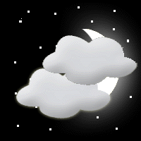
| Sat Sept 27 | becoming 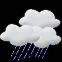 |
Partly Cloudy with clouds increasing. A chance of showers after 4am. (Snow not far away in South-central Colorado!) Turning cooler for Sunday. | Great becoming Poor | East then N winds not very strong (becoming calm after sunset) | 42 | 74 | |
| 6-9pm | 15% cloud cover, 63F, E Winds at 8mph G to 14mph | ||||||
| Cloud cover = 8 Seeing = 7 Transparency = 7 | |||||||
| 9-12am | 25% cloud cover, 49F, ENE Winds at 5mph | ||||||
| Cloud cover = 6 Seeing = 8 Transparency = 5 | |||||||
| 12-3am | 65% cloud cover, 45F, N Winds at 3mph | ||||||
| Cloud cover = 3 Seeing = 9 Transparency = 2 | |||||||
| 3-6am | 85% cloud cover, 42F, N Winds nearly calm | ||||||
| Cloud cover = 1 Seeing = 7 Transparency = 1 | |||||||
| Sun Sept 28 (Day only) | 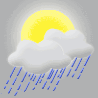 |
Mostly to Partly Cloudy, a 40% chance of a thunderstorm in the morning becoming a 60% chance of thunderstorms by afternoon | n/a (we're closed this evening) | Becoming Calm in the daytime | 44 | 62 | |
Current Conditions AND The National Weather Service Forecast (click it) ----
>

And from Accuweather.com http://wwwa.accuweather.com/adcbin/public/hbh_local.asp?zipcode=&partner=accuweather&whent=18&whend=1
![]()
For tonight's cloud cover (best after 3pm) ONLY see: UCAR - RUC Cloud Forecast Loop
The Current Infrared Satellite View
The Future Satellite View
The Following Frames are the Clouds Forecast
out 12 hours from the first frame time.
This is the same product as is in the UCAR RUC Cloud Forecast Loop above.
To know the time - subtract 5 hours (in daylight time =
summer) from the valid "xxxx" UTC time.
Remember to hop back to the night before (date wise) when you cross midnight
0000 UTC as you subract.
To know the time - subtract 5 hours (in daylight time =
summer) from the valid "xxxx" UTC time.
Remember to hop back to the night before (date wise) when you cross midnight
0000 UTC as you subract.
To know the time - subtract 5 hours (in daylight time =
summer) from the valid "xxxx" UTC time.
Remember to hop back to the night before (date wise) when you cross midnight
0000 UTC as you subract.
To know the time - subtract 5 hours (in daylight time =
summer) from the valid "xxxx" UTC time.
Remember to hop back to the night before (date wise) when you cross midnight
0000 UTC as you subract.
To know the time - subtract 5 hours (in daylight time =
summer) from the valid "xxxx" UTC time.
Remember to hop back to the night before (date wise) when you cross midnight
0000 UTC as you subract.
To know the time - subtract 5 hours (in daylight time =
summer) from the valid "xxxx" UTC time.
Remember to hop back to the night before (date wise) when you cross midnight
0000 UTC as you subract.
To know the time - subtract 5 hours (in daylight time =
summer) from the valid "xxxx" UTC time.
Remember to hop back to the night before (date wise) when you cross midnight
0000 UTC as you subract.
Disclaimer:
My confidence in the forecast beyond 3 days into the future is only moderate. Remember,
this is a place that is NOT very carefully handled by the meteorological
community since no one is out there - relatively speaking! (Compare it to
the East Coast!)