Back To Home
The Story Behind the Weather - By Forecaster John
Ensworth M.S. -
The Discussion of Weather Events Daily for Philadelphia and Pennsylvania
Last updated: 02/11/2004 02:19 PM
Good Afternoon Philadelphia!
I'm glad to announce that these
discussions will continue until at least the end of February
(it's a short month)!
I
have the necessary server space (especially with missed days!).
In short: Very quiet and not too cold weather will remain the rule through the beginning of the weekend. Then a dry but vaguely familiar slam of cold air returns.
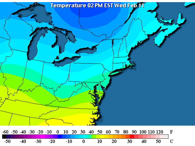
In the Long: The temperatures now aren't too bad, we are in the upper 30'sF this afternoon under...
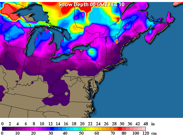
...clear skies. The white you can see in Pennsylvania is the snow cover. How do I know?
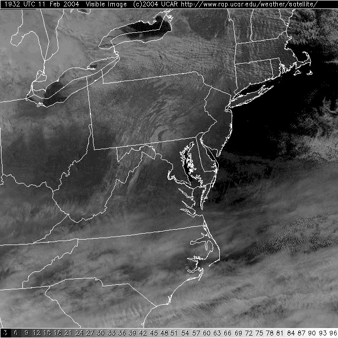
The snow reports show some of this, but we can also check the other satellite view...
The infrared satellite view shows a complete lack of clouds in Pennsylvania outside of the extreme northwest corner. You can even see the temperatures warming around Philadelphia (deeper orange colors).
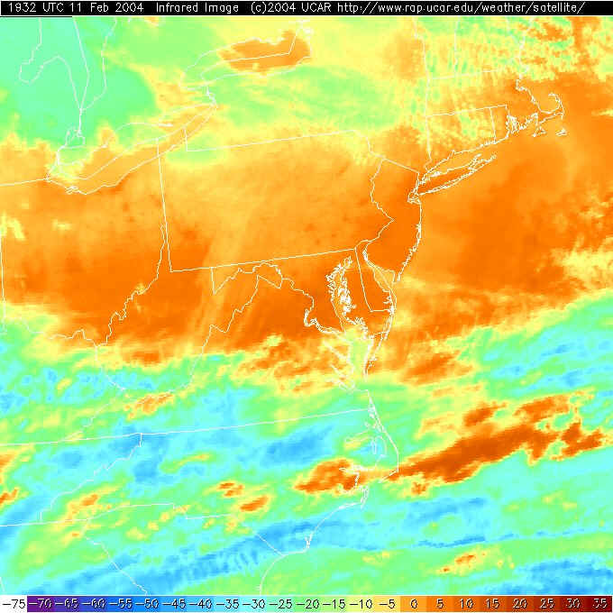
All this clearing is happening under the High pressure system moving in from the west. Again, we don't have any fronts or storm systems directly effecting our happy homes.
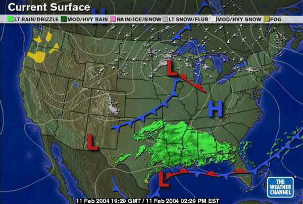
In the future, the Low down in the Gulf States will travel eastward and off the coast (by Thursday 1pm). We are just on the north edge of the rain/snow shield as it passes.
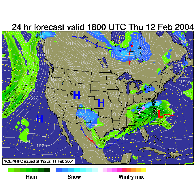
By Thursday night, 7pm, a weak semi-trough/ front like thing swings out of the northwest bringing in a bit cooler weather and kicking off some snow flurries.
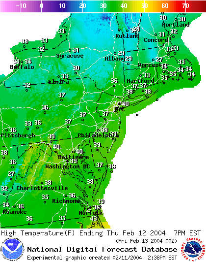
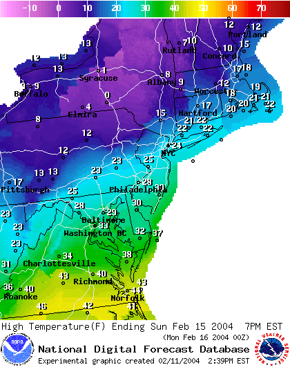
The high temperatures Thursday afternoon will only be in the mid 30's F.
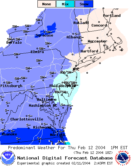
And for 1pm Thursday, the National Weather Service is calling for a mix of snow, rain and ice.
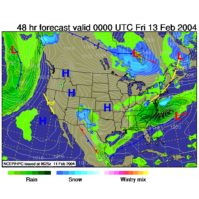
The next shot of cold air is behind the front up in Canada on the last surface map above. It swings down towards Philadelphia starting Sunday morning. You can see the core of negative temperatures hitting New York State and leaking into northern Pennsylvania.
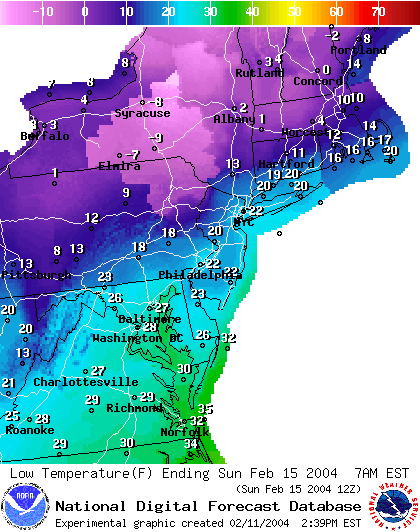
Sunday's high will only be 28F ish.
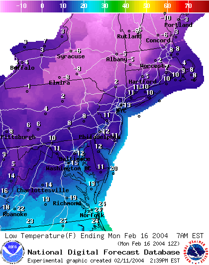
And for Monday morning, we drop to the lower 10's F for lows with wide spread single digit temperatures across Pennsylvania.
Winter isn't over, just enjoy the warmth and breaks when you get them!
I'll see you Thursday afternoon...
Meteorologist John Ensworth
Surface Station sky cover color key:
Flight category definitions:| Category | Ceiling | Visibility | |
|---|---|---|---|
| Low Instrument Flight Rules LIFR* (magenta circle |
below 500 feet AGL | and/or | less than 1 mile |
| Instrument Flight Rules IFR (red circle |
500 to below 1,000 feet AGL | and/or | 1 mile to less than 3 miles |
| Marginal Visual Flight Rules MVFR (blue circle) |
1,000 to 3,000 feet AGL | and/or | 3 to 5 miles |
| Visual Flight Rules VFR+ (green circle) |
greater than 3,000 feet AGL | and | greater than 5 miles |
| *By definition, IFR is ceiling less than 1,000 feet
AGL and/or visibility less than 3 miles while LIFR
is a sub-category of IFR. +By definition, VFR is ceiling greater than or equal to 1,000 feet AGL and visibility greater than or equal to 3 miles while MVFR is a sub-category of VFR. |
|||