Back To Home
The Story Behind the Weather - By Forecaster John
Ensworth M.S. -
The Discussion of Weather Events Daily for Philadelphia and Pennsylvania
Last updated: 02/14/2004 11:18 AM
Good Afternoon Philadelphia!
I'm glad to announce that these
discussions will continue until at least the end of February
(it's a short month)!
I
have the necessary server space (especially with missed days!).
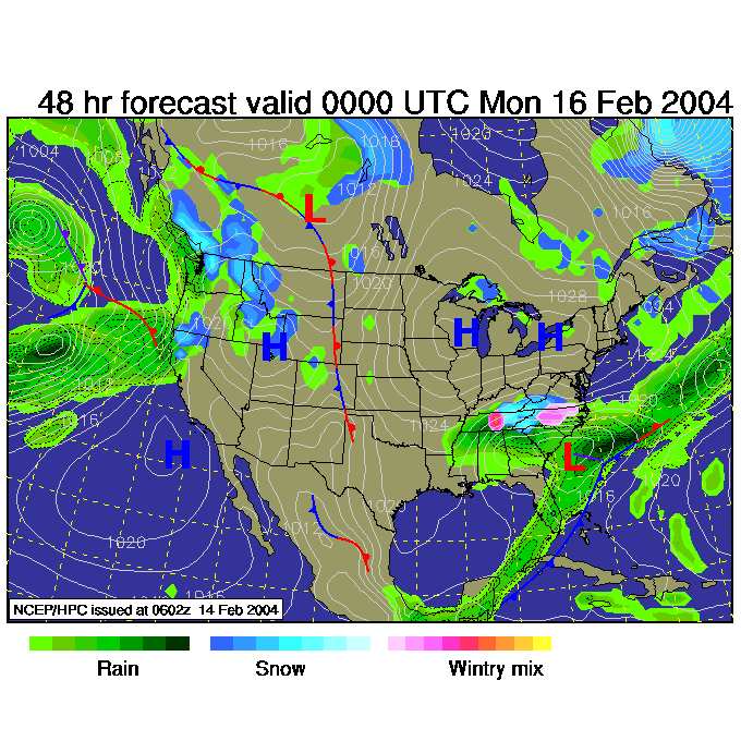
In short: The quiet weather continues, but a slap of cold is just beginning to hit us. The bigger picture is still quite valid from yesterday's discussion, so go check that out if you missed it yesterday (and it refers to the day before it as well).
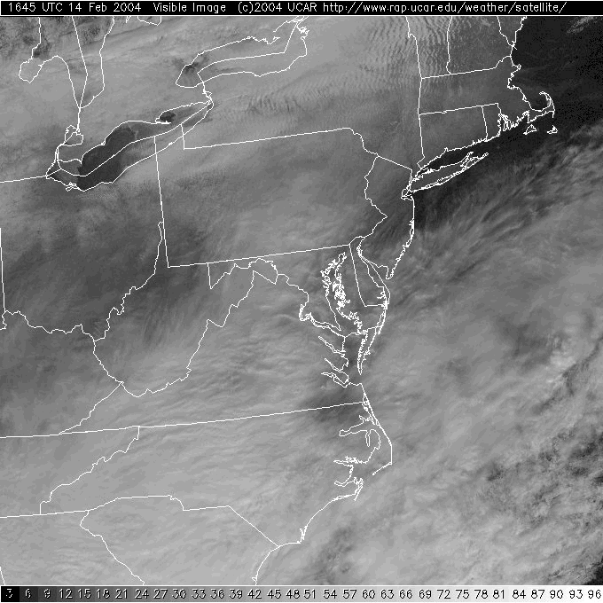
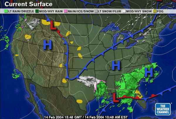
In the Long: Skies are partly cloudy with some moisture lifted by the approaching front. The main story is that front and it's cold air...
The current shot of arctic air is racing into Texas but is also sliding through the Great Lakes towards us.
Looking at the forecast highs today, you can see where the front is expected to be by the end of the day... much further south!
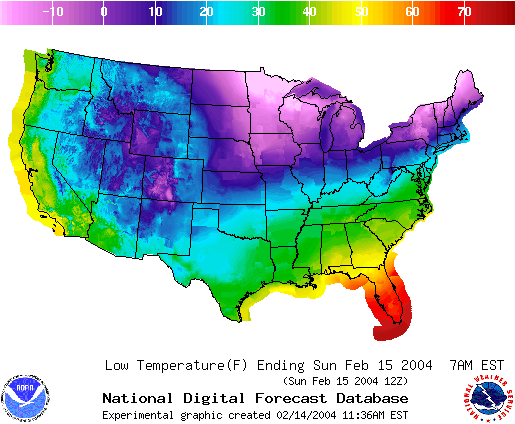
By Sunday morning, the front has pressed deep into the south (keeping the rain and snow at bay) and the center of the really cold air slides into Minnesota and noses over towards Pennsylvania and New York.
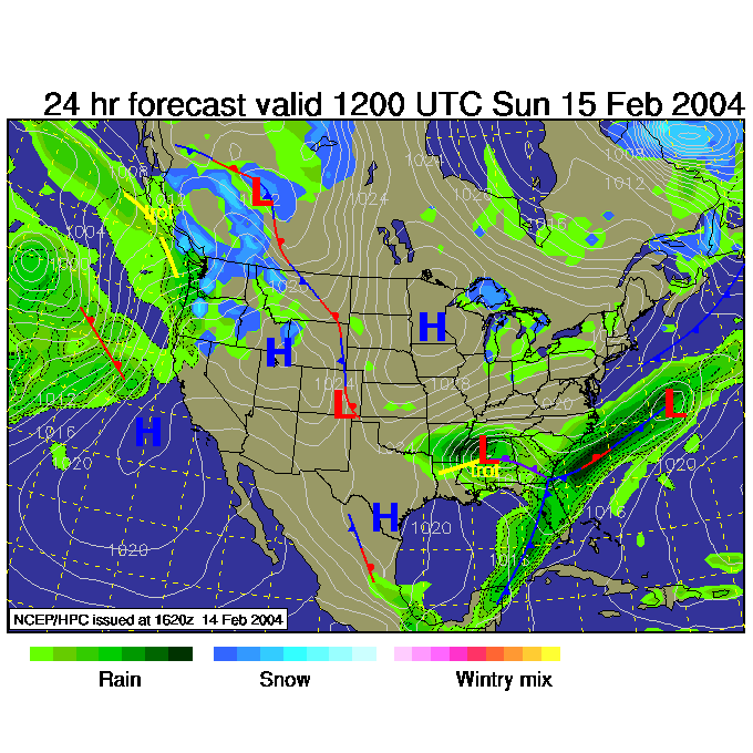
Sunday night and the front is way down in the Gulf of Mexico and heading into the south Atlantic. The high continues to build into the Lakes and our home. Brrrr.
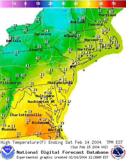
Looking at the highs and lows over the next couple of days shows this cold invasion. We'll hit a HOT 45F today.
Then we sink to the mid 20'sF tonight with below zero temperatures just to our north.
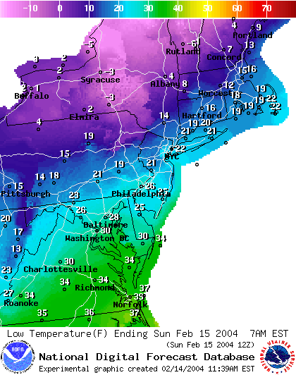
We hardly break freezing on Sunday with near zero temperatures for highs up north.
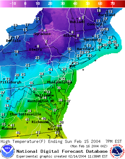
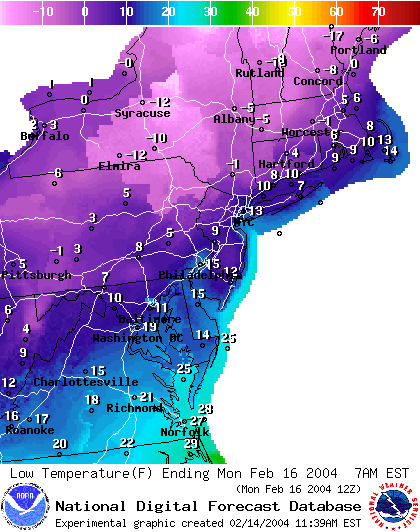
The lows Monday morning will plunge to 10-15F in Philadelphia.
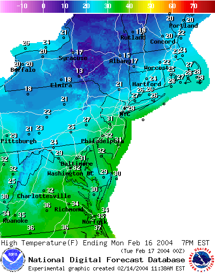
Then...as quick as it came... it begins to leave. The high on Monday is still near freezing...
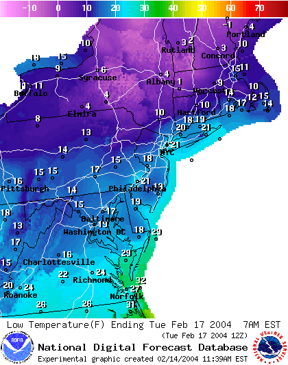
And our lows climb 10F to near 20F for Tuesday morning.
Stay warm and wait for spring...it will come someday!
Meteorologist John Ensworth
Surface Station sky cover color key:
Flight category definitions:| Category | Ceiling | Visibility | |
|---|---|---|---|
| Low Instrument Flight Rules LIFR* (magenta circle |
below 500 feet AGL | and/or | less than 1 mile |
| Instrument Flight Rules IFR (red circle |
500 to below 1,000 feet AGL | and/or | 1 mile to less than 3 miles |
| Marginal Visual Flight Rules MVFR (blue circle) |
1,000 to 3,000 feet AGL | and/or | 3 to 5 miles |
| Visual Flight Rules VFR+ (green circle) |
greater than 3,000 feet AGL | and | greater than 5 miles |
| *By definition, IFR is ceiling less than 1,000 feet
AGL and/or visibility less than 3 miles while LIFR
is a sub-category of IFR. +By definition, VFR is ceiling greater than or equal to 1,000 feet AGL and visibility greater than or equal to 3 miles while MVFR is a sub-category of VFR. |
|||