Back To Home
The Story Behind the Weather - By Forecaster John
Ensworth M.S. -
The Discussion of Weather Events Daily for Philadelphia and Pennsylvania
Last updated: 02/20/2004 11:28 AM
Good Afternoon Philadelphia!
I'm glad to announce that these
discussions will continue until at least the end of February
(it's a short month)!
I
have the necessary server space (especially with missed days!).
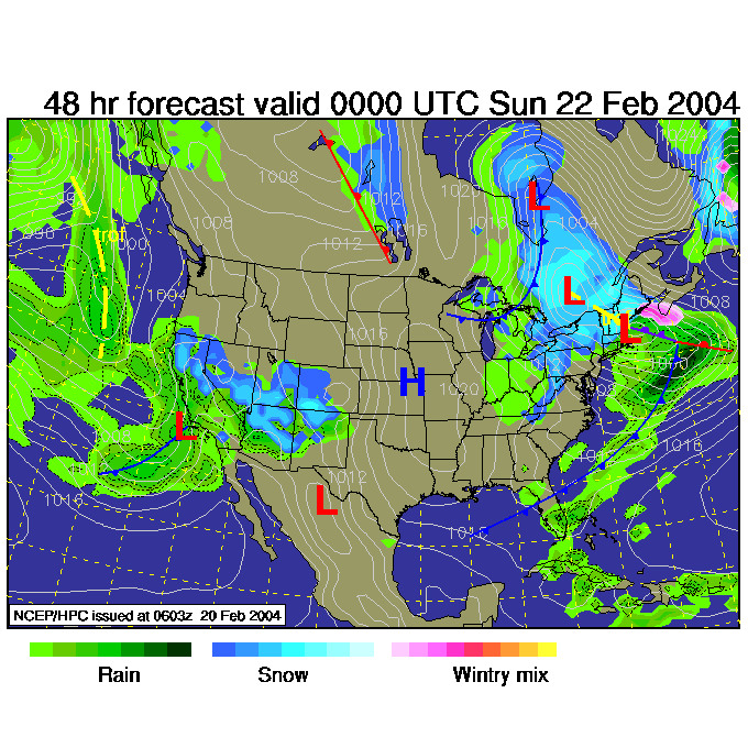
In short: The low now near Chicago is still on it's way for tomorrow... after that, nice and nice.
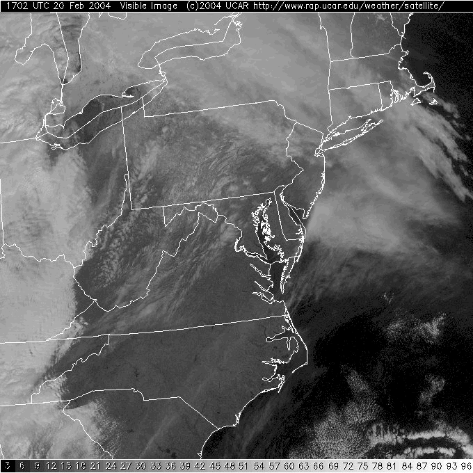
In the Long: The visible satellite view this morning shows mostly clear skies and some cirrus in Pennsylvania. Again, some of the white sharp features on this picture in our state is really snow on the higher elevation hills and mountains. The thick clouds with the next system are still out in Ohio.
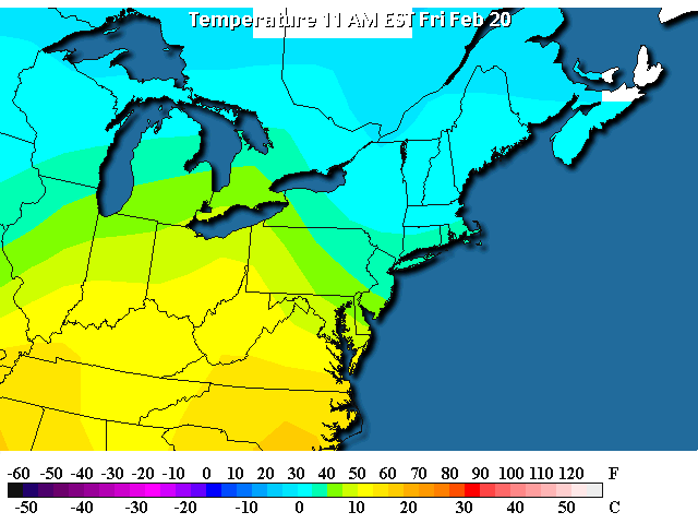
Temperatures are in the very very warm upper 40's F with 50's and 60's near by!
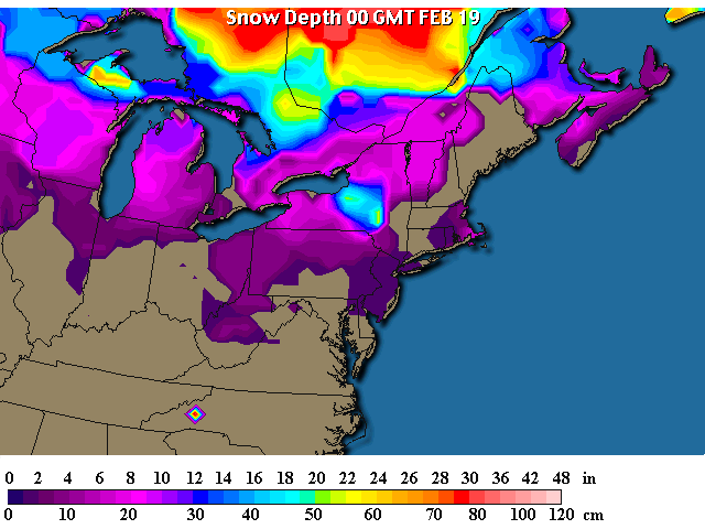
So our state's snow (this snow map is more than 24 hours old) is on the endangered list.
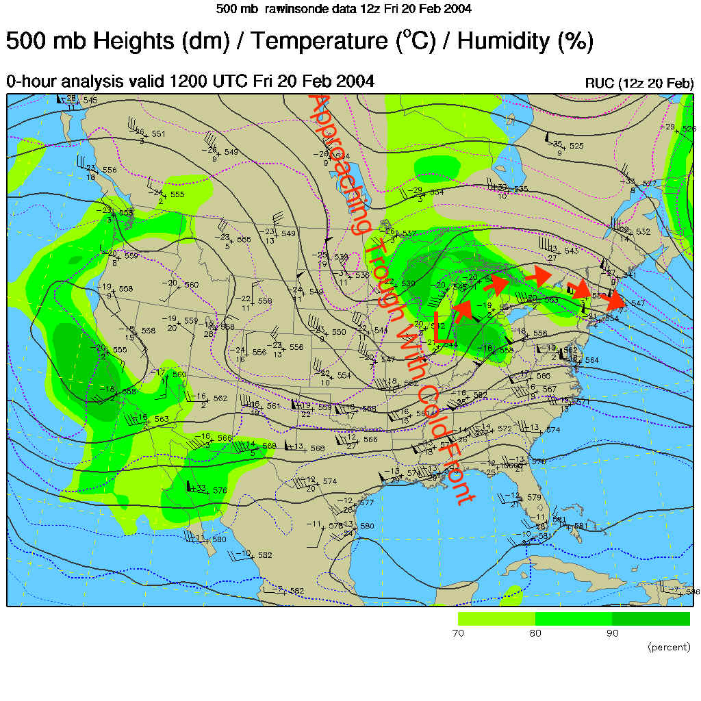
If you look back to yesterday's discussion, (yes, go do it!) you can see how far and fast the low has moved up the 'stream' at 500mb's and is now located in Chicago. A LOT of warmth is streaming up from the Gulf into the eastern US giving us the temperatures seen above.
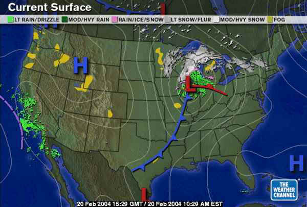
The 500mb map does, indeed, show the winds at about 18,000ft above sea level as they move west to east across the continent. The trough is formed by and moves with the cold air behind the cold front and is moving eastward in the flow (as labeled). The low at the surface is roughly steered by these winds as well so you would expect it to continue it's trip as marked in the short red arrows (again, check yesterday's forecast discussion for part 1 of this tracking).
So the bottom line is the low is coming and a LOT of warm air is coming up with it. So we'll see rain showers begin by 4am tomorrow morning...
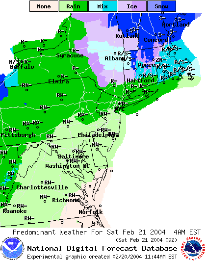
The low turns east and the cold front (not TOO cold though) sweeps over us by 7am Saturday.
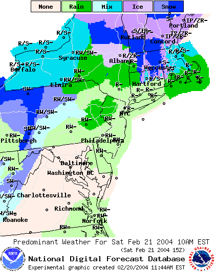
by 10am Saturday, the showers are already on the decrease (with some snow out in the higher western elevations).
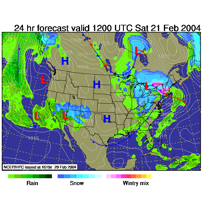
And the first low has moved a bit south of due east and a secondary low and front kick up some additional snow out west and up north west, but we are in the 'dry slot' of the system.
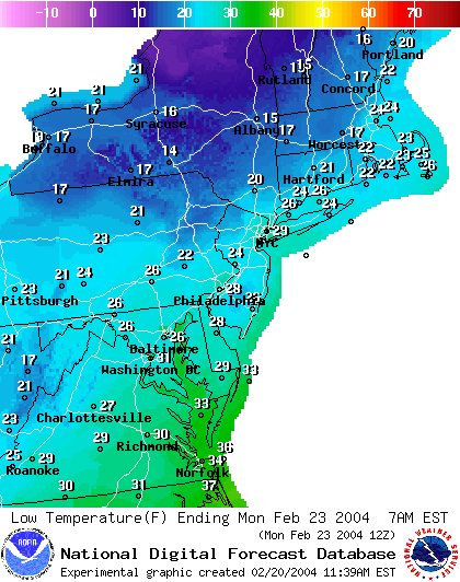
Happily, the coldest air sweeping in only drop us into the upper 20's by Monday morning, and we return to the 40's and 50's for highs quickly.
So unless you are a real weather fan (like me) this is just an ordinary forecast of a few showers and slightly cooler weather in the short term.
I'll return tomorrow- Saturday.. see ya then!
Meteorologist John Ensworth
Surface Station sky cover color key:
Flight category definitions:| Category | Ceiling | Visibility | |
|---|---|---|---|
| Low Instrument Flight Rules LIFR* (magenta circle |
below 500 feet AGL | and/or | less than 1 mile |
| Instrument Flight Rules IFR (red circle |
500 to below 1,000 feet AGL | and/or | 1 mile to less than 3 miles |
| Marginal Visual Flight Rules MVFR (blue circle) |
1,000 to 3,000 feet AGL | and/or | 3 to 5 miles |
| Visual Flight Rules VFR+ (green circle) |
greater than 3,000 feet AGL | and | greater than 5 miles |
| *By definition, IFR is ceiling less than 1,000 feet
AGL and/or visibility less than 3 miles while LIFR
is a sub-category of IFR. +By definition, VFR is ceiling greater than or equal to 1,000 feet AGL and visibility greater than or equal to 3 miles while MVFR is a sub-category of VFR. |
|||