Back To Home
The Story Behind the Weather - By Forecaster John
Ensworth M.S. -
The Discussion of Weather Events Daily for Philadelphia and Pennsylvania
Last updated: 02/27/2004 04:10 PM
Good Afternoon Philadelphia!
I'm glad to announce that these
discussions will continue until at least the end of February
(it's a short month)!
I
have the necessary server space (especially with missed days!).
In short: Clear skies and warming temperatures harbor in a Spring like weekend. Oh MAN will it be nice.
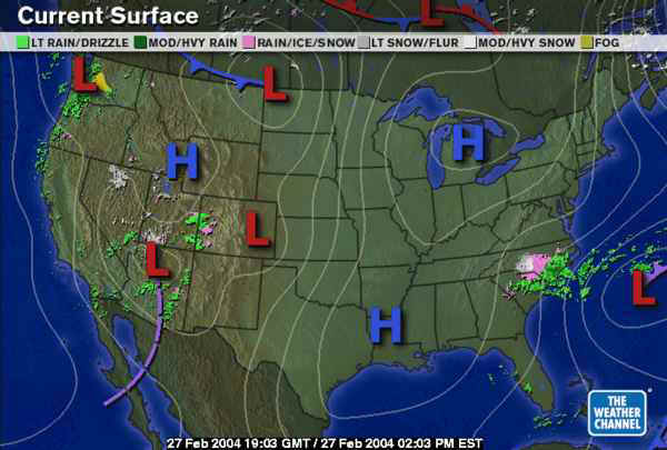
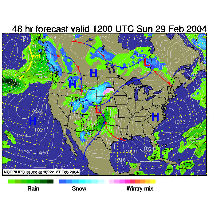
In long: Hurray for a high. The system to the southeast is off the coast and a bit of Nor'Easter like weather continues to pound the Carolinas.
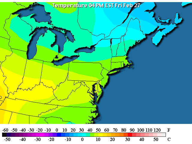
But WE are in the clear. How clear are we?
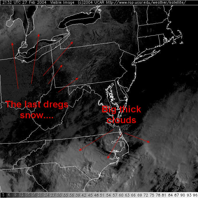
So clear, you can see the residual snow on the ground around the lakes and in Pennsylvania. I've labeled the snow regions. The darker spots in the snow are dense trees and smaller lakes. You can still see some snow on the higher elevations in central PA. Way down south are the big white reflective clouds with that storm system.
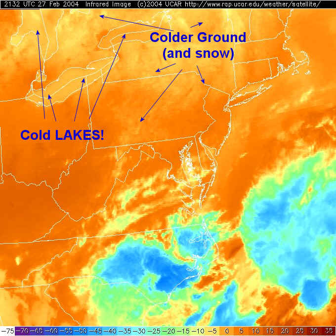
In the infrared satellite view (where you are seeing TEMPERATURE, with reds as warm and blues as cold) Ohio, West Virginia, Kentucky etc. are getting warm! The Great Lakes are finally COLDER than the surrounding ground (even much of the snow covered ground). Cold ground and snow is visible up in New York. The clouds with the Carolina storms are deep (tall) and have very cold tops. Like our ground used to be!
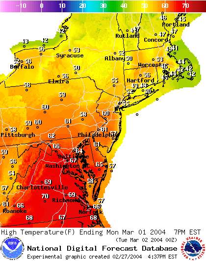
So here is the future... the red line shows the ever climbing temperature over the weekend! We'll be in the 50's Saturday and near 60F Sunday.
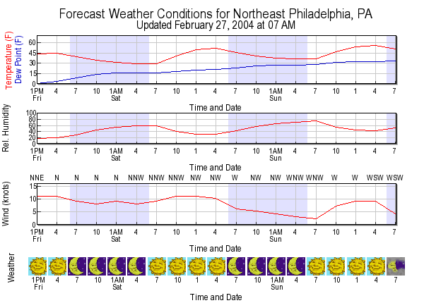
You can see the heat slipping in on an west-east tongue poking into southern PA.
The forecast 500mb map showing the steering winds at about 18,000feet above sea level shows a big FAT ridge over us by Sunday morning.
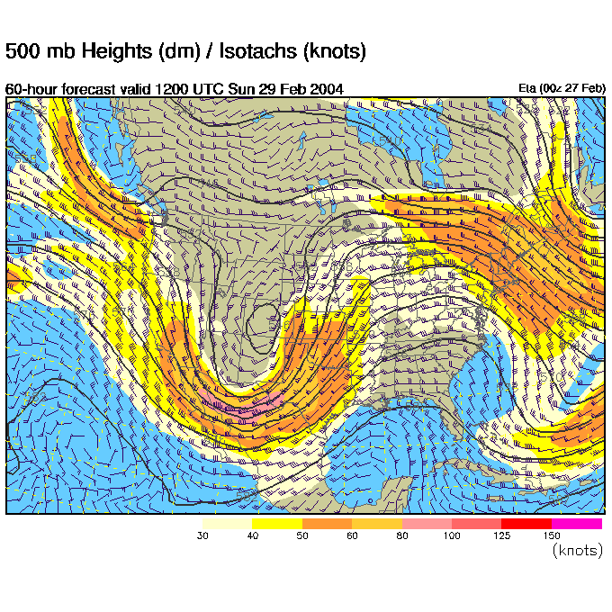
This is sustaining a big High over the entire eastern US.
And temperatures by Monday climb into the unbelievably warm lower 60's. Oh how nice!
What a GREAT weekend is coming!
I'll see you again Saturday! No, on the other hand, I
need to save server space to make it through April/May and you need to go out
and PLAY.
The weather is quiet... I'll be back Monday!!!
Now get out there and jog, hike, play!!!
Meteorologist John Ensworth
Surface Station sky cover color key:
Flight category definitions:| Category | Ceiling | Visibility | |
|---|---|---|---|
| Low Instrument Flight Rules LIFR* (magenta circle |
below 500 feet AGL | and/or | less than 1 mile |
| Instrument Flight Rules IFR (red circle |
500 to below 1,000 feet AGL | and/or | 1 mile to less than 3 miles |
| Marginal Visual Flight Rules MVFR (blue circle) |
1,000 to 3,000 feet AGL | and/or | 3 to 5 miles |
| Visual Flight Rules VFR+ (green circle) |
greater than 3,000 feet AGL | and | greater than 5 miles |
| *By definition, IFR is ceiling less than 1,000 feet
AGL and/or visibility less than 3 miles while LIFR
is a sub-category of IFR. +By definition, VFR is ceiling greater than or equal to 1,000 feet AGL and visibility greater than or equal to 3 miles while MVFR is a sub-category of VFR. |
|||