Back To Home
The Story Behind the Weather - By Forecaster John
Ensworth M.S. -
The Discussion of Weather Events Daily for Philadelphia and Pennsylvania
Last updated: 02/02/2004 09:51 PM
Good Afternoon Philadelphia!
I'm glad to announce that these
discussions will continue until at least the end of February
(it's a short month)!
I
have the necessary server space (especially with missed days!).
In short: The next storm is moving in quickly and things will fall apart by the morning drive, but warmer temperatures will keep the snow at a minimum and will instead drop ice and rain.
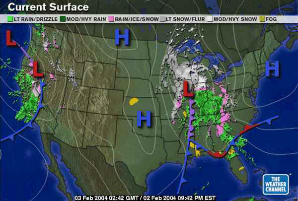
In the Long: The surface map shows the next system loaded and dumping. It has a good flow of Gulf moisture entrained in it and a moderate amount of cold air behind it. A lot of rain is falling ahead of the front with ice around the edges and snow to the north (and northwest). And is moving east quickly!
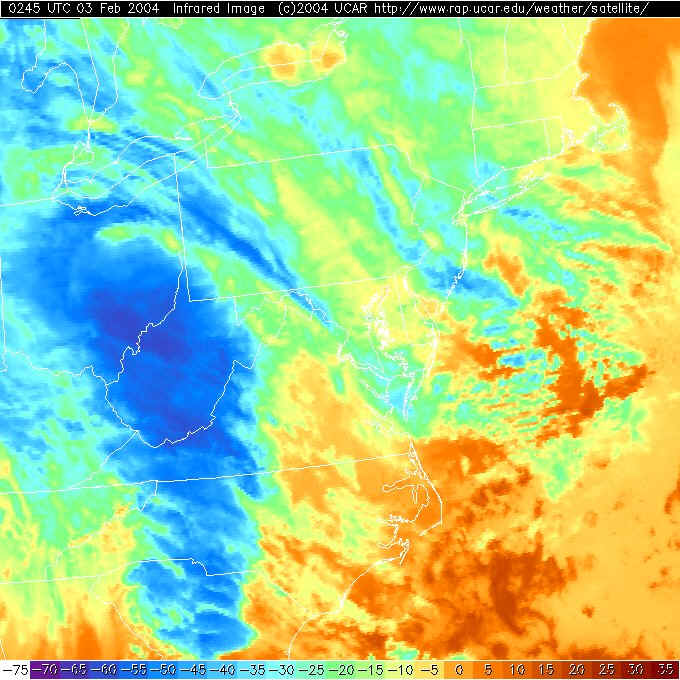
The infrared satellite view is showing the high cold clouds associated with the heavy rain (and snow) as dark blue. The clouds are already spreading over Philadelphia. So as this moves in, the clouds will thicken tonight (oddly, trapping some warmth near the ground keeping the low warmer than it has been in a very long time).
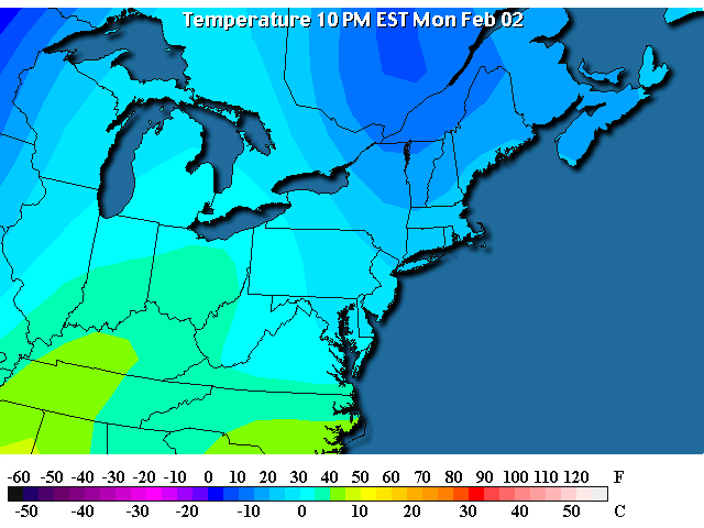
And the temperatures tonight are only in the 30'sF near Philadelphia...
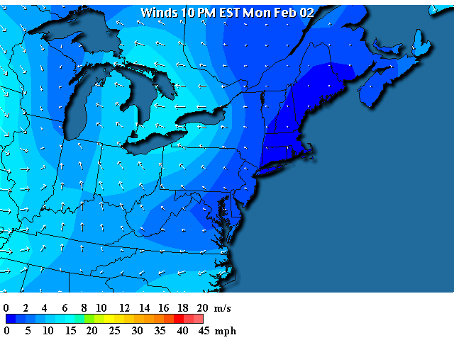
And south/ southeast winds are brining in more moist and relatively warm air.
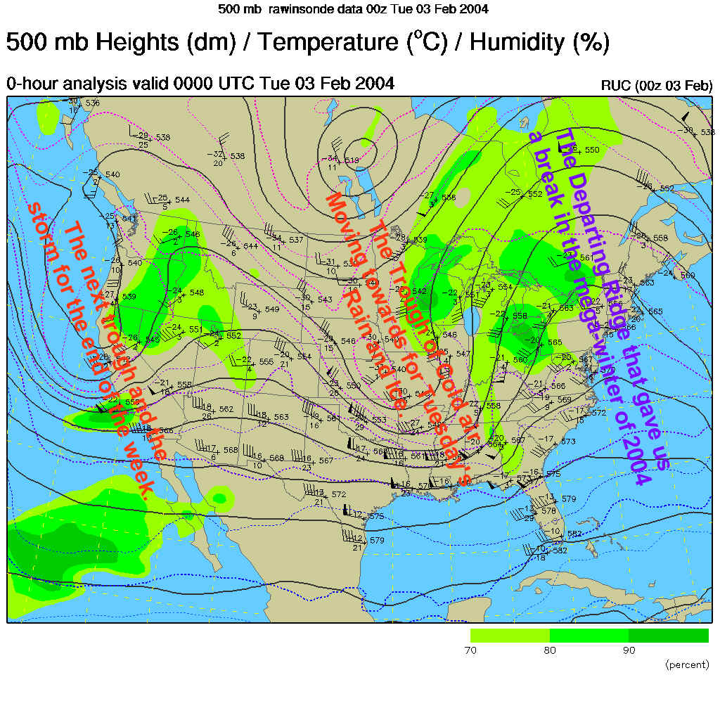
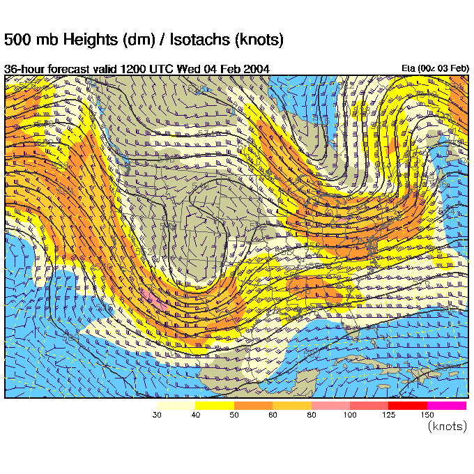
The 500mb map (showing winds as they blow parallel to the dark lines mainly west to east across the US at about 18,000feet where the atmospheric pressure is 1/2 what it is at sea level) shows the ridge (labeled in purple text) that warmed us up and gave us a break in the weather moving (sadly) off to the east and a relatively thin trough (hence a short trough, or short wave - therefore a quick moving trough) is tearing out of the midwest to the east. Out on the west coast is the trough that will be this weekend's storm.
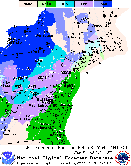
So breaking it down, by 7am, a mix of snow and ice will hit Philadelphia making the drive time rough...
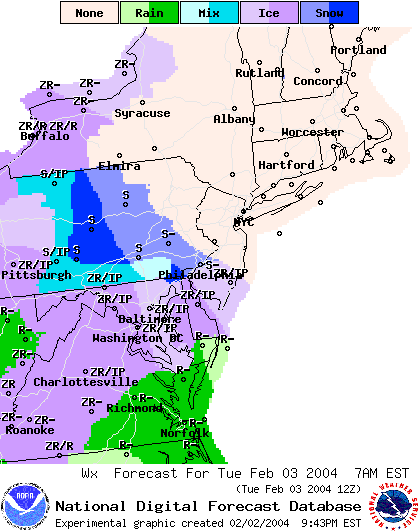
Then by 10am, we'll see ice and maybe a bit of rain mixed in (as temperatures warm).
The big picture at that time shows the low passing and the dominance of rain around the system (the really cold air is absent in the east now).
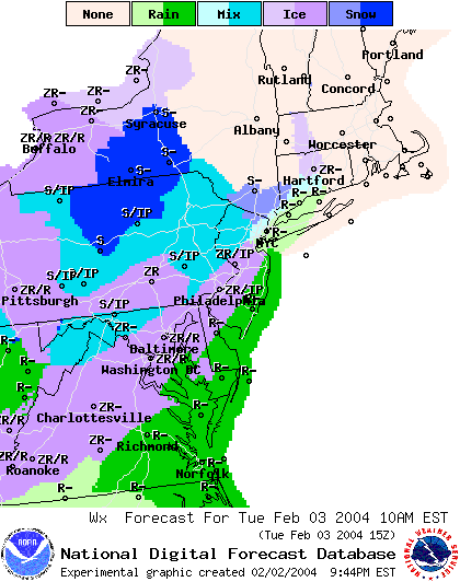
By 1pm, we should see the ice changing quite solidly to rain.
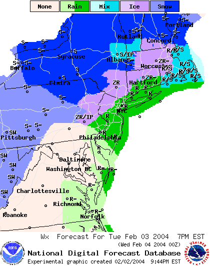
Then, by 7pm, dry air begins to push in cutting off the precipitation while what is falling is still rain. This is a bit opposite from what we've seen (rain first then snow later). The snow will remain out west and north of Philadelphia.
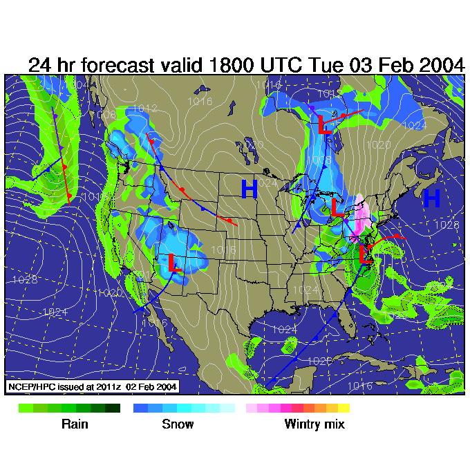
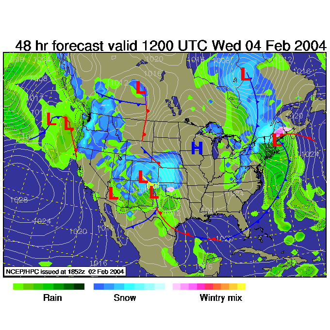
For Wednesday 7am, that mid-west trough is passing us and lifting northward, while the west coast trough digs deeply into the southwest.
At that time, the dry air remains near Philadelphia while the tail end of a cold front kicks up some snow in the western part of the state.
Drive safely tomorrow/today! I'll see you later on Tuesday!
Meteorologist John Ensworth
Surface Station sky cover color key:
Flight category definitions:| Category | Ceiling | Visibility | |
|---|---|---|---|
| Low Instrument Flight Rules LIFR* (magenta circle |
below 500 feet AGL | and/or | less than 1 mile |
| Instrument Flight Rules IFR (red circle |
500 to below 1,000 feet AGL | and/or | 1 mile to less than 3 miles |
| Marginal Visual Flight Rules MVFR (blue circle) |
1,000 to 3,000 feet AGL | and/or | 3 to 5 miles |
| Visual Flight Rules VFR+ (green circle) |
greater than 3,000 feet AGL | and | greater than 5 miles |
| *By definition, IFR is ceiling less than 1,000 feet
AGL and/or visibility less than 3 miles while LIFR
is a sub-category of IFR. +By definition, VFR is ceiling greater than or equal to 1,000 feet AGL and visibility greater than or equal to 3 miles while MVFR is a sub-category of VFR. |
|||