Back To Home
The Story Behind the Weather - By Forecaster John
Ensworth M.S. -
The Discussion of Weather Events Daily for Philadelphia and Pennsylvania
Last updated: 03/28/2004 12:41 AM
Good Afternoon Philadelphia!
I'm glad to announce that these
discussions will continue until at least the end of February
(it's a short month)!
I
have the necessary server space (especially with missed days!).
In short: Nice weather for a couple of days, then a week of rain and showers.
In long: Welcome back to the forecast discussion. I hop back in on a quiet weekend, but nothing stays quiet for long. Let's catch up first...
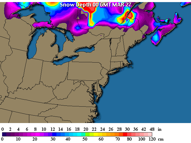
Well, can we say winter is finally gone? The snow pack is in Canada and northern Maine only. That's a good sign of spring.
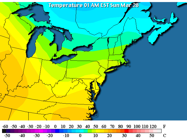
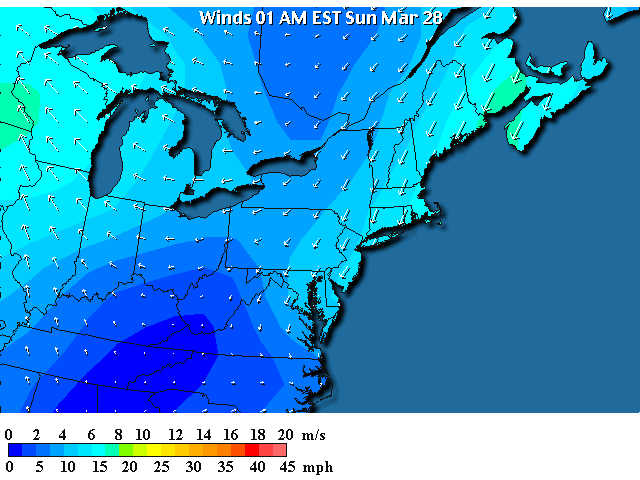
The temperatures behind our latest front are in the 40's this late evening/early morning. That's good and warm!
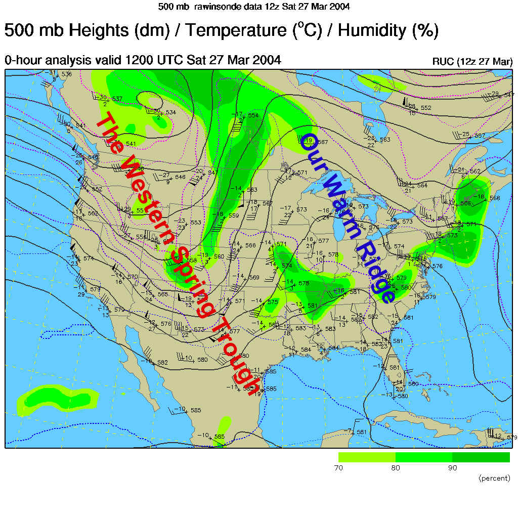
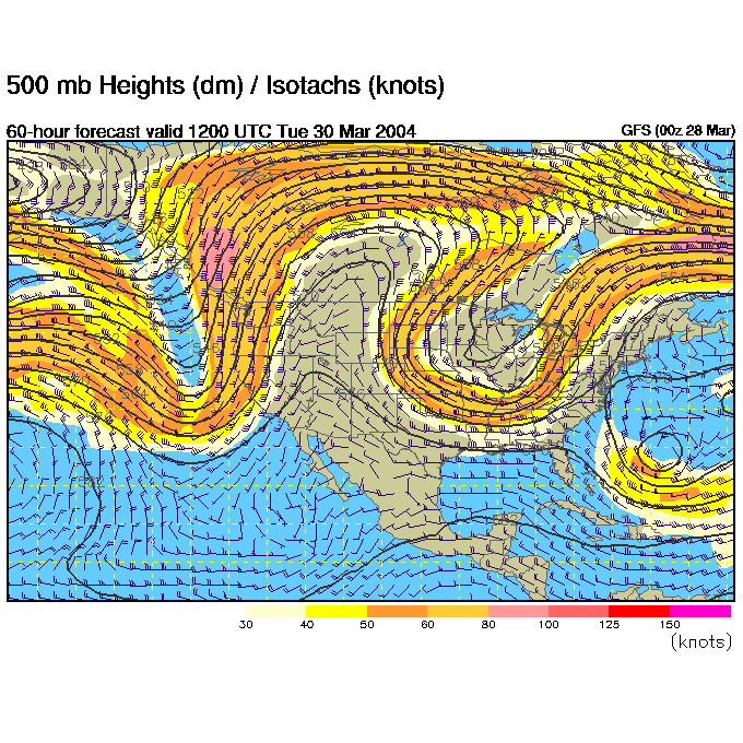
This warmth is due to the eastern ridge visible in the 500mb pattern shown below. This shows how the winds are blowing parallel to the dark black lines west to east across the continent at about 18,000 feet or 1/2 the way up in the atmosphere (according to pressure). The right side of a ridge is a good place to look for fair weather.
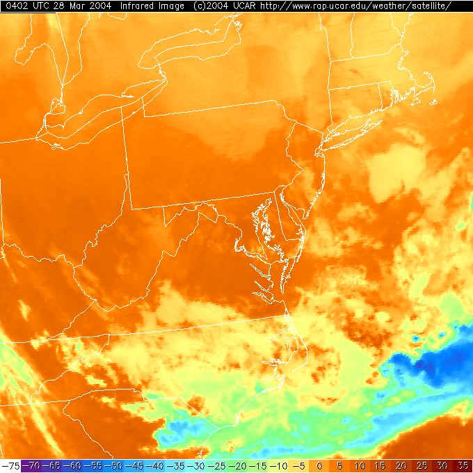
The infrared satellite view shows the temperature of surfaces the satellite sees. Warm temperatures are coded red while very cold and high altitude ice crystal clouds are colored blue. There is some cooler air sinking into the northern and central part of the state as visible in lighter orange color.
That colder air is filtering in from the northeast on winds behind the front shown in the next map. The good news is that even cold north air is only in the 40's at night. Woohoo!
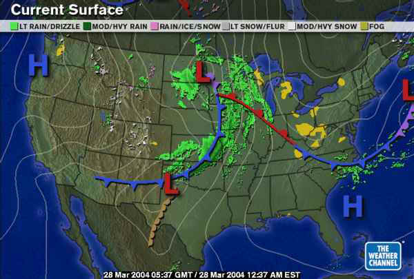
The surface map shows the leading edge of that northeast flowing air as a cold front to our south. The big front in the Plains is our next storm.
By Monday morning, that front begins to march our way.
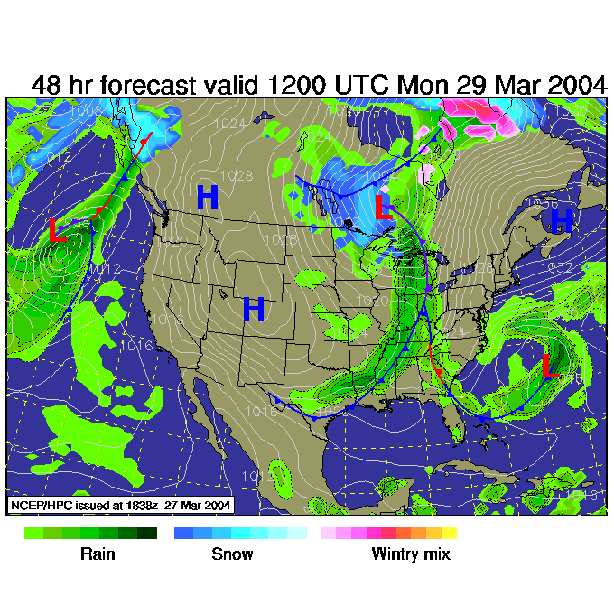
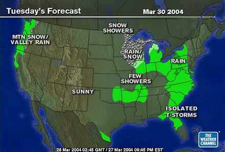
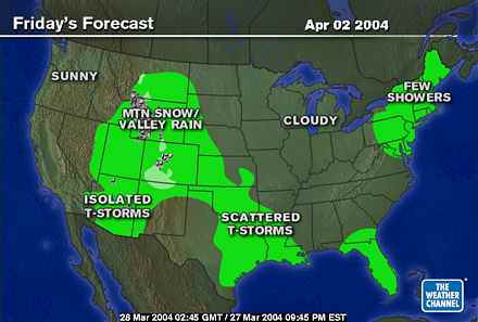
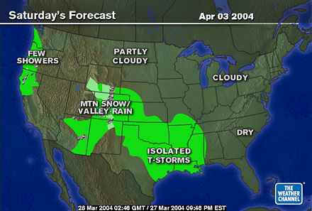
On the Weather Channel maps, the rain (and northern snow) stretches from Minnesota to Florida.
The western trough heads our way brining lift and storminess on it's right side.
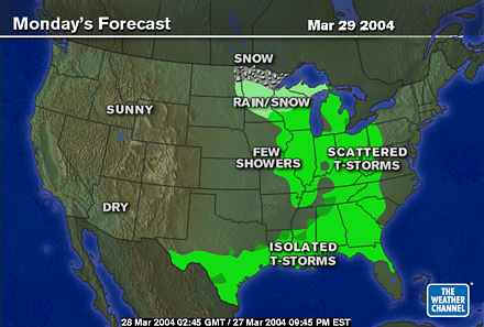
Tuesday sees the rain arrive with that decelerating front.
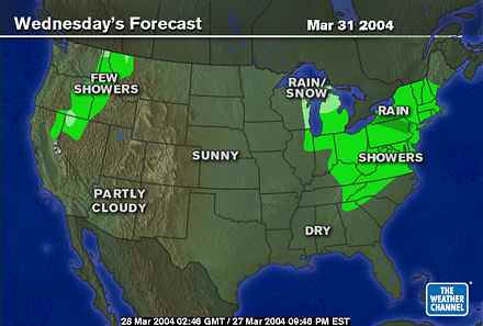
And it continues to dump on us Wednesday...
Thursday...
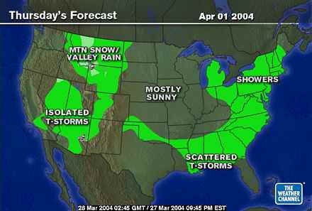
And doesn't being to pull out until Friday.
Happily (if this is true) next weekend will be a return to nice weather again, but more trouble is brewing in the deep south.
Can you find the Noah Umbrella again? Or did it wear out last Spring/Summer?
I'll see you again Monday.
Meteorologist John Ensworth
Surface Station sky cover color key:
Flight category definitions:| Category | Ceiling | Visibility | |
|---|---|---|---|
| Low Instrument Flight Rules LIFR* (magenta circle |
below 500 feet AGL | and/or | less than 1 mile |
| Instrument Flight Rules IFR (red circle |
500 to below 1,000 feet AGL | and/or | 1 mile to less than 3 miles |
| Marginal Visual Flight Rules MVFR (blue circle) |
1,000 to 3,000 feet AGL | and/or | 3 to 5 miles |
| Visual Flight Rules VFR+ (green circle) |
greater than 3,000 feet AGL | and | greater than 5 miles |
| *By definition, IFR is ceiling less than 1,000 feet
AGL and/or visibility less than 3 miles while LIFR
is a sub-category of IFR. +By definition, VFR is ceiling greater than or equal to 1,000 feet AGL and visibility greater than or equal to 3 miles while MVFR is a sub-category of VFR. |
|||