Back To Home
The Story Behind the Weather - By Forecaster John
Ensworth M.S. -
The Discussion of Weather Events Daily for Philadelphia and Pennsylvania
Last updated: 03/29/2004 10:12 AM
Good Afternoon Philadelphia!
I'm glad to announce that these
discussions will continue until at least the end of February
(it's a short month)!
I
have the necessary server space (especially with missed days!).
In short: Chill nights and nice days...ends now. Today will be the last of that good stuff. The rest of the week will be 40's for highs, 40's for lows and showers. Yuck.
In long: We'll do 'opposites' day today. We'll start with the week forecast and THEN look at the current and local conditions...
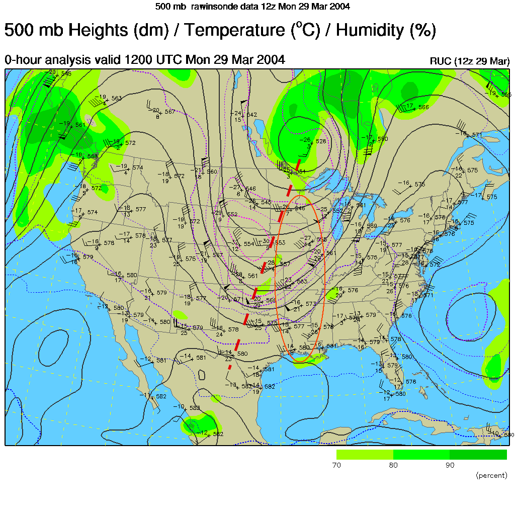
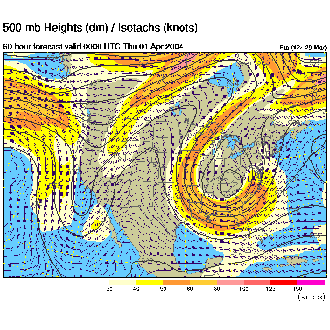
The first map on the roundup today is the 500mb map. This shows winds as they blow mainly from west to east across the continent parallel to the black lines at about 18,000 feet above sea level. This is the 'steering' level for many surface features (like storms).
The big trough in the center of the country is headed our way (red dashed line). Because air is going a bit slower than it should at the bottom of the trough and a bit faster than it should at the top, air is speeding up on the right hand side of the trough. This diverging air draws air from the surface upward lifting moisture into the atmosphere. This is the place (the right side of trough, circled in red) is where you'd expect a low to form, a front to strengthen, and clouds and rain to form.
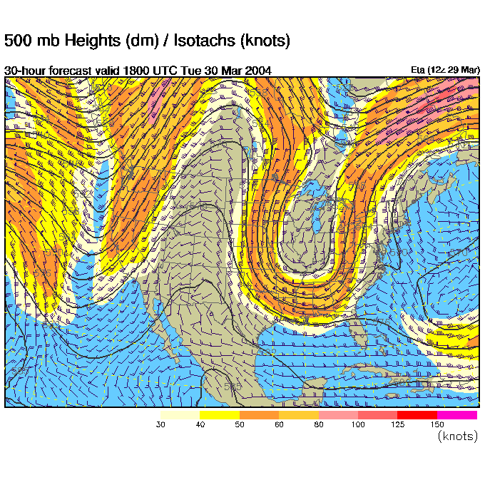
By Tuesday afternoon, that trough is deeper and has moved towards us. WE are in the 'red circle' zone.
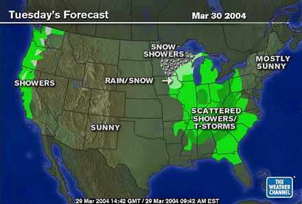
Rain does indeed spread into Pennsylvania by this time.
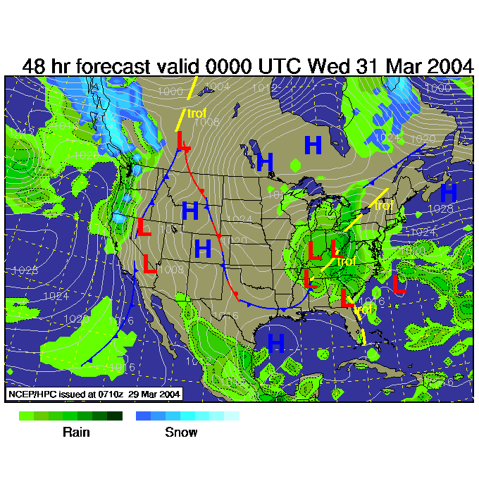
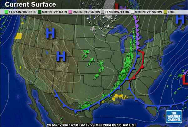
The surface map shows a mess of low pressure heading out of the southern Ohio Valley towards us by Tuesday night.
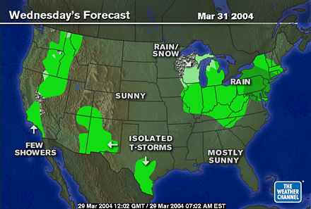
Wednesday dawns with a LOT of water falling from the sky.
And the 500mb pattern shows the deep trough still rolling on our heads.
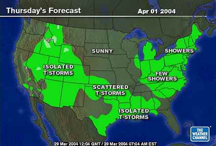
And showers continue into Thursday.
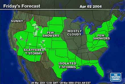
And Friday.
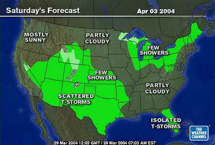
Finally, it weakens Saturday.
Now, to the current state of things here on 'opposites day'. The trough has a gigantic front stretching almost from SE Arizona through the Texas Gulf coast and all the way up into central Canada. The remains of the last front to hit us (from the northeast if you noticed) is still here but down near Florida.
The current radar shows that huge swath of rain and thunderstorms.
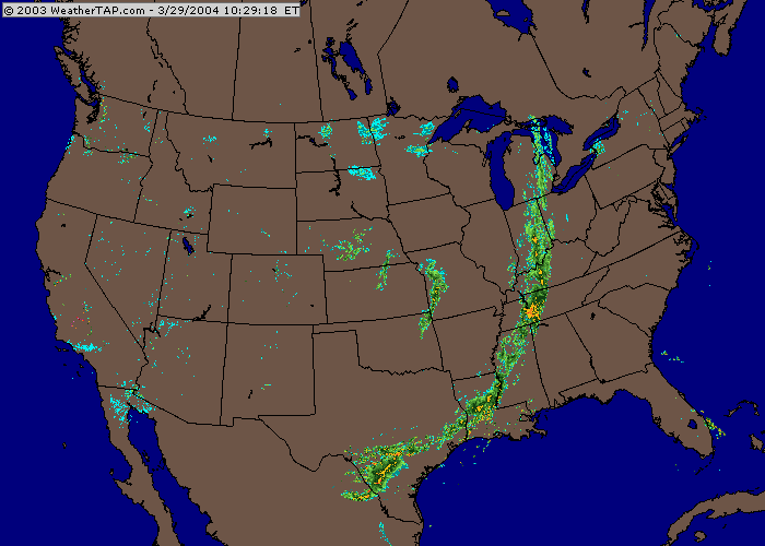
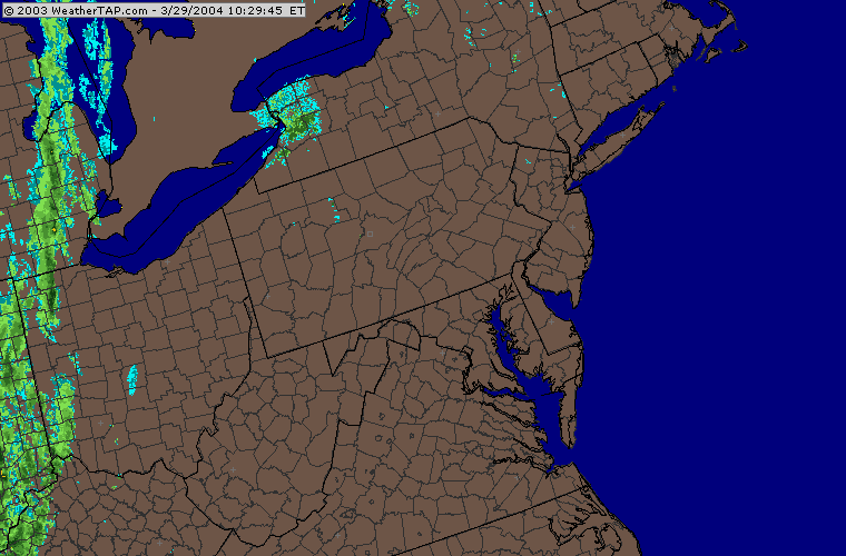
But locally, it's quiet.
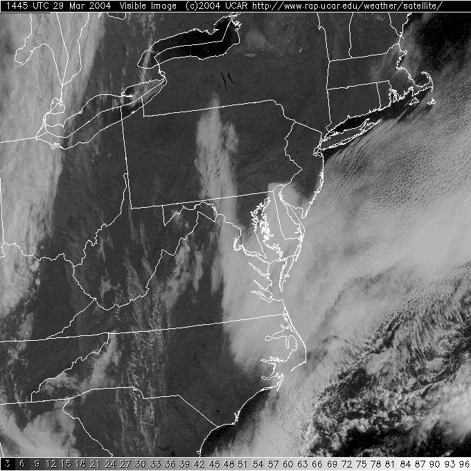
The visible satellite view shows low marine fog and cloudiness seeping in from the south and east but clear skies (mostly) across the rest of the state. The thick band of clouds with the next front are just crossing Ohio to the west.
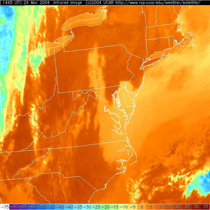
On the infrared satellite view, the land has heated up a lot by this late morning hour. That's why it is colored 'warmly' in reds. The Great Lakes visible to our northwest are cooler than the land and are now a lighter orange color. So is the ocean and low clouds/fog to our east. The clouds coming in on the strong front to the west are quite high and very cold and are colored a blue color.
You have about 24 hours of bliss. Enjoy it!
I'll see you again Tuesday.
Meteorologist John Ensworth
Surface Station sky cover color key:
Flight category definitions:| Category | Ceiling | Visibility | |
|---|---|---|---|
| Low Instrument Flight Rules LIFR* (magenta circle |
below 500 feet AGL | and/or | less than 1 mile |
| Instrument Flight Rules IFR (red circle |
500 to below 1,000 feet AGL | and/or | 1 mile to less than 3 miles |
| Marginal Visual Flight Rules MVFR (blue circle) |
1,000 to 3,000 feet AGL | and/or | 3 to 5 miles |
| Visual Flight Rules VFR+ (green circle) |
greater than 3,000 feet AGL | and | greater than 5 miles |
| *By definition, IFR is ceiling less than 1,000 feet
AGL and/or visibility less than 3 miles while LIFR
is a sub-category of IFR. +By definition, VFR is ceiling greater than or equal to 1,000 feet AGL and visibility greater than or equal to 3 miles while MVFR is a sub-category of VFR. |
|||