Back To Home
The Story Behind the Weather - By Forecaster John
Ensworth M.S. -
The Discussion of Weather Events Daily for Philadelphia and Pennsylvania
Last updated: 03/05/2004 07:18 PM
Good Afternoon Philadelphia!
I'm glad to announce that these
discussions will continue until at least the end of February
(it's a short month)!
I
have the necessary server space (especially with missed days!).
In short: With temperatures staying unusually warm, rain returns off and on, through the weekend. This still holds!
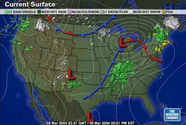
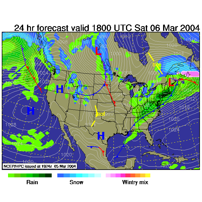
In long: The surface map shows the departing rain ahead of the warm front that is about to hit. The next batch of rain is still in the Mississippi and southern Ohio valley. The low outran the surface features to some extent and the low is relatively precipitation free. Notice the cold front sliding down into the Dakotas and Montana. This is another important feature for us!
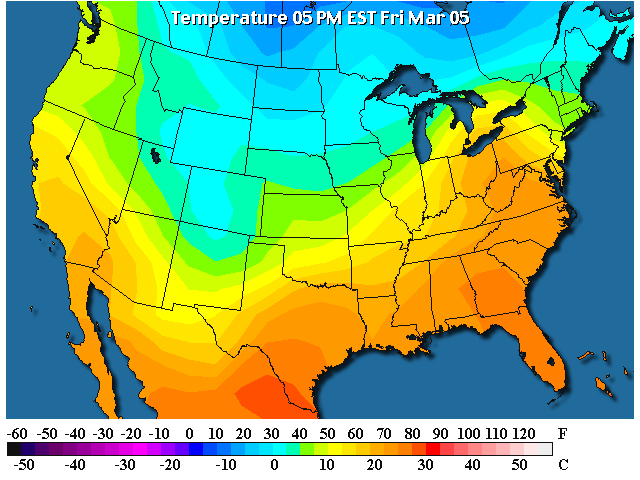
Look at how much warm air (70's F +) is streaming up the east coast. What a nice change.
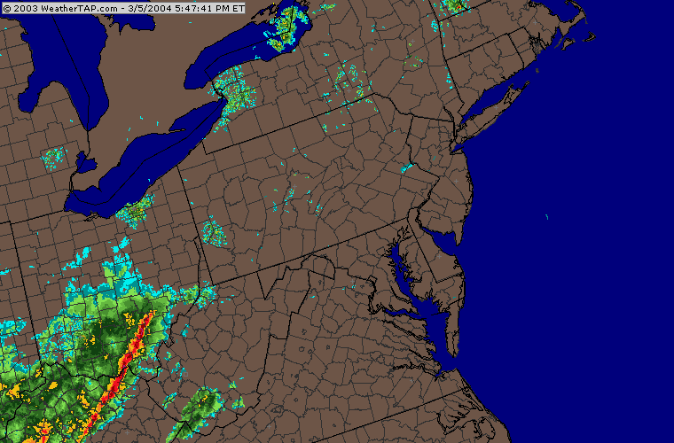
The radar is showing a knife sharp line of thunderstorms sliding up through southern Ohio...
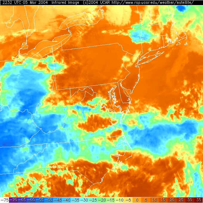
Yesterday's cirrus cleared and new cloudiness with the Pacific front sliding through Kentucky, Tennessee and Ohio is making the new clouds. We, surprisingly with a warm front on the door, are in the clear! See how the lakes are now colder than the surrounding land. They are a lighter color than the land on this infrared satellite picture.
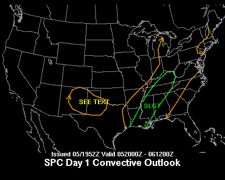
With the front vigorous to the south, a slight risk of severe weather exists almost to W. Virginia. We are within the 'chance of convection' area. We may see some storms as the front approaches, but nothing severe here.
Saturday sees the front hit and rain and wind takes over the nice weather. Sorry, no nice weekend this weekend.
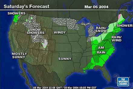
The surface map at 1pm shows the front past us and tons of
cool blustery rain washing Philadelphia clean.
Note the Montana front is sweeping south and a bit east.
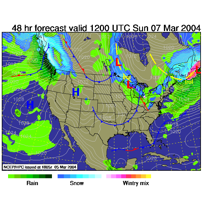
Sunday comes with some more cold air coming in behind our front and the SECOND front sweeping in with more snow in the region (but not here, in Philadelphia).
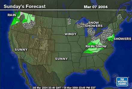
Sunday morning and the Montana front has swept even further east with snows and rains with it. But we'll remain too warm for snow in the city.
Hark! Is that spring that is coming?
Stay dry and I'll see you Saturday.
Meteorologist John Ensworth
Surface Station sky cover color key:
Flight category definitions:| Category | Ceiling | Visibility | |
|---|---|---|---|
| Low Instrument Flight Rules LIFR* (magenta circle |
below 500 feet AGL | and/or | less than 1 mile |
| Instrument Flight Rules IFR (red circle |
500 to below 1,000 feet AGL | and/or | 1 mile to less than 3 miles |
| Marginal Visual Flight Rules MVFR (blue circle) |
1,000 to 3,000 feet AGL | and/or | 3 to 5 miles |
| Visual Flight Rules VFR+ (green circle) |
greater than 3,000 feet AGL | and | greater than 5 miles |
| *By definition, IFR is ceiling less than 1,000 feet
AGL and/or visibility less than 3 miles while LIFR
is a sub-category of IFR. +By definition, VFR is ceiling greater than or equal to 1,000 feet AGL and visibility greater than or equal to 3 miles while MVFR is a sub-category of VFR. |
|||