Back To Home
The Story Behind the Weather - By Forecaster John
Ensworth M.S. -
The Discussion of Weather Events Daily for Philadelphia and Pennsylvania
Last updated: 10/14/2003 05:37 PM
Good Morning Philadelphia!
I'm glad to announce that these discussions will continue until at least the end of October.
Baton down the hatches, here comes a gully washin' house thwaper! Let's see why...
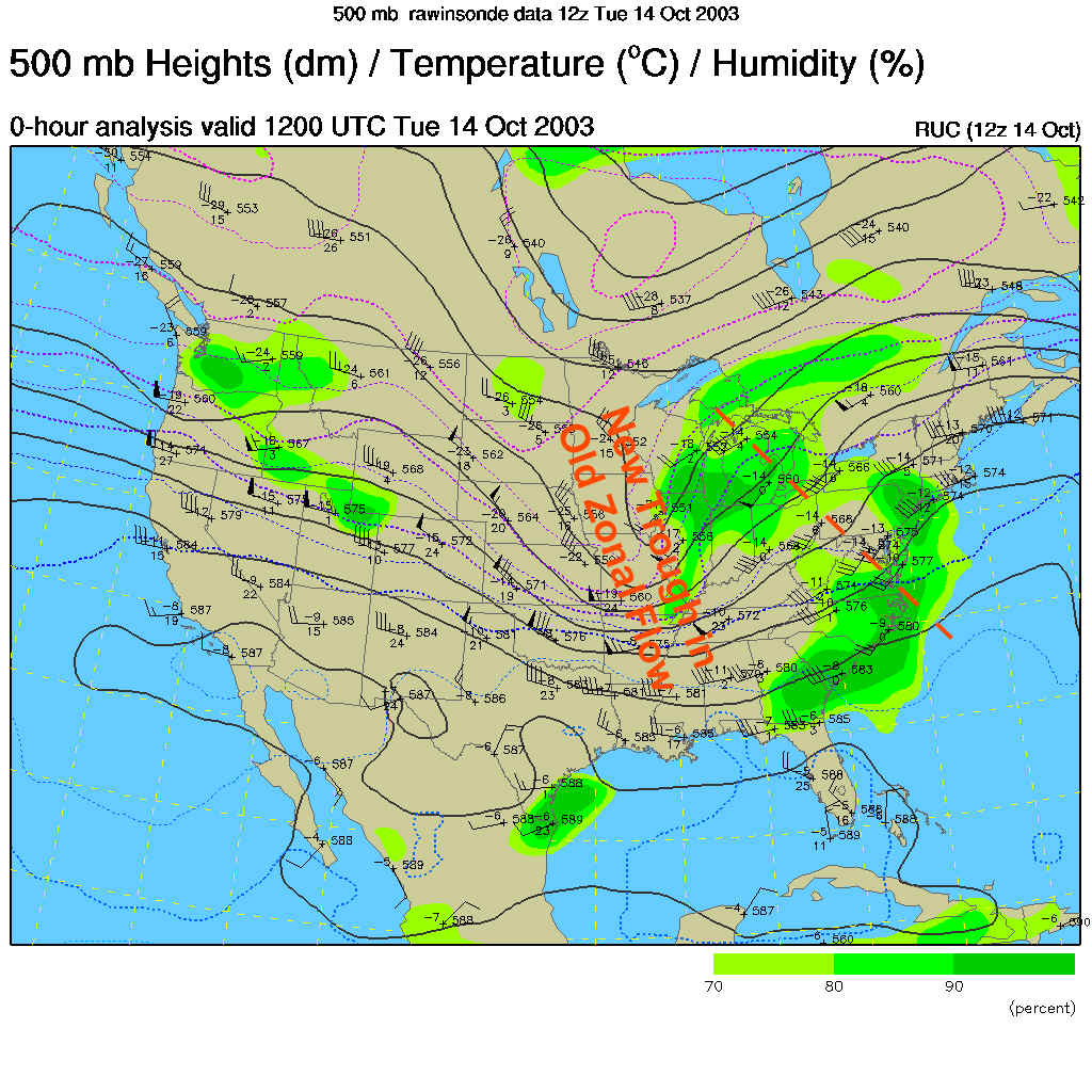
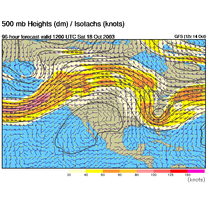
The story today, in addition to the front, is what is all happening aloft. We'll start with the 500mb map (which is the winds at 18,000feet above sea level blowing west to east parallel to the black lines on the map below). Just a day ago, we had pretty darn zonal flow (straight west to east flow), now a new trough has deepened (as labeled below) AND there is a short wave (marked as a dotted red line) moving towards us. We are on the right side of BOTH the 'long wave' trough and the 'short wave' trough. So fireworks are happening!
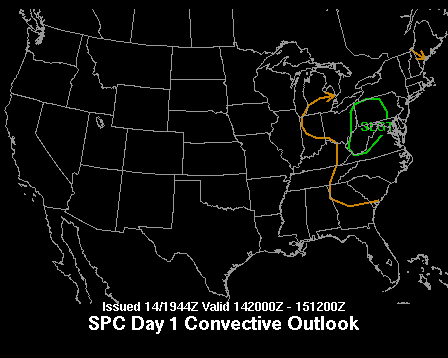
The Severe Storms Prediction Center has, because of this and more, issued a slight risk of severe weather for most of Pennsylvania. If daytime heating lasted longer, we'd be more worried about dangerous stuff happening around Philadelphia later tonight.
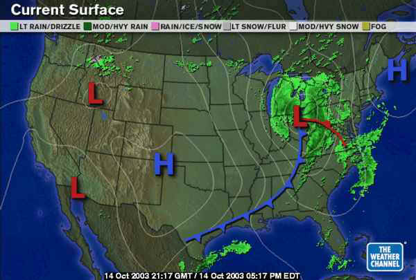
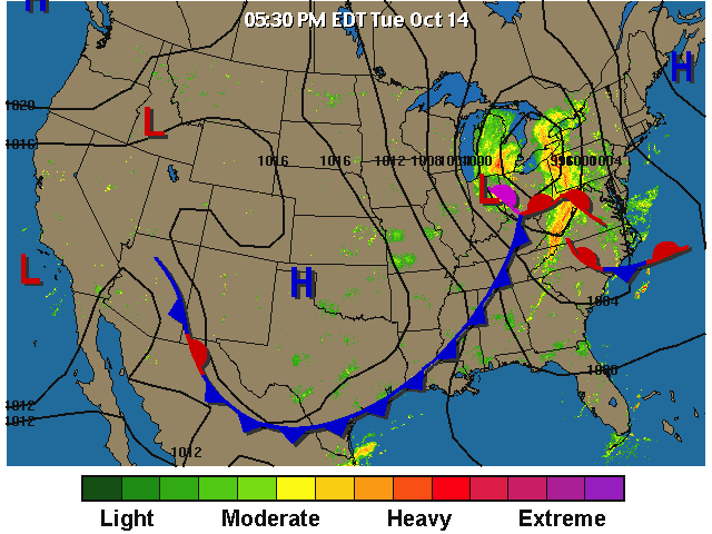
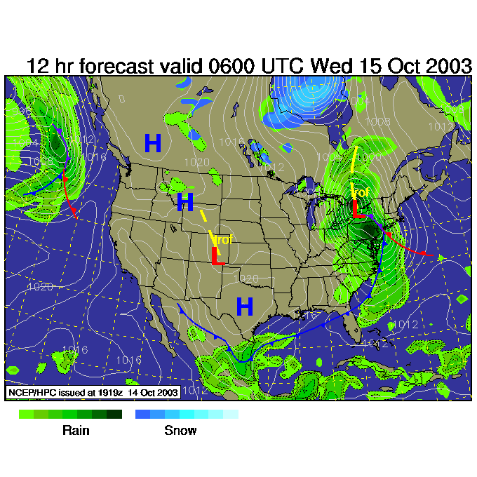
Our big system looks like thus... A strong Low is sliding through Ohio at present with a warm front racing northward around the Low center in the counterclockwise flow around it. A cold front is sweeping eastward south of the low. Widespread rain is occurring around the system.
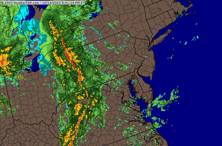
A look at the latest radar shows a big line of thunderstorms (with some approaching severe levels) in western PA.
Just for fun, you can see how the strongest convection is arranged ahead of the system.
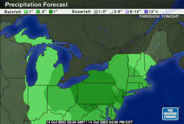
Overnight, widespread 1 inch rainfall amounts are expected across the state including Philadelphia.
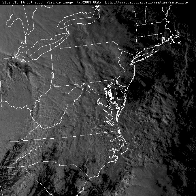
In the low angle of the later afternoon sun, you can see convection galore (bumpy clouds with shadows in the crevices).
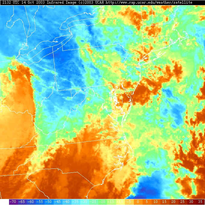
The Infrared Satellite view shows the coldest cloud tops (where the strongest convection is generating the highest clouds -which are colder - and are colored blue) over the convection line. It's going to be noisy here tonight!
By 2am, the cold front will have pushed east over us bringing the rainfall bull's-eye to Philadelphia. 12am to 4am should be the stormiest.
The next chance of rain comes Saturday morning, when ANOTHER trough forms and moves east...
...with a blob of showers and storms ahead of it. Until then, cool and dry weather will rule... once tonight's storms pass.
Try to sleep through the thunder and stormy weather. I'll see you tomorrow morning!
Meteorologist John Ensworth
Surface Station sky cover color key:
Flight category definitions:| Category | Ceiling | Visibility | |
|---|---|---|---|
| Low Instrument Flight Rules LIFR* (magenta circle) |
below 500 feet AGL | and/or | less than 1 mile |
| Instrument Flight Rules IFR (red circle) |
500 to below 1,000 feet AGL | and/or | 1 mile to less than 3 miles |
| Marginal Visual Flight Rules MVFR (blue circle) |
1,000 to 3,000 feet AGL | and/or | 3 to 5 miles |
| Visual Flight Rules VFR+ (green circle) |
greater than 3,000 feet AGL | and | greater than 5 miles |
| *By definition, IFR is ceiling less than 1,000 feet
AGL and/or visibility less than 3 miles while LIFR
is a sub-category of IFR. +By definition, VFR is ceiling greater than or equal to 1,000 feet AGL and visibility greater than or equal to 3 miles while MVFR is a sub-category of VFR. |
|||