Back To Home
The Story Behind the Weather - By Forecaster John
Ensworth M.S. -
The Discussion of Weather Events Daily for Philadelphia and Pennsylvania
Last updated: 10/15/2003 09:12 AM
Good Morning Philadelphia!
I'm glad to announce that these discussions will continue until at least the end of October.
The storms have passed, but the wind is a-blowin'! So keep those hatches batoned down.
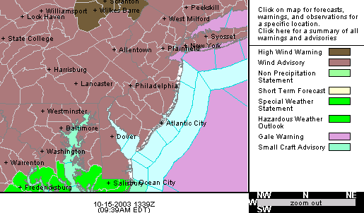
First off, the National Weather Service has issued a Wind Advisory for the Philadelphia area. I'll include the text from them here:
URGENT - WEATHER MESSAGE
NATIONAL WEATHER SERVICE MOUNT HOLLY NJ
430 AM EDT WED OCT 15 2003


...A WIND ADVISORY REMAINS IN EFFECT FOR EASTERN PENNSYLVANIA...
DELAWARE...NORTHEASTERN MARYLAND...AND MOST OF NEW JERSEY INTO EARLY
THIS EVENING...

.A COLD FRONT ASSOCIATED WITH STRONG LOW PRESSURE OVER CENTRAL NEW
YORK STATE EARLY THIS WEDNESDAY MORNING WILL MOVE WELL OFF THE COAST
BY THIS AFTERNOON. THE FLOW OF AIR AROUND THIS LOW PRESSURE SYSTEM
WILL PRODUCE SUSTAINED WESTERLY WINDS IN THE RANGE OF 20 TO 35 MPH
WITH GUSTS TO 50 MPH...ESPECIALLY IN THE HIGHER ELEVATIONS.
THESE WINDS ARE EXPECTED TO SUBSIDE EARLY THIS EVENING AS THE LOW
PRESSURE SYSTEM MOVES RAPIDLY NORTH INTO EASTERN CANADA.
That is pretty strong wind!
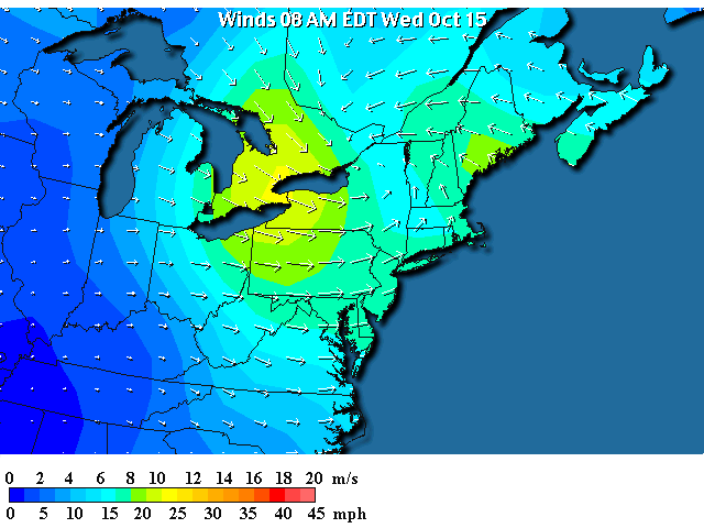
Looking at the winds currently, the bulls-eye of strongest winds are still to our west, but should pivot around towards us. Warming of the atmosphere today will also allow (via thermals that form) stronger winds aloft to be translated (or mixed) down to the surface.
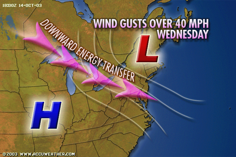
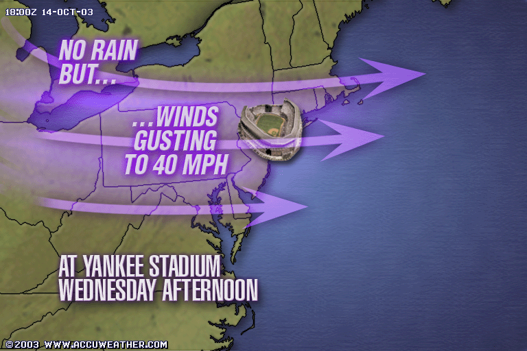
Thanks to Accuweather.com ( www.accuweather.com ) you can see (pictorially) how the wind fields are expected to shape up from this strong jet in the middle/upper atmosphere.
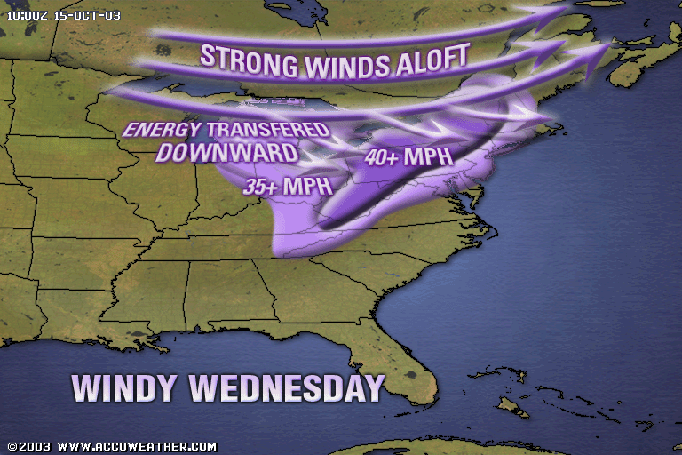
At the surface, the low to the northeast and the high to the southwest will tighten what is called the Pressure Gradient, over our region. A pressure gradient is JUST like a slope on a hillside. The steeper the hillside, the stronger the winds. The High Pressure center is the mountain top (too much air) and the Low Pressure center is the bottom of a valley.
So for Yankee Stadium (and the game tonight) winds will be howling from the west! We'll see how that changes things.
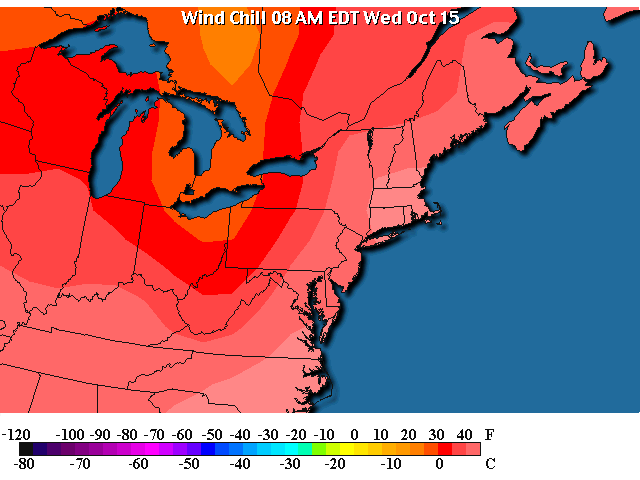
With temperatures this morning only in the mid 50's, one would not expect the wind chill to be very serious...
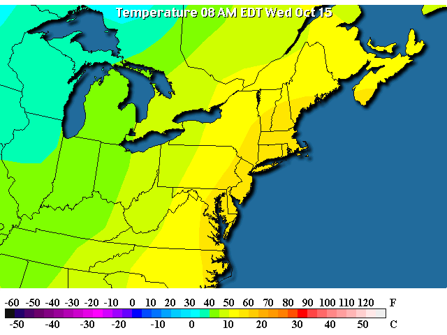
But it feels closer to 40 out there than you might like this morning, with wind chills in the 20's out west where the winds are stronger and the temperatures are lower. Good thing it will warm as the day goes on.
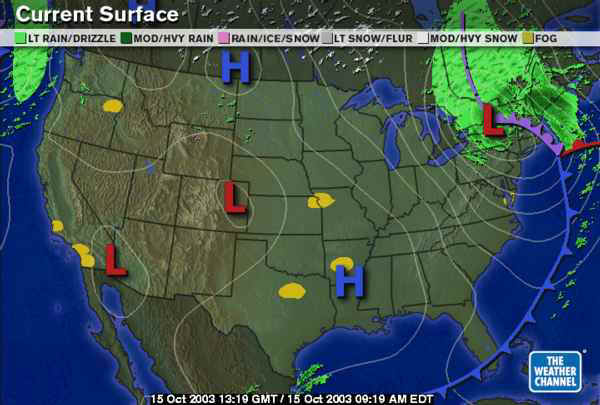
Even without the diagrams above, you could tell why and where the wind is blowing stronger on the surface map. Almost all surface maps now have the pressure contours drawn in (see the white lines). These are lines of equal surface barometric pressure. You can see the 'hillside' slope of the pressure as places where these lines are closer together... and that is over US!
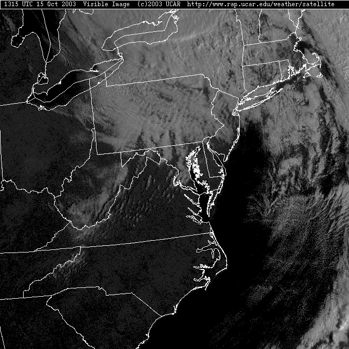
A quick peek at the clouds in the Visible Satellite view shows clouds for now, but clearing is going to move in (as the clouds move out) as the day goes on. Can you see the Northeast to Southwest cloud lanes over central and eastern Pennsylvania? They are orientated perpendicular to the winds in the atmosphere (almost straight out of the west-northwest)
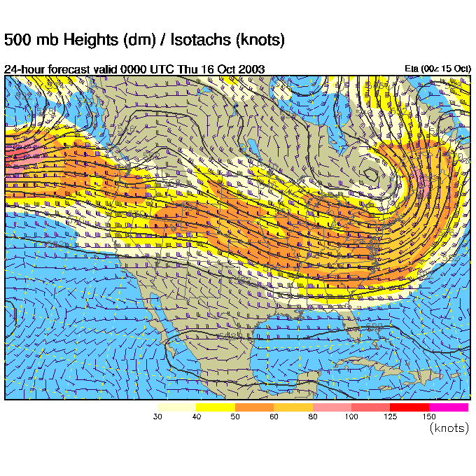
The winds aloft (at about 18,000feet) are shown blowing west to east parallel to the black lines in the map below. This map is a forecast from the ETA model for 8pm tonight. You can see the strong winds continuing overhead as the trough (the dip in the flow) moves off the east coast.
The rest of the United States is seeing a very strong west to east flow (with little ripple at all).
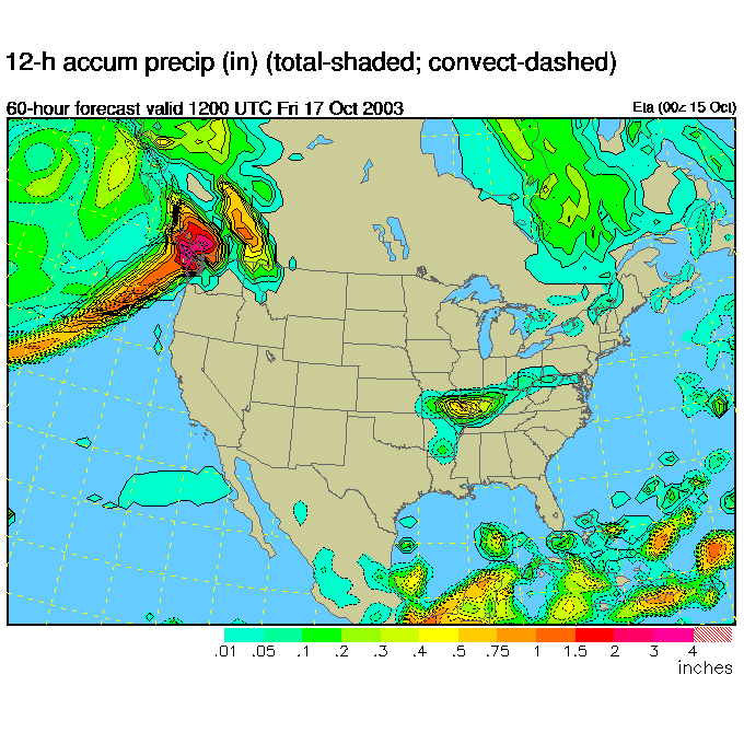
By Friday morning (8am ish) we see a front slip back northward into the area bringing in a chance of showers.
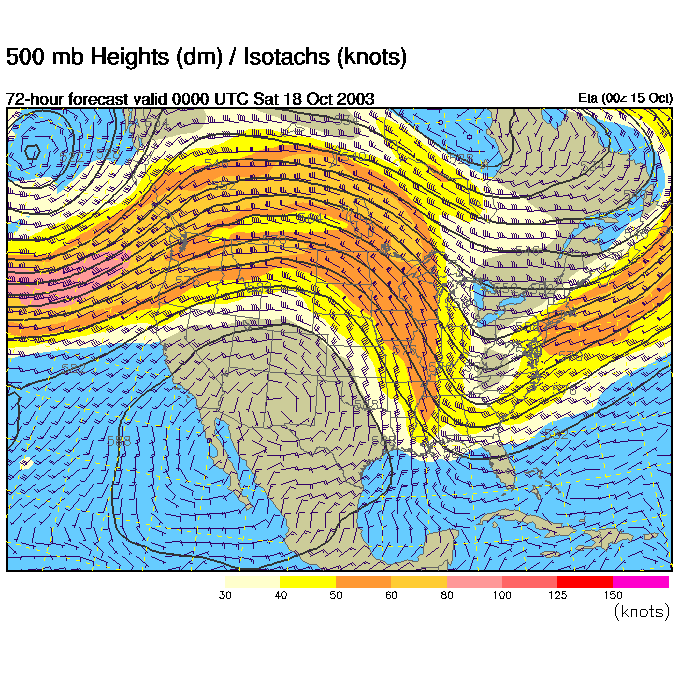
The upper air pattern by Friday night shows the wind flow aloft buckling over the US. There is a big ridge now in the flow out West, and a trough near and on us in the East.
By Friday night, the front oozes a bit closer increasing, a bit, the chance of rain.
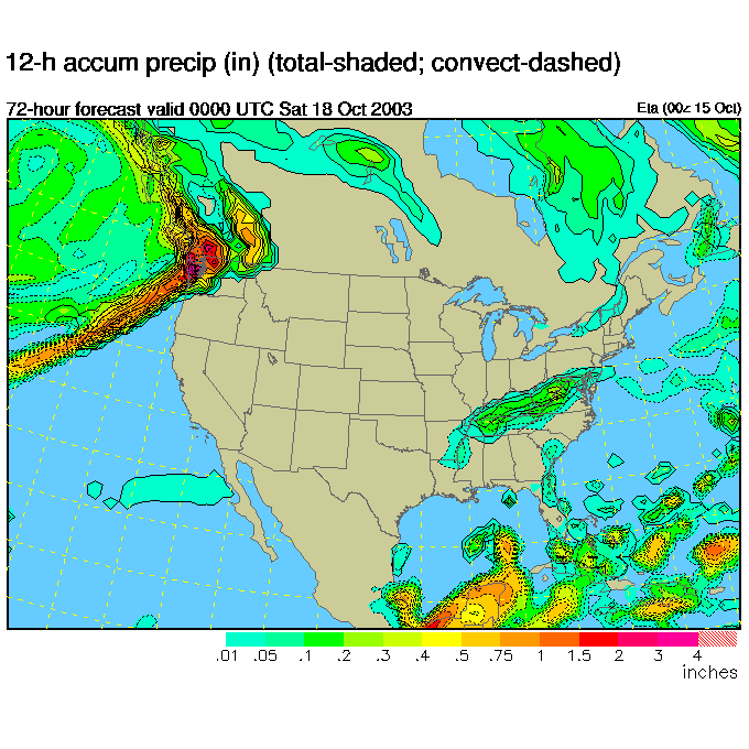
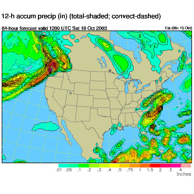
Then we see yet more activity by Saturday morning, but it isn't a really exciting mega-storm in anyway.
So hold on to your hat and stay warm, that wind will rip your body heat away if you don't dress well.
And I'll see you tomorrow morning!
Meteorologist John Ensworth
Surface Station sky cover color key:
Flight category definitions:| Category | Ceiling | Visibility | |
|---|---|---|---|
| Low Instrument Flight Rules LIFR* (magenta circle) |
below 500 feet AGL | and/or | less than 1 mile |
| Instrument Flight Rules IFR (red circle) |
500 to below 1,000 feet AGL | and/or | 1 mile to less than 3 miles |
| Marginal Visual Flight Rules MVFR (blue circle) |
1,000 to 3,000 feet AGL | and/or | 3 to 5 miles |
| Visual Flight Rules VFR+ (green circle) |
greater than 3,000 feet AGL | and | greater than 5 miles |
| *By definition, IFR is ceiling less than 1,000 feet
AGL and/or visibility less than 3 miles while LIFR
is a sub-category of IFR. +By definition, VFR is ceiling greater than or equal to 1,000 feet AGL and visibility greater than or equal to 3 miles while MVFR is a sub-category of VFR. |
|||