Back To Home
The Story Behind the Weather - By Forecaster John
Ensworth M.S. -
The Discussion of Weather Events Daily for Philadelphia and Pennsylvania
Last updated: 10/22/2003 10:35 AM
Good Morning Philadelphia!
I'm glad to announce that these discussions will continue until at least the end of November.
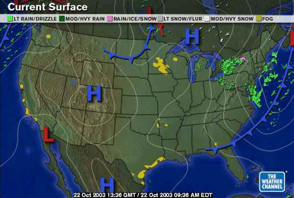
A chill mixes with the drizzle and reminds you that Fall is here! The low that swept through with the current cold front is way off to the northeast, but the cloud and showers are not gone yet. There are some light snow flurries up in Canada and some freezing rain in upstate New York. Ooooh, winter is creeping around up there.
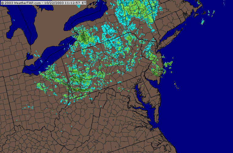
You can see on this mornings radar the wide spread very light showers moving to the southeast.
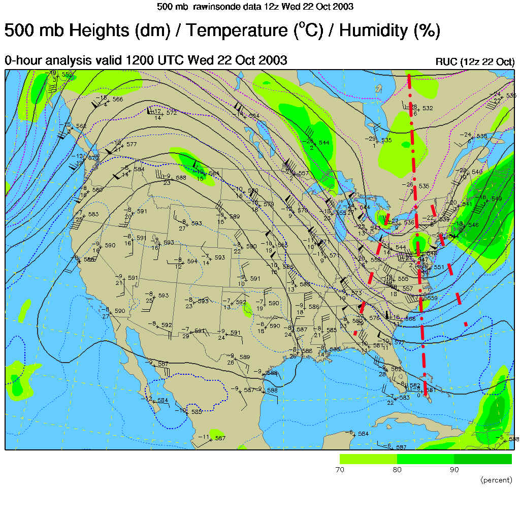
These showers are being kicked off by the troughs marked on the upper air map below. This map shows winds at about 18,000feet above sea level with winds blowing parallel to the black lines from west to east across the US. On the right side of any dip in the flow, you can expect rising motion and showers or storms to form. The MAIN trough in the flow is marked with the BIG dash dot line in red, but two smaller waves (two short waves) are moving through that flow and have an 'uphill side' as well. These are keeping the rising motion going over us.
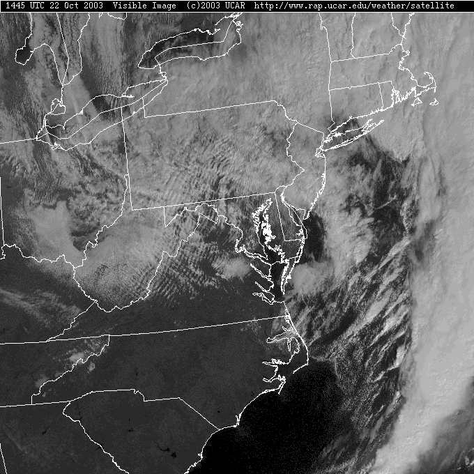
You can see the copious amount of clouds across the entire state. Remember from earlier that the lower atmospheric winds are blowing Perpendicular to the cloud lanes you see in lower cloud decks like those in the central part of our state. In this case, winds are blowing from the northwest.
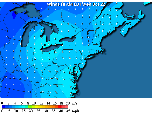
At the surface, you can seethe winds rotating counterclockwise around the low east of Maine. Wind speeds are pretty strong at present.
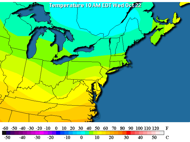
"Upstream" of us are temperatures in the 30's and 40's. This is why the forecast is for temperatures to stay steady (they normally rise) all day, or even decrease as the day goes on.
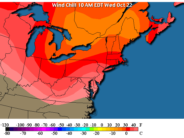
The combination of cool temperatures and strong wind makes the human body cool more than it would if there were no wind, so it feels colder than it really is (and you loose heat at a greater rate). We have wind chills at 10am in the 40's in Philadelphia with wind chills in the 20's up at the opposite corner of the state.
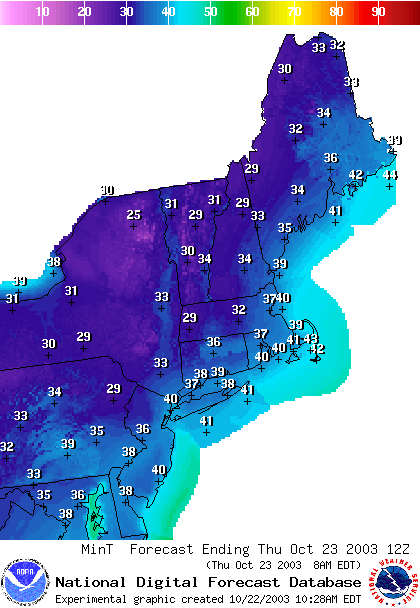
The low temperatures tonight are expected to drop to the 30's in the city and 20's in the northern parts of the state. If the showers remain, there should be a dusting of snow. As long as the winds keep up (which should remain for a day or so) we shouldn't have to worry 'yet' about a frost.
By 2pm today, little has changed. Winds continue to blow and a chance of rain remains.
At 2am, showers are indeed forecasted over spots in the state as these short waves continue to travel through the trough.
Somebody in Pennsylvania should get a dusting of snow.
Then, for Thursday night 8pm, we continue to have fairly brisk north winds, but the showers are to our east and west. We'll just have mostly cloudy skies and chilly winds.
Stay dry and warm! I'll see you again tomorrow morning.
Meteorologist John Ensworth
Surface Station sky cover color key:
Flight category definitions:| Category | Ceiling | Visibility | |
|---|---|---|---|
| Low Instrument Flight Rules LIFR* (magenta circle) |
below 500 feet AGL | and/or | less than 1 mile |
| Instrument Flight Rules IFR (red circle) |
500 to below 1,000 feet AGL | and/or | 1 mile to less than 3 miles |
| Marginal Visual Flight Rules MVFR (blue circle) |
1,000 to 3,000 feet AGL | and/or | 3 to 5 miles |
| Visual Flight Rules VFR+ (green circle) |
greater than 3,000 feet AGL | and | greater than 5 miles |
| *By definition, IFR is ceiling less than 1,000 feet
AGL and/or visibility less than 3 miles while LIFR
is a sub-category of IFR. +By definition, VFR is ceiling greater than or equal to 1,000 feet AGL and visibility greater than or equal to 3 miles while MVFR is a sub-category of VFR. |
|||