Back To Home
The Story Behind the Weather - By Forecaster John
Ensworth M.S. -
The Discussion of Weather Events Daily for Philadelphia and Pennsylvania
Last updated: 10/24/2003 09:17 AM
Good Morning Philadelphia!
I'm glad to announce that these discussions will continue until at least the end of November.
Today's discussion starts with a look back, a look around, and a look up...
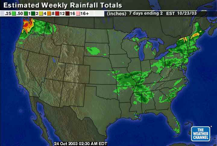
The rainfall over the last 7 days has been spotty but measurable in Pennsylvania. Philadelphia received less than a half inch of chilly rain over much of the city.
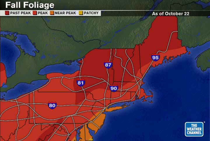
The fall foliage map shows that we are at peak now. The trees look as good as they are going to this weekend and over the upcoming week. Use the mostly clear skies this weekend to go out and get some pictures!
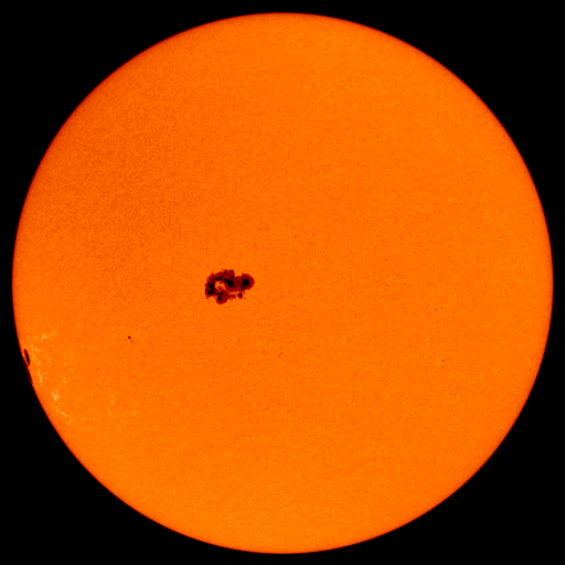
We do have a GIANT sunspot group on the face of the sun this morning (and over the last 3-5 days). This is sending a burst of energy towards the earth that could disrupt communications, electrical transmission and satellite operations this afternoon. How exciting is that?
See www.spaceweather.com for up to the minute details.
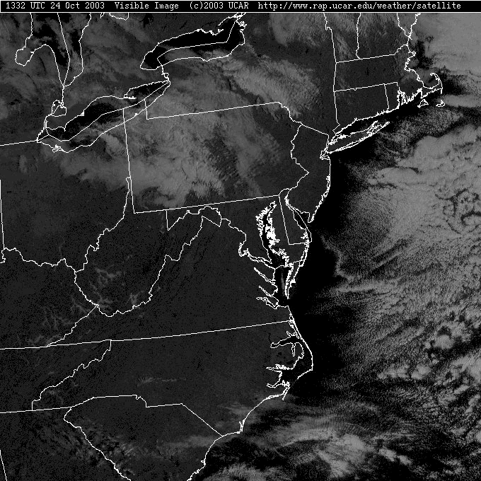
Now to the current weather, the northwest winds over the warm lakes is still generating lake effect light snow flurries over New York and even western Pennsylvania! (And yes, that might be lake effect drizzle in green.)
On the visible satellite picture, you can see the clouds forming down wind (from the northwest) of the lakes. The northwest side of the lakes are CLEAR! The small lanes in the clouds form like water going up and down in waves downstream of a rock... they are perpendicular to the wind flow (again, out of the northwest). The air sinks and warms across the state and the clouds evaporate until the cold air goes out over the ocean and clouds reform as moisture is picked up and condenses.
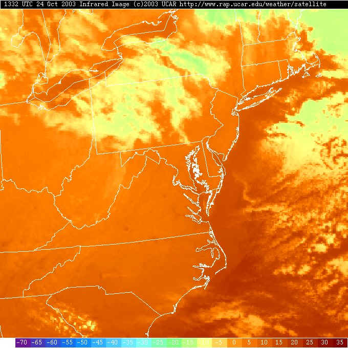
In the infrared satellite view, you can see the oceans and Great Lakes are warmer than the surrounding land (they are a darker orange). You can see the clouds forming off the lakes very clearly on this view!
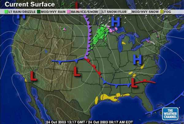
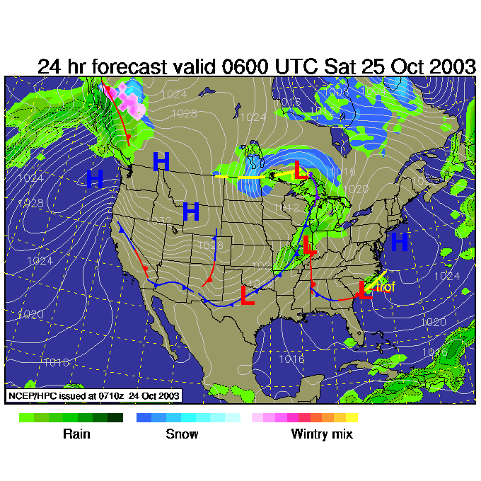
The big picture surface map shows our low to the northeast all the way off the map, but air is still moving counterclockwise around it as it moves away (nearly parallel to the white lines of equal barometric pressure). Air moves clockwise around highs, which are to our west, so the air flow across us is out of the northwest.
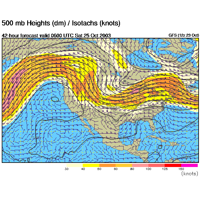
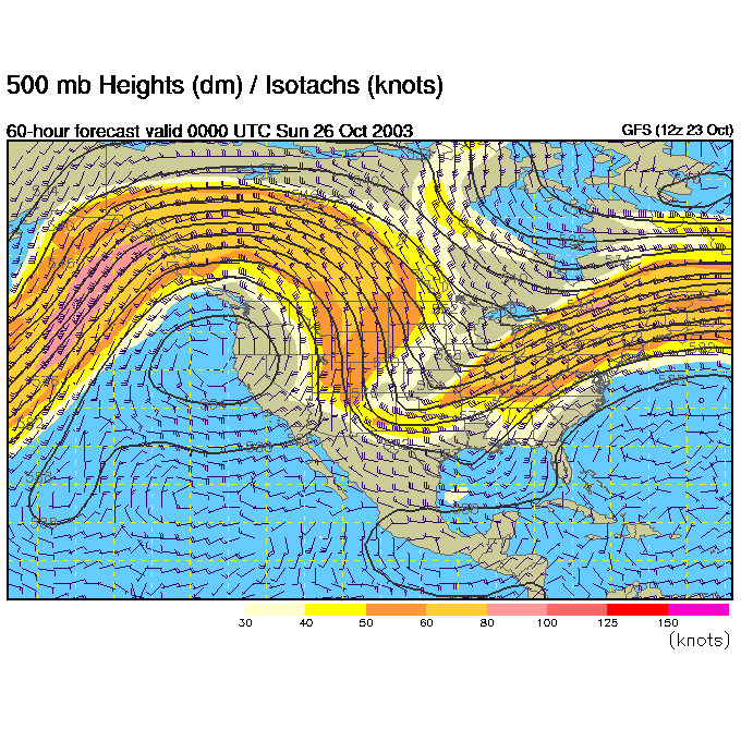
The upper level map (winds at about 18,000 feet above sea level moving west to east nearly parallel to the dark black lines) shows our east coast trough off to our east. We get clear weather when we are on the right side of the ridge (the ridge axis is over the Dakotas this morning). There is a new trough digging into the Rockies, and that will be effecting us early next week.
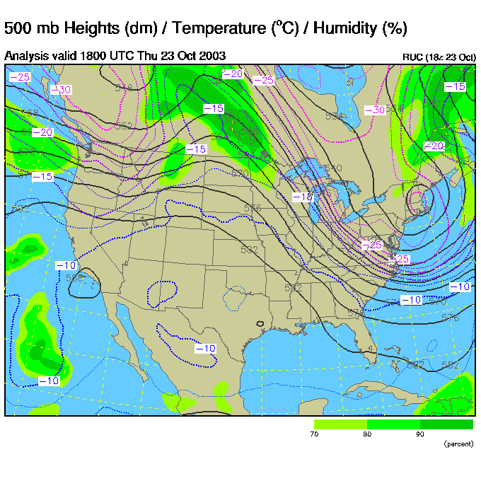
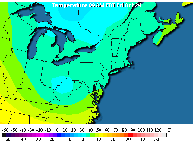
The temperatures are now in the mid 40's this morning (brrr!). The coldest temperatures are located where the trough is on the 500mb map above. The trough is formed by these colder temperatures!
And you can see the northwest winds blowing across (mainly New York)...
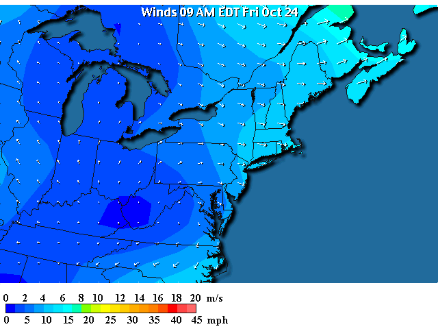
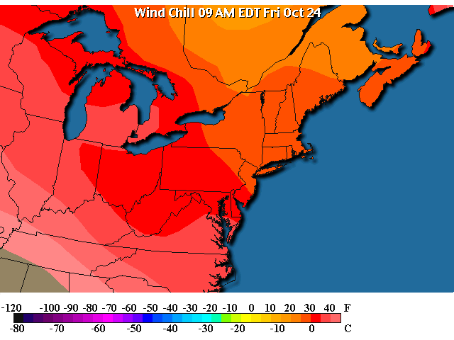
These combined are making a WIDE area of chilly wind chills (in the mid 30's for here at home).
Saturday 2am shows a flat ridge moving eastward to sit on us.
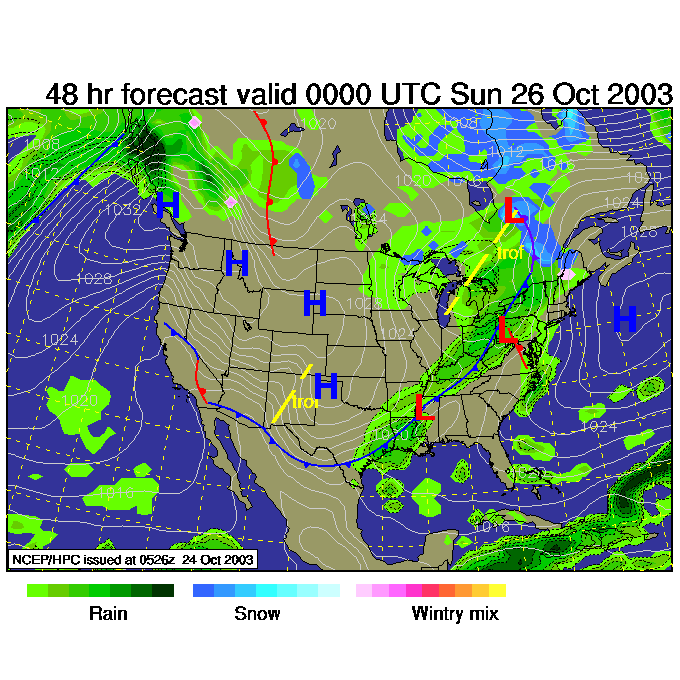
And the high center passes giving us a frosty night. The new trough in the central Plains is kicking up a strong front that is beginning to march eastward (or the reverse, the front and it's cold air is causing an upper air trough to deepen).
Saturday night, and the trough is already approaching us!
And we might see rain beginning already! Wow, what a fast progression of storms.
Stay warm and I'll see you again tomorrow morning.
Meteorologist John Ensworth
Surface Station sky cover color key:
Flight category definitions:| Category | Ceiling | Visibility | |
|---|---|---|---|
| Low Instrument Flight Rules LIFR* (magenta circle) |
below 500 feet AGL | and/or | less than 1 mile |
| Instrument Flight Rules IFR (red circle) |
500 to below 1,000 feet AGL | and/or | 1 mile to less than 3 miles |
| Marginal Visual Flight Rules MVFR (blue circle) |
1,000 to 3,000 feet AGL | and/or | 3 to 5 miles |
| Visual Flight Rules VFR+ (green circle) |
greater than 3,000 feet AGL | and | greater than 5 miles |
| *By definition, IFR is ceiling less than 1,000 feet
AGL and/or visibility less than 3 miles while LIFR
is a sub-category of IFR. +By definition, VFR is ceiling greater than or equal to 1,000 feet AGL and visibility greater than or equal to 3 miles while MVFR is a sub-category of VFR. |
|||