Back To Home
The Story Behind the Weather - By Forecaster John
Ensworth M.S. -
The Discussion of Weather Events Daily for Philadelphia and Pennsylvania
Last updated: 10/25/2003 08:04 PM
Good Evening Philadelphia!
I'm glad to announce that these discussions will continue until at least the end of November.
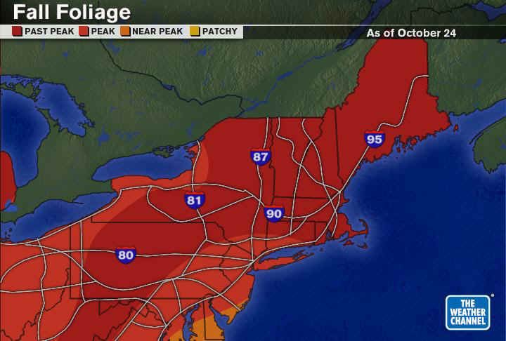
Today's discussion starts with a look at the trees thanks to the Weather Channel. With the shots of cold air we've had and the winds that have rushed through Philadelphia, the trees are quickly passing their peak in color. Get out there and look, before the next rain and wind shot hits (with it's version of winter!).
Following up on yesterday's solar activity, we have TWO massive sunspot clusters on the face of the sun that can disrupt satellite communications and power grids. Nothing wide scale happened on Friday, but some technological outages happened (Check CNN and Fox News for info) .
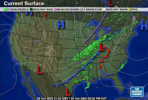
The high that calmed the weather and brought us a near freezing night is taking off to the northeast, and a NEW system is gathering to the west. Its low pressure system is in Indiana and deepening.
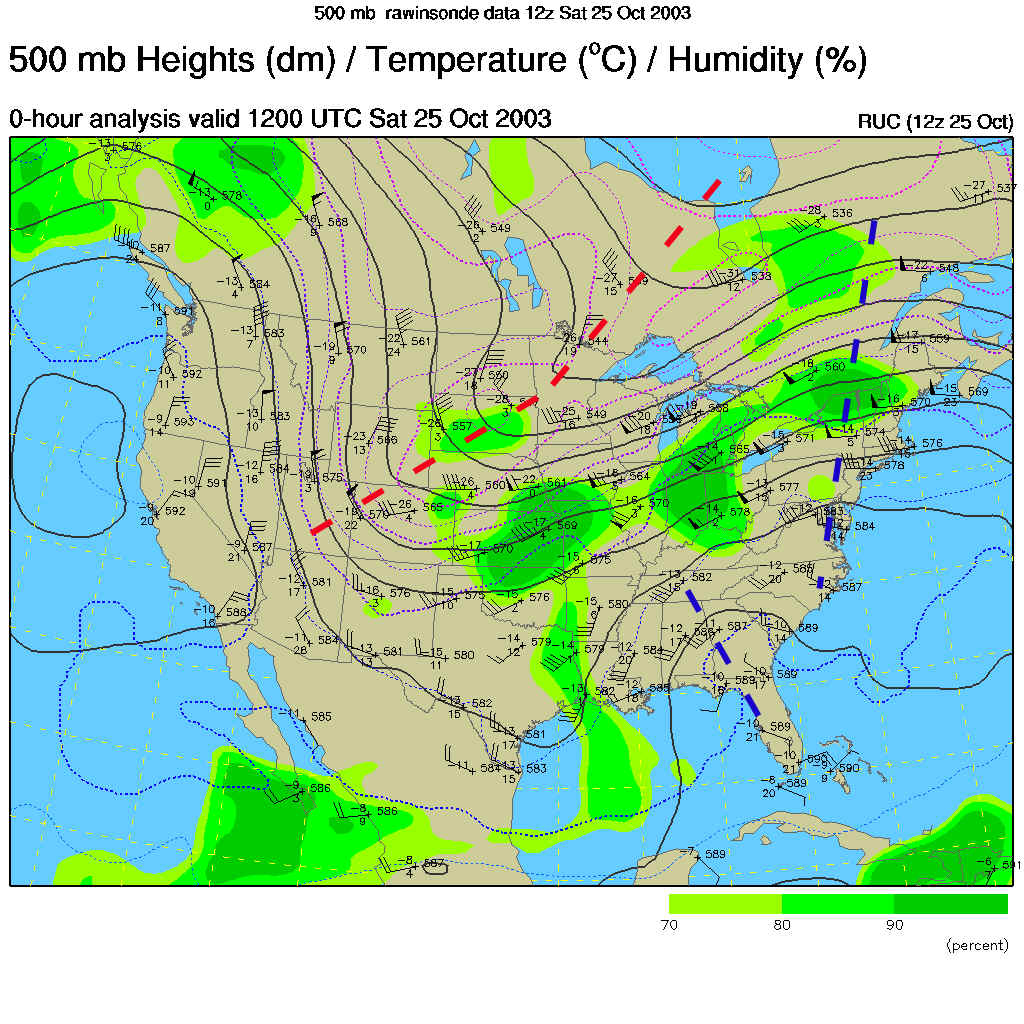
The high was built up by the ridge over our heads (marked with blue dashed lines) and the low is being deepened by the trough swinging down out of the Rockies and Canada (marked with a red dashed line). This map shows how the winds are blowing west to east across the US (parallel to the dark lines).
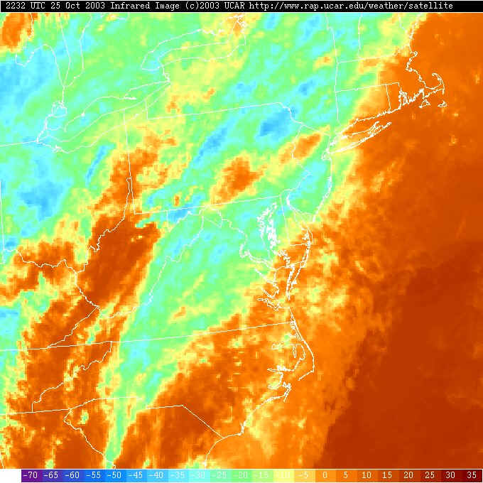
With the high departing and with small ripples coming out of the big trough in the central US, we have a line of high and mid level clouds streaming overhead (only visible on the infrared satellite view at this time of night).
Surface winds are out of the south across the state warming us up.

You can see 60's and 70's air flooding up (mainly west of the Appalachians so far) ahead of the new storm.
Highs today were expected to hit the 60's...
And tonight, the lows will only drop to 48.
Looking into the future, Sunday 2pm the big central US trough is moving towards us (run!).
The low in Indiana races into the state pushing a warm front ahead of it (see the dip to the south in the warm front? That is formed by the Appalachians not letting warm air get as far to the northeast).
Monday morning has us VERY MUCH on the uphill side of the new central US trough and you would expect storms and rain galore.
And storms galore - we have!. A new low center begins to intensify down in western North Carolina and a LOT of tropical moisture will be drawn in ahead of the system and front and shuttled up along the front. A LOT of water will hit the east coast on Monday.
Monday night and the trough is closer...
And storms continue over all of Pennsylvania (with some snow possible near the Great Lakes (and the northern Plains).
Tuesday morning sees the trough broader (a new push of cold air is plunging out of Canada through Minnesota).
And the rain continues to the point that you may want an Arc prepared ... just in case. Snow will spread through the Great Lakes again and possibly in the Appalachian Mountains to our west.
Stay dry once the deluge starts and I'll see you again Monday morning.
Meteorologist John Ensworth
Surface Station sky cover color key:
Flight category definitions:| Category | Ceiling | Visibility | |
|---|---|---|---|
| Low Instrument Flight Rules LIFR* (magenta circle) |
below 500 feet AGL | and/or | less than 1 mile |
| Instrument Flight Rules IFR (red circle) |
500 to below 1,000 feet AGL | and/or | 1 mile to less than 3 miles |
| Marginal Visual Flight Rules MVFR (blue circle) |
1,000 to 3,000 feet AGL | and/or | 3 to 5 miles |
| Visual Flight Rules VFR+ (green circle) |
greater than 3,000 feet AGL | and | greater than 5 miles |
| *By definition, IFR is ceiling less than 1,000 feet
AGL and/or visibility less than 3 miles while LIFR
is a sub-category of IFR. +By definition, VFR is ceiling greater than or equal to 1,000 feet AGL and visibility greater than or equal to 3 miles while MVFR is a sub-category of VFR. |
|||