Back To Home
The Story Behind the Weather - By Forecaster John
Ensworth M.S. -
The Discussion of Weather Events Daily for Philadelphia and Pennsylvania
Last updated: 10/04/2003 06:37 PM
Good Afternoon Philadelphia!
I'm glad to announce that these discussions will continue until at least the end of October.
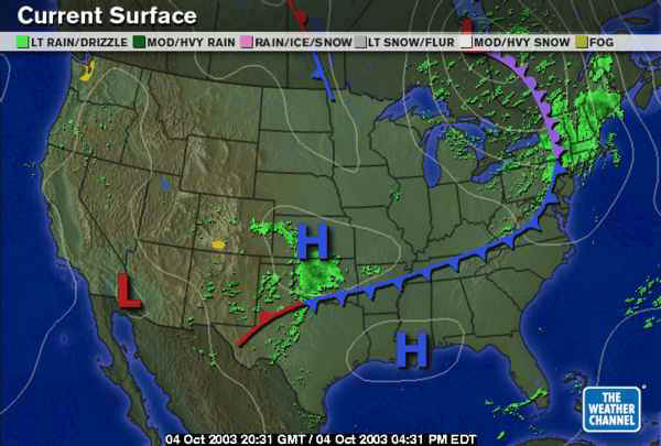
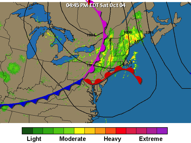
Hi again! The big weather maker is this fairly mild (compared to the last front) front stretching across the entire country. Note there is no snow even up north this time (well maybe under the shaded part near the low, but that IS farther north than the last storm).
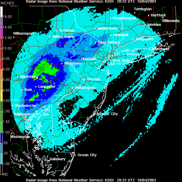
The rainfall amounts over the last day have been fairly light but widespread over the Ohio Valley and into Pennsylvania.
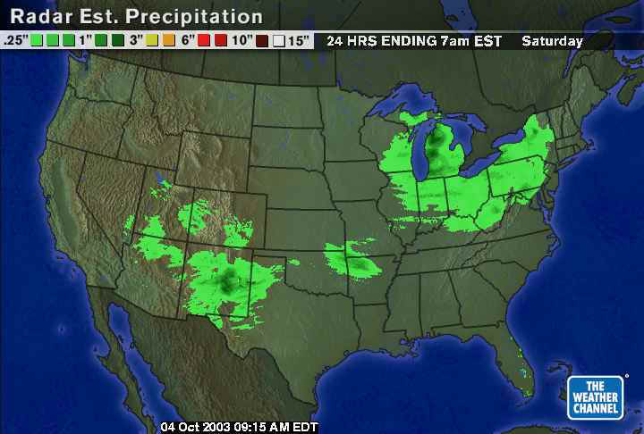
Locally, we saw a small area near Harrisburg and Lancaster that received more than an inch, but around Philadelphia, the rainfall has been light so far.
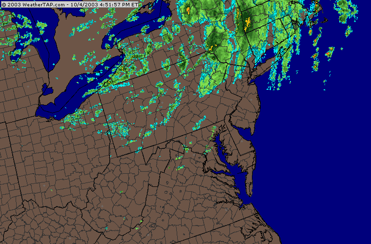
And it is still VERY spotty and scattered as the main punch of the system remains to our north.
We are located near the meeting of the warm front (red), the cold front (blue) and the occluded front (purple). With an Occluded front, the cold front (which moves faster than the warm front) has caught up with the warm front. A sideways view would show the warm air has been lifted aloft above cool air (to the east) and colder air (to the west). We might see a few puffs of warm air as the warm front moves north in the next few hours, then cooler air will rapidly push it out.
On the infrared satellite view, we can see the 'popcorn' looking cumulus clouds in the circled area. These are cold air cumulus. The ground is warm and the incoming air is cool making thermals rise and form cellular clouds in the cold air. Another sign winter is trying to invade (or at least Fall).
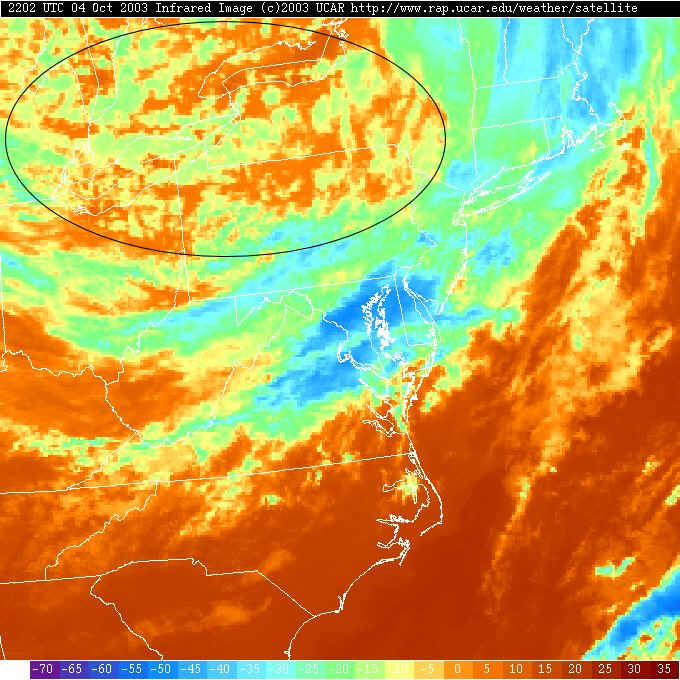
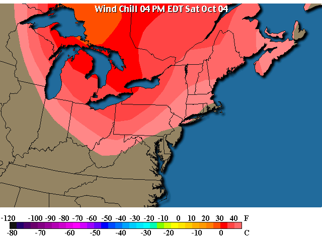
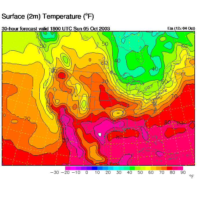
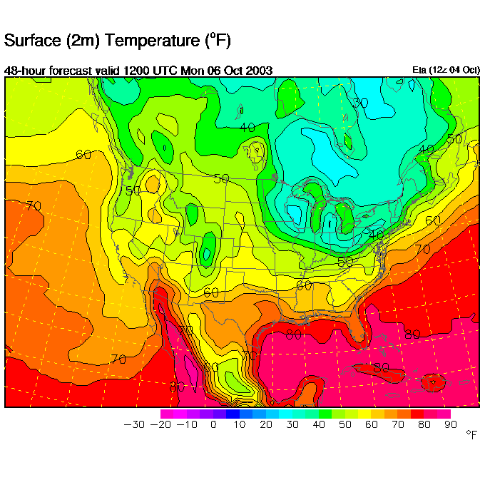
The coldest air is up where the cumulus is forming where temperatures this afternoon are in the low 40's. We, meanwhile, are still in fairly mild 60's locally.
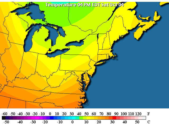
One reason our air is more mild is it is coming from the west, not the northwest or north.
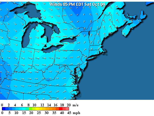
But the combination of winds and cool temperatures is making it feel a bit cooler - the upper 40's to 50ish.
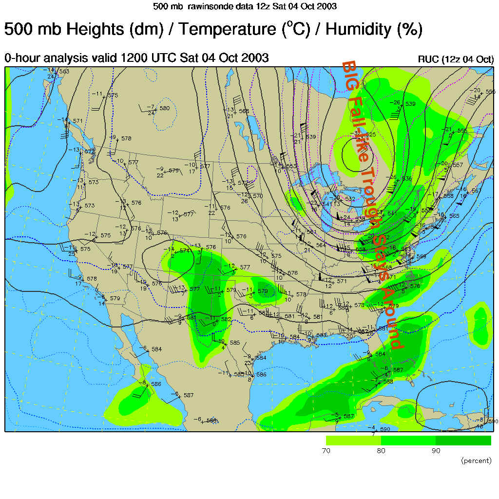
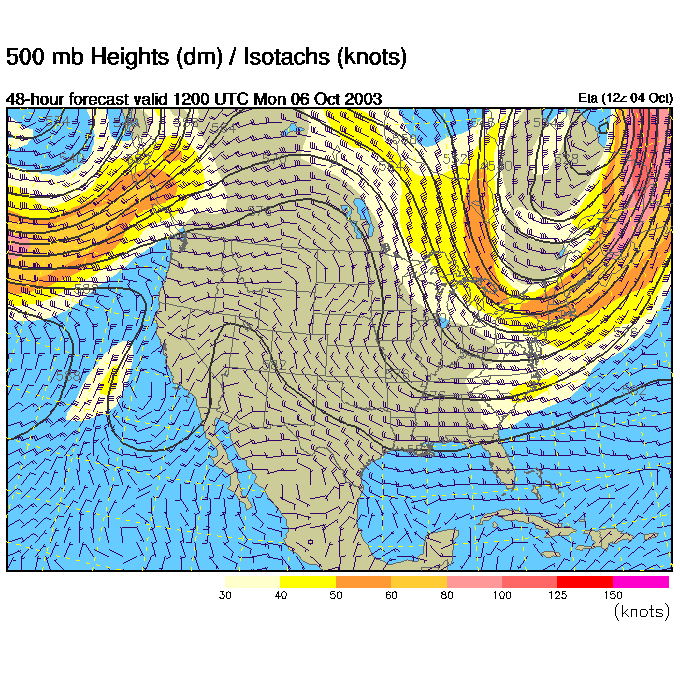
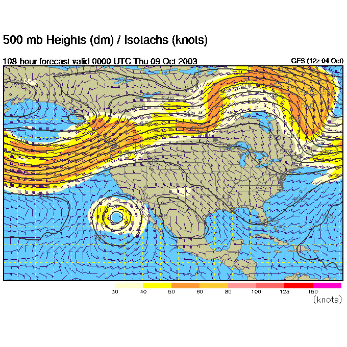
With the cool air to the north, the jet stream (which is actually formed by the temperature difference horizontally across the earth's surface) is dipping south and then right back north over us.
You can see this same pattern on the 500mb map (the winds blow from basically west to east parallel to the dark black lines at about 18,000 feet). This big trough is keeping us cool. Next week, we should see this pattern switch to a big ridge and a GREAT warm-up. Get ready to put the coats away again.
So by 2pm Sunday, the trough is a bit further to the east...
And the front is out to sea leaving us in partly cloudy conditions...
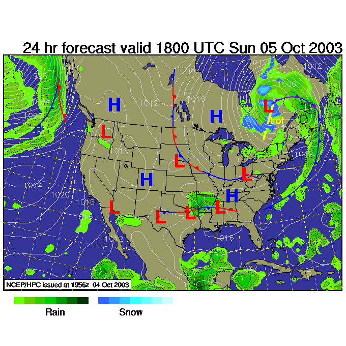
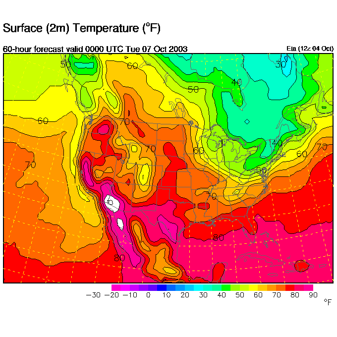
And relatively cool temperatures (mid 60's).
Monday morning, we see the trough pulling north east...
...and a quite low slipping off to the east... (with no rain locally)
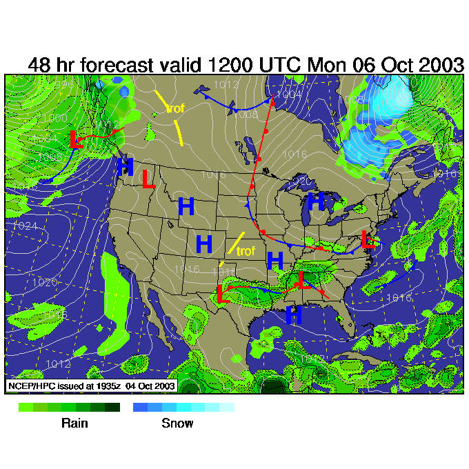
And warm conditions are inching back up from the south.
By Monday night, we'll see 50's in the area. BUT...
Come mid week (this is the GSF solution for Wednesday night). We have a BIG warm ridge in place (and a trough digging way out west over California. The change is coming.
In the meantime, keep warm!
Meteorologist John Ensworth
Surface Station sky cover color key:
Flight category definitions:| Category | Ceiling | Visibility | |
|---|---|---|---|
| Low Instrument Flight Rules LIFR* (magenta circle) |
below 500 feet AGL | and/or | less than 1 mile |
| Instrument Flight Rules IFR (red circle) |
500 to below 1,000 feet AGL | and/or | 1 mile to less than 3 miles |
| Marginal Visual Flight Rules MVFR (blue circle) |
1,000 to 3,000 feet AGL | and/or | 3 to 5 miles |
| Visual Flight Rules VFR+ (green circle) |
greater than 3,000 feet AGL | and | greater than 5 miles |
| *By definition, IFR is ceiling less than 1,000 feet
AGL and/or visibility less than 3 miles while LIFR
is a sub-category of IFR. +By definition, VFR is ceiling greater than or equal to 1,000 feet AGL and visibility greater than or equal to 3 miles while MVFR is a sub-category of VFR. |
|||