Back To Home
The Story Behind the Weather - By Forecaster John
Ensworth M.S. -
The Discussion of Weather Events Daily for Philadelphia and Pennsylvania
Last updated: 10/07/2003 09:11 AM
Good Morning Philadelphia!
I'm glad to announce that these discussions will continue until at least the end of October.
Today's discussion will be sort of brief, because we have very quiet nice conditions in place.
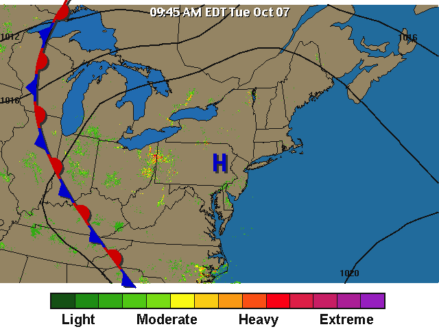
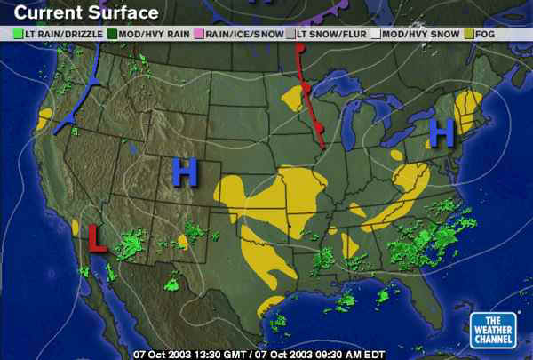
There is the back end of the current air mass who's center is the blue H (High pressure center) visible to the west.
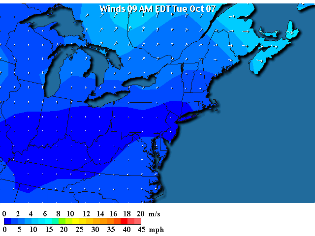
With the High centered over us, winds are light...
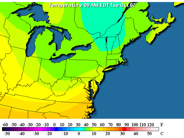
And temperatures are cool (upper 40's around Philadelphia).
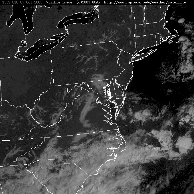
The Visible Satellite view shows almost the exact same view as it did yesterday. With cooler temperatures, clear skies and light winds, valley fog formed again AND the weather service almost issued a frost warning for much of the state. But it didn't get THAT cold last night (mid 30's is all that is needed).
In fact, the high pressure over us noses all the way down into the Great Plains and fog is wide spread over the Nation. See the rain showers down in the south? That will become our next weather maker in a few days.
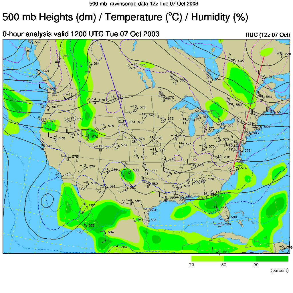
The 500mb map (showing how the winds are moving across the nation at about 18,000 feet - basically west to east parallel to the dark black lines) shows the trough in the east (marked with a red dashed line) is MUCH less noticeable than it has been for a few weeks. This is helping to create the tranquil weather. Even the ridge out in the Rockies doesn't have it's feet anchored all the way to the southern states. The pattern is changing.
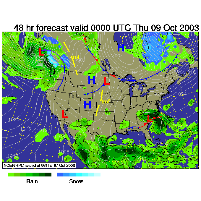
Into the future, at the end of the week, we will see this Low down over the Carolinas organize and move our way.
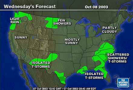
Tomorrow we have showers extending up into Virginia.
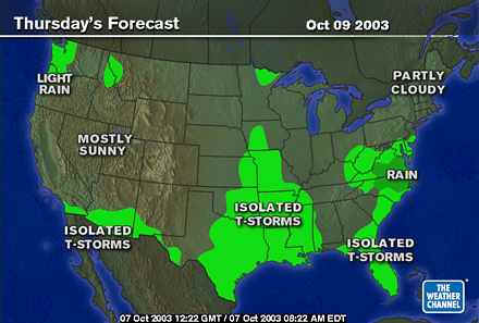
Heavier rain hits Virginia and N. Carolina on Thursday, and a chance of showers inches in to Philadelphia.
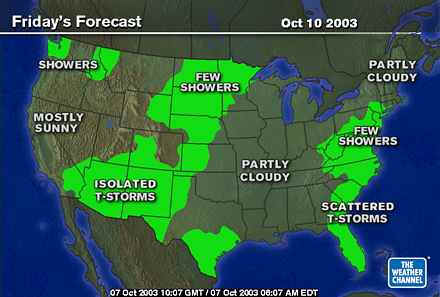
It's Friday and the rain has arrived.
The Low begins to move out to sea, but we still have the wrap-around precipitation drippin on us.
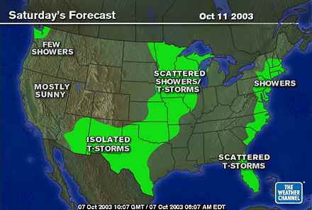
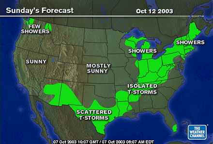
Then the next front (out in the Plains on Saturday) begins to approach us for an end of weekend start of the next workweek rain episode.
In the meantime, enjoy the fantastic weather!
Meteorologist John Ensworth
Surface Station sky cover color key:
Flight category definitions:| Category | Ceiling | Visibility | |
|---|---|---|---|
| Low Instrument Flight Rules LIFR* (magenta circle) |
below 500 feet AGL | and/or | less than 1 mile |
| Instrument Flight Rules IFR (red circle) |
500 to below 1,000 feet AGL | and/or | 1 mile to less than 3 miles |
| Marginal Visual Flight Rules MVFR (blue circle) |
1,000 to 3,000 feet AGL | and/or | 3 to 5 miles |
| Visual Flight Rules VFR+ (green circle) |
greater than 3,000 feet AGL | and | greater than 5 miles |
| *By definition, IFR is ceiling less than 1,000 feet
AGL and/or visibility less than 3 miles while LIFR
is a sub-category of IFR. +By definition, VFR is ceiling greater than or equal to 1,000 feet AGL and visibility greater than or equal to 3 miles while MVFR is a sub-category of VFR. |
|||