Back To Home
The Story Behind the Weather - By Forecaster John
Ensworth M.S. -
The Discussion of Weather Events Daily for Philadelphia and Pennsylvania
Last updated: 10/08/2003 10:01 AM
Good Morning Philadelphia!
I'm glad to announce that these discussions will continue until at least the end of October.
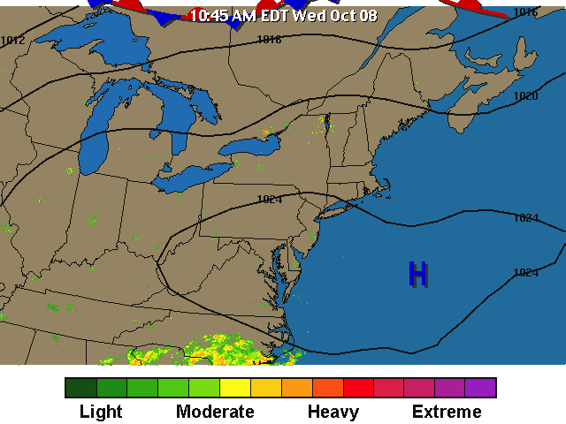
Today's discussion will be still be sort of brief, because we have very quiet nice conditions in place. The main story is FOG!
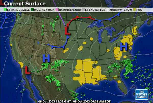
On the national map, you can see we don't have any systems nearby or threatening us (except maybe those showers way down to the south.
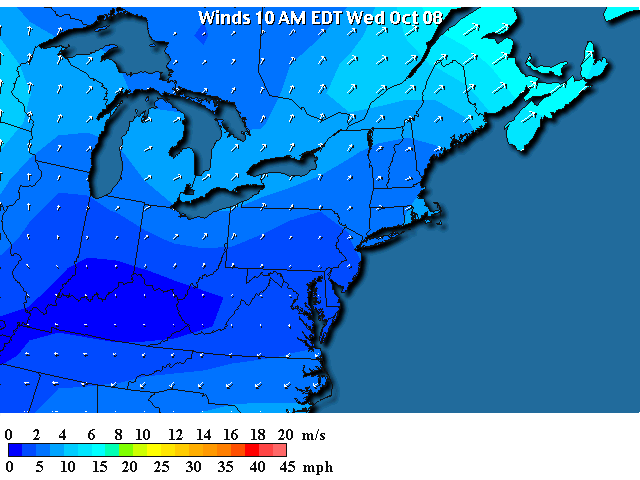
Near home, a big High Pressure system (with air moving in a clockwise pattern around the High center - roughly parallel to the black lines) dominates our weather.
Under this high, winds are very light to calm in Philadelphia.
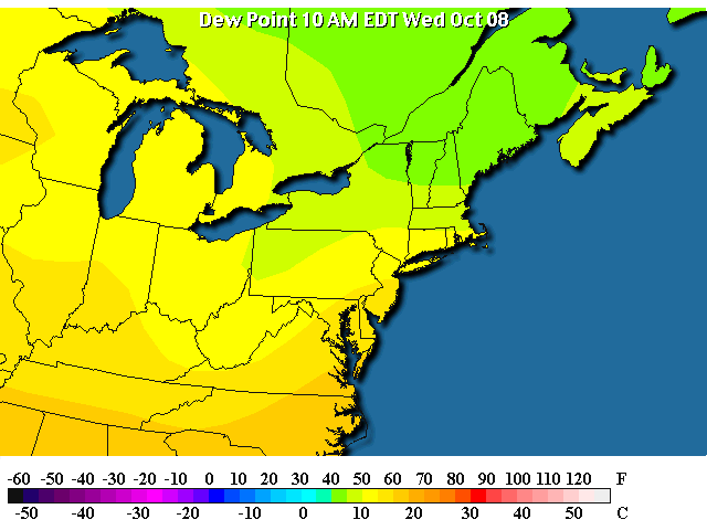
Temperatures this morning have cooled as low as they can go - that is the dew point. Unless water falls out of the atmosphere, the temperature cannot ever go below the dew point (if water falls out, then the dew point goes down). We have a dew point near 60, and a temperature neat 60F.
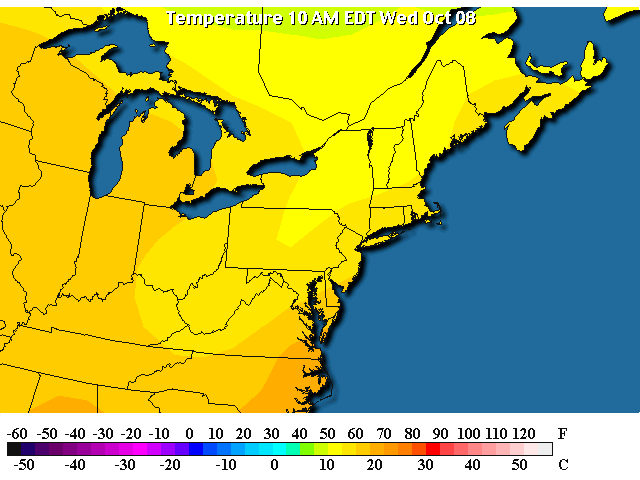
AND the dew point is, indeed, nearly 60F.
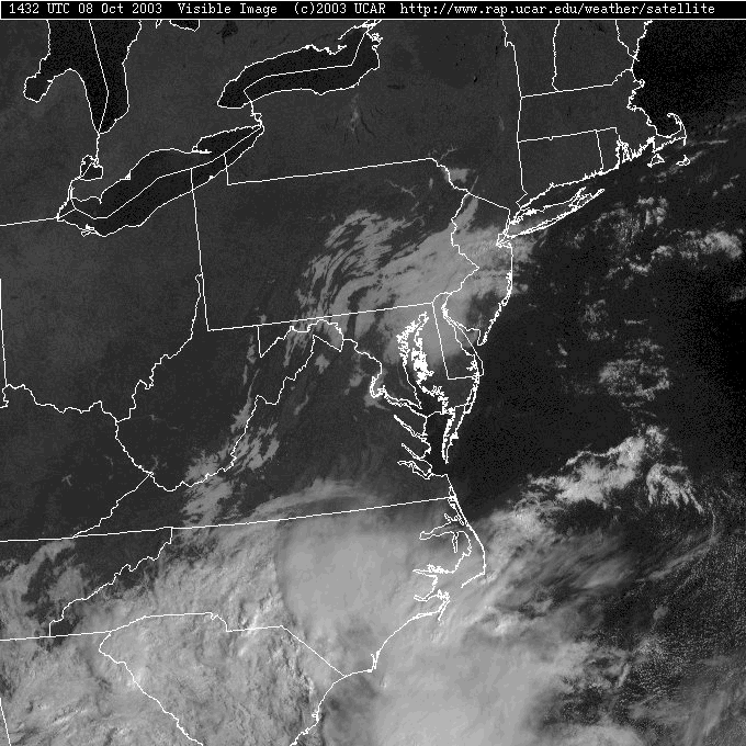
And on the visible satellite, you can see this blob of morning fog that will (as the lower atmosphere warms through the morning) lift to become what is called a stratus layer. Out west, you can see the fog staying to the lower valleys and avoiding the ridges (they are poking up into warmer air).
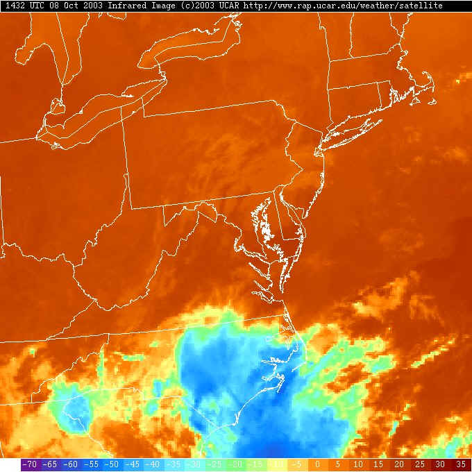
On the infrared satellite view, you can see that the low clouds are nearly the same temperature as the ground (when you have fog, the ground and air are really close to the dew point).
There are not big weather makers near us this morning, because the upper air flow is sort-of 'changing gears'. We don't have any big ridge or trough over us (remember, we've had a nearly permanent east coast trough for 11 months now!).
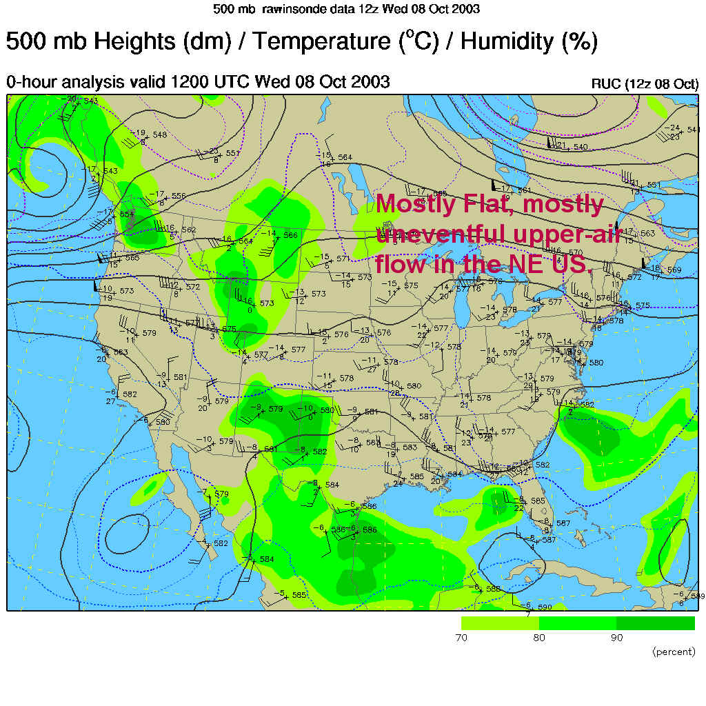
The next fly in the ointment for the weekend is the trough you can see down in the Southeastern US on the map above and the showers it will kick off over the Carolinas.
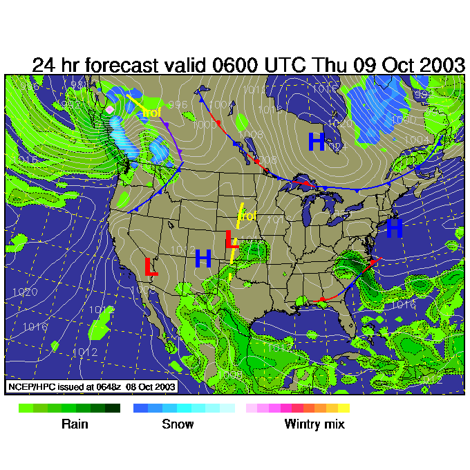
By Thursday night, it is inching northeastward towards us. This will be the source of our weekend rain (that and the front coming out of the plains).
Enjoy the cool moist weather!
Meteorologist John Ensworth
Surface Station sky cover color key:
Flight category definitions:| Category | Ceiling | Visibility | |
|---|---|---|---|
| Low Instrument Flight Rules LIFR* (magenta circle) |
below 500 feet AGL | and/or | less than 1 mile |
| Instrument Flight Rules IFR (red circle) |
500 to below 1,000 feet AGL | and/or | 1 mile to less than 3 miles |
| Marginal Visual Flight Rules MVFR (blue circle) |
1,000 to 3,000 feet AGL | and/or | 3 to 5 miles |
| Visual Flight Rules VFR+ (green circle) |
greater than 3,000 feet AGL | and | greater than 5 miles |
| *By definition, IFR is ceiling less than 1,000 feet
AGL and/or visibility less than 3 miles while LIFR
is a sub-category of IFR. +By definition, VFR is ceiling greater than or equal to 1,000 feet AGL and visibility greater than or equal to 3 miles while MVFR is a sub-category of VFR. |
|||