Back To Home
The Story Behind the Weather - By Forecaster John
Ensworth M.S. -
The Discussion of Weather Events Daily for Philadelphia and Pennsylvania
Last updated: 10/13/2003 08:11 AM
Good Morning Philadelphia!
I'm glad to announce that these discussions will continue until at least the end of October.
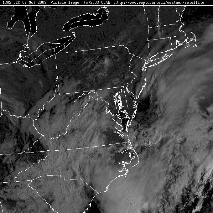
Today's discussion will, yet again, be sort of brief, because we have very quiet nice conditions in place. The main story for another morning is FOG!
See? When a pattern locks in, new things don't happen anymore.
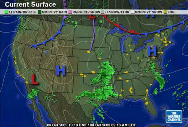
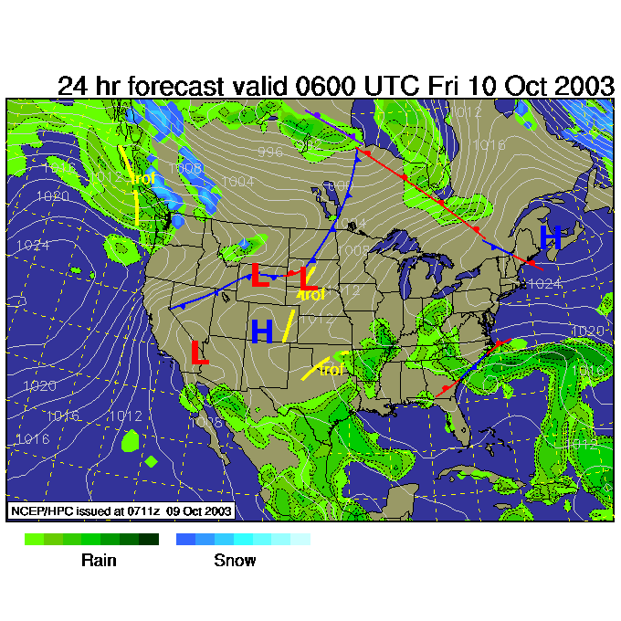
There is a nearly stationary front across the Canadian Providences to our north, and the center of the latest High Pressure system sitting on our heads. Just like the last two mornings, this High has resulted in calm winds and cool air (with circulation around a high being clockwise, moisture from the east is being brought into the state from the south and southwest.
Our system to the south that was suppose to rain on us, is NOT looking like such a sure bet at present.
We, at this late morning hour, have another round of valley fog and fog in low lying areas. Thicker clouds are oozing around to our south and may bring us mostly cloudy conditions later this morning (which would help the fog and mist to hang on longer by blocking the sun that would otherwise warm the fog and make it dissipate).
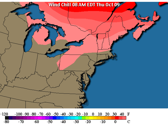
Temperatures this morning are in the 60's and winds are calm, so we don't have any wind chill (unless you are running or riding a bike). We left the taste of early winter and have backed into fall. Be prepared for continued warm conditions as you'll see below.
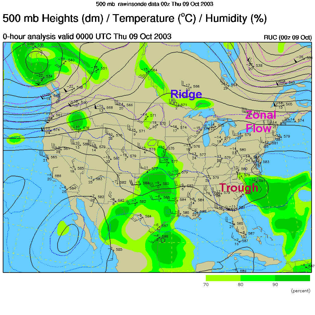
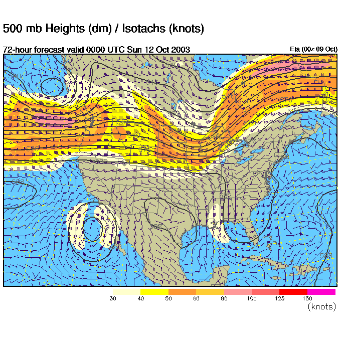
The 500mb map (showing how the winds, that show how storms move, are moving at about 18,000 feet above sea level from mainly west to east across the U.S. parallel to the dark lines) shows a trough (look for rain on the right side of any trough) over the SE US and a ridge over that over the Great Lakes (look for warming conditions and clearing skies to the right of a ridge). We have straight west to east flow over the NE US. This is called zonal flow and is neither a ridge nor a trough. Zonal flow moves systems and storms quickly off to the east when they are present.
Into the future, the High moves off to the northeast by 2pm today and the showers continue in the Carolinas with that trough down there.
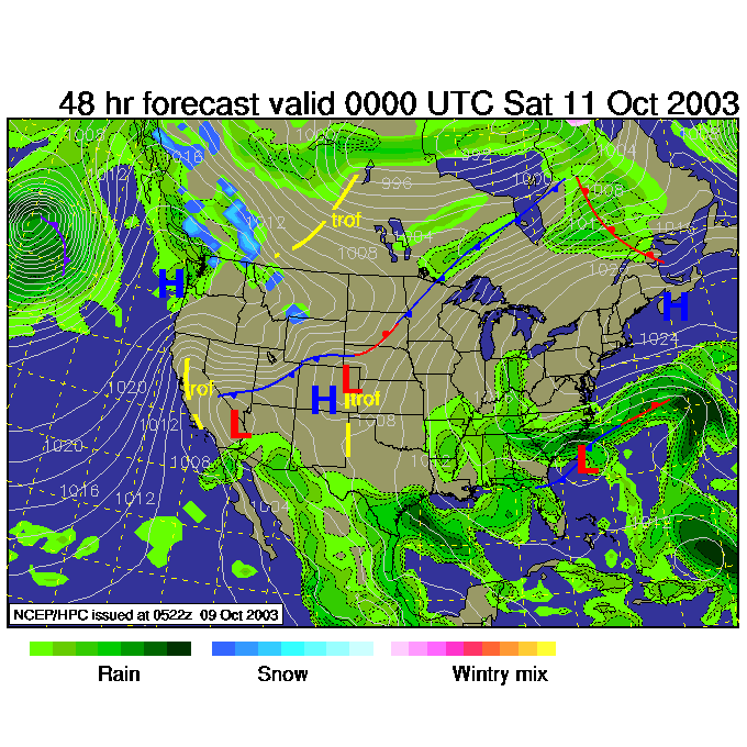
Friday night, and another wave coming out of the plains kicks off more showers in the southern states, but we are still under the influence of our departing High.
Changing to the GFS computer model, Saturday morning looks like the SE US system finally slips up here. But other models don't show this happening anymore.
By Saturday night (now according to the ETA computer model) has the ridge sliding past us (pushing that High off to the east) and a new trough approaching from the northern Plains. Our SE US trough is STILL there!
So we see a front moving across the Lakes due to that northern trough, and the showers continue near Florida and the Carolinas with THAT trough. We are in the clear again with no real cool air around at all.
I'll be traveling Friday - Sunday, so don't panic if I have connectivity problems and can't make an update in that time.
Everyone needs a vacation now and then!
Enjoy the cool moist weather!
Meteorologist John Ensworth
Surface Station sky cover color key:
Flight category definitions:| Category | Ceiling | Visibility | |
|---|---|---|---|
| Low Instrument Flight Rules LIFR* (magenta circle) |
below 500 feet AGL | and/or | less than 1 mile |
| Instrument Flight Rules IFR (red circle) |
500 to below 1,000 feet AGL | and/or | 1 mile to less than 3 miles |
| Marginal Visual Flight Rules MVFR (blue circle) |
1,000 to 3,000 feet AGL | and/or | 3 to 5 miles |
| Visual Flight Rules VFR+ (green circle) |
greater than 3,000 feet AGL | and | greater than 5 miles |
| *By definition, IFR is ceiling less than 1,000 feet
AGL and/or visibility less than 3 miles while LIFR
is a sub-category of IFR. +By definition, VFR is ceiling greater than or equal to 1,000 feet AGL and visibility greater than or equal to 3 miles while MVFR is a sub-category of VFR. |
|||