Back To Home
The Story Behind the Weather - By Forecaster John
Ensworth M.S. -
The Discussion of Weather Events Daily for Philadelphia and Pennsylvania
Last updated: 11/04/2003 10:30 AM
Good Morning Philadelphia!
I'm glad to announce that these discussions will continue until at least the end of November.
In Short: Sunny and Warm/Hot... with showers and cooler air moving in on Wednesday..
Philadelphia is still on the edge of the collision zone between the cold air to the north and warm tropical air to the south, but the pattern is going to start to wave around shortly.... here we go...
I apologize for how similar today's discussion is to yesterday's, but the pattern is just starting to shift and become something different. For now, the changes are measured in 10's of miles of cold air advancement and warm air retreat.
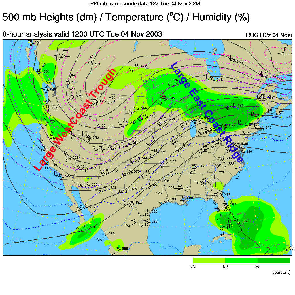
To remind you, the big pattern is a huge trough (southward bend of the air in the upper atmosphere, here at about 18,000feet above sea level- seen blowing mainly west to east parallel to the dark lines drawn in) in the west, and a ridge (a northward bulge of the air flow) in the east. The trough is caused by cold air (and helps bring more cold air down) over that area, and the ridge is the opposite, containing warm air underneath it.
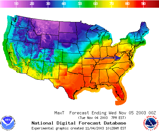
The temperatures expected as highs today across the nation exactly matches the trough / ridge pattern above. Wow!
And therefore, the frontal boundary across the US is dividing the cold from the warm air, and IT too matches the overall ridge/trough pattern (right up the slope of one and over the other).
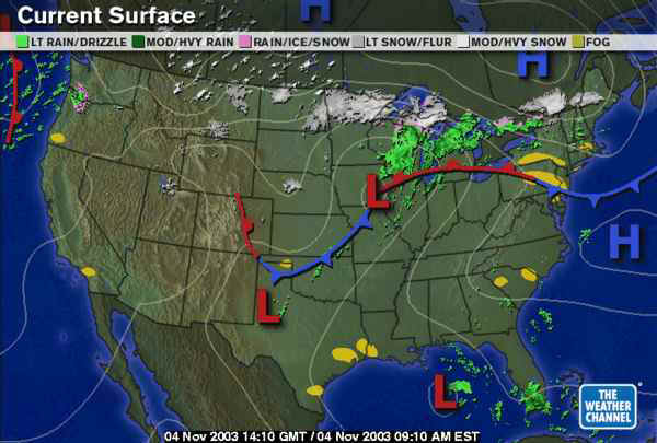
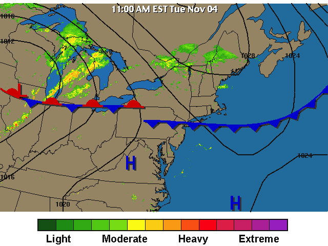
The clouds over Pennsylvania are all north of the frontal boundary (even the fog to our northeast is cold air that has leaked southward). We are still in the clear...
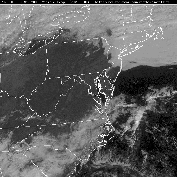
A close-up of the frontal system sort of shows this cloud boundary as being the front. There isn't, yet, any rain falling nearby.
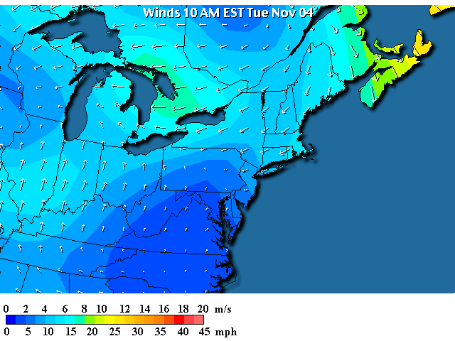
Winds north of the front are out of the northeast (which is why the cold moist air to our northeast could leak down). Winds south of the front are nearly calm and slightly out of the south.
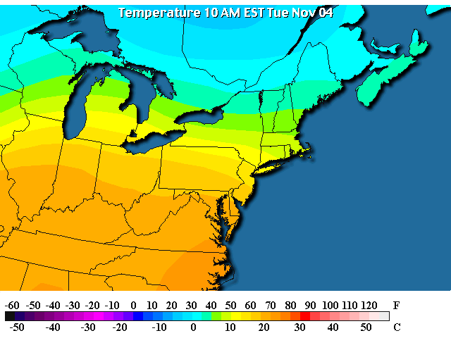
And in the surface temperature map, the front is just as visible, with current temperatures in the 20's way north, and upper 70's way south. A HUGE difference.
So, into the future, the front on our heads will begin to push northward as a warm front, leaving us in the warm moist air.
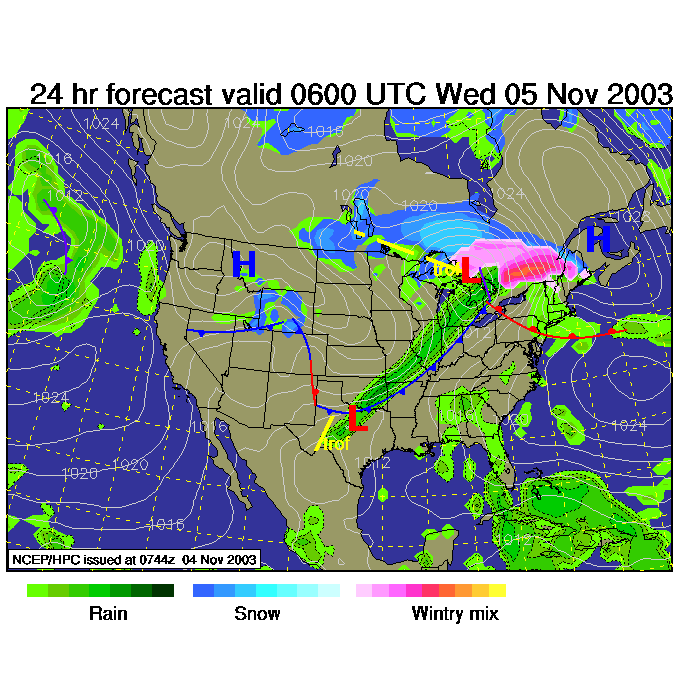
As the trough out west moves/expands eastward, we'll see rain kicking off by Wednesday morning over much of the region.
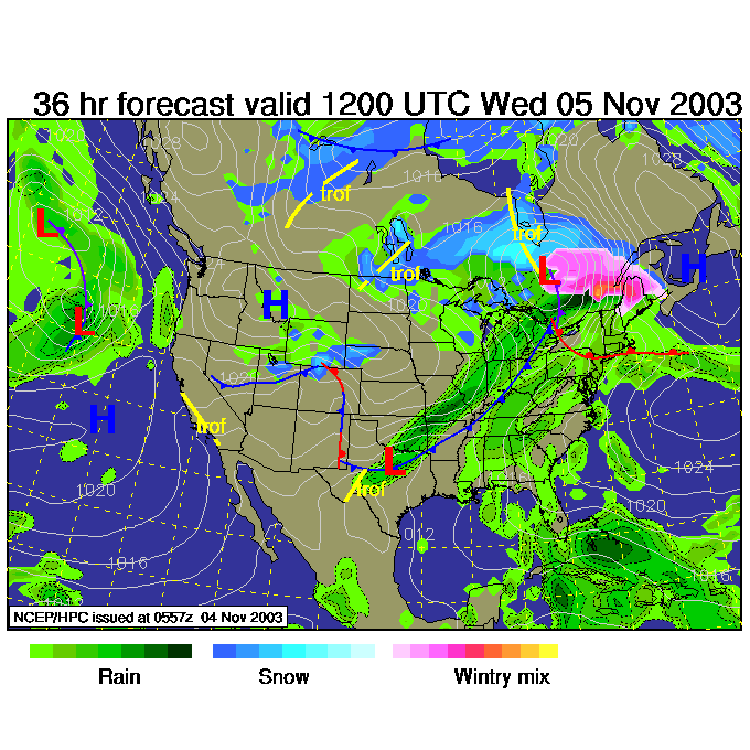
Then the big cold/cool front comes slamming through with a LOT of rain and cooler temperatures Wednesday night. It's not TOO cold though, the nearest snow is all north of the lower 48 US states.
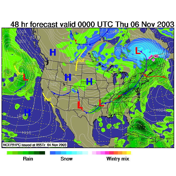
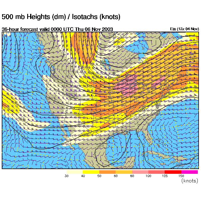
At the time of this last surface map, you can see what the upper air (500mb again) chart has evolved to. The center of the trough is now over the plains instead of the west coast, and the center of the ridge is way out to sea to the east, instead of over the east coast. This is why the front is advancing and showers are coming for tomorrow.
Have a great Tuesday! Come on back, and I'll see you again tomorrow.
Meteorologist John Ensworth
Surface Station sky cover color key:
Flight category definitions:| Category | Ceiling | Visibility | |
|---|---|---|---|
| Low Instrument Flight Rules LIFR* (magenta circle) |
below 500 feet AGL | and/or | less than 1 mile |
| Instrument Flight Rules IFR (red circle) |
500 to below 1,000 feet AGL | and/or | 1 mile to less than 3 miles |
| Marginal Visual Flight Rules MVFR (blue circle) |
1,000 to 3,000 feet AGL | and/or | 3 to 5 miles |
| Visual Flight Rules VFR+ (green circle) |
greater than 3,000 feet AGL | and | greater than 5 miles |
| *By definition, IFR is ceiling less than 1,000 feet
AGL and/or visibility less than 3 miles while LIFR
is a sub-category of IFR. +By definition, VFR is ceiling greater than or equal to 1,000 feet AGL and visibility greater than or equal to 3 miles while MVFR is a sub-category of VFR. |
|||