Back To Home
The Story Behind the Weather - By Forecaster John
Ensworth M.S. -
The Discussion of Weather Events Daily for Philadelphia and Pennsylvania
Last updated: 11/05/2003 10:32 AM
Good Morning Philadelphia!
I'm glad to announce that these discussions will continue until at least the end of November.
In Short: Cloudy and Warm with dropping temperatures and lots of rain!.
Philadelphia is about to see a large cold front and a new source of air. We won't see temperatures approach 80F again (well, until next Spring!).
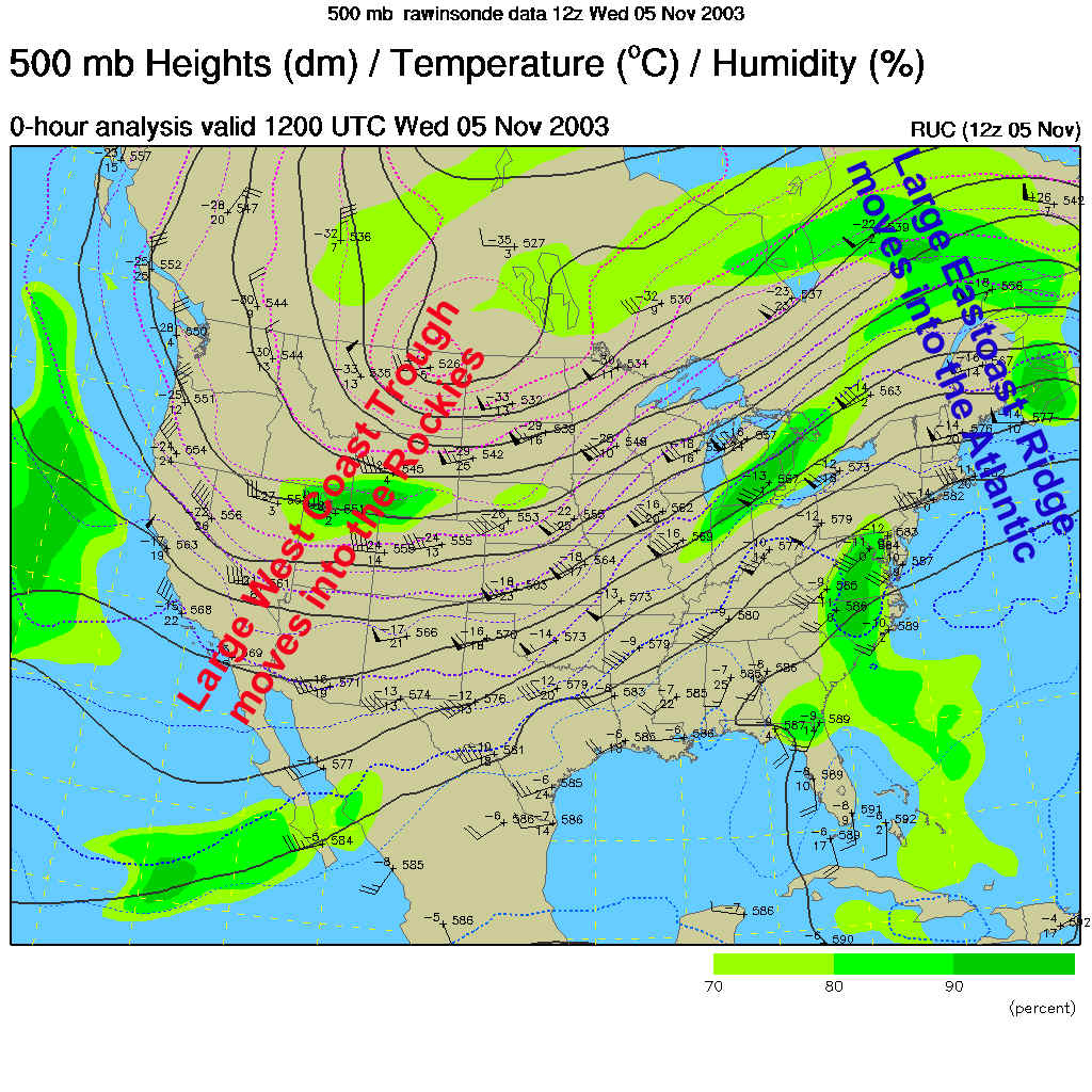
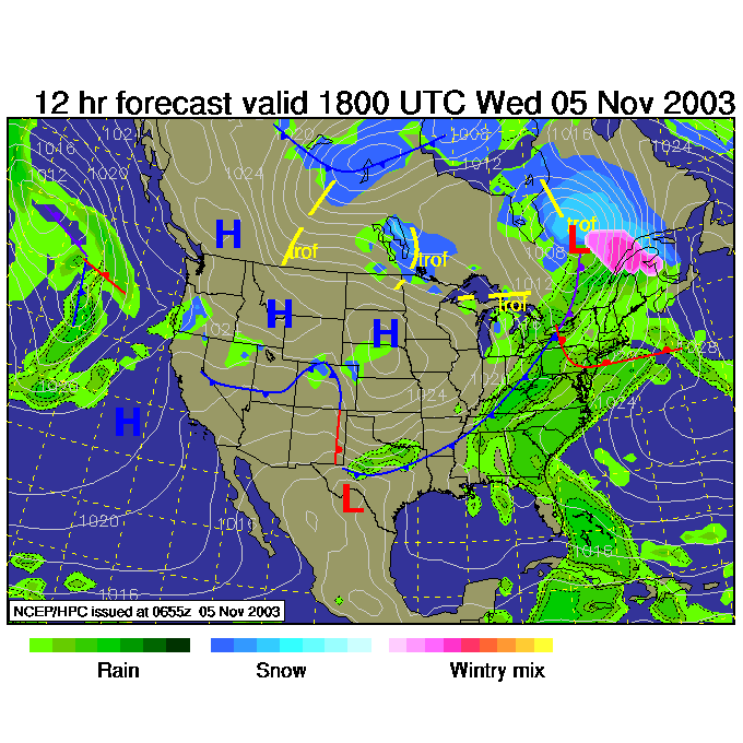
Since we've been following the upper air pattern, we'll start off again with it today. Our east coast upper air (about 18,000ft) air flow is flowing northward then south again off the east coast now (a Ridge, labeled in Blue). The trough (southward then northward flow of air- labeled in Red) is now centered on the Rocky Mountains. You would expect rain/storms to form on the "up hill" region between a trough and ridge (on the right side of the trough).
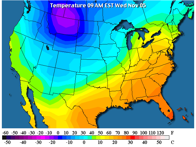
The temperatures match the trough/ridge pattern with cold air shifting eastward as well. This translates to a cold front shifting east...
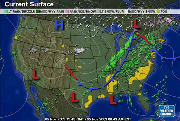
And there it is! It is dropping snow from the central and northern Plains to all across Canada. Large bands of rain are forming to the south in the warm moist tropical air.
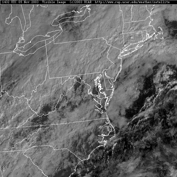
The clouds are thick and ever-present on the Visible Satellite view this morning. The 'bumpy' appearance comes from a low morning sun angle (the taller clouds are being lit from the side) and the fact that the clouds are convective. They are thunderstorms.
And, sure enough, on the radar, we see fairly significant thunderstorm cells spreading into western Pennsylvania. There is a wandering shower near Philadelphia this morning, the best chances of rain (100%) will be later this afternoon and tonight.
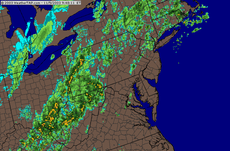
Where the storms are, air is colliding at the surface. You can see that collision zone marked on red. To the right, winds are coming from the south (mainly) and they are coming from the west and northwest to the left of this zone. The colliding air can't go into the ground, so it needs to rise. And that is what is making the storms form. This is the current location of the cold front.
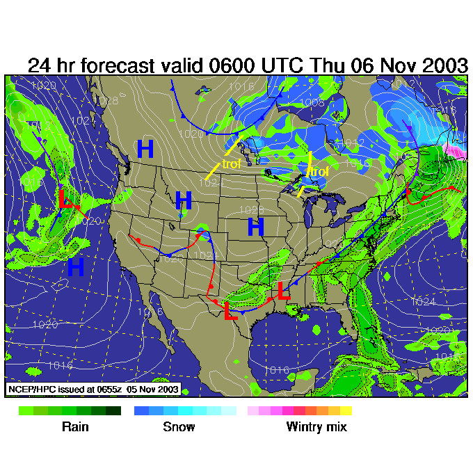
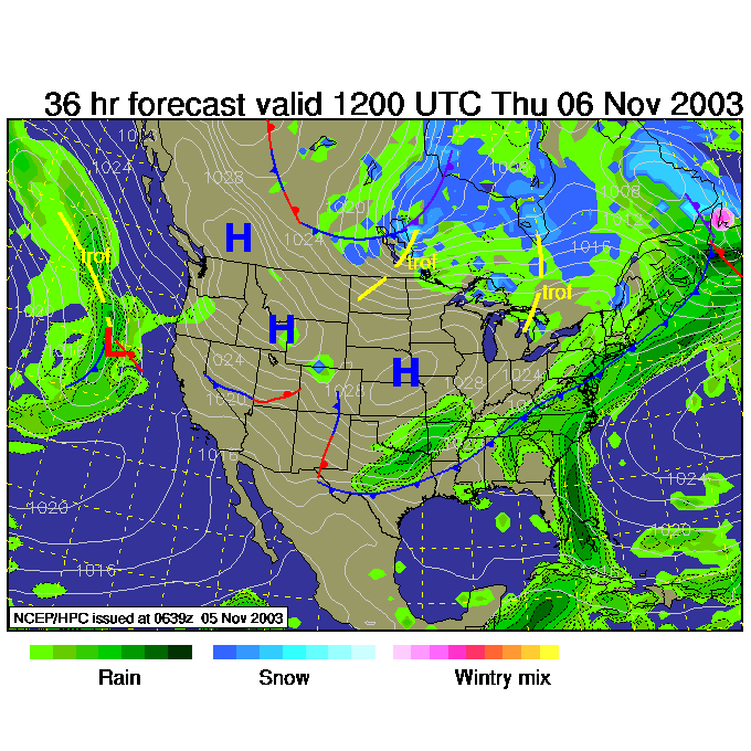
Looking forward: The front pushes further eastward (it is probably already past this position actually) by noon.
By midnight tonight, the cold front itself is sitting ON
Philadelphia and the rain keeps falling.
The temperatures will start to drop quite rapidly after this.
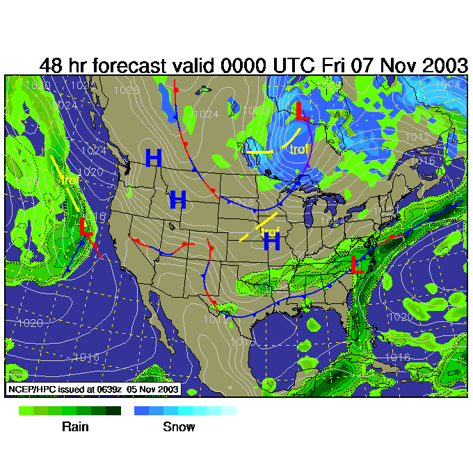
By Thursday morning, 5am, the front will have cleared the
area, but some showers could still be falling behind it.
The big thunderstorms will be over though.
Then Thursday night, 7pm, we see the front to our south and the chance of rain even more diminished (but not out of the story yet).
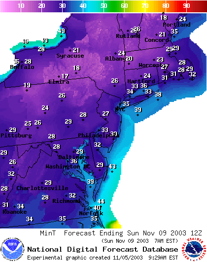
Cold air will keep filtering in into the weekend, and the coldest night yet this season will hit Sunday morning. We will sink into the upper 20's and lower 30's around Philadelphia. Brrrrr! Then warming returns.
Stay Dry and Warm and come on back. I'll see you again tomorrow.
Meteorologist John Ensworth
Surface Station sky cover color key:
Flight category definitions:| Category | Ceiling | Visibility | |
|---|---|---|---|
| Low Instrument Flight Rules LIFR* (magenta circle) |
below 500 feet AGL | and/or | less than 1 mile |
| Instrument Flight Rules IFR (red circle) |
500 to below 1,000 feet AGL | and/or | 1 mile to less than 3 miles |
| Marginal Visual Flight Rules MVFR (blue circle) |
1,000 to 3,000 feet AGL | and/or | 3 to 5 miles |
| Visual Flight Rules VFR+ (green circle) |
greater than 3,000 feet AGL | and | greater than 5 miles |
| *By definition, IFR is ceiling less than 1,000 feet
AGL and/or visibility less than 3 miles while LIFR
is a sub-category of IFR. +By definition, VFR is ceiling greater than or equal to 1,000 feet AGL and visibility greater than or equal to 3 miles while MVFR is a sub-category of VFR. |
|||