Back To Home
The Story Behind the Weather - By Forecaster John
Ensworth M.S. -
The Discussion of Weather Events Daily for Philadelphia and Pennsylvania
Last updated: 11/06/2003 10:37 AM
Good Morning Philadelphia!
I'm glad to announce that these discussions will continue until at least the end of November.
In Short: Cloudy, Drizzly, and fairly Warm with dropping temperatures through the weekend!.
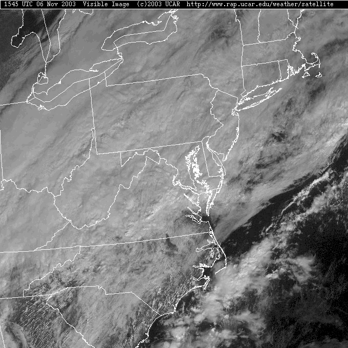
Philadelphia is socked in with clouds and showers this fine morning. The whole state is under a THICK shield of cumulus clouds.
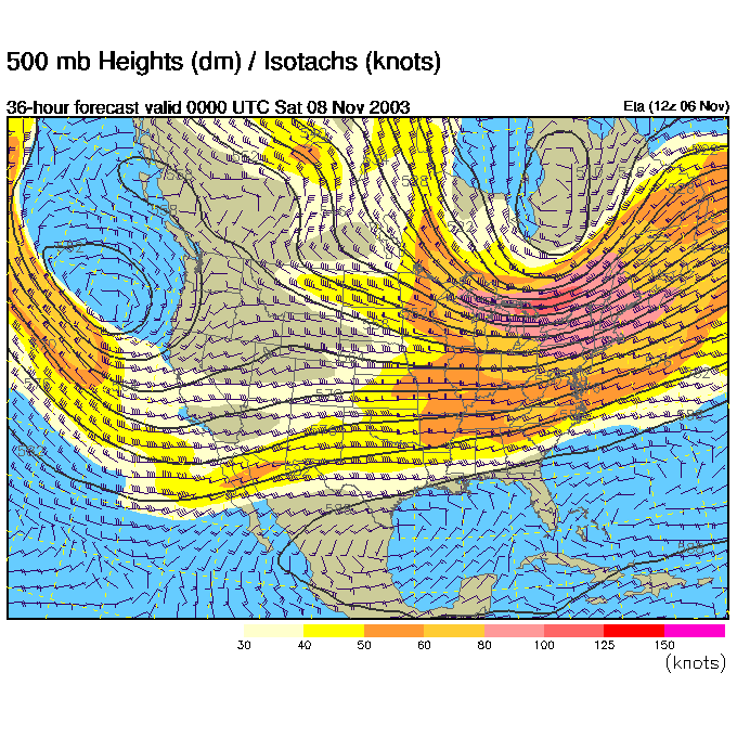
Since we've been tracking the wind patterns at 18,000feet aloft, we'll keep it up this morning. Remember, the best place to find rain and storms is on the right side of a trough. The ridge that kept us warm and dry is way off the N. American continent to our east (off the map). There is a big trough that was on the west coast, now the northern part of it is heading towards us, so the trough is really tilted across the country. Remember this trough when we get the final forecast maps at the bottom.
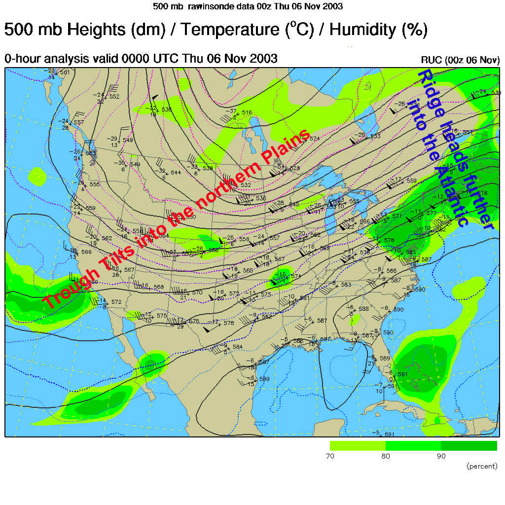
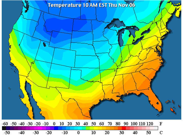
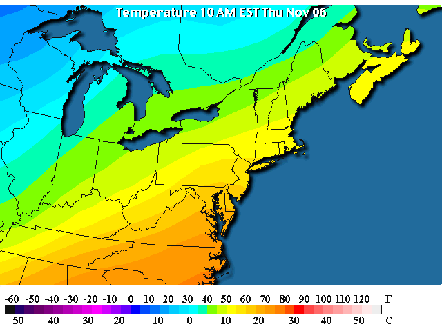
The trough is associated with cool/cold air. On the current temperature map, you can see the cold temperature, indeed, in the same place as the big trough. Fun- no?
The front that just came through dumped the rain seen below up the east coast.
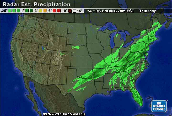
Locally (near Philadelphia) received about a half inch of rain, but just to our north, there are a number of 1 to 1.5" rain amounts.
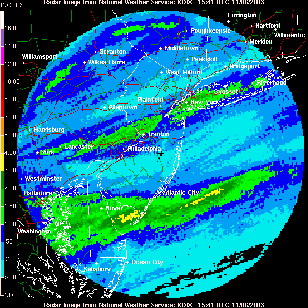
And at the issuance of this discussion, there are showers still falling in Philadelphia, and more rain out west.
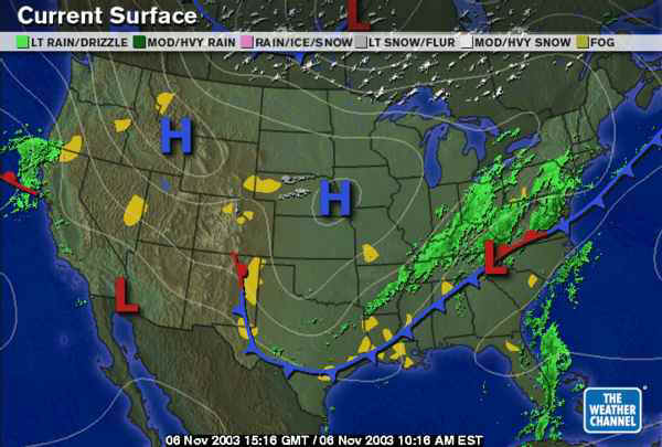
On the surface map, you can see the front that passed over us sitting to the south, down in Virginia. A new low pressure system is forming on the front in eastern Tennessee. This is pumping warm moist air from the Atlantic up over the front to it's east, which is sliding over us and producing rain.
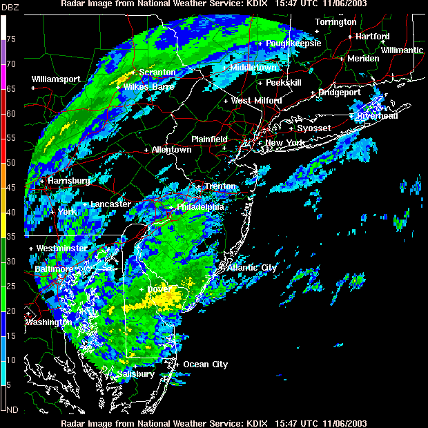
Locally, you can see that most of the rain is falling north of the front. This is commonly called overrunning (although meteorologists like to use the term isentrophic uplift but that's beyond these discussions.).
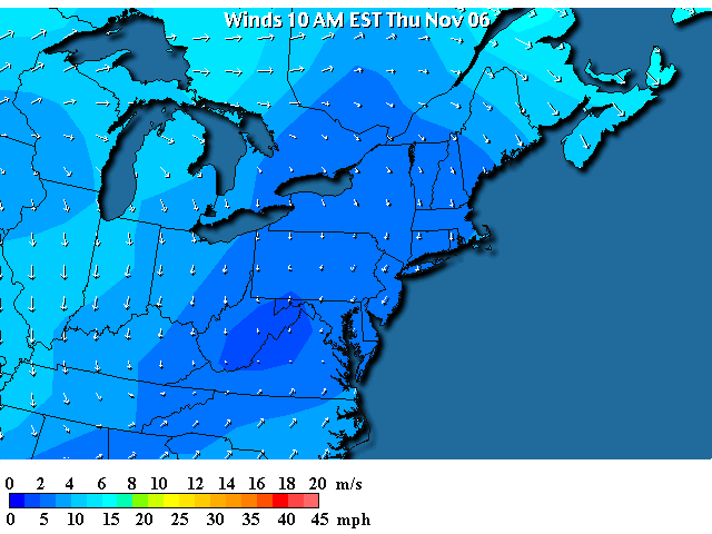
You can see the cooler air north of the front, now mostly in place over Pennsylvania, but it is only cool air. The really cold air is way up north and west beyond the Lakes.
So now, differently than the last week, we have north winds (winds blowing from the north) sliding down over the entire state.
So, into the future, the low on the frontal boundary stops the front from moving further south - away from us. With the low there, and with the front nearby, rain will stay in the forecast.
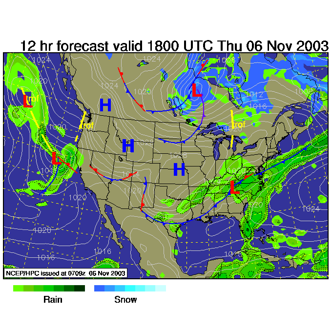
Tonight, by midnight, it is the low, following the pattern of upper air flow moving to the northeast, that brings even more rain.
Look out in the northern Plains for the NEXT front headed our way.
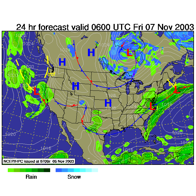
Friday night, 7pm, and the low and front have moved on, with that NEW front and shot of colder air sliding rapidly to the southeast towards us.
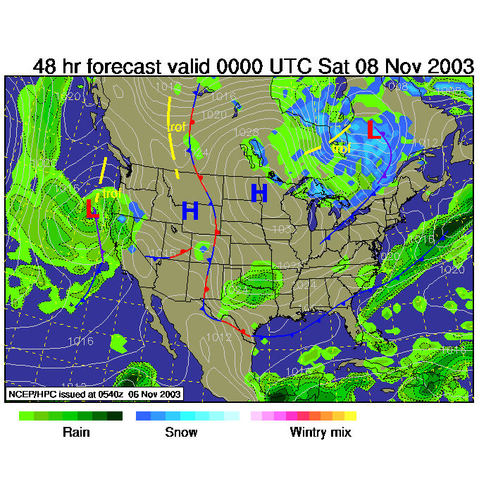
That new, colder, front is being kicked forward by the northern part of the trough that has now split apart. The northern (colder) part of the trough is, by Friday night, east of the Great Lakes. The southern part is still off on the west cost. Weird - huh?
Try to stay dry and warm. I'll see you again tomorrow.
Meteorologist John Ensworth
Surface Station sky cover color key:
Flight category definitions:| Category | Ceiling | Visibility | |
|---|---|---|---|
| Low Instrument Flight Rules LIFR* (magenta circle) |
below 500 feet AGL | and/or | less than 1 mile |
| Instrument Flight Rules IFR (red circle) |
500 to below 1,000 feet AGL | and/or | 1 mile to less than 3 miles |
| Marginal Visual Flight Rules MVFR (blue circle) |
1,000 to 3,000 feet AGL | and/or | 3 to 5 miles |
| Visual Flight Rules VFR+ (green circle) |
greater than 3,000 feet AGL | and | greater than 5 miles |
| *By definition, IFR is ceiling less than 1,000 feet
AGL and/or visibility less than 3 miles while LIFR
is a sub-category of IFR. +By definition, VFR is ceiling greater than or equal to 1,000 feet AGL and visibility greater than or equal to 3 miles while MVFR is a sub-category of VFR. |
|||