Back To Home
The Story Behind the Weather - By Forecaster John
Ensworth M.S. -
The Discussion of Weather Events Daily for Philadelphia and Pennsylvania
Last updated: 11/07/2003 10:13 AM
Good Morning Philadelphia!
I'm glad to announce that these discussions will continue until at least the end of November.
In Short: Mostly clear, breezy with temperatures dropping through the weekend!.
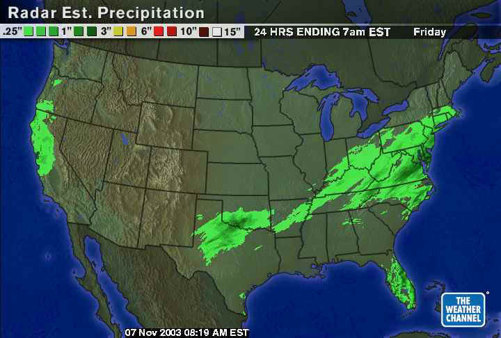
A quick look at the droppings from our last front shows widespread light rain over the southeast three quarters of Pennsylvania. The heavier, roughly one inch amounts, are limited to areas further southeast from Philadelphia (we received 0.22 inches at the airport).
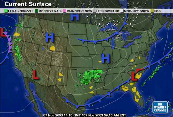
The front to our south sagged further south than expected and the low that formed stayed south as well. This has prematurely eliminated our chance of rain. I like it! The next player we need to be concerned with is the front sweeping out of the northern plains.
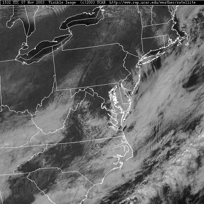
With the front clearing the area, the skies are becoming mostly clear as well. (The visible satellite view sort of looks like a piece of abstract art this morning!).
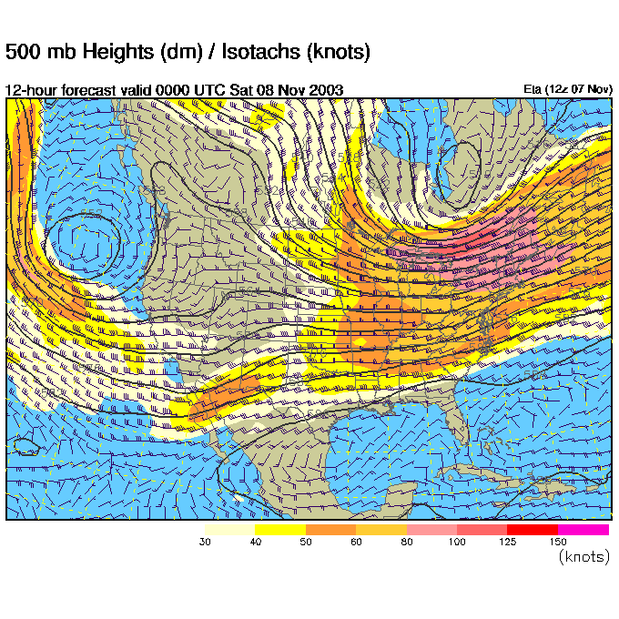
Over the last many discussions, we've been tracking the west coast and east coast troughs. Yesterday we were watching the west coast trough split into a northern dip and a southern dip. The southern dip was staying on the west coast and the northern dip was heading for the Great Lakes.
The northern dip has indeed traveled further to the east and is moving with a big cold blob of air. On the west coast, you can still see the hint of the remaining trough.
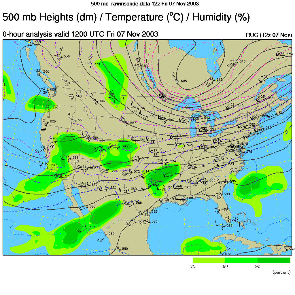
Again, compare the cold air on the expected highs map today with the pattern above. The troughs have cold air under them.

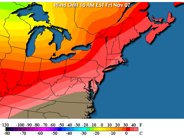
When you take in the chilling effect of the wind with the low temperatures, you get wind chill. The wind chills over the western lakes (the air that is coming here) is now getting very dangerously cold. Exposed skin will cool due to wind and cold temperatures as if the actual temperature was about 10 to 20 degrees below zero. Some of this cold air is heading for us.
The lows tonight into Saturday morning with an approaching cold high and mostly clear skies will drop to or just below freezing in Philadelphia.
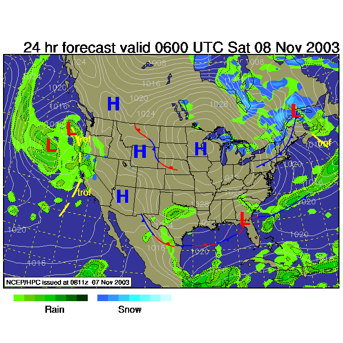
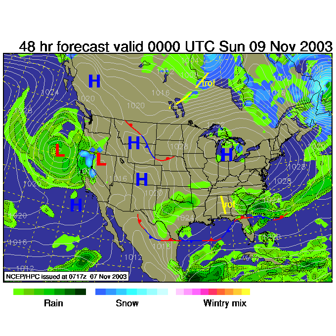
Overnight tonight, the trough pulls into the northeastern us.
And the surface map shows the leading edge of the cold air sliding in ahead of the cold High center (sitting over Minnesota).
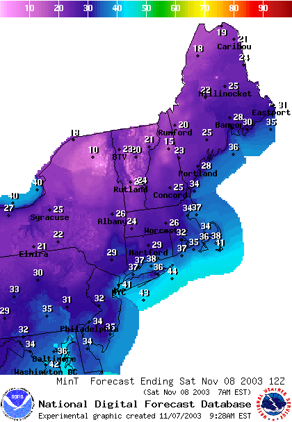
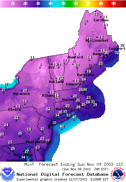
Twenty four hours later, Sunday morning, we bottom out with temperatures in the 20's near Philadelphia and 10's just to the north. This is the actual temperature, NOT the wind chill.
This happens as the center of the High oozes towards us.
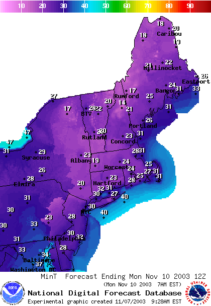
Monday morning sees the body of cold air moderating (warming a bit due to the sun shining on it all day) and moving to the east. We'll only see temperatures a bit below freezing in the city proper.
Stay warm. Enjoy the crisp clear sunlight and I'll see you again tomorrow.
Meteorologist John Ensworth
Surface Station sky cover color key:
Flight category definitions:| Category | Ceiling | Visibility | |
|---|---|---|---|
| Low Instrument Flight Rules LIFR* (magenta circle) |
below 500 feet AGL | and/or | less than 1 mile |
| Instrument Flight Rules IFR (red circle) |
500 to below 1,000 feet AGL | and/or | 1 mile to less than 3 miles |
| Marginal Visual Flight Rules MVFR (blue circle) |
1,000 to 3,000 feet AGL | and/or | 3 to 5 miles |
| Visual Flight Rules VFR+ (green circle) |
greater than 3,000 feet AGL | and | greater than 5 miles |
| *By definition, IFR is ceiling less than 1,000 feet
AGL and/or visibility less than 3 miles while LIFR
is a sub-category of IFR. +By definition, VFR is ceiling greater than or equal to 1,000 feet AGL and visibility greater than or equal to 3 miles while MVFR is a sub-category of VFR. |
|||