Back To Home
The Story Behind the Weather - By Forecaster John
Ensworth M.S. -
The Discussion of Weather Events Daily for Philadelphia and Pennsylvania
Last updated: 11/12/2003 10:35 AM
Good Morning Philadelphia!
I'm glad to announce that these discussions will continue until at least the end of November.
This morning's forecast discussion follows only 12 hours after last nights unusually late forecast discussion. They work well together since very subtle changes have occurred in this time. Please read it over first, then hop to this one.
In Short: After the rain passes Wednesday, we'll be really windy and cooler, briefly. Some snow may fly as this storm passes in the higher elevations of central and northern Pennsylvania. This forecast still holds from yesterday.
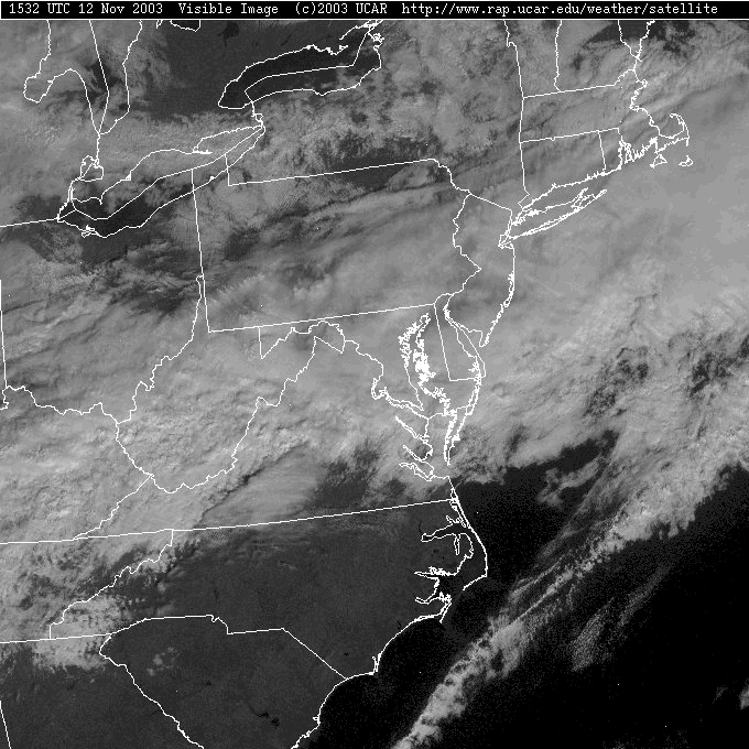
The visible satellite view this morning (since the sun is up, we don't have to use the infrared view to see what is going on. In this view, what is white and bright [reflective] shows up as white, and what is dark and absorbs light [absorptive] shows up dark - simple, no?) shows a thick band of clouds just south of the state. These clouds also appear bumpy; they are convective clouds called cumulonimbus clouds.
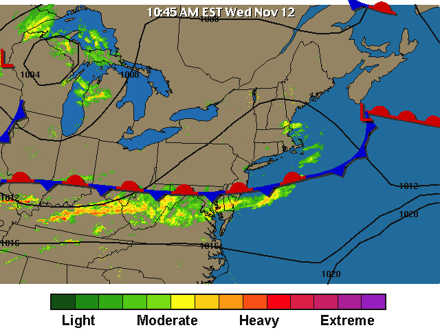
Under those bumpiest clouds, we find the heaviest and most continuous rainfall. There appear to be some good lines of thunderstorms especially south of Ohio.
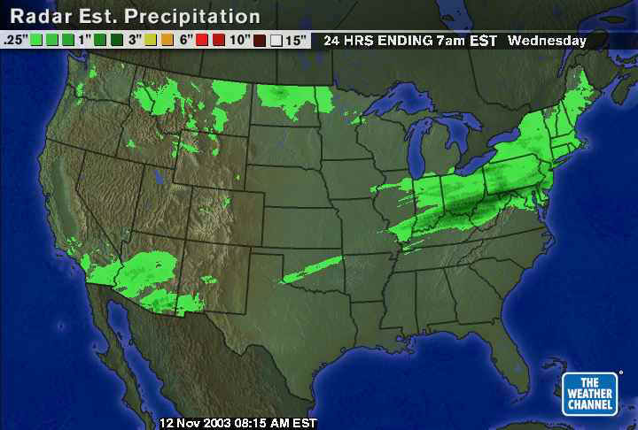
Over the last 24 hours (thanks to the Weather Channel) the entire northeastern US has had a brush of light to moderate amounts of rain. The heaviest is falling where the heavy cells are this morning.
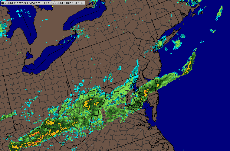
Like yesterday, the Weather Channel has NOT analyzed a front near us, but just shows the band of rain on the radar (note the cold front out on the Plains is beginning to swing to the east and snow is starting on it's NW side).
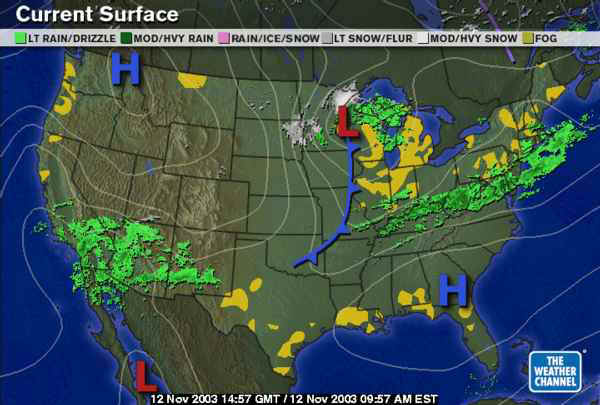
The National Weather Service, on the other hand, does have a stationary front drawn in through the line of heavier rain and storms south of us.
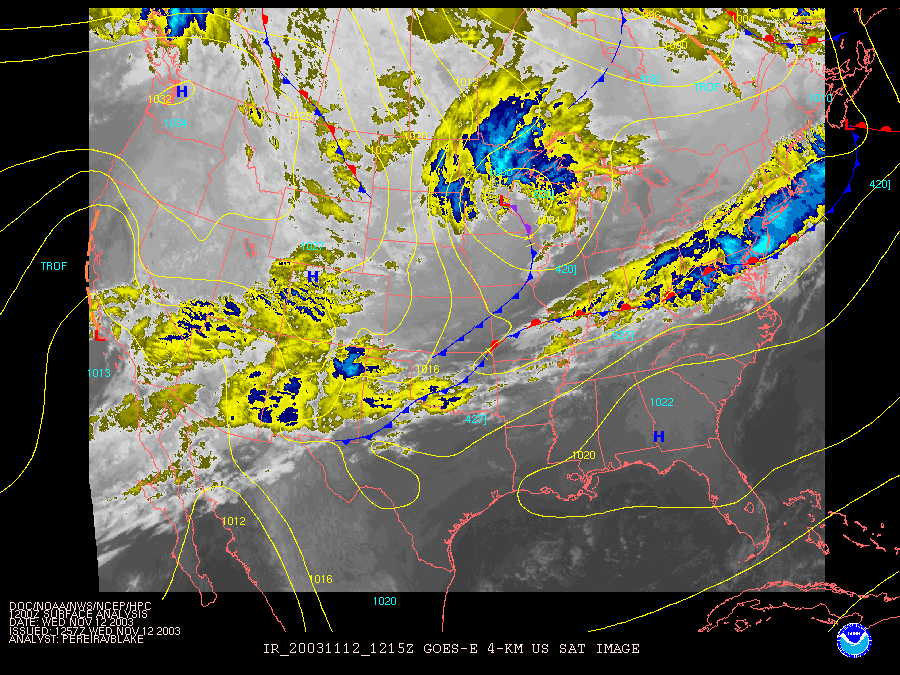
The Weatherunderground.com is also drawing in a front through here. Note the precipitation is falling south of the front in the warmest and moistest tropical air.
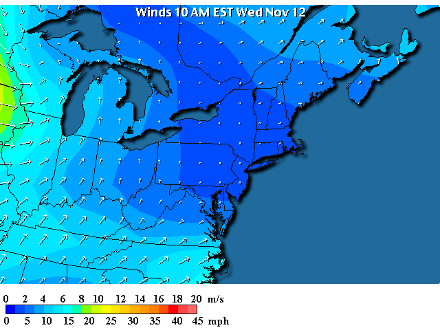
Winds are still generally from the south everywhere (except for the strong west winds behind the front in the Plains) but they are calm now over Pennsylvania and New York. So now there IS a slowdown/convergence of air south of us where the flow from the southwest comes to a near stop. That is what is helping those storms form. The air goes UP when it comes to a stop and since it is warm and moist, clouds and rain can form.
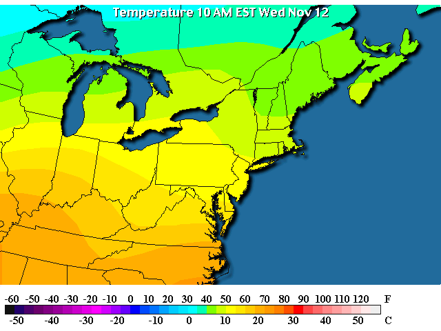
Pennsylvania is feeling 50's quite uniformly, but there are 70's F just to the south. Summer is still lingering in the neighborhood for a bit more.
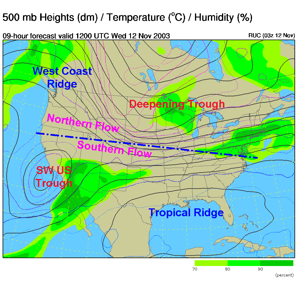
On the upper air map (showing the west to east flow of air at about 18,000 feet above sea level parallel to the dark lines) we still see two flows - marked by the blue dot/dash line and the purple labels. The northern flow is seeing a Ridge (high pressure) forming on the west coast with a deepening trough over the central and eastern US (which is helping to get our front on the Plains moving).
The southern flow still has a cut-off Low/Trough over southern California and a broad ridge in the Gulf of Mexico. Two different weather stories. We are most concerned with the deepening and approaching trough over the Plains.
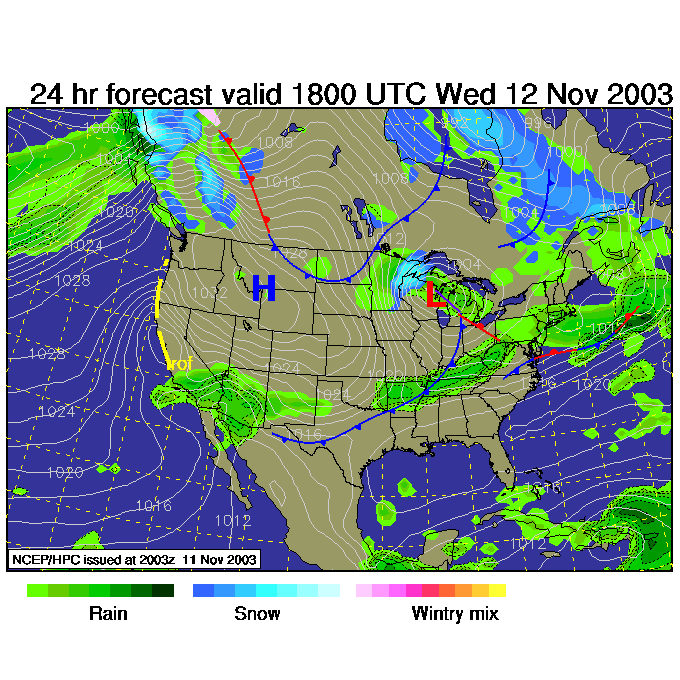
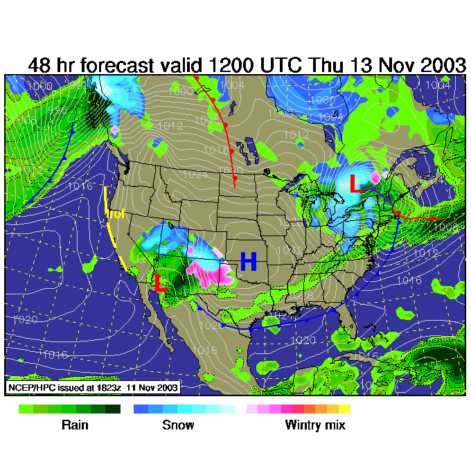
At first, the stationary front (as it's name implies) is still near Philadelphia and a chance of rain continues. The cold front on the plains gets bigger and begins to move east. (This map is for 1pm Today).
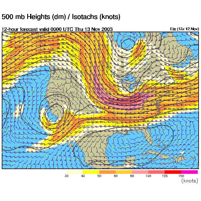
By tonight, 7pm, the trough in the east (and northern flow) has grown quite noticeably.
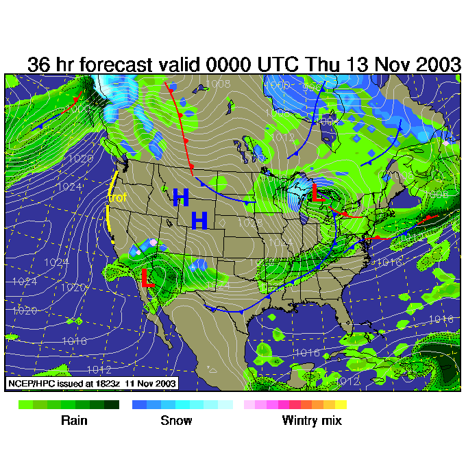
At this time, the stationary front has become a warm front and has moved north of Philadelphia. We get briefly quite warm (and wet).
Then by Thursday 7am, the trough is even BIGGER on the east coast...
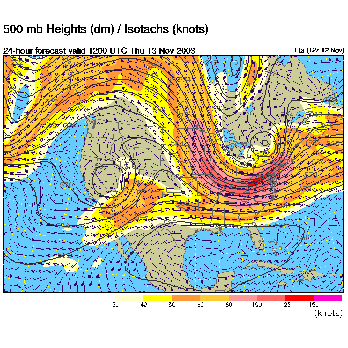
And more serious cold air flows in behind the low and cold front. The cold front sweeps through (by Thursday morning 7am) and we get colder and VERY windy. The white lines on this map are lines of equal barometric pressure. The closer they are packed, the stronger the winds (look back at the pressure maps for hurricane Isabel this fall in the archives). We will feel MUCH colder with all this wind and actually colder air.
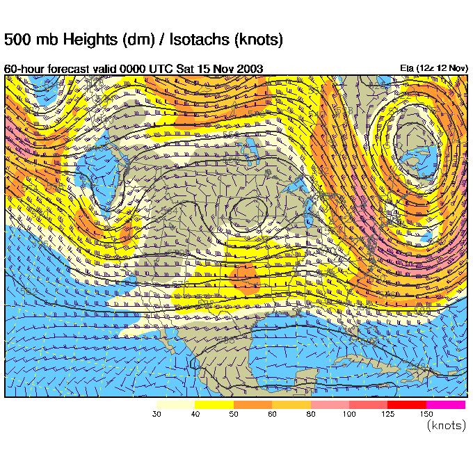
Way off to Friday night (for a quick peek) we see that trough leaving us and a ridge building in the northern flow (well there is a trough below that, then another ridge down in the Gulf of Mexico -- GREAT !! THREE FLOWS!). Overall, it should warm up some by the weekend.
Enjoy the warmth before it is gone and stay dry.
I'll see you again Thursday!
Meteorologist John Ensworth
Surface Station sky cover color key:
Flight category definitions:| Category | Ceiling | Visibility | |
|---|---|---|---|
| Low Instrument Flight Rules LIFR* (magenta circle) |
below 500 feet AGL | and/or | less than 1 mile |
| Instrument Flight Rules IFR (red circle) |
500 to below 1,000 feet AGL | and/or | 1 mile to less than 3 miles |
| Marginal Visual Flight Rules MVFR (blue circle) |
1,000 to 3,000 feet AGL | and/or | 3 to 5 miles |
| Visual Flight Rules VFR+ (green circle) |
greater than 3,000 feet AGL | and | greater than 5 miles |
| *By definition, IFR is ceiling less than 1,000 feet
AGL and/or visibility less than 3 miles while LIFR
is a sub-category of IFR. +By definition, VFR is ceiling greater than or equal to 1,000 feet AGL and visibility greater than or equal to 3 miles while MVFR is a sub-category of VFR. |
|||