Back To Home
The Story Behind the Weather - By Forecaster John
Ensworth M.S. -
The Discussion of Weather Events Daily for Philadelphia and Pennsylvania
Last updated: 11/13/2003 11:41 PM
Good Morning Philadelphia!
I'm glad to announce that these discussions will continue until at least the end of November.
This evenings forecast is so LATE that it is almost tomorrow! I'll keep it short, and to the WIND!
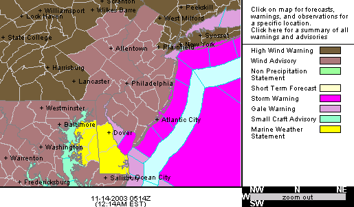
We have a Wind Advisory for Philadelphia with winds roaring up to 70mph in some parts of the state. We can expect (as the text below states) 40-50mph wind gusts tonight. Wow!
Here is the exact text from the National Weather Service for Philadelphia.
A WIND ADVISORY HAS BEEN ISSUED FOR OVERNIGHT AND FRIDAY MORNING... A WEST WIND RANGING FROM 20 TO 35 MPH CONTINUED TO AFFECT THE REGION THIS EVENING AND WIND GUSTS OF 40 TO 50 MPH WERE COMMON. BEING THAT WIND SPEEDS HAVE DIMINISHED A BIT, THE HIGH WIND WARNING HAS BEEN DOWNGRADED TO A WIND ADVISORY. THE ADVISORY WILL REMAIN IN EFFECT OVERNIGHT AND INTO FRIDAY MORNING. THE WINDY CONDITIONS MAY CAUSE MORE TREES LIMBS TO FALL AND MORE POWER OUTAGES. ITEMS SUCH AS TRASH CANS AND OUTDOOR FURNITURE WILL CONTINUE TO BE BLOWN ABOUT IF THEY ARE NOT TIED DOWN OR STORED INDOORS. ALSO, IT WILL REMAIN DIFFICULT TO DRIVE HIGH PROFILE VEHICLES AT TIMES. THE WIND WILL DIMINISH EVEN FURTHER DURING LATE FRIDAY AND FRIDAY NIGHT. THE INTENSE AREA OF LOW PRESSURE RESPONSIBLE FOR THE STRONG WIND WAS MOVING ACROSS SOUTHERN QUEBEC THIS EVENING. THE LOW WILL PASS OVER CANADA'S ATLANTIC PROVINCES ON FRIDAY.
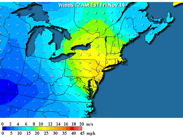
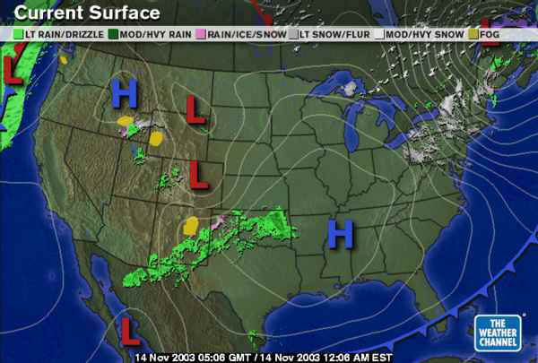
The winds over the area are incredible blowing around the low pressure system to the northeast (more on this on the surface map below).
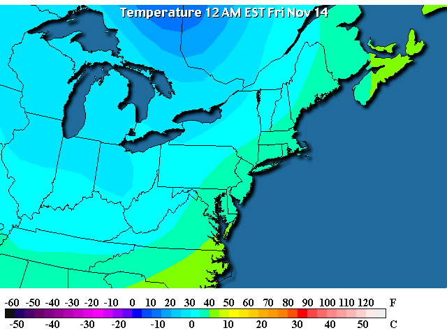
Temperatures behind this latest front are dropping (more to the north than here). Temperatures in Canada near the Lakes are dropping to the single digits and lower teens. We are still in the 30's and 40's near Philadelphia, BUT...
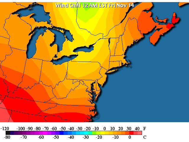
The winds plus the temperatures are giving us wind chills near and below 20 degrees F. Now we get a taste of winter.
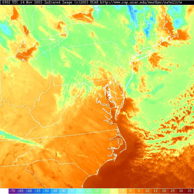
The northwest winds are sweeping over the warm lakes (in the Infrared satellite view below, reds are WARM surfaces- usually the ground or open water, and greens/blues are very COLD surfaces - usually clouds). The Great Lakes are still very warm (see the reds?) and the air is picking up heat and moisture from them creating clouds and snow flurries over much of Pennsylvania tonight. Brrr.
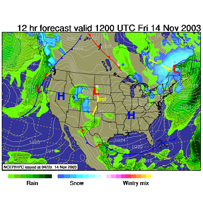
On the surface map, the low is under the 'key' bar at the top, but winds are blowing around it in a counterclockwise direction (as they usually do). The white lines are lines of equal barometric pressure (adjusted to sea level). The closer the lines are, the greater the pressure is changing over the area (the greater the 'pressure gradient' is). The greater the pressure change over a small distance, the stronger the winds--- hence our powerful winds tonight.
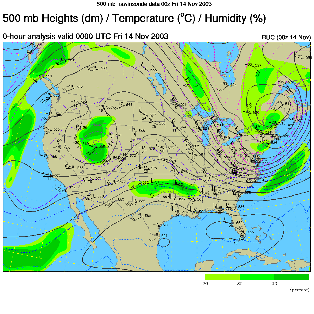
The upper level map (the winds blow west to east along the black lines here at 18,000feet above sea level) shows a deep trough over the eastern US and another TIGHT bunching of the lines of equal height-of-the-500mb-pressure-surface (like a topographic map of pressure), the stronger the winds blow here. This is a strong system!
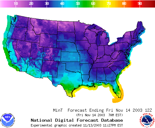
The colder air is found in the troughs, there is also a trough in the western US on the map above, and both pools of cold air are visible on the forecast of minimum temperatures.
For tomorrow morning, the pressure gradient will still be tight over the northeastern US and the winds will keep whistling along. Lake effect snow and rain showers will continue as well.
I'll see you either tomorrow morning, or afternoon!
Watch out for falling limbs.
I'll see you again Friday!
Meteorologist John Ensworth
Surface Station sky cover color key:
Flight category definitions:| Category | Ceiling | Visibility | |
|---|---|---|---|
| Low Instrument Flight Rules LIFR* (magenta circle) |
below 500 feet AGL | and/or | less than 1 mile |
| Instrument Flight Rules IFR (red circle) |
500 to below 1,000 feet AGL | and/or | 1 mile to less than 3 miles |
| Marginal Visual Flight Rules MVFR (blue circle) |
1,000 to 3,000 feet AGL | and/or | 3 to 5 miles |
| Visual Flight Rules VFR+ (green circle) |
greater than 3,000 feet AGL | and | greater than 5 miles |
| *By definition, IFR is ceiling less than 1,000 feet
AGL and/or visibility less than 3 miles while LIFR
is a sub-category of IFR. +By definition, VFR is ceiling greater than or equal to 1,000 feet AGL and visibility greater than or equal to 3 miles while MVFR is a sub-category of VFR. |
|||