Back To Home
The Story Behind the Weather - By Forecaster John
Ensworth M.S. -
The Discussion of Weather Events Daily for Philadelphia and Pennsylvania
Last updated: 11/19/2003 09:38 AM
Good Morning Philadelphia!
I'm glad to announce that these discussions will continue until at least the end of this Year!. I have the needed server space.
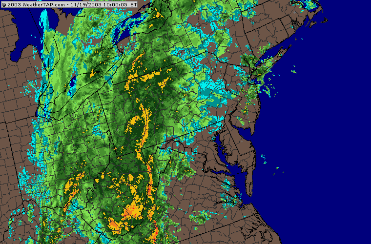
In short: Mild temperatures and a LOT of rain over the next 24 hours.
Here it comes. A tremendous amount of water is falling and moving eastward towards us.
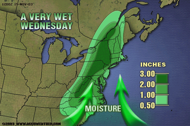
You can see the last 24 hours of rain across the nation as this big cold front pulled eastward. Small areas in the south topped 3 inches of water, but, for the most part, 1" rainfalls were the norm.

From www.accuweather.com and http://pro.accuweather.com (you NEED to Subscribe to that site...excellent weather info and videos!).
As winds increase from the south, a strong draw of tropical moisture will get pulled into flow ahead of the storm system today and up to 3" might fall many places up the east coast (especially up the Appalachians ).
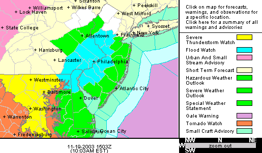
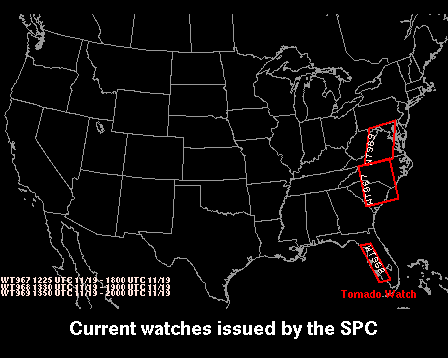
With all this approaching, there are a LOT of watches and warnings for the area. Philadelphia is under a flash flood watch today.
I've included the exact text from the National Weather Service (NWS) here:
A STRONG COLD FRONT WILL MOVE EAST CROSSING THE REGION THIS EVENING. ABUNDANT MOISTURE ACCOMPANIES THIS FRONTAL SYSTEM AND 1 TO 3 INCHES OF RAIN COULD FALL THIS AFTERNOON AND EVENING. RAINFALL RATES IN EXCESS OF AN INCH AN HOUR ARE ALSO POSSIBLE FLOODING OF CREEKS...STREAMS AND LOW LYING POOR DRAINAGE AREAS ARE POSSIBLE WHEREVER THIS RAINFALL MATERIALIZES. BE ESPECIALLY CAUTIOUS IN URBAN AREAS WHERE LEAVES AND OTHER DEBRIS MAY CLOG STORM DRAINS. THE HEAVIEST RAINFALL SHOULD BE OVER BY MIDNIGHT TONIGHT. A FLOOD WATCH MEANS THAT FLOODING OF STREAMS...CREEKS AND OTHER DRAINAGE AREAS IS POSSIBLE WITHIN THE WATCH AREA. PEOPLE IN THE WATCH AREA SHOULD KEEP AN EYE ON THE WEATHER AND BE PREPARED FOR IMMEDIATE ACTION SHOULD HEAVY RAINS AND FLOODING OCCUR OR A FLOOD WARNING BE ISSUED. $$ STAY TUNED TO NOAA WEATHER RADIO...YOUR LOCAL RADIO OR TELEVISION STATIONS...OR YOUR CABLE TELEVISION OUTLET FOR FURTHER DETAILS OR UPDATES. ADDITIONAL WEATHER INFORMATION CAN BE FOUND ON THE INTERNET AT WWW.WEATHER.GOV/ER/PHI IN SMALL LETTERS. RNS
With all this lift and instability, the Severe Storms Prediction center has issued a slight risk of severe weather for the east coast (inside the green area).
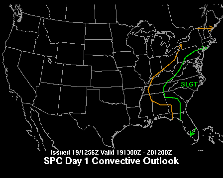
We also, this morning, have a tornado watch extending to just south of the city. This is an indication of how strong a system it is. You should keep a radio nearby in case warnings are issued today.
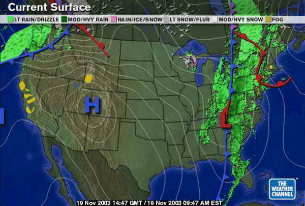
So the weather at the surface is as follows.
The Low in the South has slid eastward almost entering North Carolina. The warm front has rushed northward, and rain is happening all over.
Zooming in (and now borrowing from the Weatherunderground.com ) you can see the cold front is the main source of lift...the storms are forming ahead of the front even beyond the warm front.
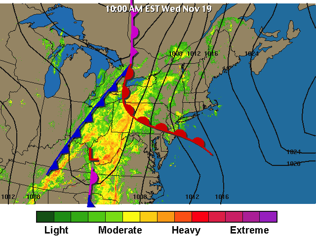
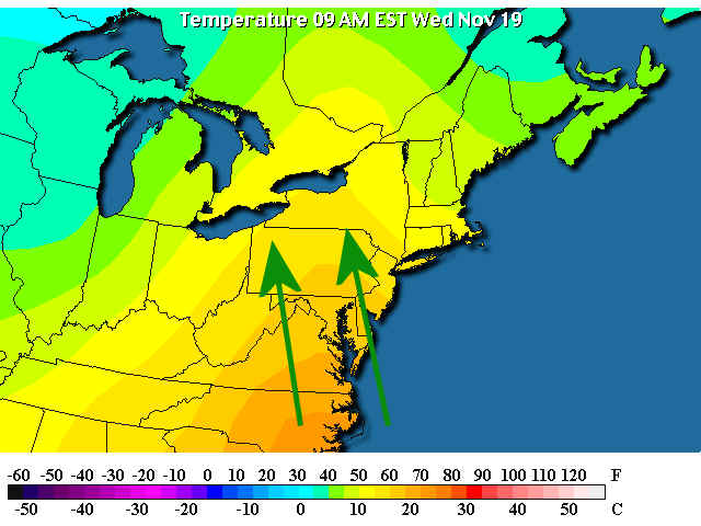
Surface winds ahead of the front are roaring out of the south...
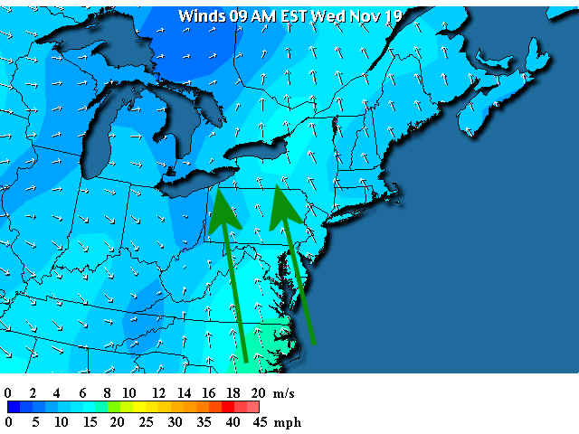
Which is pulling 70+F to 80+F air northward...
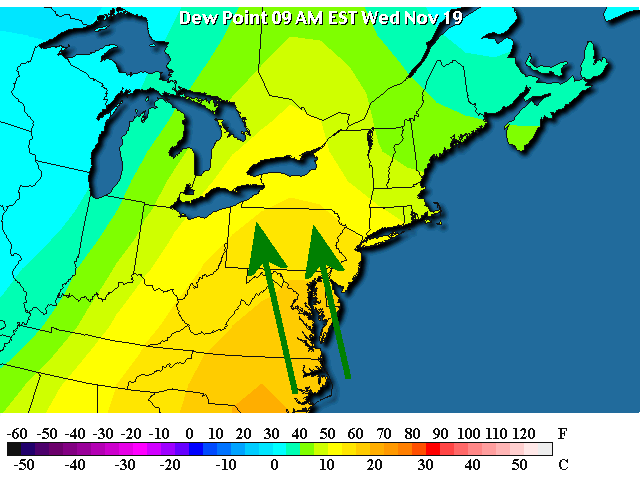
And they are pulling 70+F dew points northward as well. Remember, the dew point tells us how much actual water vapor there is in the atmosphere. The 30F dew points out to the northwest is very dry air.
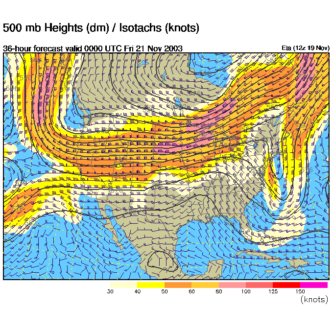
The good news is the upper air pattern is NOT expected to cut-off right over our heads like yesterday and the surface low is already sliding over Philadelphia by 1am tonight. Cooooo!.
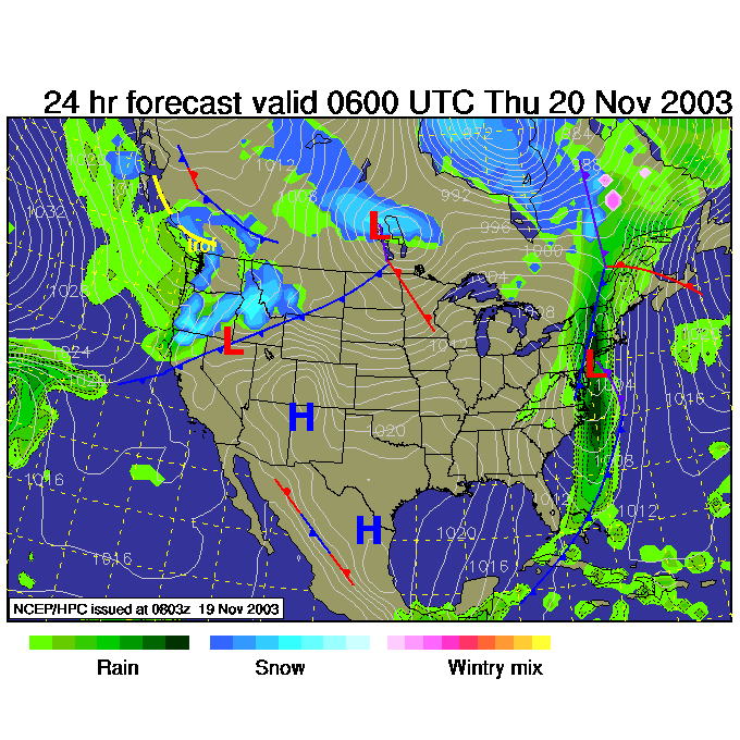
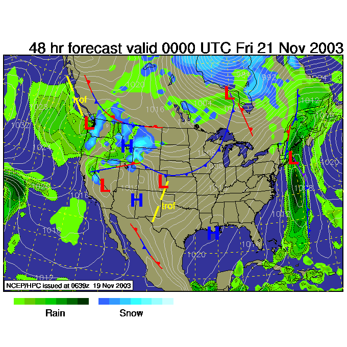
When 7am arrives Thursday - the low is offshore and we are only getting wrap around rainfall (some snow appears up in New York!).
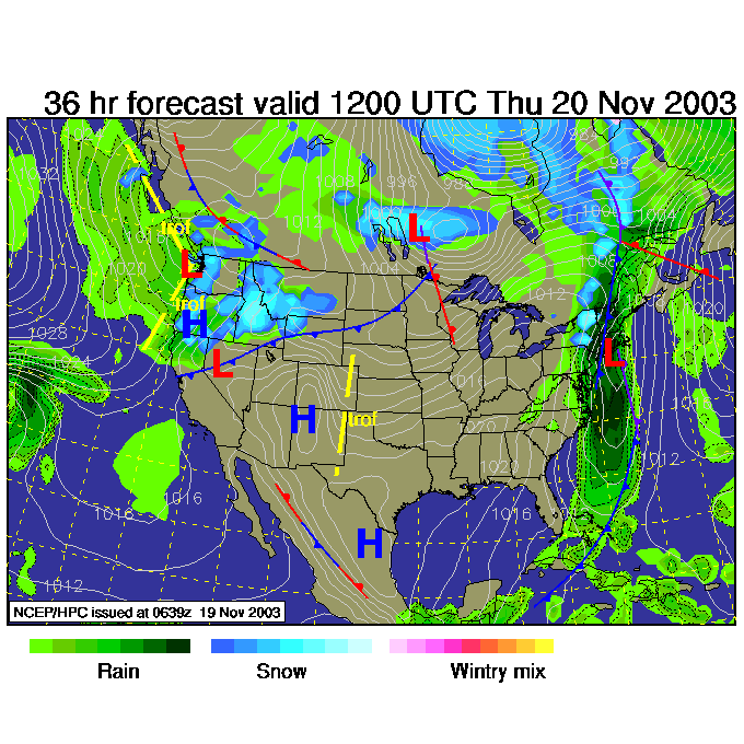
The upper level map (the winds blow west to east parallel to the dark black lines at about 18,000feet a.s.l. ) shows the trough sitting off the east coast and NOT really cut off from the main flow.
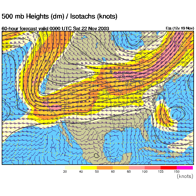
Thursday 7pm and the rain is GONE. Woohoo! What is happening out on the Plains though? Another cold front?
Yes, you can see the deep western trough swinging down kicking more cold air into the body of the US on Friday night...
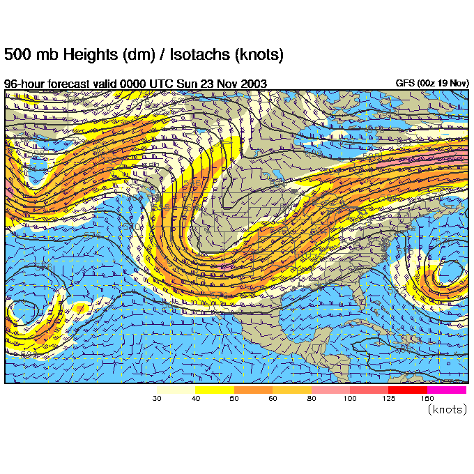
And by Saturday night, we are still in a nice warm ridge, but very cold nasty stuff is coming in! Brrrr for next week.
Finish loading the animals into your recently completed Ark. I'll see you back here Thursday as the rain pulls (thankfully) away.
Meteorologist John Ensworth
Surface Station sky cover color key:
Flight category definitions:| Category | Ceiling | Visibility | |
|---|---|---|---|
| Low Instrument Flight Rules LIFR* (magenta circle) |
below 500 feet AGL | and/or | less than 1 mile |
| Instrument Flight Rules IFR (red circle) |
500 to below 1,000 feet AGL | and/or | 1 mile to less than 3 miles |
| Marginal Visual Flight Rules MVFR (blue circle) |
1,000 to 3,000 feet AGL | and/or | 3 to 5 miles |
| Visual Flight Rules VFR+ (green circle) |
greater than 3,000 feet AGL | and | greater than 5 miles |
| *By definition, IFR is ceiling less than 1,000 feet
AGL and/or visibility less than 3 miles while LIFR
is a sub-category of IFR. +By definition, VFR is ceiling greater than or equal to 1,000 feet AGL and visibility greater than or equal to 3 miles while MVFR is a sub-category of VFR. |
|||