Back To Home
The Story Behind the Weather - By Forecaster John
Ensworth M.S. -
The Discussion of Weather Events Daily for Philadelphia and Pennsylvania
Last updated: 12/10/2003 10:05 AM
Good Morning Philadelphia!
I'm glad to announce that these
discussions will continue until at least the end of
this Year!.
I
have the necessary server space.
In short: Clouds are still thick, and the 'warm-up' and snow melt are still on schedule. But another shot of some snow is possible at the end of the weekend.
In long: The soil moisture
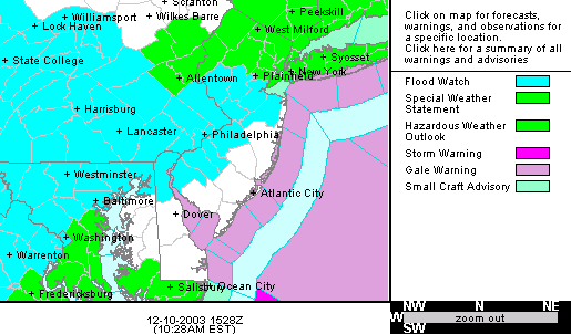
graphic that opened yesterday's discussion is relevant today to the first
graphic today... that of the Flood Watch the National Weather Service has issued
in light of a wet ground, snow pack, and approaching warm temperatures along
with heavy rainfall.
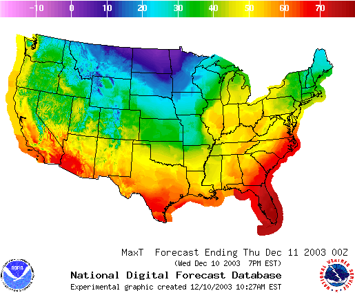
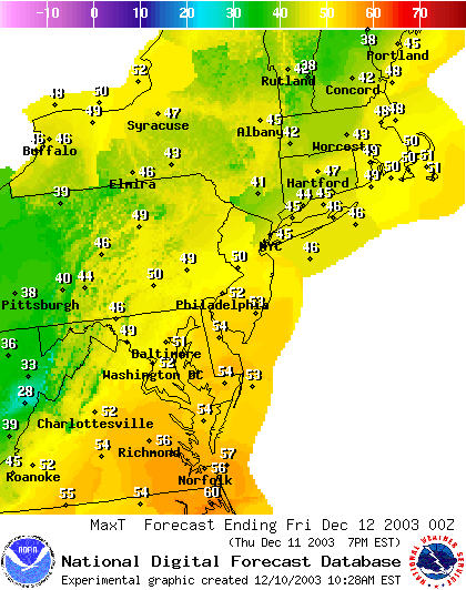
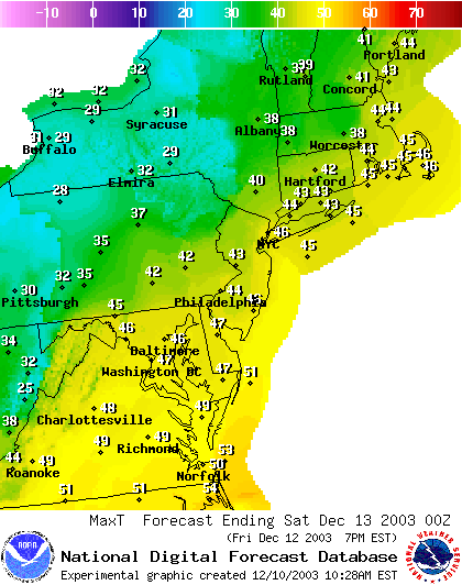
The forecast high temperatures today show the rapid warm up flooding up the Mississippi and Ohio Valleys. The snow on the ground in the northeast is the only thing fighting for cool temperatures anymore.
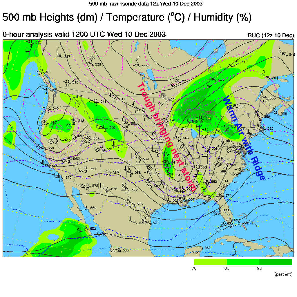
The warm air is found in the south air flow I've circled below. We have east winds which, at this time of year with snow on the ground, are also warm (since the ocean is relatively warm).
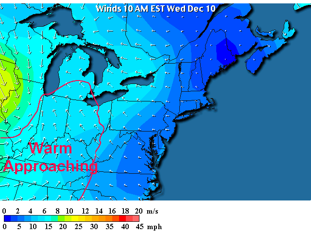
This wind flow is being caused by the position of the Low Pressure center now just past St. Louis. Strong counterclockwise flow is dominating the eastern half of the US.
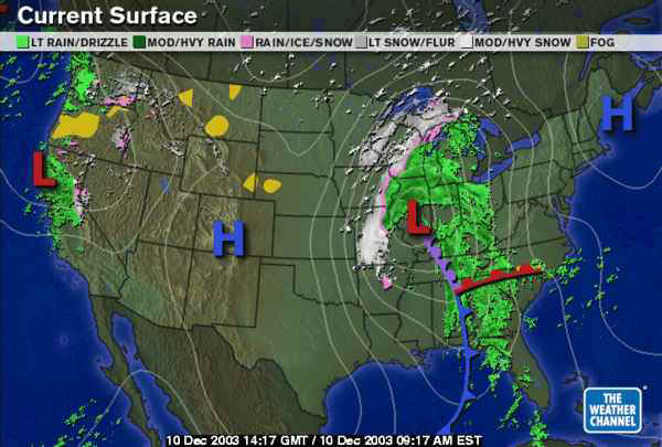
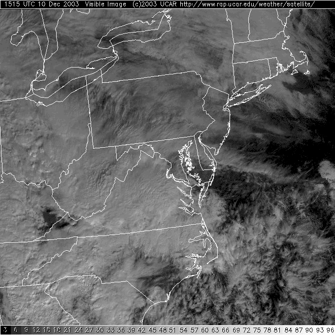
A thick cloud cover is also pouring eastward on the Visible satellite view...
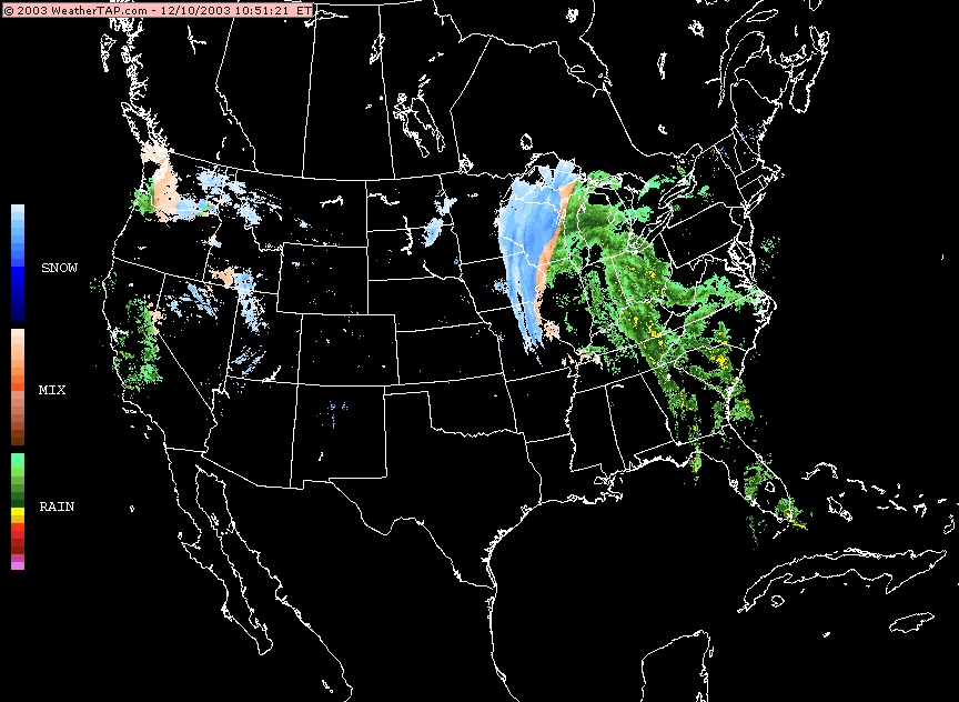
And a large amount of rain is already dominating the states to our west and southwest.
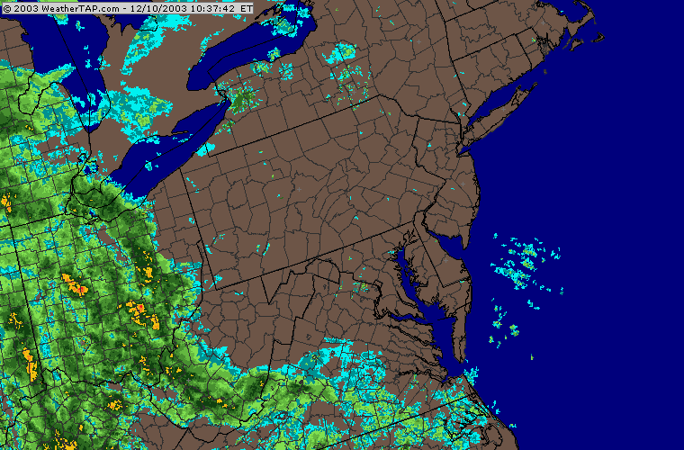
And color coding the radar with temperature information shows that the snow is ONLY found on the extreme northwest side of the Low system.
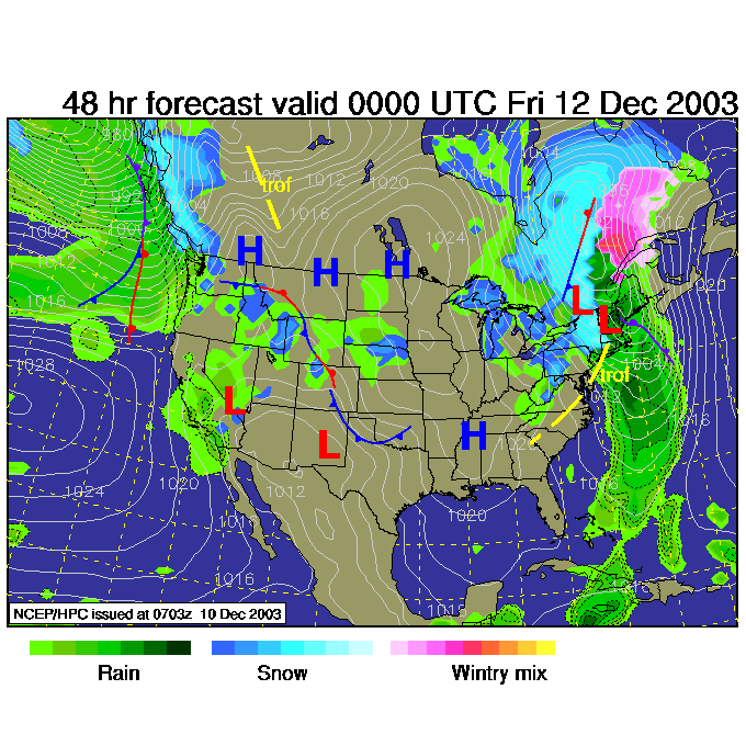
Our warm air is associated with a Ridge on the east coast, while the next storm is being driven by the deep but narrow trough sliding through the Plains.
(This map shows how the winds are flowing from -mainly- west to east at about 18,000feet above sea level parallel to the dark black lines. Dips southward are called troughs and are associated with cold air, while bumps northward are called ridges and are associated with warm air.)
Into the FUTURE!
By 1pm today, the system is just beginning to touch western PA.
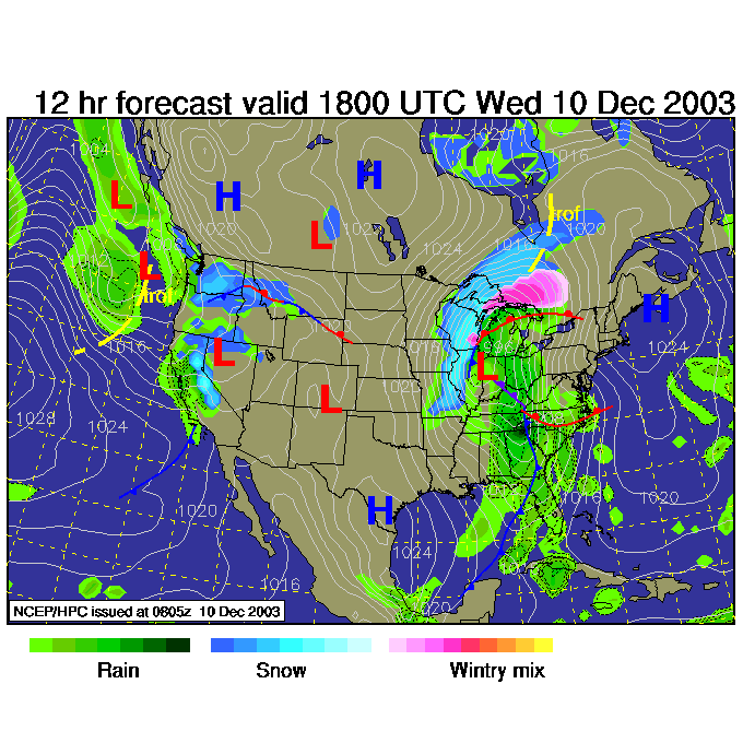
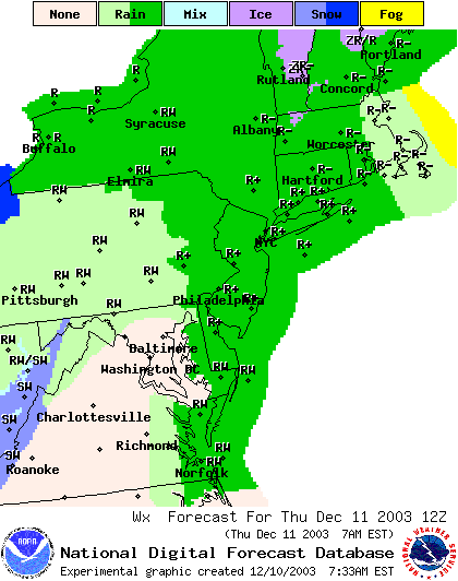
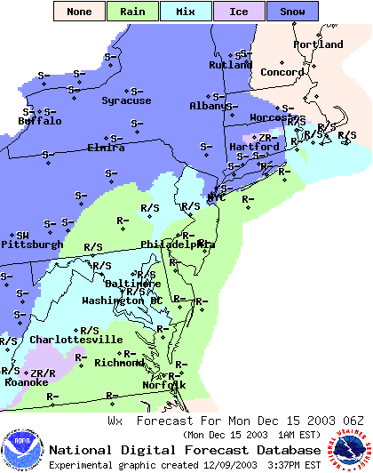
Rain showers (light at first) spread over Philadelphia and its snow by tonight 7pm.
By 1am, the heavy rain is approaching with the center of the system.
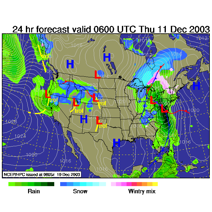
And you can see the heavy rain region at this same time.
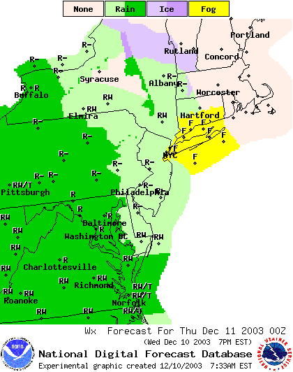
When you wake up at 7am on Thursday, the heavy rain will be pounding the Northeastern US and snow will be explosively melting.
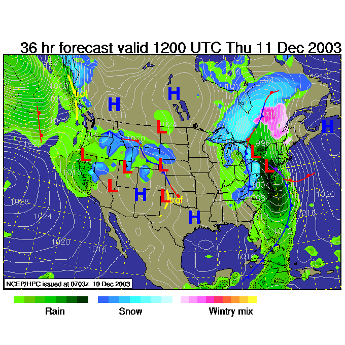
At this time (7am Thursday) the back edge of the rain shield will be approaching Philadelphia but the rain should still be going on.
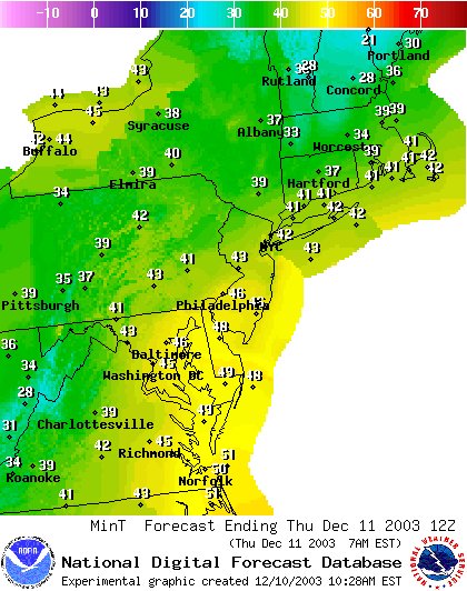
The low temperatures as all this precipitation is falling are in the upper 40's!!! No snow whatsoever.
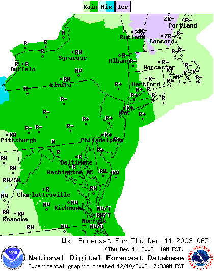
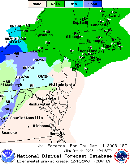
For Thursday 1pm, the heavy rain has moved off to the northeast and a few snow showers are hitting the higher elevations out west as somewhat cooler/colder air follows the front (but it won't be much even if some flurries hit the city).
Thursday night, 7pm, some snow is happening out near the lakes, but little but a chilly northwest wind is effecting Philadelphia.
To further kill the snow, the highs Thursday should see the lower 50's!!!
The lows Thursday night/ Friday morning will be chillier and get near freezing...but who cares after this weekend?!
There will be some snow showers out west off the lakes (the northwest cold flow is still blowing over warm lake water so Lake effect snows are possible).
The Highs Friday are down a bit into the mid 40's and breezy, but not too bad.
Now jumping WAY into the future to look for the next chance of rain or snow, we see a chance of either late night Sunday into Monday. We'll talk more about this as the week goes on.
Stay dry, watch out for flooding, and I'll see you here again tomorrow!
Meteorologist John Ensworth
Surface Station sky cover color key:
Flight category definitions:| Category | Ceiling | Visibility | |
|---|---|---|---|
| Low Instrument Flight Rules LIFR* (magenta circle |
below 500 feet AGL | and/or | less than 1 mile |
| Instrument Flight Rules IFR (red circle) |
500 to below 1,000 feet AGL | and/or | 1 mile to less than 3 miles |
| Marginal Visual Flight Rules MVFR (blue circle) |
1,000 to 3,000 feet AGL | and/or | 3 to 5 miles |
| Visual Flight Rules VFR+ (green circle) |
greater than 3,000 feet AGL | and | greater than 5 miles |
| *By definition, IFR is ceiling less than 1,000 feet
AGL and/or visibility less than 3 miles while LIFR
is a sub-category of IFR. +By definition, VFR is ceiling greater than or equal to 1,000 feet AGL and visibility greater than or equal to 3 miles while MVFR is a sub-category of VFR. |
|||