Back To Home
The Story Behind the Weather - By Forecaster John
Ensworth M.S. -
The Discussion of Weather Events Daily for Philadelphia and Pennsylvania
Last updated: 12/19/2003 08:00 AM
Good Morning Philadelphia!
I'm glad to announce that these
discussions will continue until at least the end of
this Year!.
I
have the necessary server space.
BUT I may have to switch to an approximately every-other-day schedule as Christmas year-end work piles up. I'll do my best to stick with ya!
In short: Skies are gray and
the rain is changing to snow as I write. Off and on show showers will hit us for
the next day followed by a slight warming.
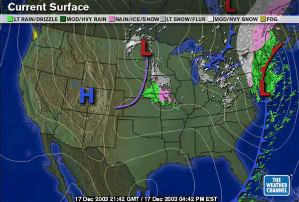
In long: Hooah - the lake effect snow machine is turned on again. The surface map tonight shows the low departing with its copious amounts of rain and trailing snow band. What a wild and wet year this has been. You gotta love it (since, as Joe Bastardi at Accuweather.com says, Enjoy the Weather- it's the Only weather you've got.).
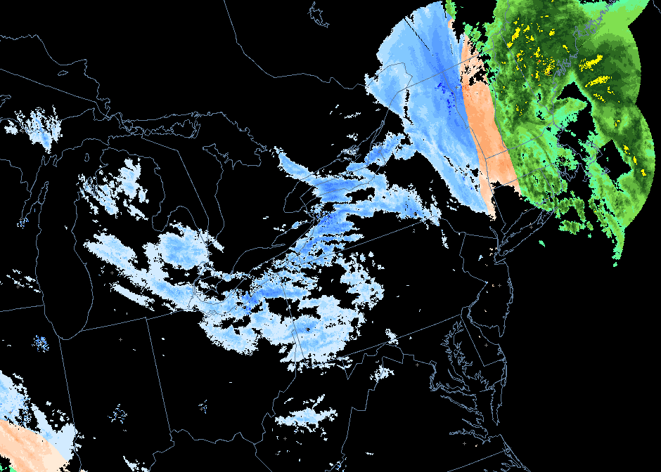
Earlier this afternoon (about 4pm) , as the rain pulled out, it briefly mixed with snow and sleet across Philadelphia...
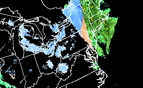
Later this evening (about 10pm) that precipitaion is
gone and lake effect snow is breaking out all along the down-wind side of the
Great Lakes.
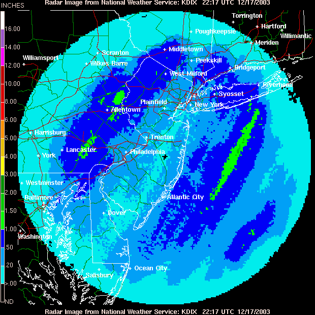
Locally we've seen relatively light (quarter inch or so) rainfall amounts with up to an inch out west and off shore to the east (though some of that might be a highly reflective layer of melting precipitation in the sky that fools the radar - not THAT much real rain might have fallen).
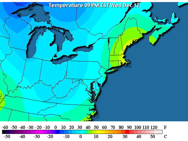
Temperatures are below freezing again over all of Pennsylvania...
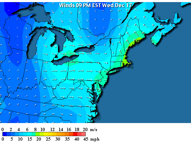
And winds are roaring out of the west and northwest circulating around the low pressure system to our northeast (can you see the center of circulation just north of New York state?).
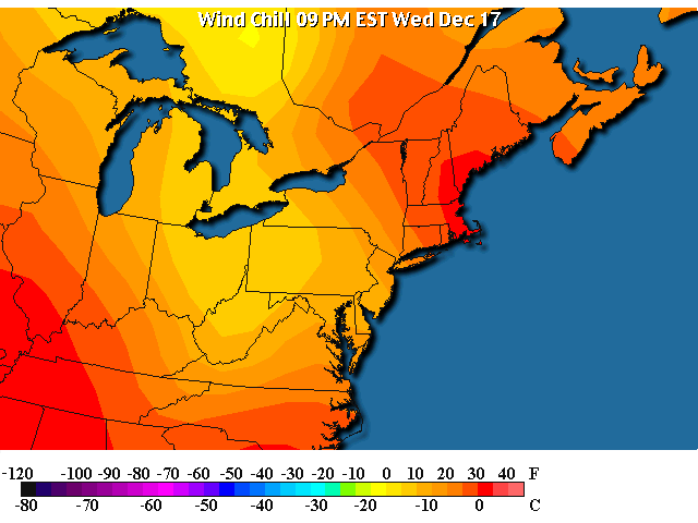
The wind and below freezing temperatures are making it feel like winter again with wind chills below zero out west and in the single digits near Philadelphia this evening. Oh, my, cold!
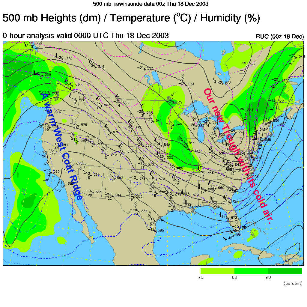
This cold air is associated with the new trough that has moved to and is going to remain parked for a while on the east coast. Look for a good stretch of cold air now if this doesn't leave (as it is forecasted not to).
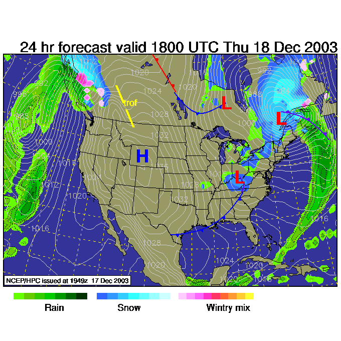
By 1pm Thursday, the Low will not have moved much, so the Lake Effect snows will continue to our north and west. A new smaller low pressure system moves through Kentucky generally enhancing snow and precipitation out there. We'll be in a cold west flow with off and on clouds.
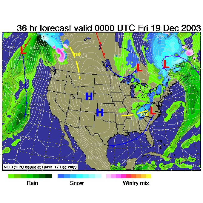
By 8pm Thursday, not much has changed. The cold continues and lake effect snows continue out west.
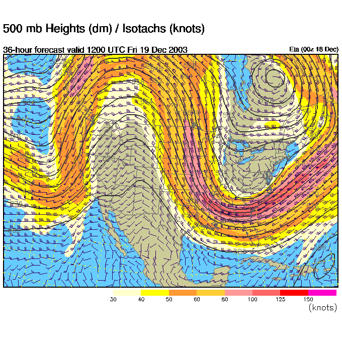
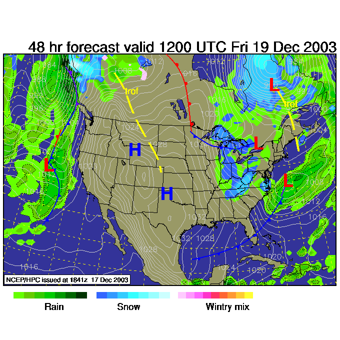
By Friday 8am, the big trough in the upper air flow is STILL in place so cold temperatures will still be the rule...
and the combination of lake effect snows and the passing low to the south will keep skies partly to mostly cloudy (with weaker winds in Philadelphia - since the white lines - lines of equal barometric pressure- are farther apart at that time).
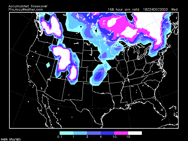
And finally, keeping an eye on what the GFS computer model is saying about Christmas Eve and Christmas morning snow cover (from the pro side of the www.accuweather.com site (see http://pro.accuweather.com and subscribe !!)
It is NOW showing snow on the ground in northern Pennsylvania!!! (This is closer than earlier model runs). If this trend continues... maybe...just maybe...we'll see a White Christmas. Keep prayin' for it!
Stay warm and I'll be here every day I can.
Meteorologist John Ensworth
Surface Station sky cover color key:
Flight category definitions:| Category | Ceiling | Visibility | |
|---|---|---|---|
| Low Instrument Flight Rules LIFR* (magenta circle |
below 500 feet AGL | and/or | less than 1 mile |
| Instrument Flight Rules IFR (red circle) |
500 to below 1,000 feet AGL | and/or | 1 mile to less than 3 miles |
| Marginal Visual Flight Rules MVFR (blue circle) |
1,000 to 3,000 feet AGL | and/or | 3 to 5 miles |
| Visual Flight Rules VFR+ (green circle) |
greater than 3,000 feet AGL | and | greater than 5 miles |
| *By definition, IFR is ceiling less than 1,000 feet
AGL and/or visibility less than 3 miles while LIFR
is a sub-category of IFR. +By definition, VFR is ceiling greater than or equal to 1,000 feet AGL and visibility greater than or equal to 3 miles while MVFR is a sub-category of VFR. |
|||