Back To Home
The Story Behind the Weather - By Forecaster John
Ensworth M.S. -
The Discussion of Weather Events Daily for Philadelphia and Pennsylvania
Last updated: 12/01/2003 10:22 AM
Good Morning Philadelphia!
I'm glad to announce that these
discussions will continue until at least the end of
this Year!.
I
have the necessary server space.
In short: Temperatures will continue to stay cool and even drop as the day goes on while lake effect snows/rains keep going out west. Cold dry conditions will hold on for the next 3 or more days.
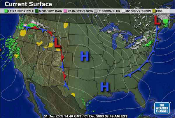
In long: The surface map this morning shows the latest in the unending (that's weather after all) precession of fronts. The main precipitation producer is lake effect snow (and rain) pouring into the state from the northwest. More on this below!
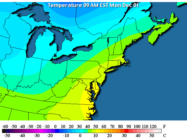
Temperatures this morning are in the 40's around Philadelphia (the full flow of cold air is not here yet, it is still moving in from the west and northwest).
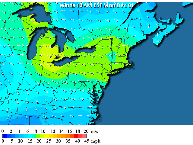
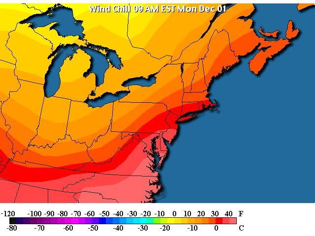
And here are the winds roaring out of the west (west northwest) across PA giving us wind chills...
...in the 10's and 20's out west and in the lower 40's in the city.
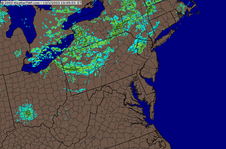
On the normal reflectivity radar, there are a lot of light showers across northern and western Pennsylvania (nothing near the city though).
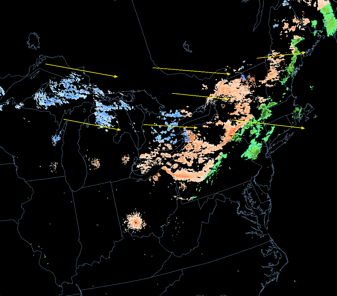
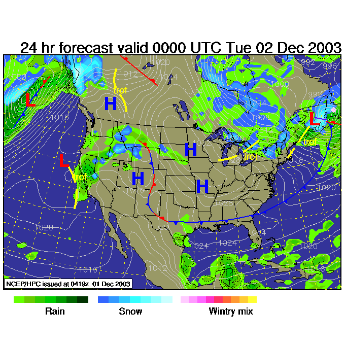
Adding in the surface temperatures and the vertical temperature structure of the atmosphere and a computer algorithm and we can color code the radar for winter precipitation. The blues are snow, the greens are rain, and the pinks are a mix of rain and snow. I've drawn in the yellow arrows to remind you of the wind flow over the region. All this precipitation is Great Lake moisture getting added to the cold dry air as it flows over the lakes then is lifted up on to the land where it cools and forms clouds and rain.
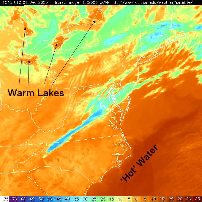
The infrared satellite view shows temperatures of the first thing the satellite sees from space. Reds are warm and blues are cold (often ice in high clouds). You can see the warm Gulf Stream in the ocean off N. Carolina AND the warm lakes. The lake heat and moisture is the source for the precipitation that will fall as the air continues to flow over the lakes for the next few days. Rarely does this precipitation ever make it as far as Philadelphia, but the National Weather Service has added a 10% chance of rain 'just in case'.
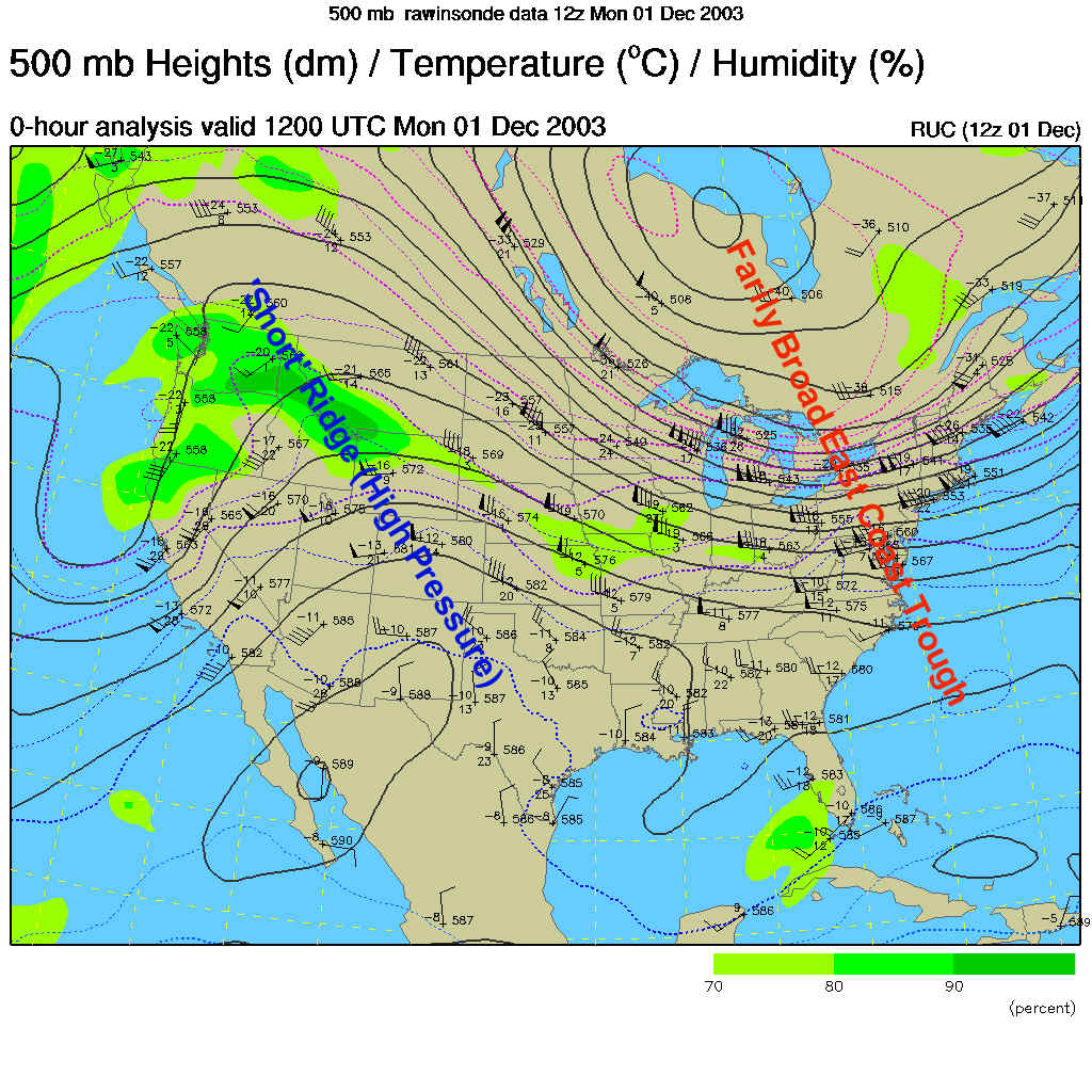
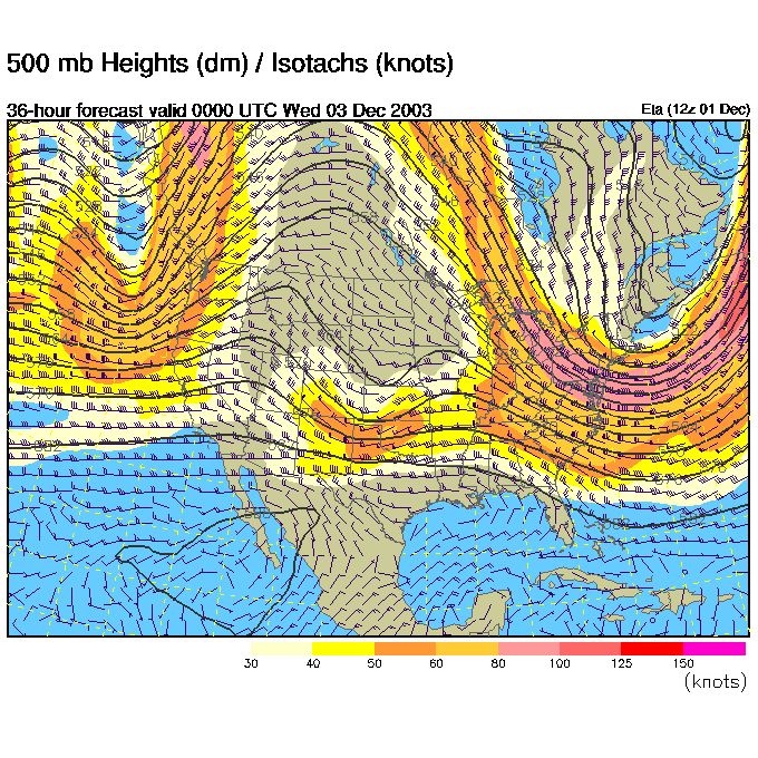
The winds aloft on the 500mb map (which shows the winds at about 18,000feet above sea level as they blow mainly west to east parallel to the dark black lines) shows a broad trough over the east. You would expect rain and clouds to form on the 'uphill' or right side of a trough, which, in this instance, is way off in the Atlantic.
By 7pm tonight, the front is further to the east, more cold air is pouring in behind it and the lake effect snow is still happening, but mainly up in New York state.
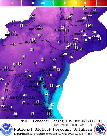
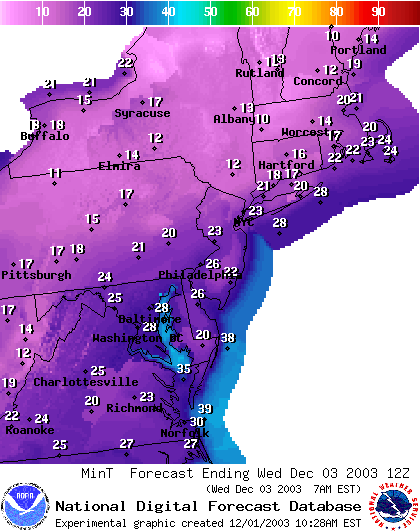
Lows tonight will drop to about 30F in Philadelphia.
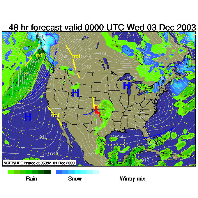
As upper air flow continues out of the northwest, cold air keeps flowing in.
The center of the cold air, the high pressure system over the western Great Lakes moves closer. Air flows clockwise around a high, so you can see the west winds on the north side of the high center are keeping the lake effect flow going.
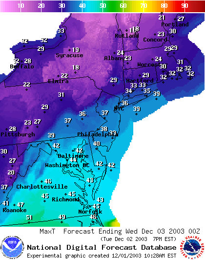
And here comes the really cold air. Highs on Tuesday (before 7pm which is 00z Wed) are plunging out west. They will be 38F in the city, and only in the 20's out west!
Then with mostly clear skies, dying winds and more cold air, we drop to the mid 20's again by Wednesday morning.
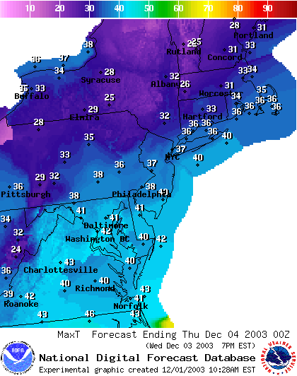
On Wednesday, the highs just recover to the upper 30's and lower 40's in Philadelphia. Brrrr indeed.
Stay warm and get some early Christmas shopping done. I'll see you tomorrow morning!
Meteorologist John Ensworth
Surface Station sky cover color key:
Flight category definitions:| Category | Ceiling | Visibility | |
|---|---|---|---|
| Low Instrument Flight Rules LIFR* (magenta circle) |
below 500 feet AGL | and/or | less than 1 mile |
| Instrument Flight Rules IFR (red circle) |
500 to below 1,000 feet AGL | and/or | 1 mile to less than 3 miles |
| Marginal Visual Flight Rules MVFR (blue circle) |
1,000 to 3,000 feet AGL | and/or | 3 to 5 miles |
| Visual Flight Rules VFR+ (green circle) |
greater than 3,000 feet AGL | and | greater than 5 miles |
| *By definition, IFR is ceiling less than 1,000 feet
AGL and/or visibility less than 3 miles while LIFR
is a sub-category of IFR. +By definition, VFR is ceiling greater than or equal to 1,000 feet AGL and visibility greater than or equal to 3 miles while MVFR is a sub-category of VFR. |
|||