Back To Home
The Story Behind the Weather - By Forecaster John
Ensworth M.S. -
The Discussion of Weather Events Daily for Philadelphia and Pennsylvania
Last updated: 12/24/2003 10:48 AM
Good Morning Philadelphia!
I'm glad to announce that these
discussions will continue until at least the end of January!
I
have the necessary server space (especially with missed days!).
In short: Rain is here and
so is a Flood Watch.
Please Note: I'm logging in via dial-up modem from
Corpus Christi, TX where I will be spending the Christmas break.
Due to the slow connection, I'll keep it brief when I can log
on and update this site. I may have to switch to an every-other-day
schedule as I travel.
In long: The chance of seeing some flakes falling out of the sky at the very end of this big rain event is possible for Christmas Day, but a white Christmas seems quite out of the question.
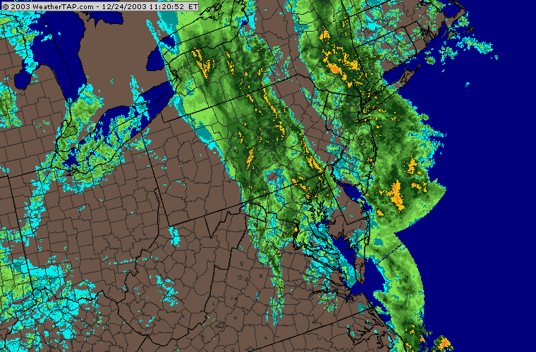
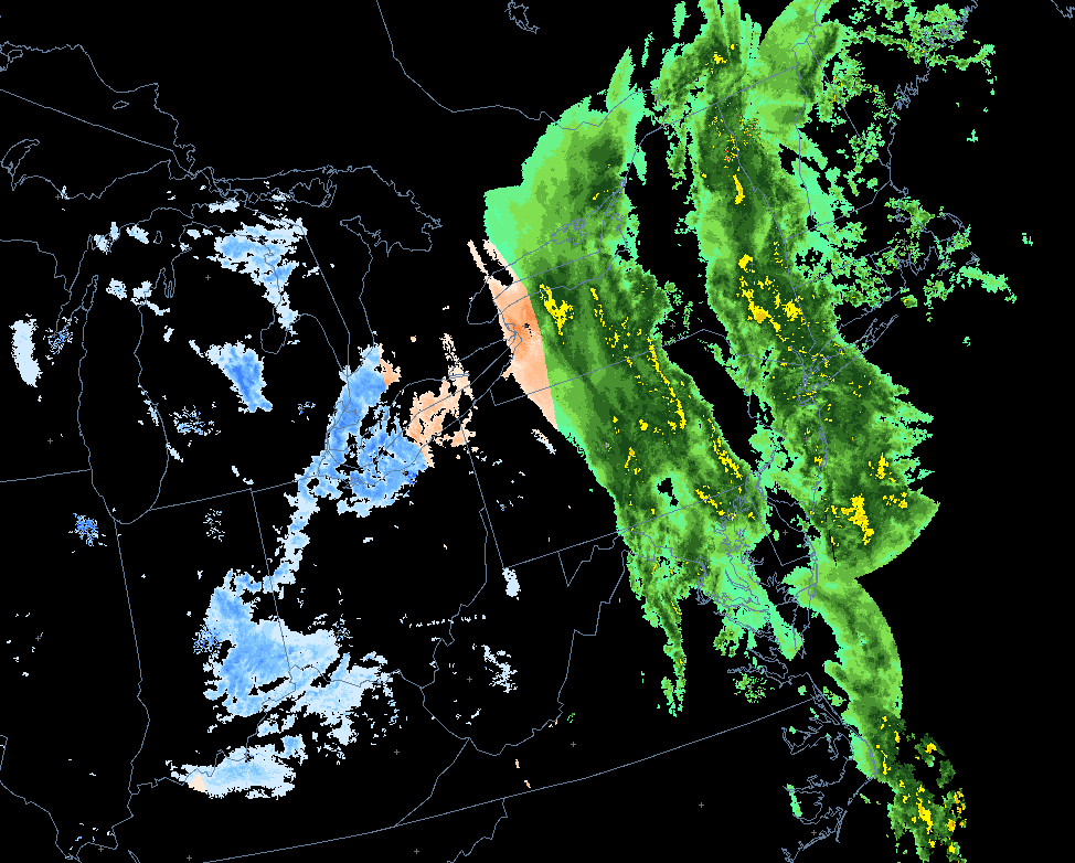
The current radar view shows two big waves of rain moving through. The first has cleared Philadelphia but the second is still moving in. Rain rain rain (oh, I said that yesterday).
Looking at the combination of temperature data, the vertical temperature structure of the atmosphere and the radar, we can get an estimate of where it is raining, snowing and a mix of both (with the possibility of freezing rain or sleet). Everything in the eastern half of Pennsylvania is rain. Just up in the extreme northwest might some of the snow be changing over to something a bit frozen.
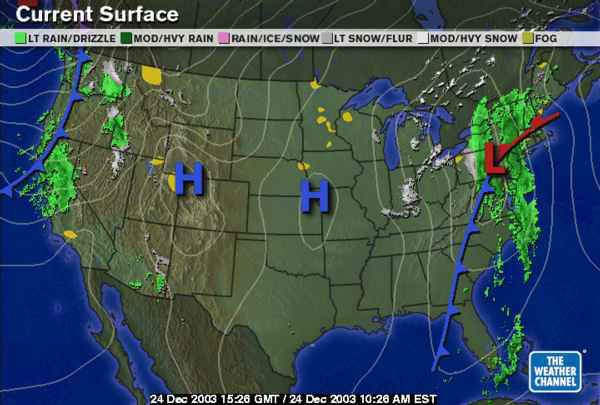
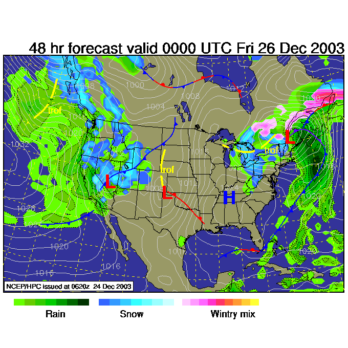
The surface map shows the Low just now passing over Philadelphia with a big pull of tropical moisture heading northward into the low on the right (or east) side of the cold front fueling the rains up the eastern seaboard.
All that will happen over the next couple of days is the low continues to move to the northeast taking rain with it. Rain should be ending overnight tonight. Northwest flow will start up the Lake Effect snow machine out west (this is 1am Christmas Day) and some snows will wrap around the Lows and effect the higher elevations out west with wintry stuff.
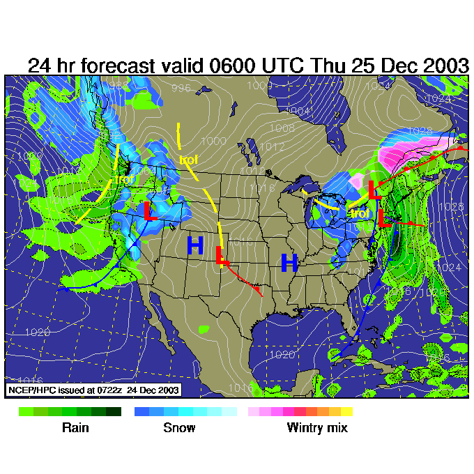
By 7pm Christmas Night, the Low is entering Maine and a mix bag of snow (more snow than rain as shown below) will wrap around counterclockwise over much of New England. (But we are still in the 'dry'.)
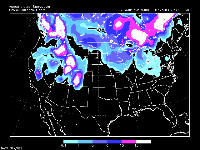
The snow pack map shows the snows behind this system (it got a hold of just a bit colder air than was seen by this model - the GFS - so there is snow out there that didn't show up on earlier forecasts. This map is for Christmas Day 1pm and is from the pro side of accuweather.com. It is an inexpensive (monthly) way to get a powerful raw feed of weather information... you need to subscribe!!! http://pro.accuweather.com
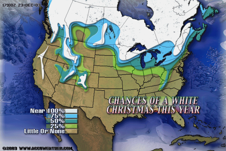
Here is another product from accuweather.com showing a human interpretation of the data giving the chance of a White Christmas for the nation. We are in the little or none region, but there is some chance over much of the rest of the state (higher elevations and more distance from the warm Atlantic helps there).
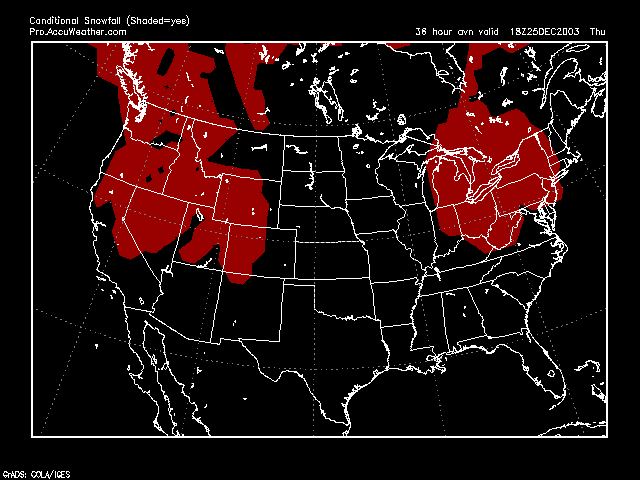
The HOPE for a few flakes at the end of the precipitation comes from this last map from accuweather.com. This is the 'if some kind of precipitation does fall at this time, is it cold enough throughout the atmosphere to make snow' map. For a while Christmas afternoon (1pm again) the atmosphere WILL be cold enough for snow...but the rain is expected to be over by then. BUT IF IT IS NOT... then the water that falls from the sky may be snow flakes.... how's THAT for reaching?
Have a Merry Christmas!
Meteorologist John Ensworth
Surface Station sky cover color key:
Flight category definitions:| Category | Ceiling | Visibility | |
|---|---|---|---|
| Low Instrument Flight Rules LIFR* (magenta circle |
below 500 feet AGL | and/or | less than 1 mile |
| Instrument Flight Rules IFR (red circle) |
500 to below 1,000 feet AGL | and/or | 1 mile to less than 3 miles |
| Marginal Visual Flight Rules MVFR (blue circle) |
1,000 to 3,000 feet AGL | and/or | 3 to 5 miles |
| Visual Flight Rules VFR+ (green circle) |
greater than 3,000 feet AGL | and | greater than 5 miles |
| *By definition, IFR is ceiling less than 1,000 feet
AGL and/or visibility less than 3 miles while LIFR
is a sub-category of IFR. +By definition, VFR is ceiling greater than or equal to 1,000 feet AGL and visibility greater than or equal to 3 miles while MVFR is a sub-category of VFR. |
|||