Back To Home
The Story Behind the Weather - By Forecaster John
Ensworth M.S. -
The Discussion of Weather Events Daily for Philadelphia and Pennsylvania
Last updated: 12/03/2003 09:17 AM
Good Morning Philadelphia!
I'm glad to announce that these
discussions will continue until at least the end of
this Year!.
I
have the necessary server space.
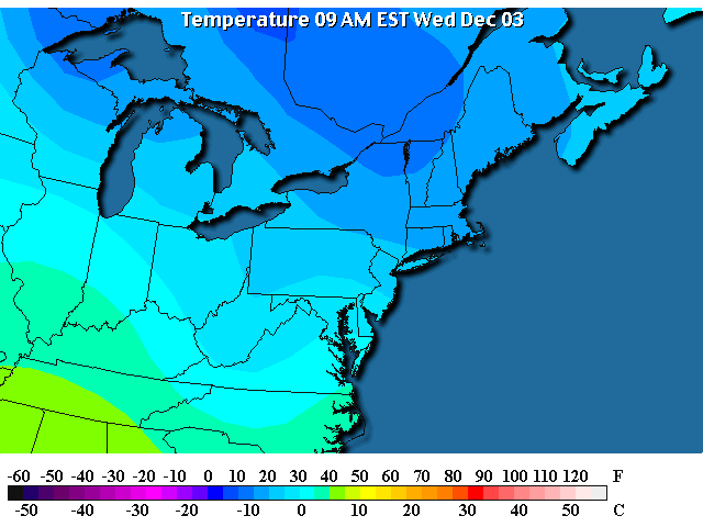
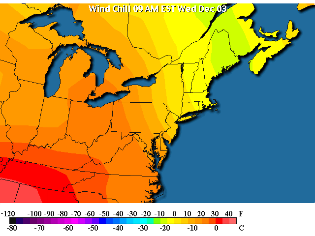
In short: The COLD morning has come and it is still in the 20's F after sunrise. We won't even reach 40F today. Brrrr! We will remain dry and quiet until a now more possible BIG storm for the Weekend (Fri PM/Sat/Sun).
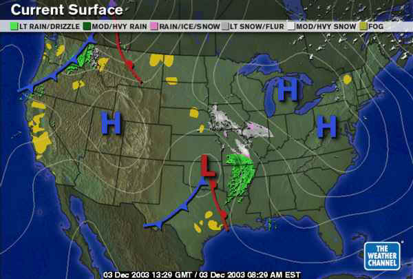
In long: The high pressure center that drove the last front is here now and the winds have calmed, the skies have cleared and it is cold.
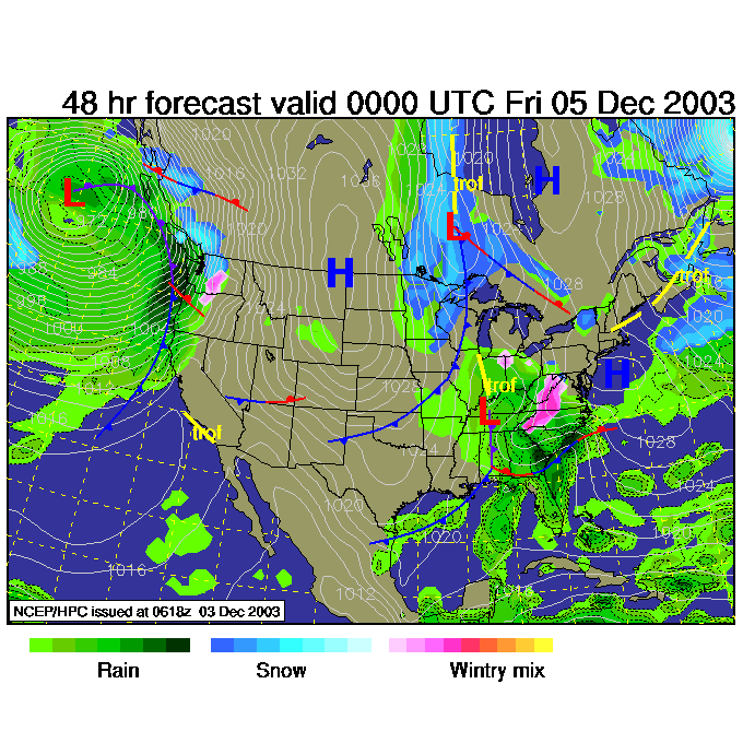
Out in Oklahoma, you can see the Low that will combine with a tropical blob of energy for this weekends storm.
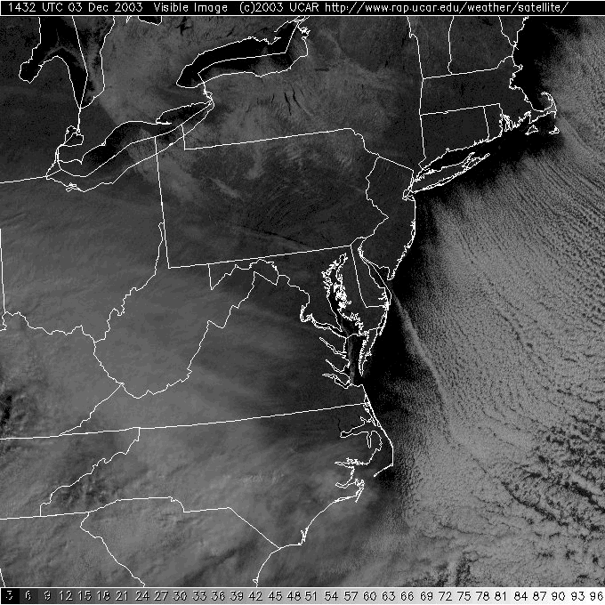
On the visible satellite view, there are no clouds in our area and the offshore breezes (very cold breezes) are picking up warm ocean water vapor and forming clouds out at sea.
Temperatures are in the 20's statewide. Did I say brrr already?
Winds are still coming weakly out of the northwest, but they will die as the center of the High arrives.
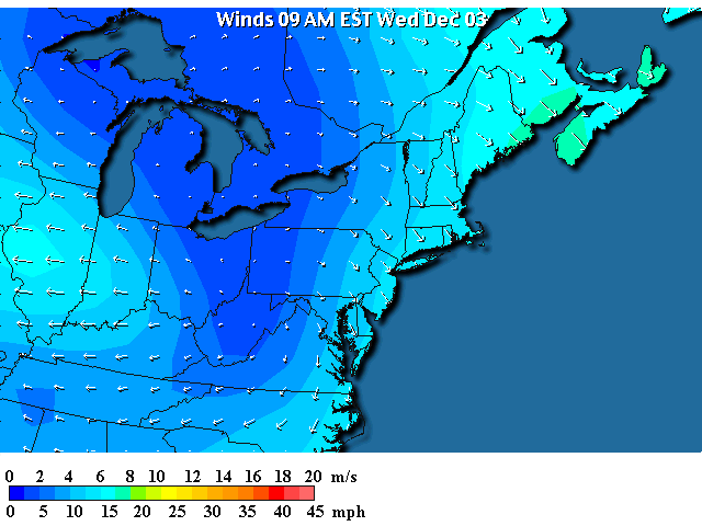
So wind chills are only in the lower 20's.
There is 'maybe' a hint of lake effect snow showers in New York, but nothing like yesterday.
The big news will be this weekends storm up the east
coast. To see the breakdown of the scenario, check out yesterday's
forecast discussion.
Since it is still a ways out and still appears in the models, I'll point to it
in general today and break it out in detail tomorrow.
By Thursday night, the low in the Plains pulls into Tennessee and Kentucky with a mix of snow and rain occurring in the Appalachians.
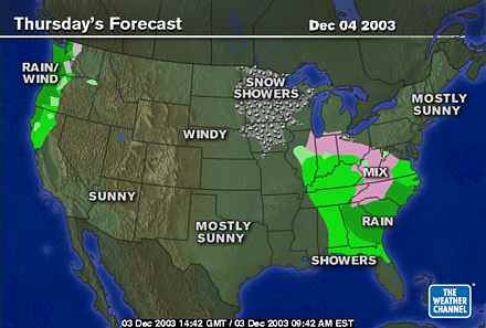
That same map from the Weather Channel shows Pennsylvania
still high and dry. But you can see the influence of the
tropical moisture pouring into the Carolinas and Georgia.
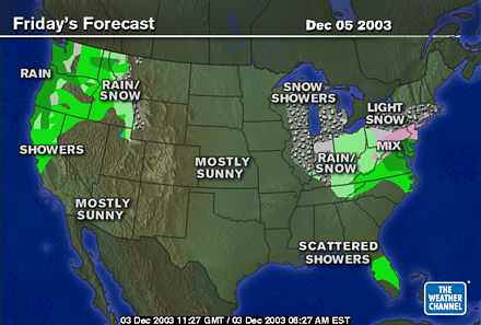
Then the moisture and cold air begin to collide over Pennsylvania on Friday with a mix of rain and snow locally.
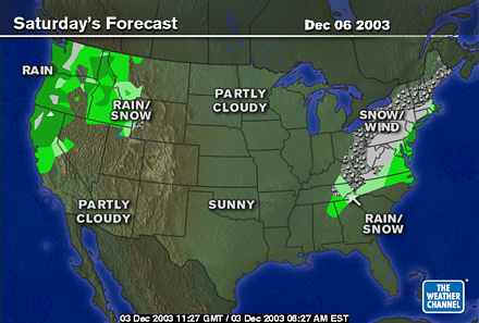
And the thinking is that on Saturday the cold air will begin to dominate and we may switch to all snow (with strong onshore winds!).
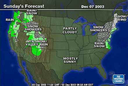
And snow showers may continue into Sunday.
This could be quite a storm, we'll see what is most likely (in the wind and snow department) tomorrow night.
I'll see you then!
Meteorologist John Ensworth
Surface Station sky cover color key:
Flight category definitions:| Category | Ceiling | Visibility | |
|---|---|---|---|
| Low Instrument Flight Rules LIFR* (magenta circle) |
below 500 feet AGL | and/or | less than 1 mile |
| Instrument Flight Rules IFR (red circle) |
500 to below 1,000 feet AGL | and/or | 1 mile to less than 3 miles |
| Marginal Visual Flight Rules MVFR (blue circle) |
1,000 to 3,000 feet AGL | and/or | 3 to 5 miles |
| Visual Flight Rules VFR+ (green circle) |
greater than 3,000 feet AGL | and | greater than 5 miles |
| *By definition, IFR is ceiling less than 1,000 feet
AGL and/or visibility less than 3 miles while LIFR
is a sub-category of IFR. +By definition, VFR is ceiling greater than or equal to 1,000 feet AGL and visibility greater than or equal to 3 miles while MVFR is a sub-category of VFR. |
|||