Back To Home
The Story Behind the Weather - By Forecaster John
Ensworth M.S. -
The Discussion of Weather Events Daily for Philadelphia and Pennsylvania
Last updated: 12/04/2003 08:07 PM
Good Morning Philadelphia!
I'm glad to announce that these
discussions will continue until at least the end of
this Year!.
I
have the necessary server space.
In short: Cold air is still sitting around and as the first of a few iterations of a winter storm begin to effect us, the snow/rain dance begins. You will see snow at night, and some rain showers in the day, and snow adding up to many inches by Sunday. Start shoveling!
In long: This forecast was a 'forecast-interruptus' (I couldn't get it done this morning) So you have some morning and some evening images to compare.
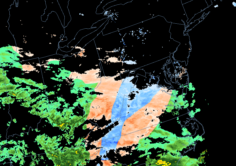
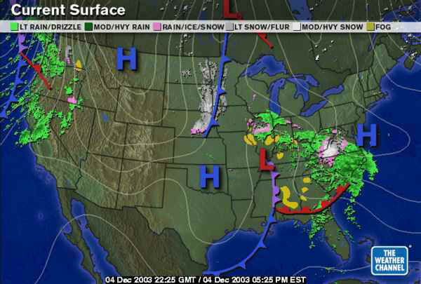
This morning, 8amish, we had snow and mix snow/rain just to our south! That can't be good for our chances to avoid snow.
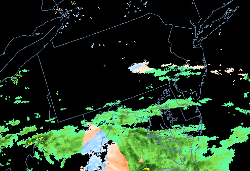
By this evening, 7pm, the day has warmed up, and the snow is confined to the higher elevations to our southwest and north. But that will change.
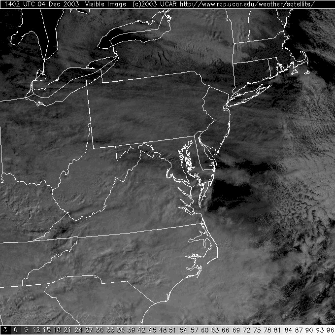
This morning, clouds were on the increase from the southwest, and they finished their trip. Now we won't get any noticeable warming from the sun tomorrow.
This morning, there was a double lobed Low moving through the Mississippi valley with rain and snow ahead of it.
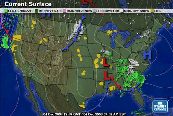
Tonight, the system has moved a tiny distance to the east spreading a bit more rain and snow out ahead of it (though elevation is the strongest indicator of where the snow is falling). Another feature to note is the front swinging down through the northern plains. THERE is the cold air!
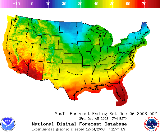
On the forecast highs for Friday, you can see the colder air in the northern plains with HIGHS in the 10's and 20's!
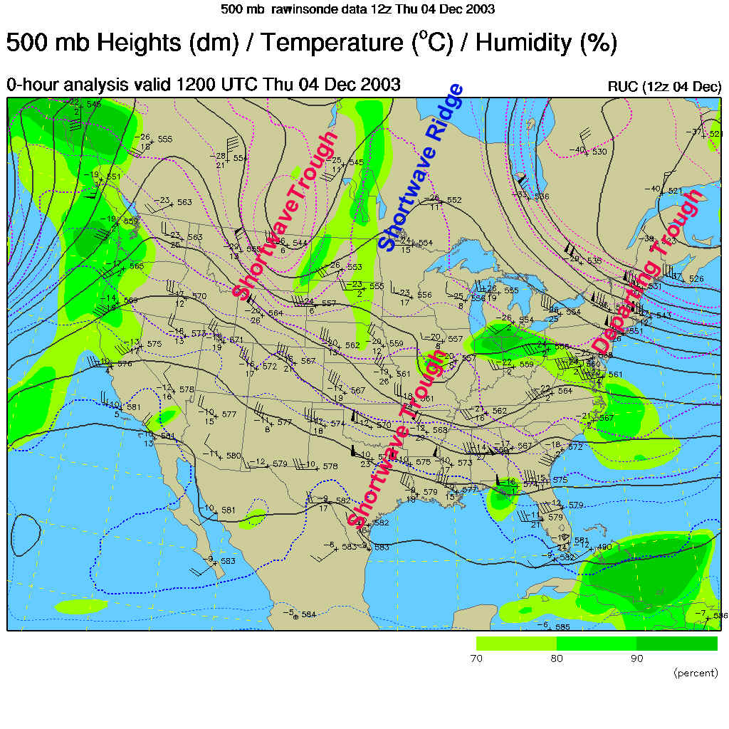
As our latest trough departs, little separates us from the next cold air 'energy' (cold air above warmer air makes the warmer and usually moister air rise and form clouds and rain/snow) but the shortwave ridge marked below. The things we need to keep our eyes on are the two shortwave troughs in the flow over the central US...
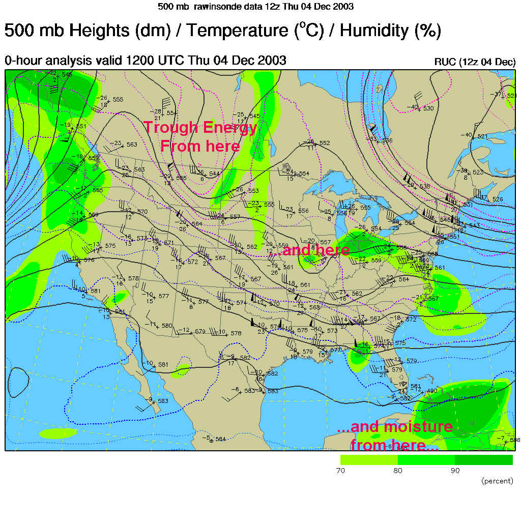
To clarify the picture, we are looking at cold air aloft ("Trough Energy") coming from the northern Rockies, the Mississippi Valley and some moisture/energy from the tropics down south (more on that in the day-by-day blow-by-blow further down the page).
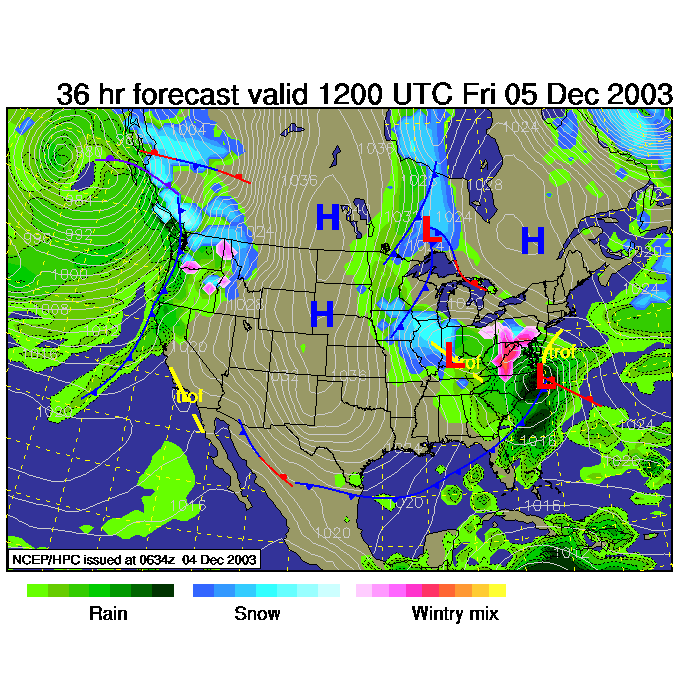
The forecast for 7am Friday shows a low deepening rapidly to our south. The north side of the low will see moisture being pumped around up and over the cold air already in place. We'll start to see a mixture of snow and rain overnight and into the day (all depending on which side of 32F we are at a given hour). The REAL cold air is only entering the Lakes by this time though.
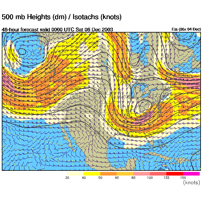
The upper air pattern shows the two troughs merging into (for the most part) one big east coast trough.
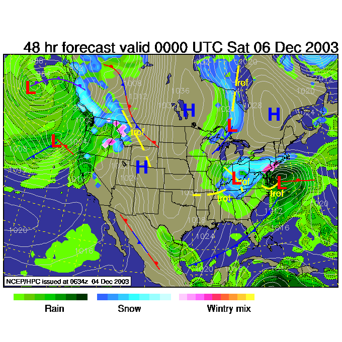
The low lingering out in the Ohio valley acts like the catcher for the pitcher on the coast. This Low, by Friday night 7pm, has INTENSE rainfall associated with it since it has one foot in the warm Atlantic. You can see the tight white lines north of the low over Philadelphia (these are lines of equal barometric pressure). The faster pressure changes over the smallest distance, the stronger the wind blows. In this case, the winds are blowing onto land from the ocean blasting us with snow and rain.
More trouble will enter the stage with the moisture you see way down south.
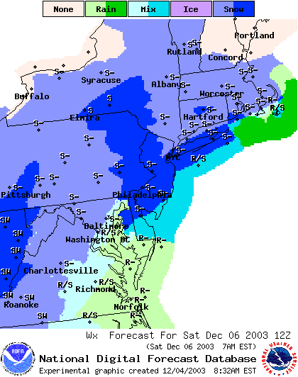
By Saturday morning, snow is wrapping around the system as part of the low heads off to the east and the part over the Ohio valley takes over keeping us hit with onshore moisture over cold air.
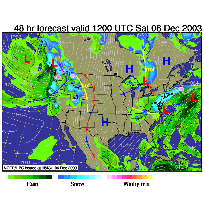
The expected weather conditions by Saturday 7am is Snow, and pretty heavy snow city wide.
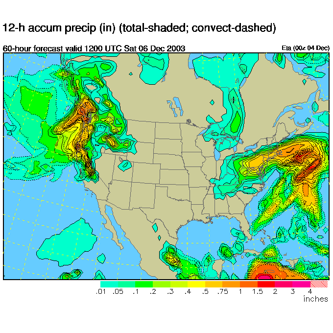
The model at that time shows A LOT of precipitation hitting the northeast.
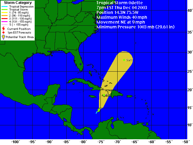
Here is the mischief from the south. Believe it or not we have a tropical storm that 'might' even see hurricane status (if Accuweather is to be believed). By Saturday it will be heading into the central eastern Atlantic. There is MORE moisture to play with!!!
So mid-day Saturday sees snow down to the coast and out to sea (even if Washington D.C. stays in the showers).
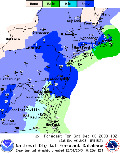
Saturday night, 7pm and we have still more precipitation falling.
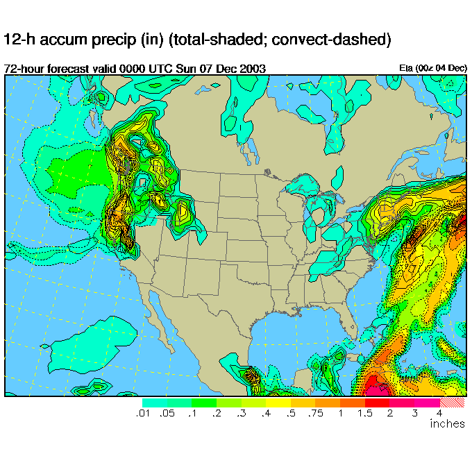
You will probably see 2-4 inches of snow city wide with a slight chance of a FOOT in places. Welcome to the winter you were hoping for.
You WERE hoping for it, right?
I'll see you again tomorrow morning to see if anything has changed!
Meteorologist John Ensworth
Surface Station sky cover color key:
Flight category definitions:| Category | Ceiling | Visibility | |
|---|---|---|---|
| Low Instrument Flight Rules LIFR* (magenta circle) |
below 500 feet AGL | and/or | less than 1 mile |
| Instrument Flight Rules IFR (red circle) |
500 to below 1,000 feet AGL | and/or | 1 mile to less than 3 miles |
| Marginal Visual Flight Rules MVFR (blue circle) |
1,000 to 3,000 feet AGL | and/or | 3 to 5 miles |
| Visual Flight Rules VFR+ (green circle) |
greater than 3,000 feet AGL | and | greater than 5 miles |
| *By definition, IFR is ceiling less than 1,000 feet
AGL and/or visibility less than 3 miles while LIFR
is a sub-category of IFR. +By definition, VFR is ceiling greater than or equal to 1,000 feet AGL and visibility greater than or equal to 3 miles while MVFR is a sub-category of VFR. |
|||