Back To Home
The Story Behind the Weather - By Forecaster John
Ensworth M.S. -
The Discussion of Weather Events Daily for Philadelphia and Pennsylvania
Last updated: 12/09/2003 12:50 PM
Good Morning Philadelphia!
I'm glad to announce that these
discussions will continue until at least the end of
this Year!.
I
have the necessary server space.
In short: Clouds are on the increase protecting the snow from the sun, but warm air is trying to slide over this thick snow pack and melt things. Rain coming Wednesday will speed this process up!
In long: I
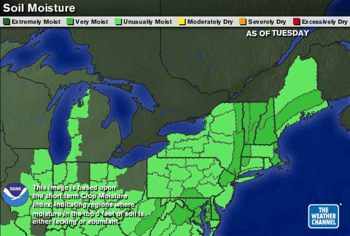
found a soil moisture map from the Weather Channel, so I thought I'd include a
graphic that confirms what you already know...the ground is wet. All PA
counties are unusually moist or very moist. It will be a
nice growing season this spring...
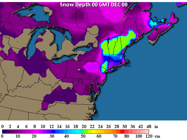
Revised and updated snowfall amounts are still very impressive (especially from eastern New York state into Maine!). I can't explain that snow free area in the center of the state, I thought it might be a missing observation (and it might still be!).
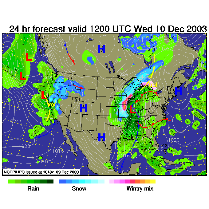
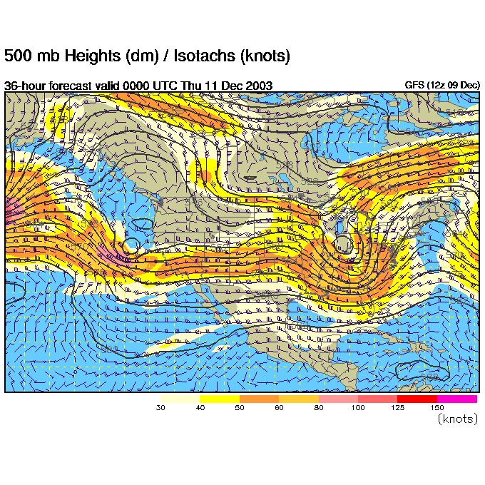
The next storm is gathering itself together nicely over Oklahoma and surrounding areas. A good swath of snow will fall from the Oklahoma panhandle up toward Chicago. Note how far west that forecast is. That means RAIN will fall here...on top of the snow.
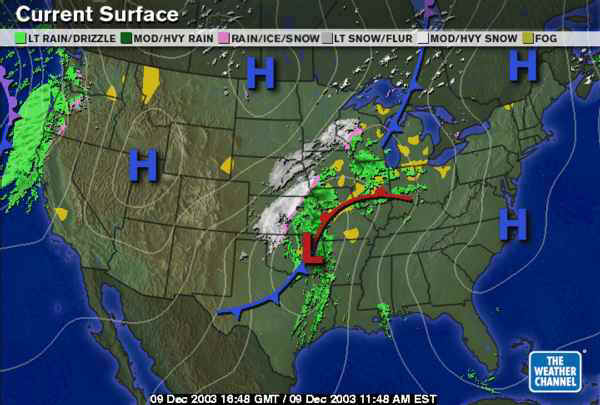
Winds are still light with the passing high pressure system to our south (see the map above this one). But south winds are approaching from the west behind the High.
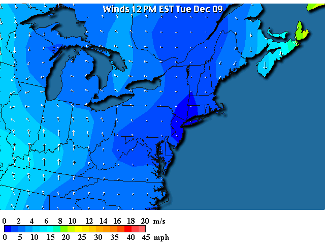
These south winds (marked in red) are bringing in temperatures that are very warm...50's!
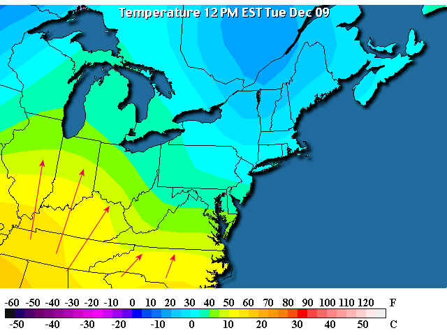
But the clouds are flowing in and protecting the snow from sunlight. It will take this advection of warm air (horizontal movement of air) to warm us up much.
Our next system is associated with the trough marked below. We are still under a short lived ridge, keeping new precipitation from falling.
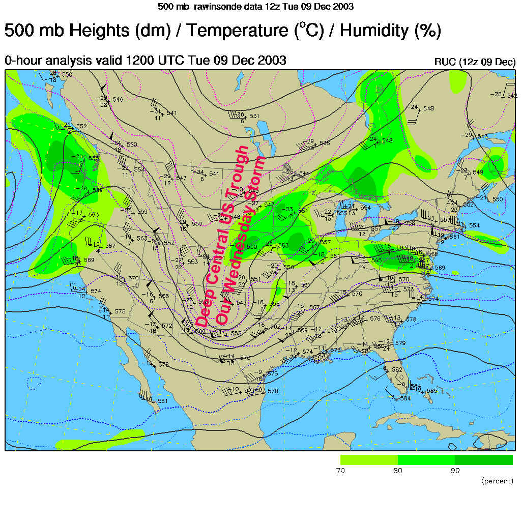
So looking at the future, we see the Low center tracking into central Illinois with all the snow on the west and northern side. We are still dry at this time (Wednesday 7am).
For Wednesday 7pm, the trough in the central US has slid into the eastern US and is now tilted so that it's bottom is to the east of it's more northern parts. This is called a negatively tilted trough, and it spells STRENGTH for a storm.
And you can see (at this same time) the huge shield of rain that begins to move over the Northeastern snow and Philadelphia.
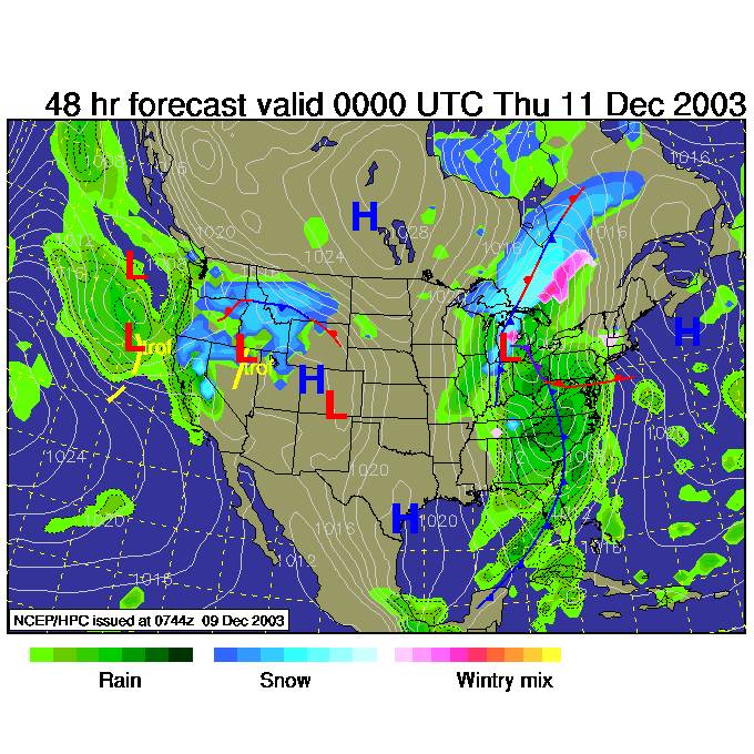
So beware of the effects of all this water, new and melted, and listen for some thunder now and then!
The NEXT system for the end of the weekend should bring snow back, so don't despair (then THAT will melt, then more snow will come...).
And I'll see you here again tomorrow!
Meteorologist John Ensworth
Surface Station sky cover color key:
Flight category definitions:| Category | Ceiling | Visibility | |
|---|---|---|---|
| Low Instrument Flight Rules LIFR* (magenta circle) |
below 500 feet AGL | and/or | less than 1 mile |
| Instrument Flight Rules IFR (red circle) |
500 to below 1,000 feet AGL | and/or | 1 mile to less than 3 miles |
| Marginal Visual Flight Rules MVFR (blue circle) |
1,000 to 3,000 feet AGL | and/or | 3 to 5 miles |
| Visual Flight Rules VFR+ (green circle) |
greater than 3,000 feet AGL | and | greater than 5 miles |
| *By definition, IFR is ceiling less than 1,000 feet
AGL and/or visibility less than 3 miles while LIFR
is a sub-category of IFR. +By definition, VFR is ceiling greater than or equal to 1,000 feet AGL and visibility greater than or equal to 3 miles while MVFR is a sub-category of VFR. |
|||