Back To Home
The Story Behind the Weather - By Forecaster John
Ensworth M.S. -
The Discussion of Weather Events Daily for Philadelphia and Pennsylvania
Last updated: 01/13/2004 08:42 PM
Good Afternoon Philadelphia!
I'm glad to announce that these
discussions will continue until at least the end of January!
I
have the necessary server space (especially with missed days!).
In short: As clouds are thickening and temperatures are warm (for this time of year) right now, but the bottom will drop out in the next 48 hours. Then the weekend will slowly warm again.
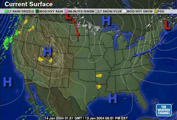
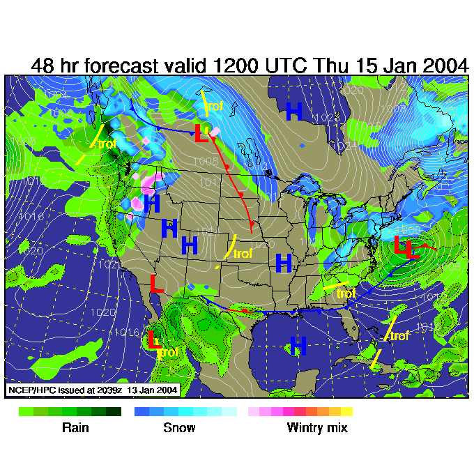
In long: This forecast builds on yesterday's forecast discussion, so pick it up before heading on... The surface map shows that the leading edge of the cold air is now invading, but the core of it is still about 48 hours off, associated with the High Pressure center north of Lake Superior.
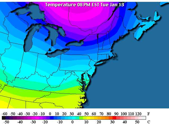
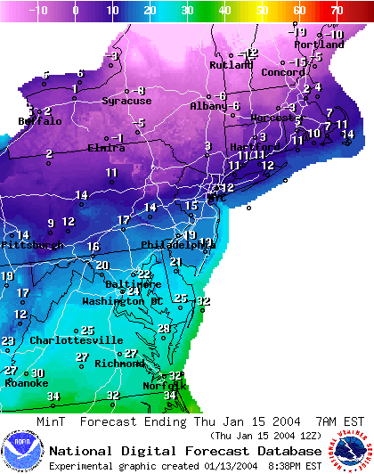
The actual temperatures tonight are dropping into the 20's F in Philadelphia and are heading for near 20 F by dawn.
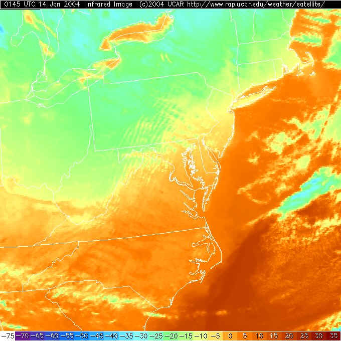
The Infrared Satellite picture shows cold air coming in colored green/blue. What is happening is clouds are forming on top of the very cold air as it cuts under the warm air that was formerly in place. The air below the clouds is cold and the clouds are cold themselves. It is clear to our north because you can see some of the Great Lakes un-obscured by clouds, but the clouds do exist in southern PA because cloud lanes are visible as alternating green and yellow bands. Brrr is the word.
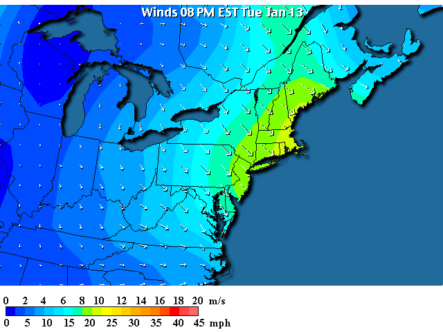
You can also see this feed of air coming in from the northwest across the entire area... stronger near the coast.
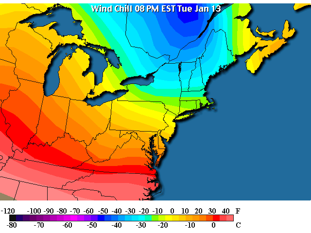
Which, combined with the temperatures, gives the following wind chill map. We are just near a wind chill of 0F right now with wind chills of -40F to our north a few states. Incredible cold resides up there!
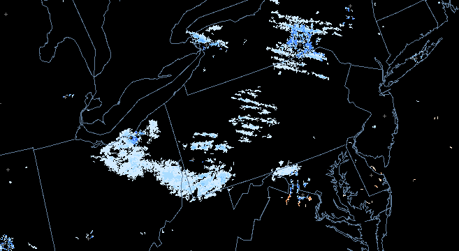
In the clouds and cold air, we are beginning to see snow flurries form in lines parallel to the wind flow. Watch these increase from the west over the next 24 hours. This next snow storm is prompting the issuance of a winter storm watch for Wednesday into Thursday. The text is included next...
Queen Anne's MD-Salem NJ-southeastern Burlington NJ- ... Winter Storm Watch in effect... A cold airmass combined with an area of low pressure will provide the region with a threat of snow late in the day on Wednesday into Thursday morning. This is a relatively weak inland system and is expected to quickly move through the region. With the expected track, all precipitation associated with the low is expected to fall in the form of snow. Current analysis suggests that the region could experience four or five inches of accumulation by the Thursday morning commute. A Winter Storm Watch is normally issued for the affected area when at least four inches of snow is possible. As with any potential snowfall event, the track and speed of the system is quite important. Stay tuned to NOAA Weather Radio or your favorite media outlet the next twenty-four hours for possible changes. |
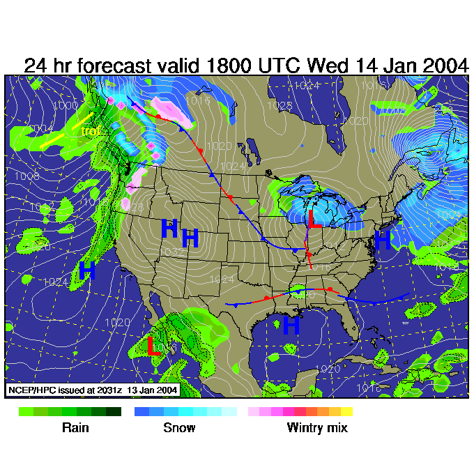
This storm comes from a Low rolling through the lakes along the edge of the really cold air kicking up a shield of snow to its north. (This map is for Wednesday 1pm).
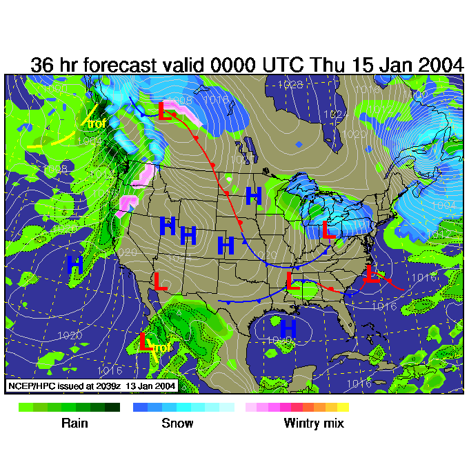
For Wednesday 7pm, we have the Low approaching and the snow begins to pick up with gusto. This retards the arrival of VERY cold air until the low passes. Small blessings, no?
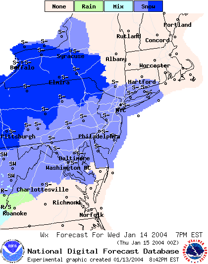
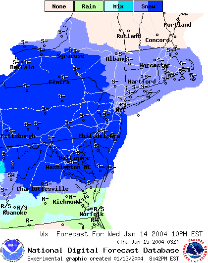
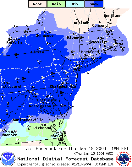
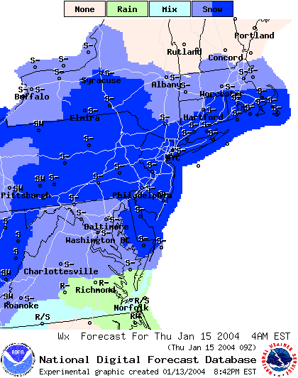
Here, from the National Weather Service, is the light to heavy snow forecast by 3 hour chunks.
The snow begins by 7pm Wednesday night.
Then 10pm Wednesday.
Then 1am Thursday.
4am Thursday the snow continues...
Thursday 7am and the snow beings to tail off...
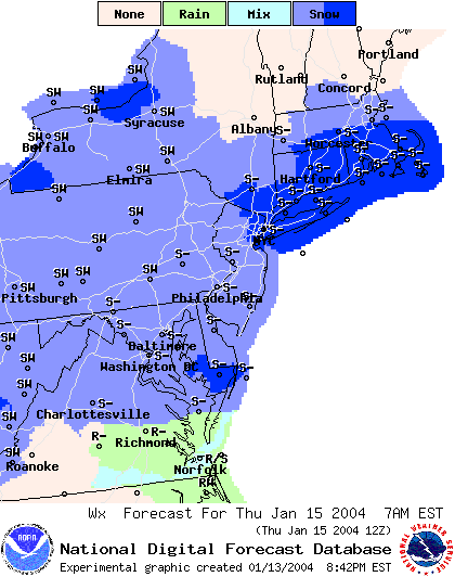
The surface map for Thursday 7am shows the low off the coast to the east. All we'll be getting then is wrap around snow and a north flow of cold cold air.
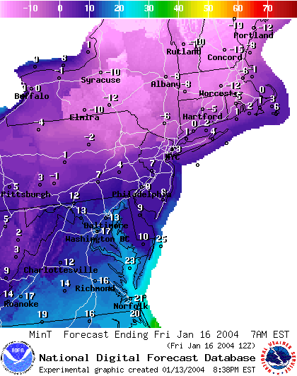
The cold air enters the stage with a vengeance by Thursday 7 am. We will be sitting at 19 F for a morning low. According to Accuweather.com, the low that morning MIGHT only be -1F to +1F and break Wednesdays and Thursdays lows. We shall see.
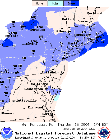
Thursday 1pm and the snow is really diminishing, but he cold air and clouds will be in place.
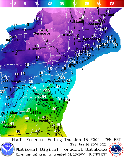
For a HIGH on Thursday you will only see 20F!!! Good gosh!
Then we plunge to the lower single digits Thursday night into Friday morning.
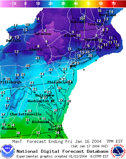
With Friday highs only near 25F again.
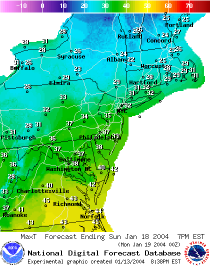
Take heart though, by Sunday, we should warm up to the upper 30's (THAT is good?!).
So hang on and prepare for a bitter cold rest of the week and look for the moderating that will return this weekend.
I'll see you here again Wednesday.
Meteorologist John Ensworth
Surface Station sky cover color key:
Flight category definitions:| Category | Ceiling | Visibility | |
|---|---|---|---|
| Low Instrument Flight Rules LIFR* (magenta circle |
below 500 feet AGL | and/or | less than 1 mile |
| Instrument Flight Rules IFR (red circle) |
500 to below 1,000 feet AGL | and/or | 1 mile to less than 3 miles |
| Marginal Visual Flight Rules MVFR (blue circle) |
1,000 to 3,000 feet AGL | and/or | 3 to 5 miles |
| Visual Flight Rules VFR+ (green circle) |
greater than 3,000 feet AGL | and | greater than 5 miles |
| *By definition, IFR is ceiling less than 1,000 feet
AGL and/or visibility less than 3 miles while LIFR
is a sub-category of IFR. +By definition, VFR is ceiling greater than or equal to 1,000 feet AGL and visibility greater than or equal to 3 miles while MVFR is a sub-category of VFR. |
|||