Back To Home
The Story Behind the Weather - By Forecaster John
Ensworth M.S. -
The Discussion of Weather Events Daily for Philadelphia and Pennsylvania
Last updated: 01/20/2004 06:43 PM
Good Afternoon Philadelphia!
I'm glad to announce that these
discussions will continue until at least the end of February
(it's a short month)!
I
have the necessary server space (especially with missed days!).
In short: More quiet chilly weather then a passing burst of light snow, then more quiet weather before a new shot of real cold hits early next week..
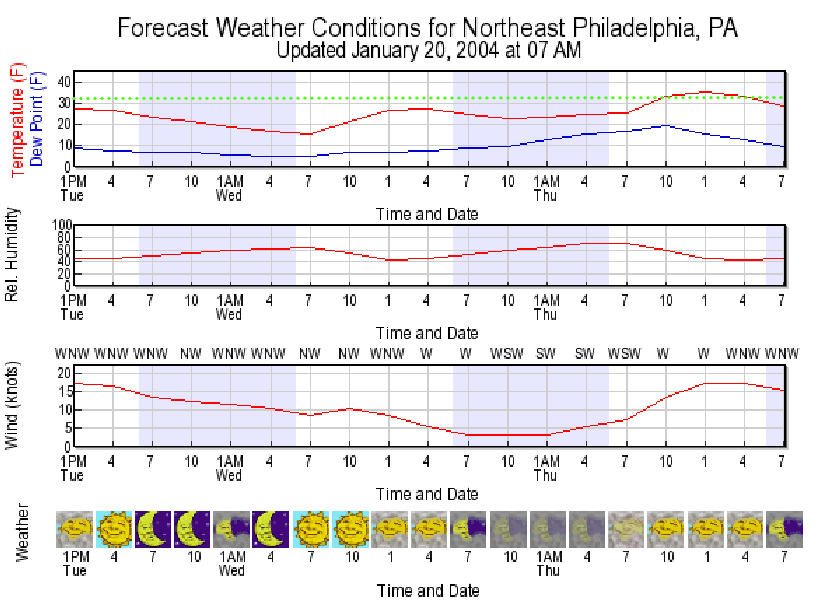
In long: Looking at the Model Output Statistics, this forecast product shows, moment by moment, the weather expected for Philadelphia through Thursday 7pm. I've added a dotted light green line at 32F. We won't see highs or lows climb that lofty level of heat until a brief period Thursday afternoon. Sorry. It is winter afterall.
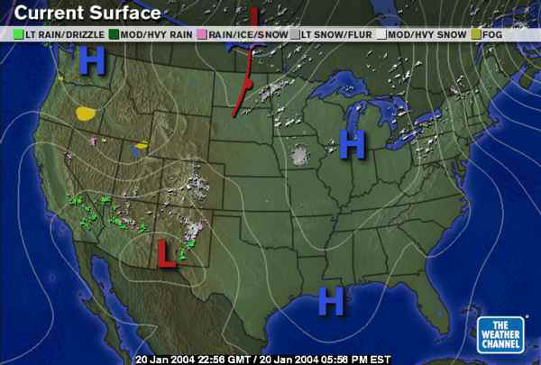
The surface map shows the continued quietness. High pressure is drifting towards us with north winds coming down ahead of the High (air moves clockwise around the High) and a bit of Lake Effect snow kicking up as the cold air moves over the still not yet frozen lakes (what IS keeping them liquid? Nuclear Waste?).
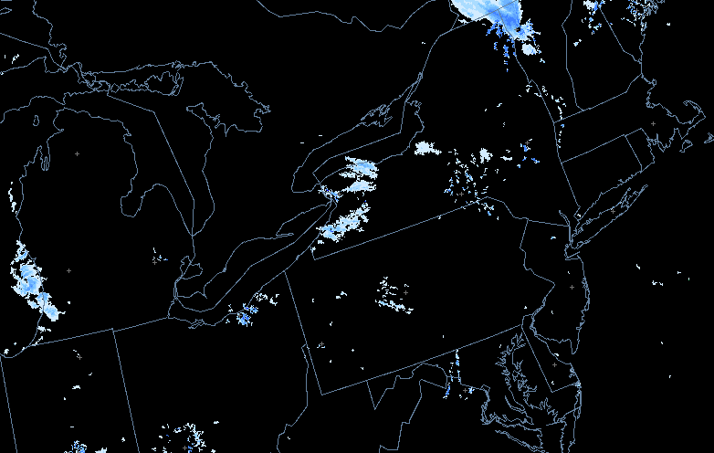
On the radar, you can see the small bits of snow in New York and Ohio. Little is even visible near the radars in Pennsylvania.
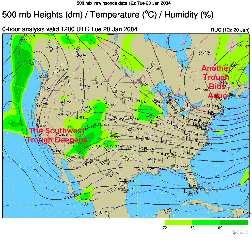
The 500mb map (showing winds as they blow parallel to the dark lines mainly west to east across the US at about 18,000feet where the atmospheric pressure is 1/2 what it is at sea level) shows our latest cold trough slinking away to the east. Our next shot of cold (Monday/Tuesday) isn't visible yet. The Southwest trough is creating minor snow and rain showers way down south but won't immediately effect us either. As I said, it's a quiet pattern!
The forecast map for Wednesday 7pm, shows the next storm gathering itself up in the Great Lakes. More cold air begins to sweep down into the Plains.
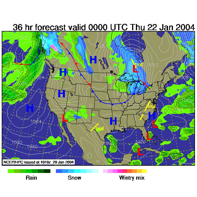
The weather channel version of this maps shows the snow in the lakes (always wondered what these meant- didn't you?).
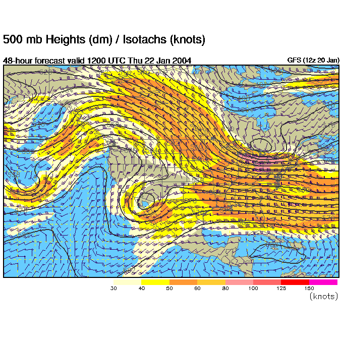
The upper level pattern (the 500mb map again) for Thursday 7am, shows a trough in the northern jet stream moving out of the lakes towards by that time.
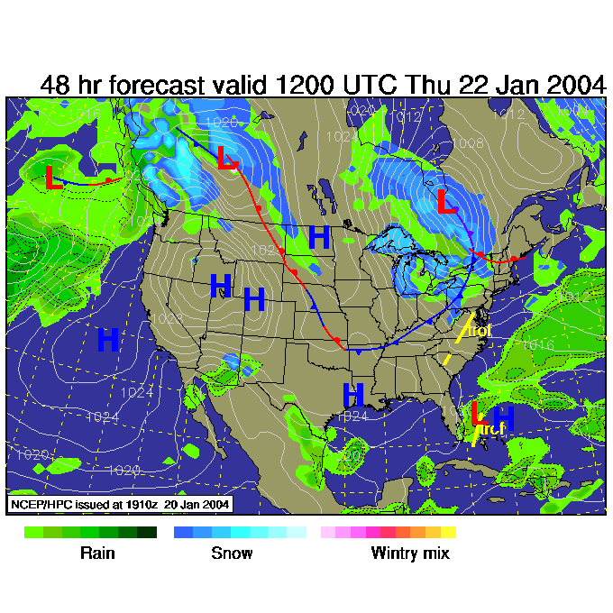
The surface map at that time shows the front getting closer and snow spreading in the state...
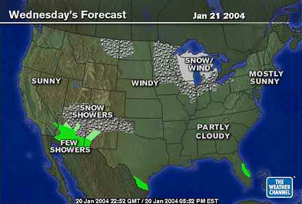
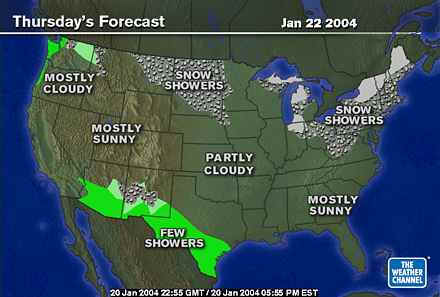
And light snow moves into most of Pennsylvania (almost into Philadelphia) according to the weather channel.
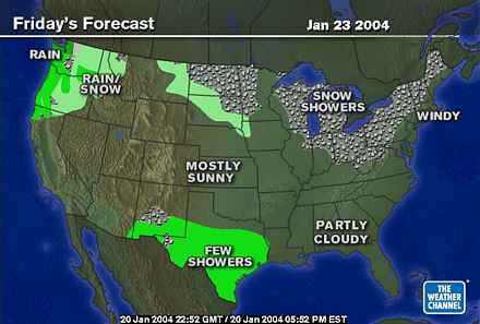
But the map the next day only shows snow in the higher elevations out west and around the lakes. Nothing significant here.
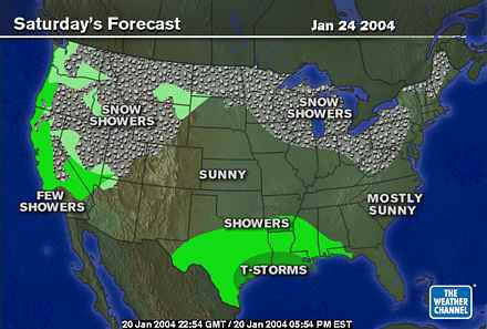
And, strangely, little changes for Saturday. Expect some clouds and flurries.
The southwest storm that is on our map for today very slowly slinks through the deep south then builds up the east coast brining snow nearby from the south this time.
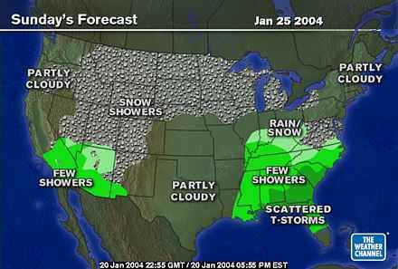
We'll be getting some snow, but should expect to miss most of the direct hits through the weekend.
I'll be back tomorrow!
Meteorologist John Ensworth
Surface Station sky cover color key:
Flight category definitions:| Category | Ceiling | Visibility | |
|---|---|---|---|
| Low Instrument Flight Rules LIFR* (magenta circle |
below 500 feet AGL | and/or | less than 1 mile |
| Instrument Flight Rules IFR (red circle |
500 to below 1,000 feet AGL | and/or | 1 mile to less than 3 miles |
| Marginal Visual Flight Rules MVFR (blue circle) |
1,000 to 3,000 feet AGL | and/or | 3 to 5 miles |
| Visual Flight Rules VFR+ (green circle) |
greater than 3,000 feet AGL | and | greater than 5 miles |
| *By definition, IFR is ceiling less than 1,000 feet
AGL and/or visibility less than 3 miles while LIFR
is a sub-category of IFR. +By definition, VFR is ceiling greater than or equal to 1,000 feet AGL and visibility greater than or equal to 3 miles while MVFR is a sub-category of VFR. |
|||