Back To Home
The Story Behind the Weather - By Forecaster John
Ensworth M.S. -
The Discussion of Weather Events Daily for Philadelphia and Pennsylvania
Last updated: 01/23/2004 08:40 AM
Good Afternoon Philadelphia!
I'm glad to announce that these
discussions will continue until at least the end of February
(it's a short month)!
I
have the necessary server space (especially with missed days!).
In short: Quick! Run outside! It's
ABOVE freezing! Well, for a few hours at least. We might see 40 F in
the next hour, then the cold hits again.
In long: Glancing into the
crystal ball from www.accuweather.com
you can see that the temperatures will be back to 'normal' tomorrow with highs
only in the mid 20'sF and lows in the mid 10'sF. through Monday
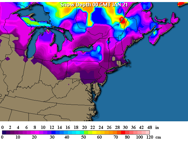
The snow pack probably will not suffer much with us climbing
to the upper 30's this afternoon. The ground is very cold and there just won't
be much sun or heat. We have a trace to an inch of snow around the
Philadelphia area at present.
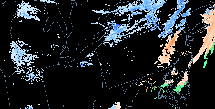
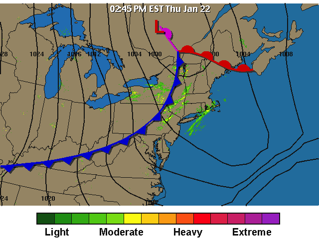
Right now, we do have a mix of rain/snow/sleet sweeping past
Philadelphia, but not much is immediately following this. It won't add
much to the existing snow...yet.
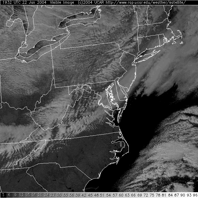
The visible satellite view shows which clouds are thick and
bright (they reflect sunlight well). This view is only good in the daylight
because of that. The radar echoes above don't look like much. You can see
the brighter, vaguely convective clouds sweeping up eastern Pennsylvania.
With temperatures this low, it doesn't take much to get precipitation to
form.
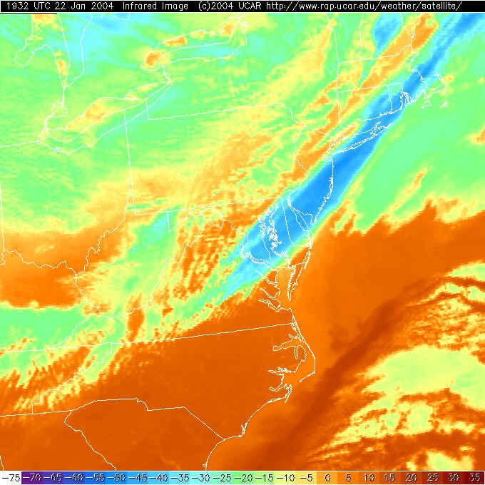
On the Infrared Satellite view, we are looking at infrared
energy emitting (glowing) from warm objects. Cold ground or cloud tops
don't emit much Infrared radiation. The innocuous sweep of clouds further east
of that line is actually made up of much higher and colder clouds and is colored
blue because of it. This is a sweep of cirrus clouds (see how it looks hazy on
the visible satellite view above?)
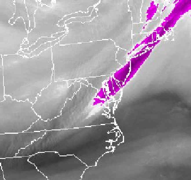
The NEXT satellite view is new to these discussions and I
just wanted to include it for completeness. If you look at the microwave
energy coming from the earth/atmosphere you can see the MOISTURE being carried
through the middle part of the atmosphere. Where the black tones are, it
is dry (which is caused by sinking/stable air). Where the whiter tones are is
moisture (which is caused by rising air bringing moisture up into the middle
atmosphere). The purples are usually ice and cirrus (which is TRUE this time as
well!).
So with the white/grays over Pennsylvania, we have generally
rising motion conducive to making precipitation if the other conditions are
right (which is happening is some places!).
The surface map shows the front sweeping out of the northern
plains and Lakes towards us. This is creating lifting motion (as is the
proximity of the low to the north). The real snow is located closer to the low
pressure system though, sorry if you really want snow.
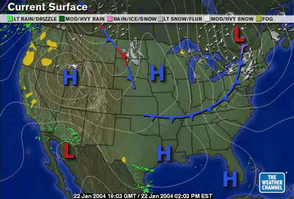
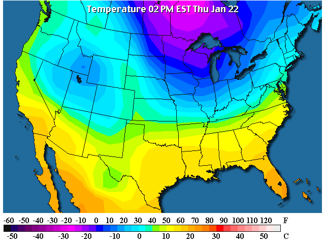
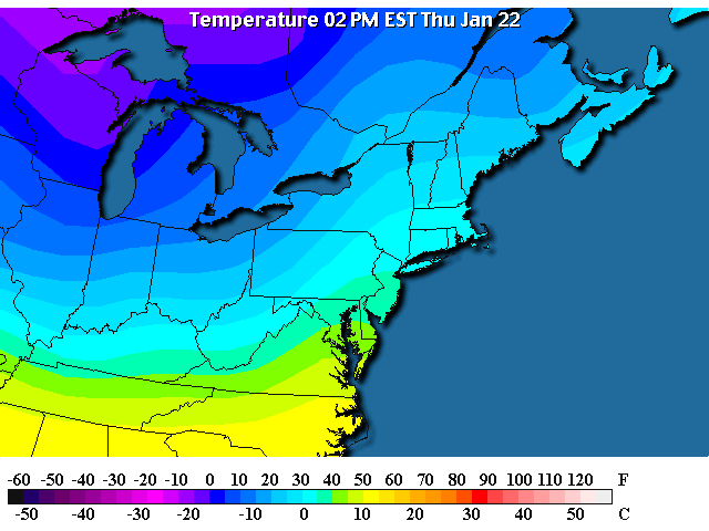
You can see the air inside the fronts analyzed above CLEARLY
as a big fat pool of cold air. Afternoon temperatures up there are in the
-20'sF at 1pm! Sheeesh, give us a break!
Looking closer, the front is about to pass through
Philadelphia and knock our temperatures back down to - durn chilly.
You can see this cold air already spilling into western
Pennsylvania with afternoon temperatures in the 20's out there.
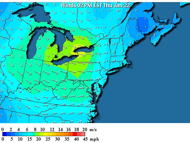
And the surface map confirms the kick/punch of cold air is
coming as winds peak in the 25-30mph strengths to our northwest with a cold west
wind invading the entire region quite rapidly.
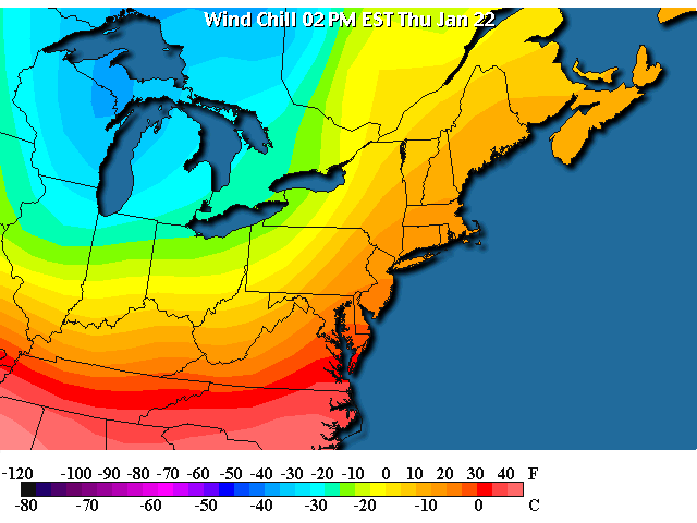
The winds + the temperatures are making wind chills drop to
the -10'sF in the northwest part of the state while they are still only in the
+10's to 20F here. Not for long though. :(
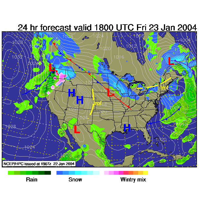
By Friday 1pm, the front will be far to the east and south
and a smooth flow of cold air will be sliding over the area (the Great Lakes are
not yet frozen over so Lake Effect snows will begin in New York and western
Pennsylvania again).
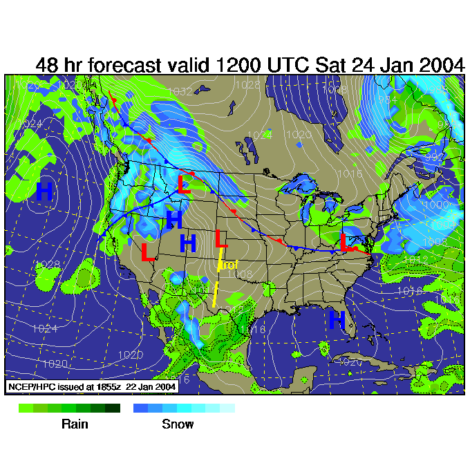
By Friday 7pm, a new surface low will form along the edge of
the cold air and kick up a strong swath of snow roaring towards Pennsylvania...
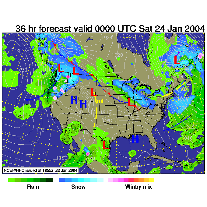
For Saturday 7am, the low turns and aims to slide by to our
south putting us in the heavy snow belt part of the storm. Ok, it has to
happen at least once or twice more before winter leaves us in a couple of months
- no?
I'll be back tomorrow for a quick update, then I'll be gone
Saturday for a quick trip.
I'll see ya then.
Meteorologist John Ensworth
Surface Station sky cover color key:
Flight category definitions:
| Category |
Ceiling |
|
Visibility |
Low Instrument Flight Rules
LIFR* (magenta circle |
below 500 feet AGL |
and/or |
less than 1 mile |
Instrument Flight Rules
IFR (red circle |
500 to below 1,000 feet AGL |
and/or |
1 mile to less than 3 miles |
Marginal Visual Flight Rules
MVFR (blue circle) |
1,000 to 3,000 feet AGL |
and/or |
3 to 5 miles |
Visual Flight Rules
VFR+ (green circle) |
greater than 3,000 feet AGL |
and |
greater than 5 miles |
*By definition, IFR is ceiling less than 1,000 feet
AGL and/or visibility less than 3 miles while LIFR
is a sub-category of IFR.
+By definition, VFR is ceiling greater than or equal to 1,000 feet
AGL and visibility greater than or equal to 3 miles while MVFR is a
sub-category of VFR. |