Back To Home
The Story Behind the Weather - By Forecaster John
Ensworth M.S. -
The Discussion of Weather Events Daily for Philadelphia and Pennsylvania
Last updated: 01/29/2004 08:59 PM
Good Afternoon Philadelphia!
I'm glad to announce that these
discussions will continue until at least the end of February
(it's a short month)!
I
have the necessary server space (especially with missed days!).
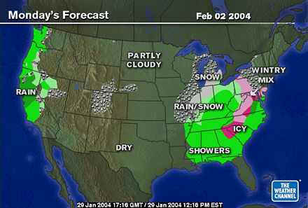
In short: A spitting of snow will move through tonight and into the morning, then continued chilly weather rules (more like a normal winter, if your asking).
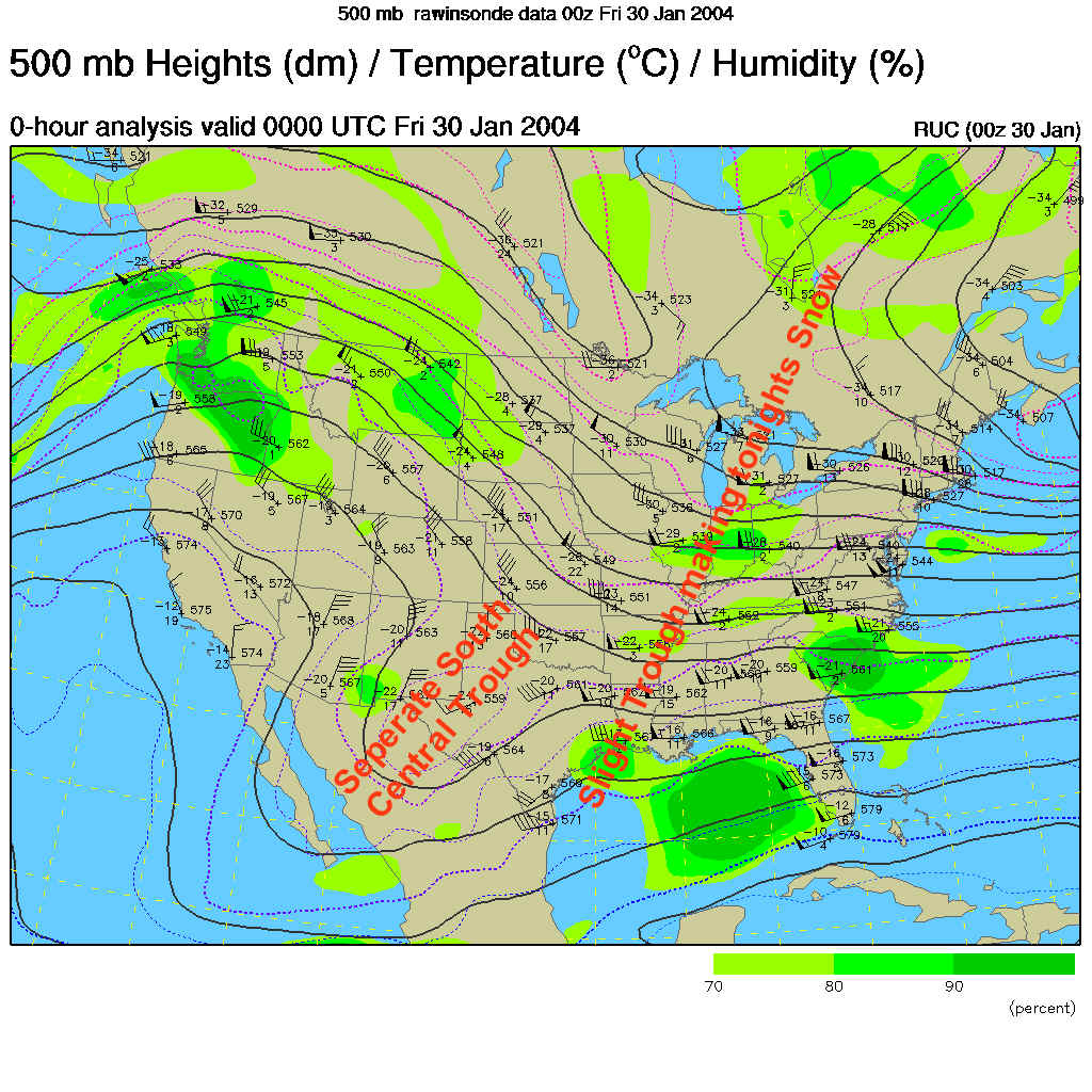
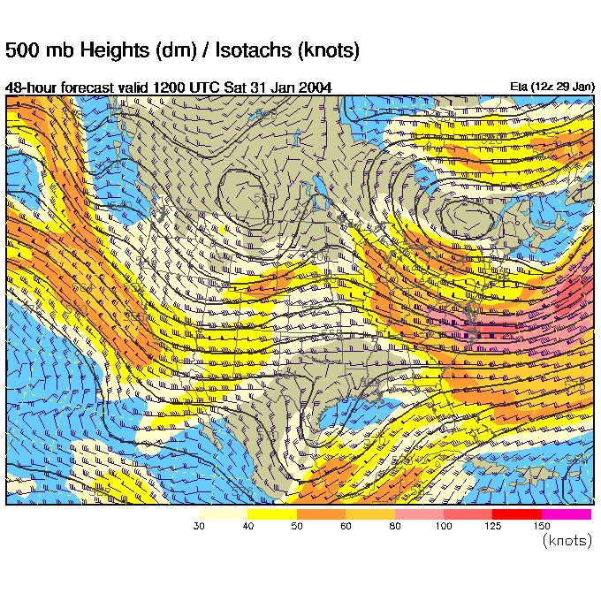
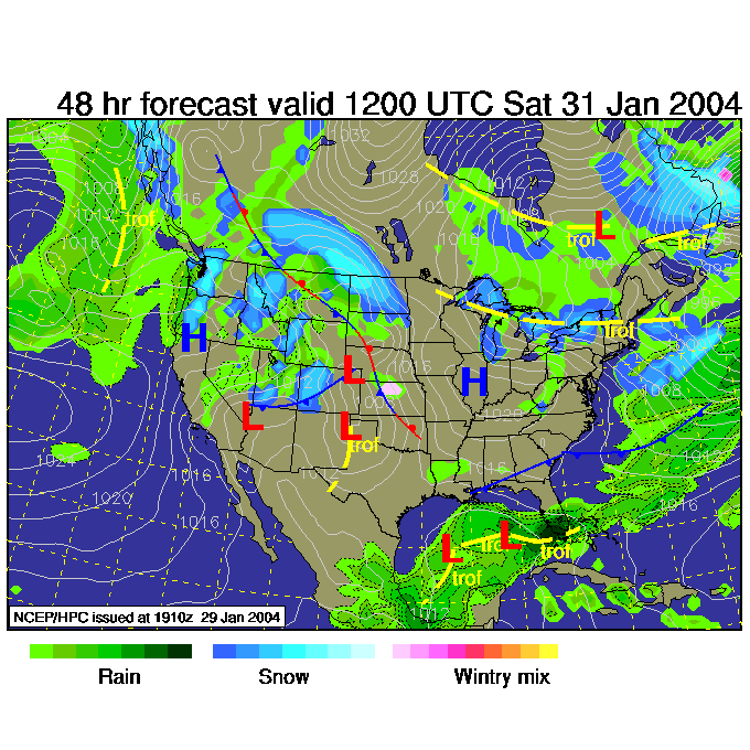
In the Long: In the 500mb map, showing winds as they blow west to east across the continent at about 18,000feet above sea level (where the steering winds are for most storm systems) you can again see a trough (not big though) moving towards in the broad trough over the eastern US (labeled in red). This will pass quickly making light snow tonight. The trough in the south central US may matter more next week, and if not it, the next southern trough will come along.
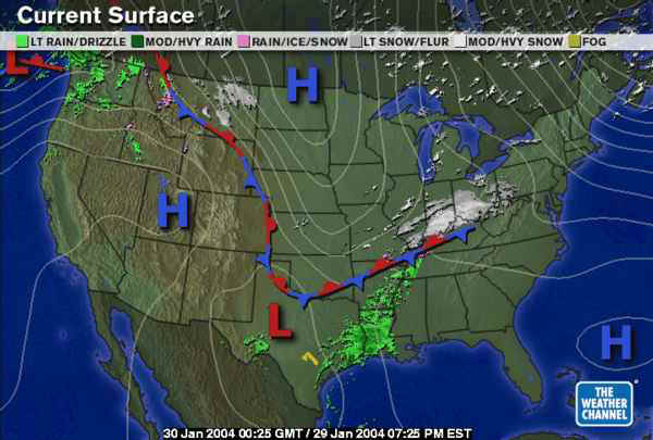
The surface map shows the front has passed us (even though the Weather Channel didn't draw it all the way to near Philadelphia). The snow being kicked up by that small trough in the bigger trough above can be seen from Indiana to Ohio presently.
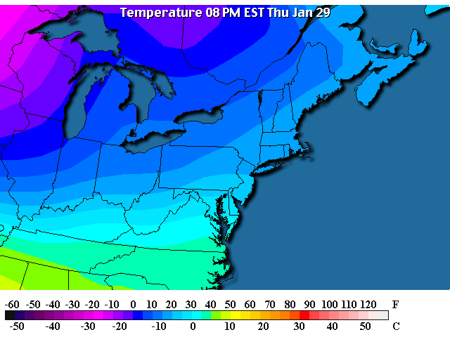
Temperatures are in the 20's F across the region with 40's F visible at the south of the picture.
The surface front has indeed just slipped past us preserving the cold air that has been in place.
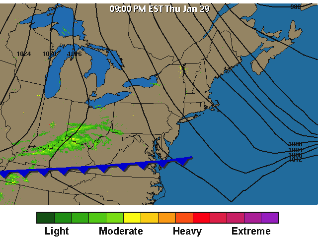
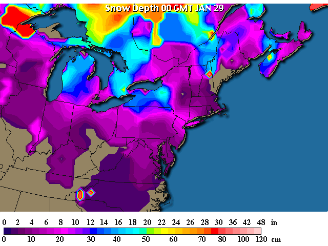
So the snow that is on the ground (about 2-4 inches in places) will hang around a while!
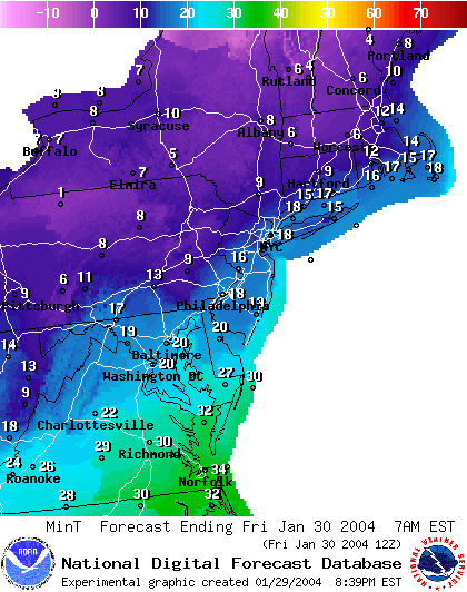
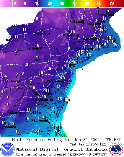
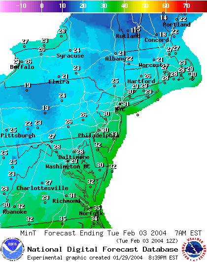
Low temperatures tonight will hit the upper 10'sF...
By Friday 1pm, the front is a bit further south and the bit of snow has moved off the coast already with another minor shot hitting western Pennsylvania.
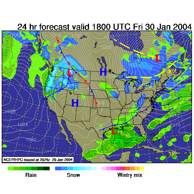
By Saturday 7am, the east coast trough bottom is off the coast again with a ridge (read warming!) out west of us moving in. The south central trough is sliding into western Texas.
Saturday morning, with little changing in the trough/ridge pattern over the eastern US, the temperatures are just a bit cooler (ok, the trough gets a bit deeper and colder) so we have lower 10's F for low temperatures.
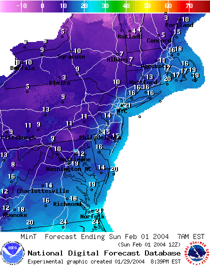
Saturday 7am, the front is even FURTHER south and we are still in the clear.
We see lows Sunday morning in the mid 10'sF.
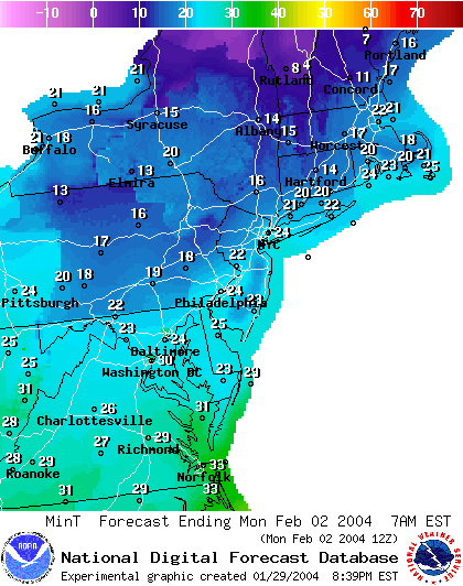
Then the ridge begins to approach us and the minimum temperatures LEAP to the mid 20'sF for Monday morning.
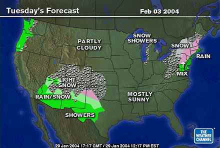
The southern central trough approaches and pumps moisture up over us, but with warm air invading the question is, will it be frozen or liquid?!
The low Tuesday will only be 30F!!!
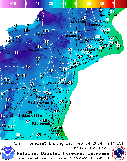
And Tuesday sees the system leaving with even more probable rain in Philadelphia. What a nice change!
Wednesday the lows drop a bit to 21F as that front passes, but we still (you must admit) are getting a break from the horrors of the winter so far.
Stay warm, drive safely and I'll see you here Friday!
Meteorologist John Ensworth
Surface Station sky cover color key:
Flight category definitions:| Category | Ceiling | Visibility | |
|---|---|---|---|
| Low Instrument Flight Rules LIFR* (magenta circle |
below 500 feet AGL | and/or | less than 1 mile |
| Instrument Flight Rules IFR (red circle |
500 to below 1,000 feet AGL | and/or | 1 mile to less than 3 miles |
| Marginal Visual Flight Rules MVFR (blue circle) |
1,000 to 3,000 feet AGL | and/or | 3 to 5 miles |
| Visual Flight Rules VFR+ (green circle) |
greater than 3,000 feet AGL | and | greater than 5 miles |
| *By definition, IFR is ceiling less than 1,000 feet
AGL and/or visibility less than 3 miles while LIFR
is a sub-category of IFR. +By definition, VFR is ceiling greater than or equal to 1,000 feet AGL and visibility greater than or equal to 3 miles while MVFR is a sub-category of VFR. |
|||