
Back To Home
The Story Behind the Weather - By Forecaster John
Ensworth M.S. -
The Discussion of Weather Events Daily for Philadelphia and Pennsylvania
Last updated: 01/08/2004 10:20 AM
Good Morning Philadelphia!
I'm glad to announce that these
discussions will continue until at least the end of January!
I
have the necessary server space (especially with missed days!).
In short: The clouds are back, but the unusual warmth continues and will get warmer before we get slapped with cold air again.
In long: There is no sense in showing the snow cover map, there isn't any. But the clouds ARE here and getting thicker. On the visible satellite picture, you can see what is very reflective as white (clouds/ snow) and what isn't as dark colors (water, bare ground). But there is a difference between clouds over the state. Some of the clouds are high cold ice crystal clouds and some are lower mostly liquid water clouds. How can we tell that?
By looking ALSO at the infrared (IR) satellite view. The IR satellite view shows what is WARM as red and what is very cold as BLUE (the scale at the bottom of the picture is the temperature in degrees Celsius). The swoop of clouds over the southeastern part of the state is very cold, so these are cold ice crystal clouds (high in the atmosphere where temperatures are that cold). Ice clouds, called cirrus, are often see-through, that is why we are still getting enough light from the sun to cast shadows. This will hold on until the lower (warmer) clouds move in.

On the surface map, we have a warm front sort of approaching the state from the south and west. Want MORE warm air? You got it...for now. Some of those low warm clouds out west are actually touching the ground, so there is fog being reported there. The fog is colored yellow on the map below.

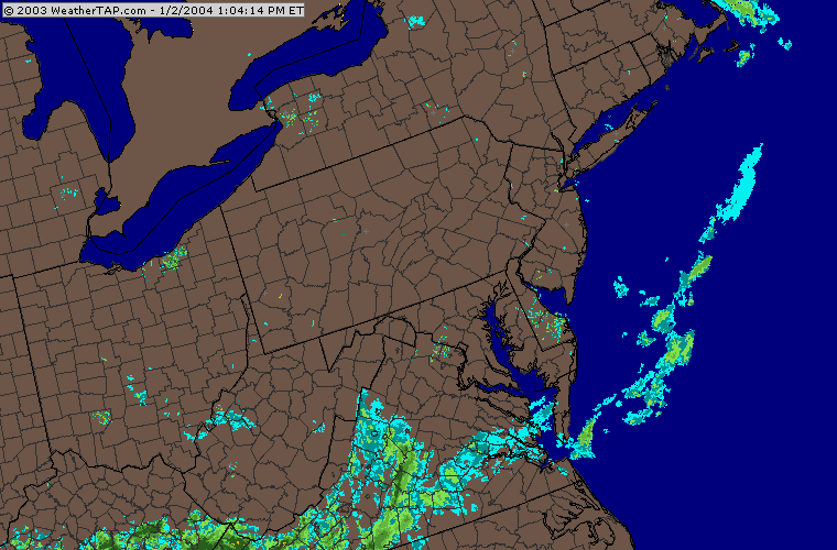
The radar view is still quiet, but rain is on the way for the weekend. The showers to our south and southwest will expand and move this way.
The big picture is, as it always is, on the 500mb map. (This map shows how winds are blowing (mostly parallel to the dark black lines) mainly from west to east at about 18,000feet above sea level). Ridges (northward bulges in the air flow) are associated with higher pressure, sinking warming air. Troughs are the opposite and have the coldest air in them. The western trough is brining tons of snow to the mountains out there, and the ridge over us has been and will continue to keep us unusually warm.

You can even see the above trough/ridge pattern in the maximum temperature forecast map from the National Weather Service. Neat, no?

Locally, expect the warmer temperatures you can see over Ohio, W. Virginia, etc., to move this way on the warm front under our ridge.

The first shot of rain comes when a smaller trough (a smaller wave, or short wave)- circled in red below - approaches the area tomorrow morning (Saturday 7am).

The forecast precipitation areas shows the heavy rain north of New York State with rain trailing southward over the state.

The warm front is passing and the next cold front is coming.

By Sunday morning (7am), the big western trough begins to roll eastward (watch out!!).

This bigger trough kicks up a bunch of (mostly) rain ahead of it (since it is still so warm).

Meanwhile, the front kicked southward by the short wave IS brining in some colder air. So some places will see some snow (but not Philadelphia).

So wait for the rain and cooler temperatures by the end of the weekend, and again, from the mountains of central Arizona I say - good day!.
Meteorologist John Ensworth
Surface Station sky cover color key:
Flight category definitions:| Category | Ceiling | Visibility | |
|---|---|---|---|
| Low Instrument Flight Rules LIFR* (magenta circle |
below 500 feet AGL | and/or | less than 1 mile |
| Instrument Flight Rules IFR (red circle) |
500 to below 1,000 feet AGL | and/or | 1 mile to less than 3 miles |
| Marginal Visual Flight Rules MVFR (blue circle) |
1,000 to 3,000 feet AGL | and/or | 3 to 5 miles |
| Visual Flight Rules VFR+ (green circle) |
greater than 3,000 feet AGL | and | greater than 5 miles |
| *By definition, IFR is ceiling less than 1,000 feet
AGL and/or visibility less than 3 miles while LIFR
is a sub-category of IFR. +By definition, VFR is ceiling greater than or equal to 1,000 feet AGL and visibility greater than or equal to 3 miles while MVFR is a sub-category of VFR. |
|||