Back To Home
The Story Behind the Weather - By Forecaster John
Ensworth M.S. -
The Discussion of Weather Events Daily for Philadelphia and Pennsylvania
Last updated: 01/31/2004 05:26 PM
Good Afternoon Philadelphia!
I'm glad to announce that these
discussions will continue until at least the end of February
(it's a short month)!
I
have the necessary server space (especially with missed days!).
In short: Quiet and warm weather will rule through the weekend and not degrade until Tuesday.
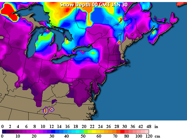
In the Long: The snow pack as of 24 hours ago hasn't changed much, but with the warm up and upcoming rain...watch it finally go away! (For a while).
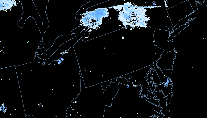
The winter color coded radar shows...nothing in Pennsylvania... all's quiet out there!
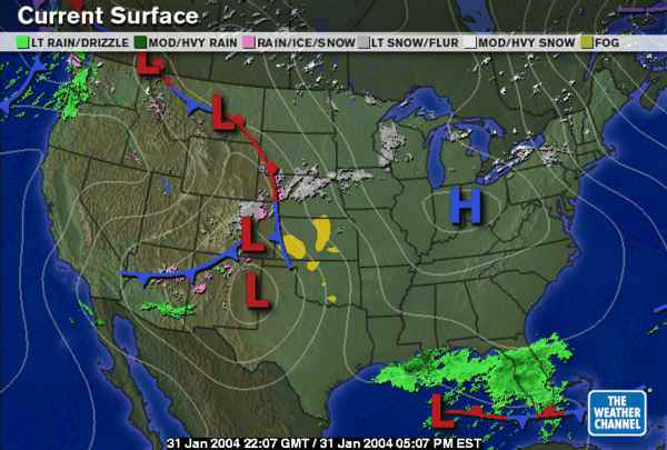
The reason for the quite weather is the High Pressure system moving overhead. Once it passes, south winds will return warming us up tomorrow (air moves clockwise around a high- remember?).
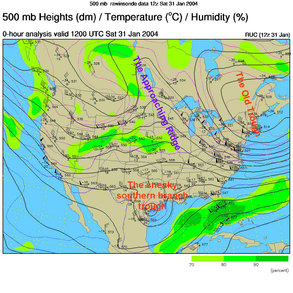
The 500mb map (showing winds as they blow parallel to the dark lines mainly west to east across the US at about 18,000feet where the atmospheric pressure is 1/2 what it is at sea level) shows our past cold front and associated trough leaving (labeled in red) and our warm happy ridge moving in from the west (marked in purple). To the right of an upper atmospheric ridge you would expect to see a High pressure system form (and it's there, on the map above). The next trough behind that ridge and the trough down south will be our weather maker Tuesday. The upper air pattern is on the move!
Sunday afternoon, 1pm, little has changed expect the center of the High is passing, so expect south winds to return (with warmer temps) by evening.
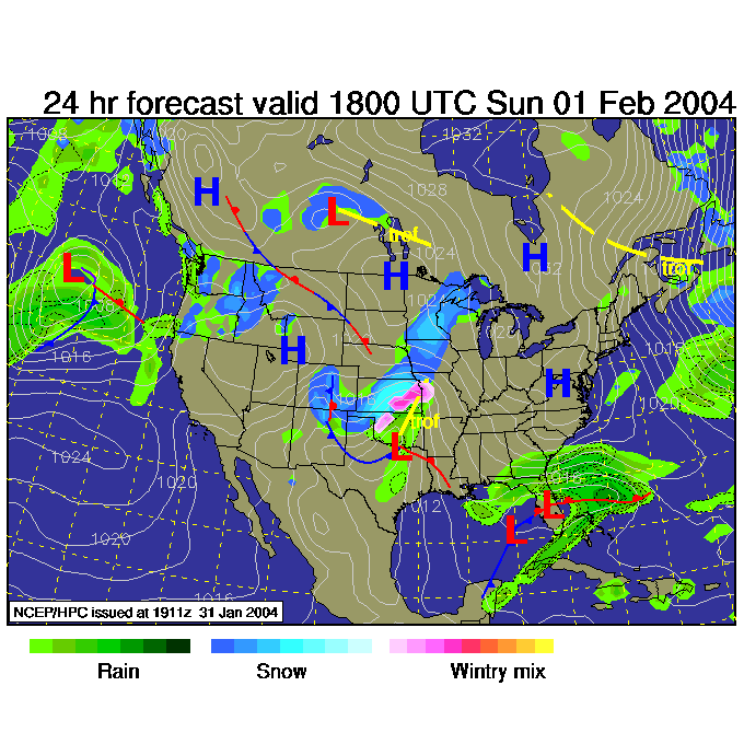
Monday see's mischief building in the Ohio and Mississippi valleys as the troughs conspire together.
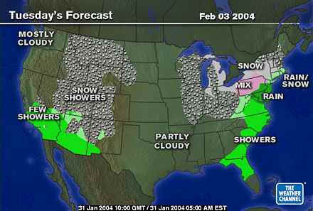
The Tuesday morning (7am) 500mb map shows the (currently) Rocky Mountain trough slamming the east coast...

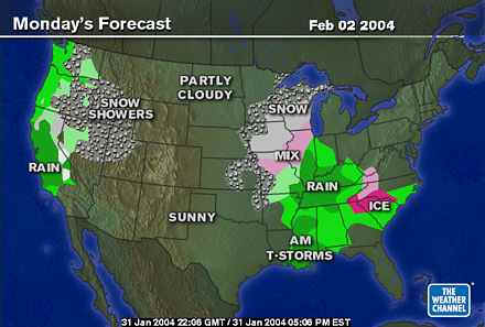
And we get a hit of RAIN (or freezing rain if it is a bit colder) with a mix of ice, snow, and rain out west.
Enjoy the warm up and I'll see you Monday. We'll see then if you should expect ice, snow, or just rain in Philadelphia proper for Tuesday.
Meteorologist John Ensworth
Surface Station sky cover color key:
Flight category definitions:| Category | Ceiling | Visibility | |
|---|---|---|---|
| Low Instrument Flight Rules LIFR* (magenta circle |
below 500 feet AGL | and/or | less than 1 mile |
| Instrument Flight Rules IFR (red circle |
500 to below 1,000 feet AGL | and/or | 1 mile to less than 3 miles |
| Marginal Visual Flight Rules MVFR (blue circle) |
1,000 to 3,000 feet AGL | and/or | 3 to 5 miles |
| Visual Flight Rules VFR+ (green circle) |
greater than 3,000 feet AGL | and | greater than 5 miles |
| *By definition, IFR is ceiling less than 1,000 feet
AGL and/or visibility less than 3 miles while LIFR
is a sub-category of IFR. +By definition, VFR is ceiling greater than or equal to 1,000 feet AGL and visibility greater than or equal to 3 miles while MVFR is a sub-category of VFR. |
|||