
The Story Behind the Weather -
John
Ensworth - forecaster
last updated: 09/14/2003
We'll start this time with the current surface map from the National Weather Service. This picture shows what is called and Infrared Satellite view with the fronts and pressure systems drawn on top. In an Infrared Satellite picture you are seeing the temperature of what ever surface the satellite is seeing. Clouds, being higher in the atmosphere are colder and are colored lighter colors of grey. The whitest colors are very cold and the areas colored yellow, and dark blue then light blue are extremely cold clouds (ice crystals from -20C to -50C). Unless you are seeing thin cirrus, the colored clouds the tops of the strongest storms and precipitation areas.
In the view below, one can see that Pennsylvania is partly cloudy with broken low clouds this morning ( the grey shaded areas over PA are not much cooler than the ground temperature) with more extensive clouds just to the south. The pink dotted line is a dying cold front just to our southeast and east. Behind it is the slightly drier and cooler air that is making today feel so nice if a bit gloomy.
A quick look at the visible satellite picture shows the partly cloudy skies the way you would see it with black and white eyes from space. Bright things are white, dark things are dark colored (this is the view you are more used to seeing). Note that the great lakes (which are still quite cool after that winter we had) are greyer than the land in the picture above, but since there is no ice on them anymore, they are dark in the visible picture below.
Just to our south is a low pressure system that is sliding out east off the coast over the next day. The thick clouds will bring showers and hide the sun for the southern counties today while the sun burns through our cool moist air through noon. The system moving by to our south is following the flow of air 'half way up' in the atmosphere. You can see this air flow on the map below, the 500mb map. It shows the height above sea level you need to go to find the pressure at about one half surface pressure (too thin to live or breath in!). The air flow is parallel and mostly from left to right (west to east) across North America, and is almost due west to east over Pennsylvania right now.

With that said, one wouldn't expect any significant weather today or tonight, but with the moisture in place and cool air aloft, the sun may heat the ground enough to make isolated non-severe thunderstorms pop up. That is where the slight chance of thunderstorms is coming from. You might want to keep an umbrella handy by 3pm on.
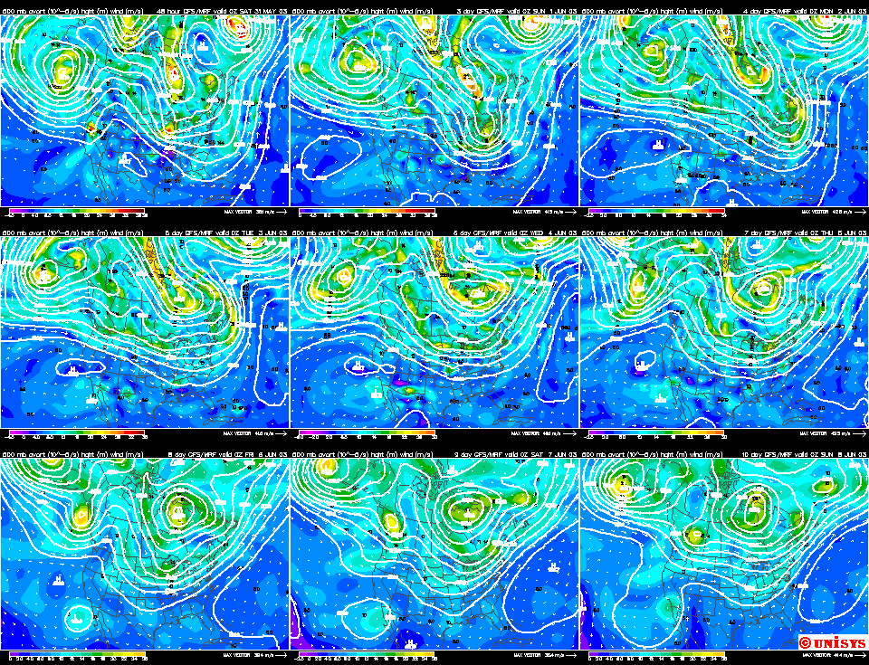
In the short term (through the weekend), it looks like the overall trough pattern (500 mb surface in the picture above has the trough axis drawn and labeled) will remain in place (see the forecast graphics below--- the trough hangs on!) won't change much, so we'll be sort of cool, cloudy and showery now and then into the start of next week and beyond. The picture below shows the 500 mb map for the next 9 days.
I'll see you back here tomorrow!
John Ensworth
(This page sometimes contains sources from AccuWeather.com www.accuweather.com ).