The Story Behind the Weather -
John
Ensworth - forecaster
last updated: 09/14/2003
I'm sorry that it's so wet today, but at
least the storm did stay to the south far enough to keep the severe weather down
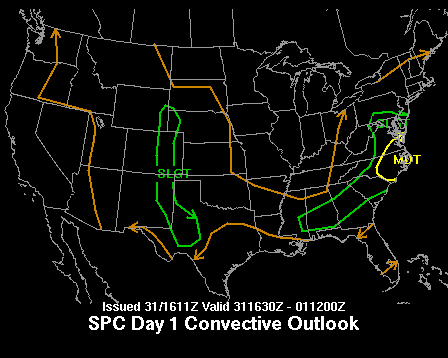
there. The severe weather threat today (from the Severe
Storms Forecast Office in Norman, OK) is primarily in southern
Virginia and western
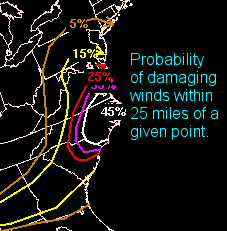
North Carolina. We can also look at the predictions they make for the probability of specific elements of severe weather, primarily tornadoes, hail and high winds...
Right now, the radar looks like this:
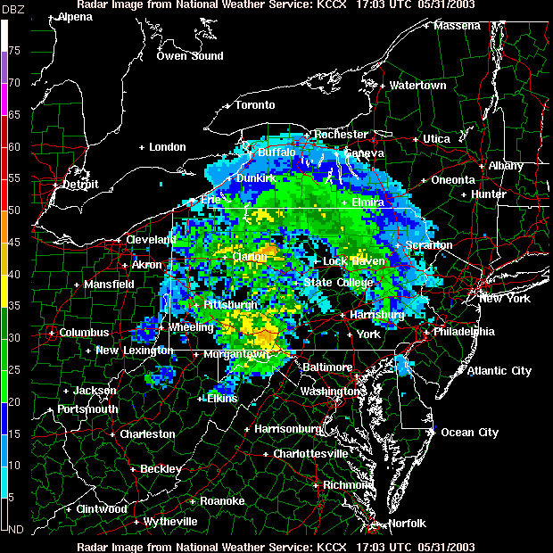
There is a large amount of rain (at noon today) moving through western Pennsylvania. Some heavy amounts of rain will hit much of the state through this afternoon and on into the night. We just don't get a break from the water. :(
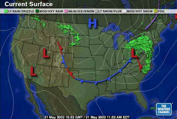
This system will move off the coast and we'll have a return to north winds and drier air for a while, but already the showers in the Dakota's (seen on the surface map below) and the associated may play a role by mid week... stay tuned. But before then, it will be getting much warmer and nicer, largely due to down-slope flow (air moving down out of the highlands of western PA).
The temperatures and strength of this system is much more like a winter storm than a late spring/early summer system. It really is quite amazing. Looking at the pattern of air flow at 500mb (half way up in the atmosphere pressurewise, about 18,000 feet above sea level)...
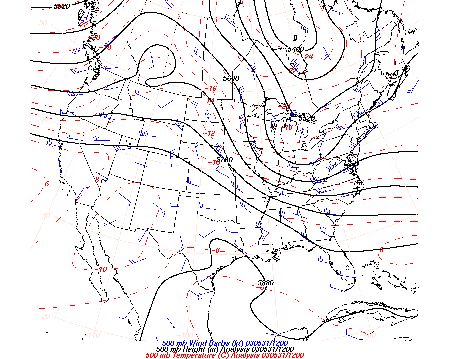
This huge deviation of the height of the 500mb pressure level southward (the deep trough just to our west) is the driving force behind the weather this weekend AND the reason that there might be snow in the higher mountains of the Appalachians and (if it weren't for a warm sea breeze along the PA coast) we might have had a frost tonight!
Hold on, better weather is coming!
Meteorologist John Ensworth, M.S.
(This page sometimes contains sources from AccuWeather.com www.accuweather.com ).