
Back To Home
The Story Behind the Weather - By Forecaster John
Ensworth M.S. -
The Discussion of Weather Events Daily for Philadelphia and Pennsylvania
last updated: 09/14/2003 02:17 PM
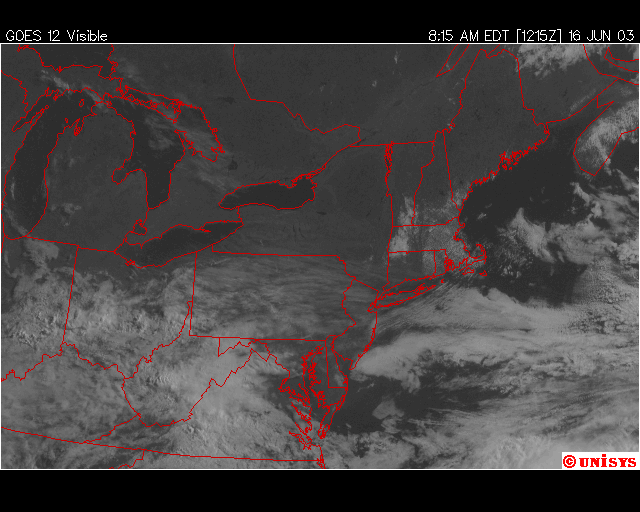
Wow! A real change in the weather. Today we have a nice cool high pressure system pushing down out of Canada keeping, what could have been, our next storm to the south. We just have the cirrus from that system spreading overhead, but the sun is shining through that in most places except for the southwest part of the state.
In the following visible satellite picture, you can see the cirrus streaming overhead.
The map below is another representation of the 500mb forecast map from the GFS computer model that we've looked at before. One thing you can notice is that the region where most rapid change from the lower 500mb heights (blues) and the higher 500mb heights (oranges) [which is the tighter height gradient] is now much further north than it has been for the last month of these discussions. This means the jet stream (that forms where the gradient is the tightest) is heading north - as we would expect as summer approaches. Still, we are near where the jet will be for a while longer. Bulges (short waves) in the 500mb pattern will run us over now and then over the next nine days (pictured below). The black circles are periods of time where the approaching short waves put PA on the right side of a trough. That is the stormy side of the short (or long) waves. From this we can see that Wednesday and Thursday will bring another shot of stormy weather, then we have an approximately four day break before storminess returns (the last three weeks of this forecast map). The red arrowed lines show the axis of the troughs (short waves) that are rippling towards us.

It looks like a more normal (cool then warm then cool then warm) pattern without as much unrelenting rain. It's time to mow that forest that was your lawn.
Meteorologist John Ensworth