Back To Home
The Story Behind the Weather - By Forecaster John
Ensworth M.S. -
The Discussion of Weather Events Daily for Philadelphia and Pennsylvania
last updated: 09/14/2003 02:17 PM
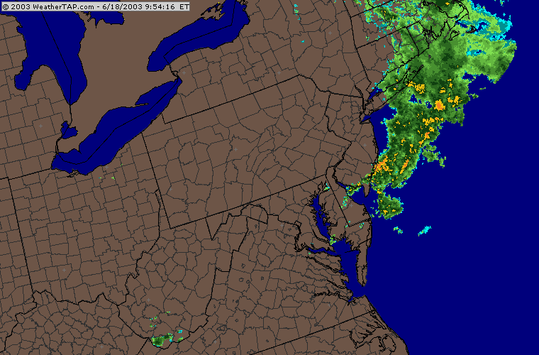
Hi there! The current batch of rain is pushing off into the ocean, but unsettled weather will remain a problem through Thursday with more spotty showers possible through Saturday morning.
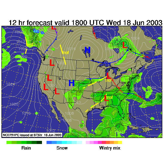
This next series of surface maps shows the forecasted progression of the surface features that will bring repeated chances of rain through the next two days. By 2pm Wednesday you can see sort-of backwash precipitation forming behind the departing blob of rain. Basically the upper air is cool enough for daytime heating to kick off showers and some thunderstorms.
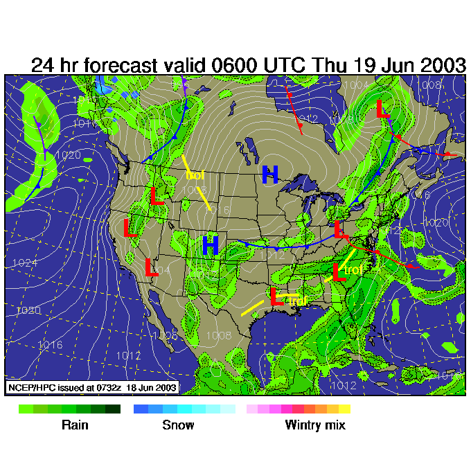
By 2am the next low pressure system that formed over the Plains will be moving towards us with lifting north of the warm front sweeping up from the south.
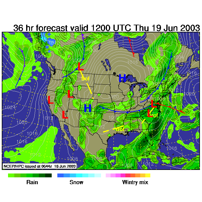
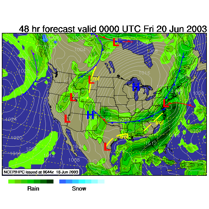
Then the low (by Thursday 8am) skirts along the southern border of Pennsylvania as a cool front sweeps in from the northwest. All you need for rainfall is moisture in the air, and a way to lift that moisture up to form clouds (and precipitation). We have TWO reasons for the air to rise!
Then at 8pm Friday, the front is pushing through the area with general storminess all around. This ushers in some cooler air for a day or two before 80's reestablish themselves by the very end of the weekend/start of the new week.
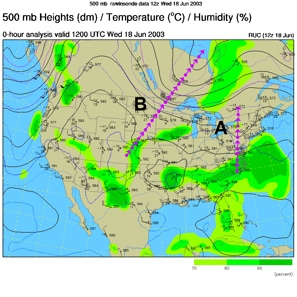
The 500mb map this morning shows the short wave (marked A) leaving the area today with the much larger wave approaching from the west (marked B). What can I say? We have an active jet stream over us and storms will happen.
The 500mb forecast for the last surface map above shows the huge trough rolling over us. This is quite strong for this time of year (summer is now beginning).
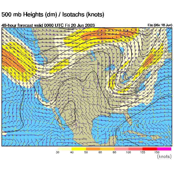
By Friday 8pm, the trough becomes a big cut-off (at least in the ETA model, one other model moves this off shore). If it sits overhead, then we will possibly see afternoon showers pop up due to all the cool air aloft.

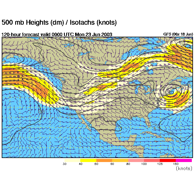
Then switching to the GFS, we can look at Sunday 8PM. The trough is oozing off shore and southwest winds will warm us up as advertised.
At least it's not raining all the time. There IS a silver lining.
Meteorologist John Ensworth
Surface Station sky cover color key:
Flight category definitions:| Category | Ceiling | Visibility | |
|---|---|---|---|
| Low Instrument Flight Rules LIFR* (magenta circle) |
below 500 feet AGL | and/or | less than 1 mile |
| Instrument Flight Rules IFR (red circle) |
500 to below 1,000 feet AGL | and/or | 1 mile to less than 3 miles |
| Marginal Visual Flight Rules MVFR (blue circle) |
1,000 to 3,000 feet AGL | and/or | 3 to 5 miles |
| Visual Flight Rules VFR+ (green circle) |
greater than 3,000 feet AGL | and | greater than 5 miles |
| *By definition, IFR is ceiling less than 1,000 feet
AGL and/or visibility less than 3 miles while LIFR
is a sub-category of IFR. +By definition, VFR is ceiling greater than or equal to 1,000 feet AGL and visibility greater than or equal to 3 miles while MVFR is a sub-category of VFR. |
|||