Back To Home
The Story Behind the Weather - By Forecaster John
Ensworth M.S. -
The Discussion of Weather Events Daily for Philadelphia and Pennsylvania
last updated: 09/14/2003 02:18 PM
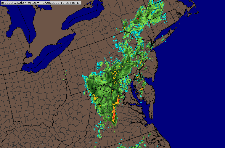
Howdy again. Yep, we're still under a flash flood watch for the eastern two thirds of the state. The rain keeps coming in waves.
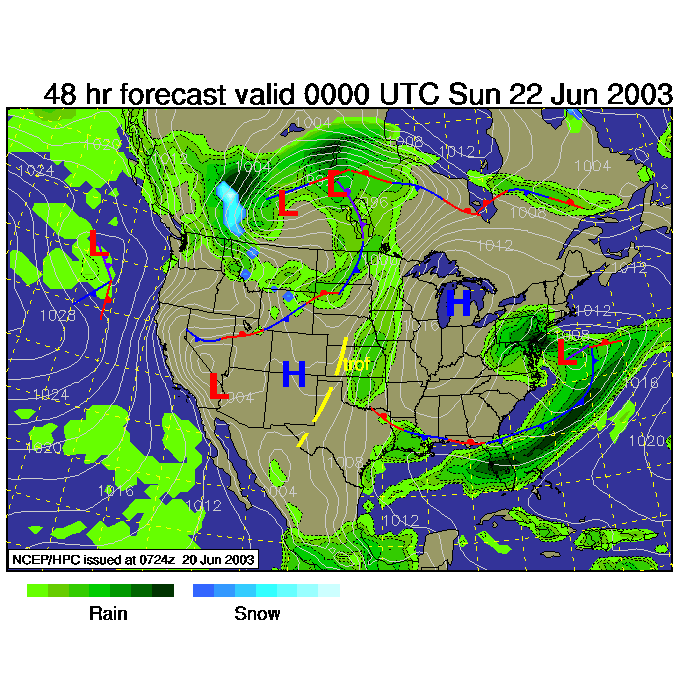
![]()
The current wave on the table is mostly through the state, but still approaching Philadelphia... the rain has just begun here.
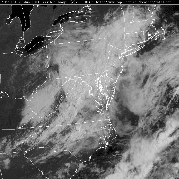
The visible satellite picture shows clear skies to the north, west and southwest tempting us... but it won't be our lot until later Sunday and Monday.
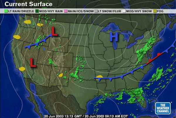
This time, one might even take the rain personally. Computer model forecasts earlier in the week didn't show rain for the weekend, but the upper air and surface features conspired to reach out and give us rain anyway. On the surface map below, you can see the Low that ran us over is off the picture to the east, but the front it dragged down is parked a couple of states to the south. This isn't far enough away to keep us dry...
The 500mb map shows the errant trough tilted to the southwest over us (marked with a purple line).
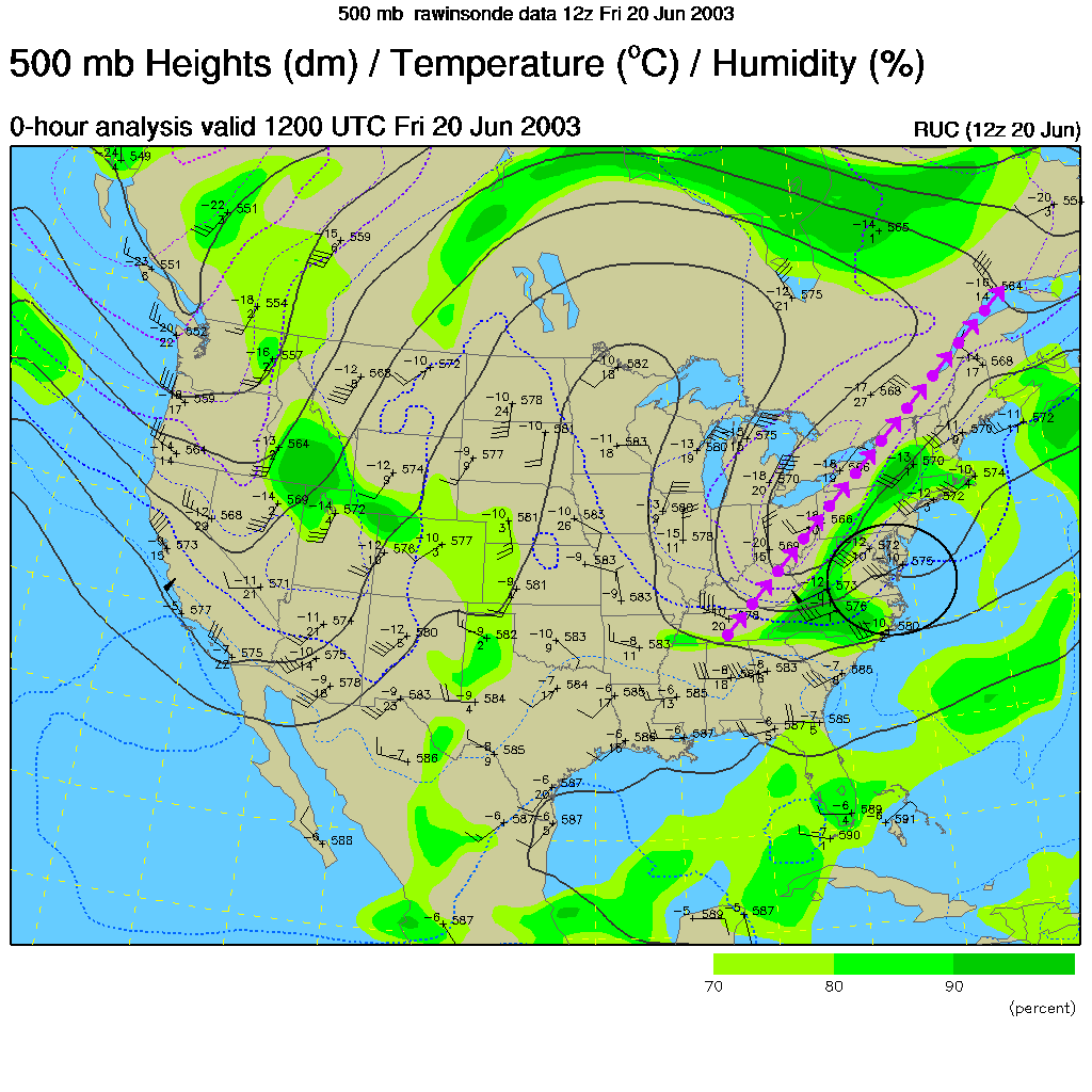
Looking into the future... we can see that the trough staying just overhead and the area in the black circle is the area where air is lifted by the dynamics associated with air flow around the trough (storms usually form to the right of a trough). A Low pressure system will form along this front and spin up moisture off the ocean on to our heads.
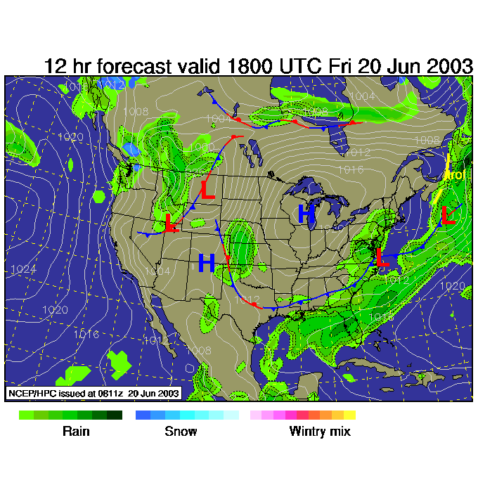
This first of a series of forecast maps shows the low off the Virginia coast and rain kicking northward (since air flows counterclockwise around a Low). This map is valid for 2pm today (Friday).
Now the rain is just coming up here to be spiteful! This map is created for 2am Saturday, local time.
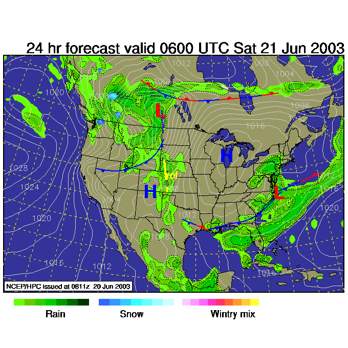
And still, the rain funnels up to Pennsylvania just because it can. This map is for Saturday 8am.
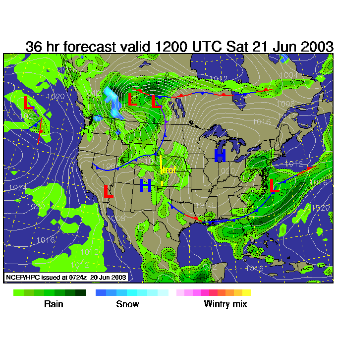
And, just for the fun of it, the rain gets heavier by Saturday 7pm.
I'm afraid to predict clearing, but ... yes...eventually it will dry out. It has to!
Stay dry,
Meteorologist John Ensworth
Surface Station sky cover color key:
Flight category definitions:| Category | Ceiling | Visibility | |
|---|---|---|---|
| Low Instrument Flight Rules LIFR* (magenta circle) |
below 500 feet AGL | and/or | less than 1 mile |
| Instrument Flight Rules IFR (red circle) |
500 to below 1,000 feet AGL | and/or | 1 mile to less than 3 miles |
| Marginal Visual Flight Rules MVFR (blue circle) |
1,000 to 3,000 feet AGL | and/or | 3 to 5 miles |
| Visual Flight Rules VFR+ (green circle) |
greater than 3,000 feet AGL | and | greater than 5 miles |
| *By definition, IFR is ceiling less than 1,000 feet
AGL and/or visibility less than 3 miles while LIFR
is a sub-category of IFR. +By definition, VFR is ceiling greater than or equal to 1,000 feet AGL and visibility greater than or equal to 3 miles while MVFR is a sub-category of VFR. |
|||