
Back To Home
The Story Behind the Weather - By Forecaster John
Ensworth M.S. -
The Discussion of Weather Events Daily for Philadelphia and Pennsylvania
last updated: 09/14/2003 02:23 PM
Welcome back! Let's look at what's behind the forecast this fine Thursday...
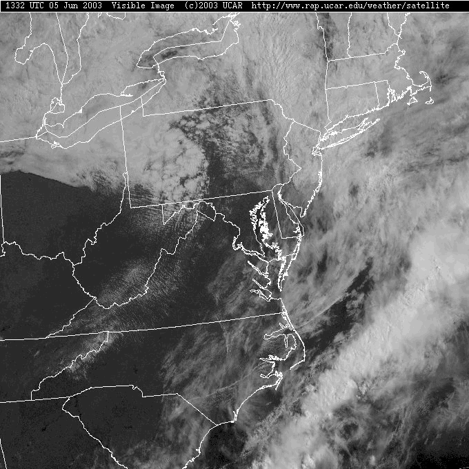
The low that wasn't suppose to move far...hasn't moved far. It is now north of the western part of the state over Lake Ontario with a strange purple front draped down to the eastern edge of PA. This front, colored a combination of red and blue, and given the half circles and triangles of both a cold front and a warm front (which are colored blue and red, respectively) is called an Occluded Front.
The cold front moves, on the average, twice the speed of the warm front. As you can see in the images from www.usatoday.com below, the cold front is a surface based dome of cold, dense air that can plow beneath the warm air it is invading. But the warm front is warm air pressing against denser cool air ahead of it, and is itself lifted up over the cool air. This allows the cold front to eventually catch up with the warm front...


 (hover your mouse over these pictures)
...creating an occluded front that starts to form next to the low pressure system, then spreading down the frontal boundaries away from it. (There are two kinds of occluded fronts. Number 1 is where the cold air catches up with cool air (it is the most common) and Number 2 where cool air catches up with cold air (more common up here in the NE US)).


 (Hover your mouse over these pictures)
This is the dying state of a frontal system. The fact that the low has hung around for the last day and a half near our state, gave the cold front time to catch up and make this form of a front. Rainfall usually decreases but cloudy skies remain with an occluded front.
Drier air is approaching from the west, but colder air than normal in the upper atmosphere will keep puffy cumulus (cotton ball looking) clouds forming throughout the day.
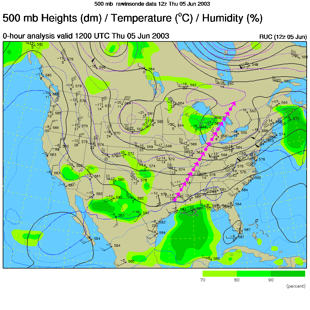
A quick look at the pattern of air flow high overhead (about 17,000 feet up; i.e. the 500mb map) shows winds over our state coming from the Southwest. The trough (marked in purple), or dip in the air flow to the south, is slowly moving to the west. This will put the state in a position to have the next major low (around Tuesday) move more to the north of us. We'll see a chance of a line of thunderstorms ahead of the cold front next time.
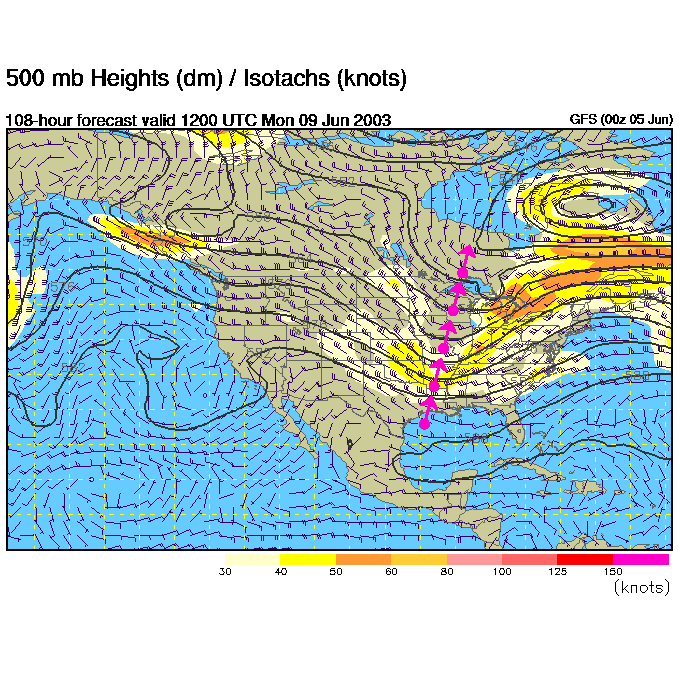
Looking into the future, you can see on the next 500mb map (for Monday at 8am), that the trough axis (in purple) has moved west (at least the northern extent of the line). And the next map...
... is the surface forecast map for Monday morning at 8am EDT. You can see the low to our north and the aproximate position of the cold front and warm front.
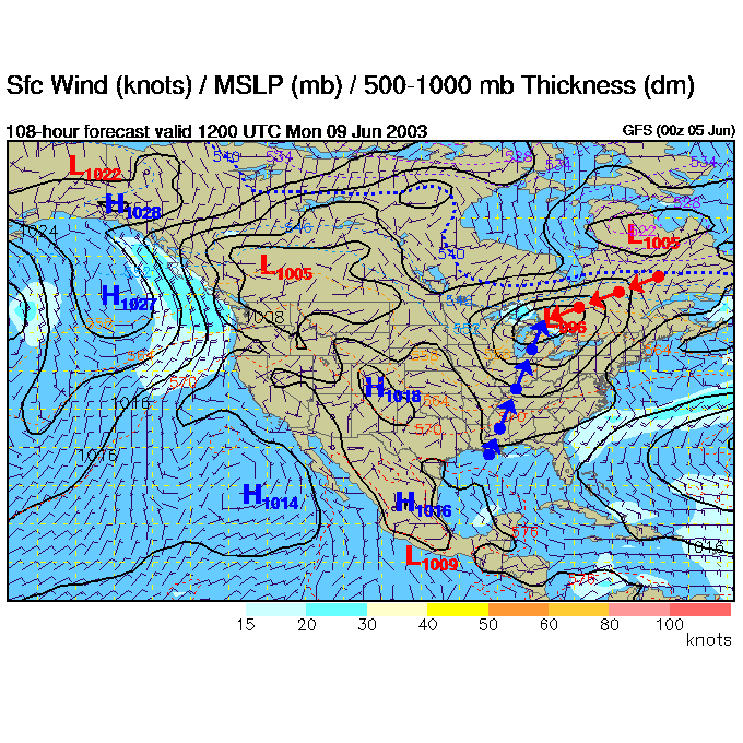
There will be another chance of rain due to a short wave (a ripple in the pattern in the 500mb wind flow, or a bubble of cool upper level air) moving over the area... more on that tomorrow. Enjoy the warming and drying out for a day or so!
Meteorologist John Ensworth, M.S.
(This page sometimes contains sources from AccuWeather.com www.accuweather.com ).