Back To Home
The Story Behind the Weather - By Forecaster John
Ensworth M.S. -
The Discussion of Weather Events Daily for Philadelphia and Pennsylvania
last updated: 09/14/2003 02:24 PM
Welcome to another week! Are you ready for a warm up? Here comes one.
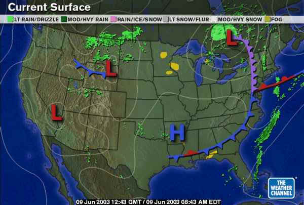
But first, a quick glance at the current surface map, we can see the weekend's system departing to the east of us. Because there is cold air aloft, as the June sun warms the ground, we might see some isolate thunderstorms pop up over eastern PA for the first part of the day. Don't worry though, these will be isolated and not severe. Behind this front is a BIG break. The next system (now visible over Wyoming, is expected to pass quite far to our north and only the northern few tiers of counties in PA will have a chance of rain Tuesday night.
For a glance into what is to come, we need to look at the change in the pattern of air flow over the US. For the last month we have had a near permanent trough (a southward dip in the air flow) over the eastern US. This has allowed storms to come to rest here and has kept cool air over the region (for most of the time).
But looking at the forecast for the next week from the ETA model (one of many models we can consult for an indication of what is to come). I've marked in red arrows the troughs sitting over the US for the near future. You can see the east coast one (now anchored over the Great Lakes and dropping to the Gulf of Mexico changing until it is way out in the Rocky Mountains(!) by Thursday. By that time, the wind will be coming from the southwest over Pennsylvania. This means (except for rain and clouds , now more convective/thunderstormy than before) more heat! We should see 80's and mid 70's for highs now (no more 50's for highs!).
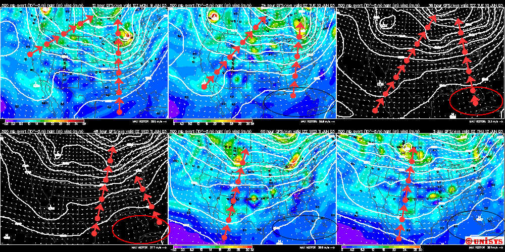
The red or black ovals over Florida (depending on the
background) show a ridge (northward bulge of air flow) that will bring lots of
heat and tropical moisture to the SE US. This could allow many more
hurricanes to make landfall this year. Watch out for that!
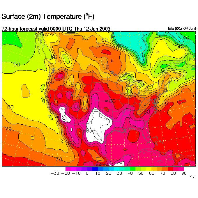
An example of the heating can be seen in the ETA forecast surface temperatures
for Wednesday afternoon. You can see warmth slipping up both sides of the Appalachians
toward PA. (That's a swamp in Florida!).
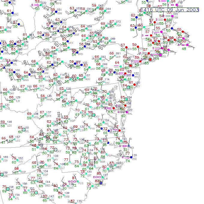
The next map is the current conditions this morning by station. Each place that someone is making weather observations is shown with a colored dot and the symbols and numbers around the dot tell what those weather conditions are. A clear one to see is the station AVP in northeast PA (which is Scraton ). It has a temperature (red and upper left) of 66F and a dew point (green lower left) of 57F. The pressure is marked small in grey to the upper right (091 = 1009.1mb), and (importatnly for us) the winds are marked by the arrows with feathers you can see. The wind direction is from feathers to the small station ball. So the winds at AVP are from the southwest. The wind speeds are marked by how many feathers there are. The whole barb is 10knots (almost 10 mph), a half barb is 5, and a triangle is 50knots. So the wind speed at AVP is from the southwest at 10knots.
From this map you can see that ahead of the occluded front to our east the winds are weak out of the southeast, and from the west southwest at a good clip )up to 20 knots or so). These west winds spell drying and warming. Get out the shorts!
Until tomorrow... Have a great day!
Meteorologist John Ensworth, M.S.
(This page sometimes contains sources from AccuWeather.com www.accuweather.com ).