Back To Home
The Story Behind the Weather - By Forecaster John
Ensworth M.S. -
The Discussion of Weather Events Daily for Philadelphia and Pennsylvania
Last updated: 09/14/2003 02:25 PM
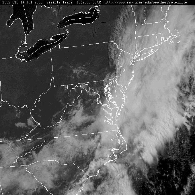
Good Monday morning to you... Jumping right to the visible satellite picture, you can see there are clear skies just a few miles to our west! The rain and clouds are associated with a nearly stationary front just to our south and east.
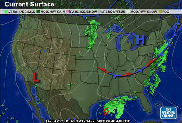
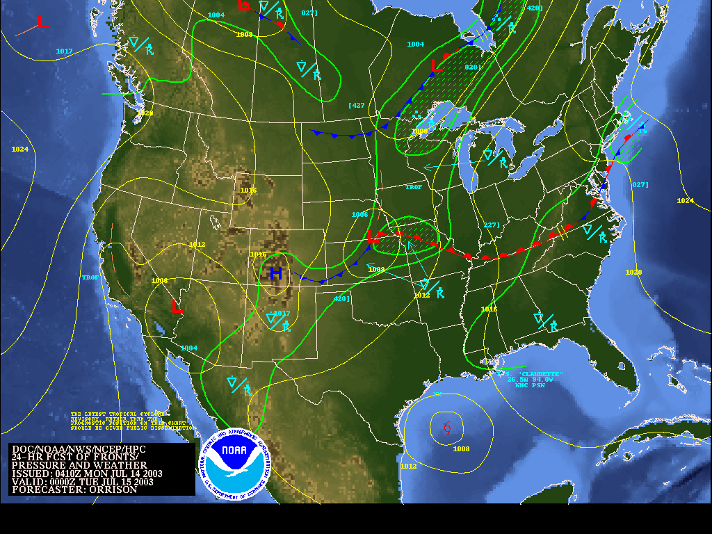
You can see this old front on the surface map below. Because it isn't moving very quickly, moisture from the south is sliding gently up from the south, getting lifted and cooled to the point where water condenses out to make clouds and rain (the dew point) and raining just north of the boundary... which is just barely Philadelphia.
(Look out in the northern plains... there is the next chance of rain by Wednesday. More on that below...)
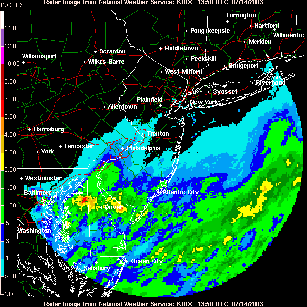
This morning's radar reflectivity image shows that the rain showers are 'just barely' hitting Philadelphia. It won't last long as it travels up to the north east (and you can see the end of the rain just to our southwest).
The rainfall totals for the last day shows that some seriously heavy rain hit Baltimore and eastward, but we only picked up (so far) about a tenth of an inch. We won't get much more this late morning and noon time.
This front is hung up on the right side of a big trough sitting on the east coast (the large purple dotted line over the eastern US on the 500mb map below. This map shows how the wind is flowing (parallel to the dark lines) from west to east across the continent). This is also bringing us slightly cooler and drier air than we've had much of late June and early July. The next system (for Wednesday) is associated with the short wave (the smaller purple dashed line out on the northern Plains - over the Dakotas and Nebraska).
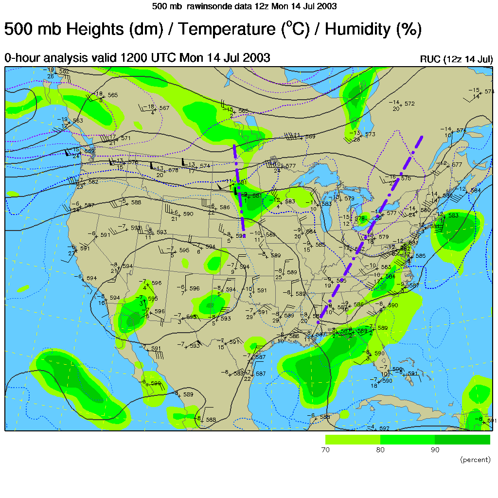
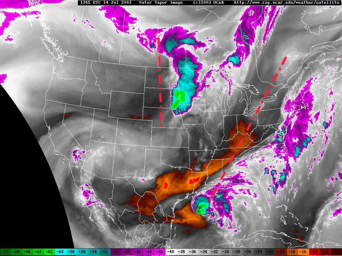
The water vapor satellite picture (which shows the amount of water vapor in the middle/ lower levels of the atmosphere... the reds/oranges are dry sinking air, the whites to purples are very moist, the blues and greens are icy tops of thunderstorms and rain clouds) shows (in red dashed lines) the same two waves - the big one on the east coast and the smaller one coming from the west. Both have rain and convection on their right side.
The forecast map for 8pm tonight shows that the front hasn't really gone anywhere and there is a chance of more shower activity to form just where it is right now over the Philadelphia area and southeast Pennsylvania. At least that keeps it cooler!
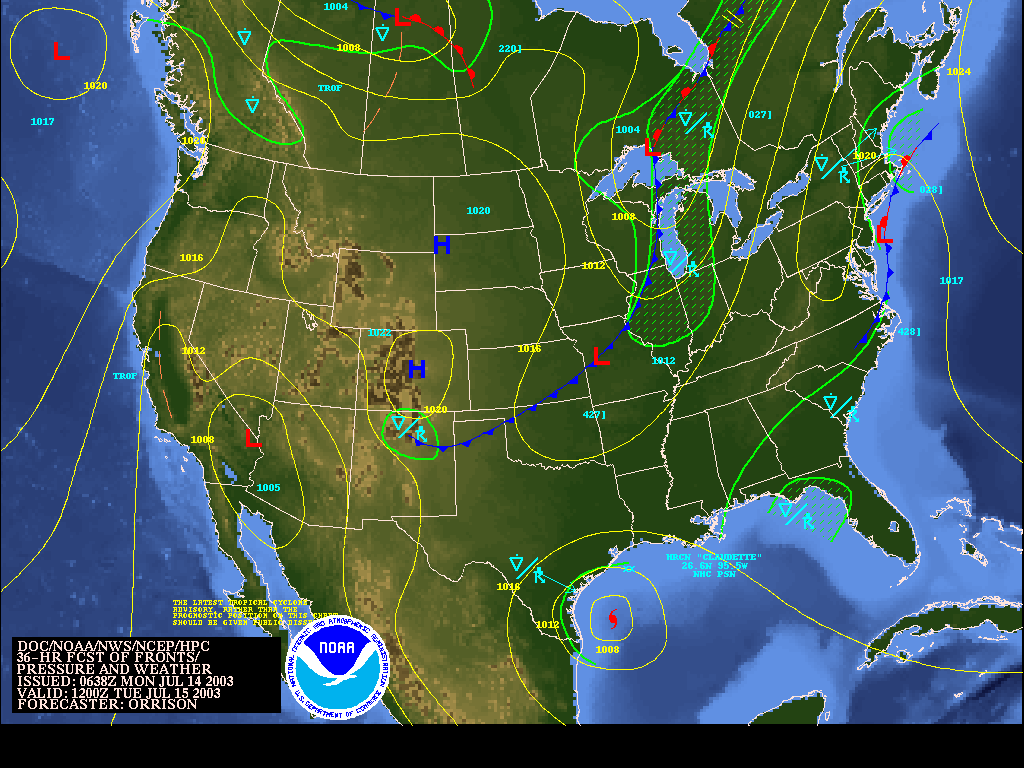
By Tuesday morning 8am, the system over the Great Lakes is getting closer, and the progression of that short wave had nudged the trough over us and the front near us a bit further east giving us clearing skies. Woopiee! (Note Claudette had become a hurricane in the Gulf of Mexico!).
Tuesday night, the front is getting stronger and moving toward us, but the weather locally will still be very nice.
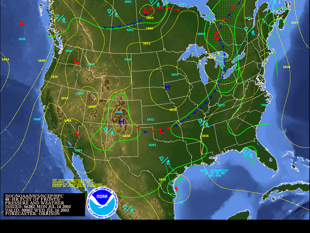
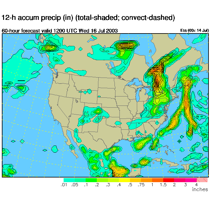
Switching to another forecast surface map to move out to Wednesday morning, we see the front is finally affecting us with rain and thunderstorms...
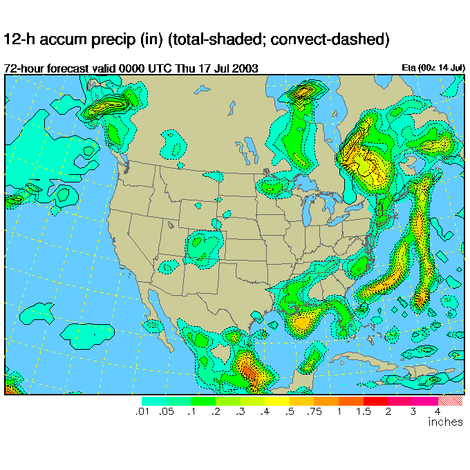
But by Wednesday night (8pm - midnight ish) this new front is heading off the coast having done it's worst.
So we'll keep getting periodic breaks in the heat and humidity and rain to water the lawns and gardens. The hurricane in the Gulf will not, ultimately, have any effect on us, but will be interesting to watch. You don't want to live near Corpus Christi right now.
Meteorologist John Ensworth
Surface Station sky cover color key:
Flight category definitions:| Category | Ceiling | Visibility | |
|---|---|---|---|
| Low Instrument Flight Rules LIFR* (magenta circle) |
below 500 feet AGL | and/or | less than 1 mile |
| Instrument Flight Rules IFR (red circle) |
500 to below 1,000 feet AGL | and/or | 1 mile to less than 3 miles |
| Marginal Visual Flight Rules MVFR (blue circle) |
1,000 to 3,000 feet AGL | and/or | 3 to 5 miles |
| Visual Flight Rules VFR+ (green circle) |
greater than 3,000 feet AGL | and | greater than 5 miles |
| *By definition, IFR is ceiling less than 1,000 feet
AGL and/or visibility less than 3 miles while LIFR
is a sub-category of IFR. +By definition, VFR is ceiling greater than or equal to 1,000 feet AGL and visibility greater than or equal to 3 miles while MVFR is a sub-category of VFR. |
|||