Back To Home
The Story Behind the Weather - By Forecaster John
Ensworth M.S. -
The Discussion of Weather Events Daily for Philadelphia and Pennsylvania
Last updated: 09/14/2003 02:27 PM
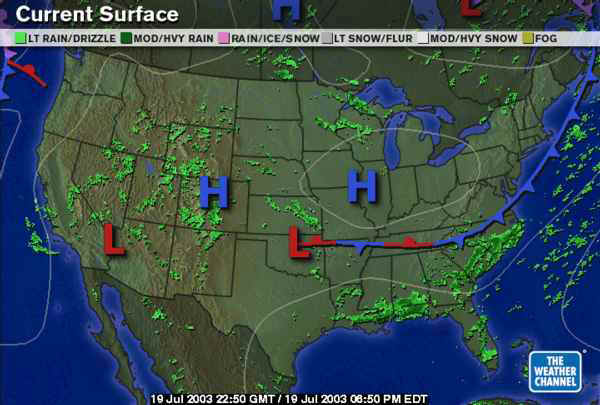
A great afternoon to you! We may be warm, but we are cooler than normal and a bit drier than normal. The front that passed is south of us by a state and a half. High pressure continues to build in over us through the weekend. This is a weekend to remember (unlike the swath of the country from S. Arizona to Oklahoma and Texas where temperatures are well above 100 and dew points are high).
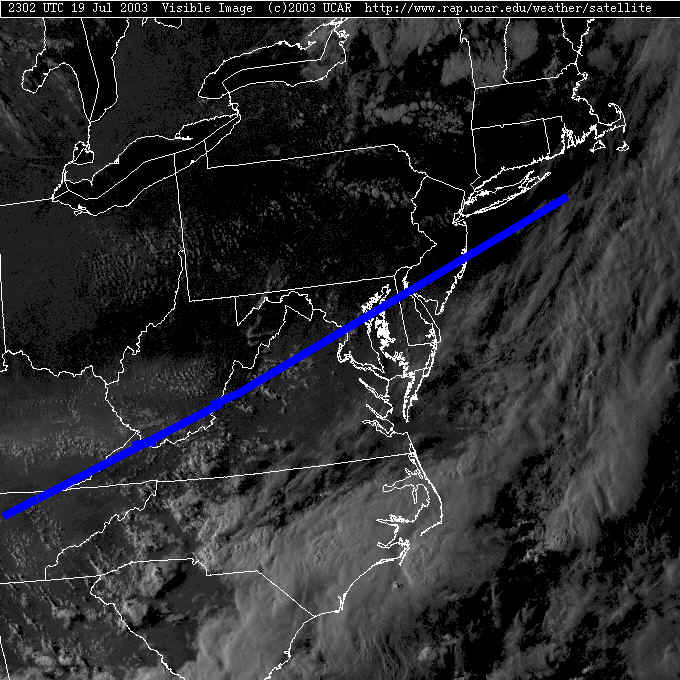
The visible satellite image shows a few cumulus building up in the cool air aloft across the north, but nothing significant statewide. It is interesting to note the moisture in the atmosphere visible south of the cold front (the hazy grays on the satellite picture below).
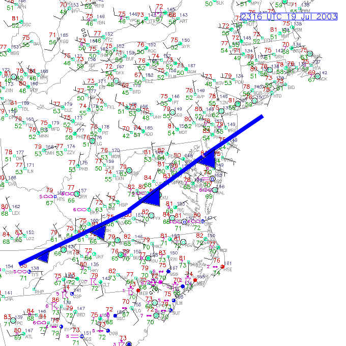
Looking at the surface observations, where the gray haze is worst, the dew points (the green numbers expressing the amount of water vapor in the atmosphere - high values = more water vapor and more discomfort) are in the 60's. Muggy! We are in the 50's (with 40's at the other end of the state). This just feels nicer.
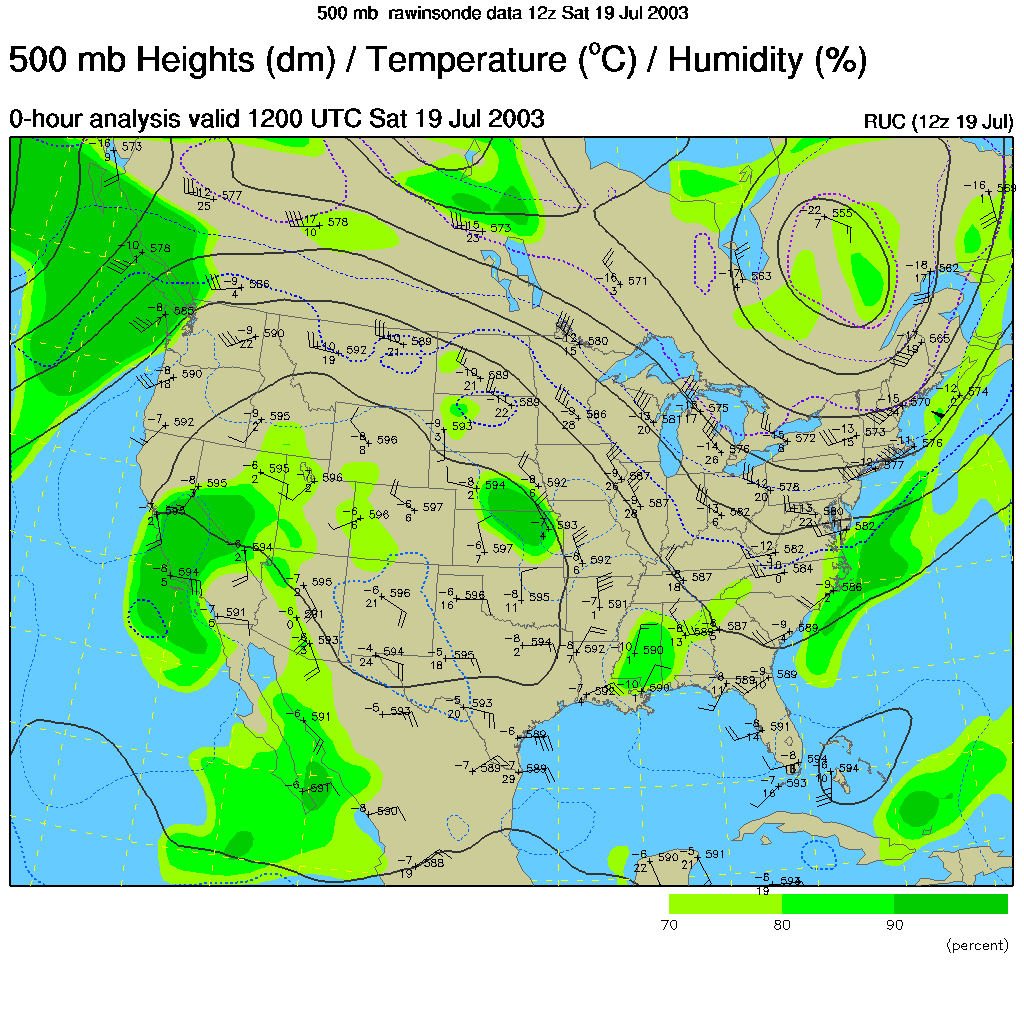
The reason for the nice weather is the upper air pattern (that is in response to the front to our south). The big dip southward in the winds at the 500mb height (half way up 'pressure-wise' in the atmosphere at about 18,000 feet) means cool air is in place. The air flowing over our heads is coming from Canada and the polar regions.
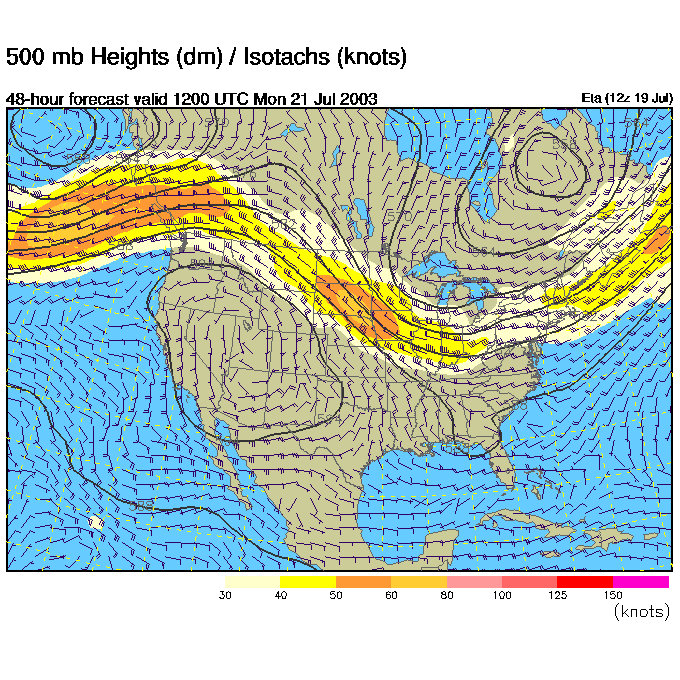
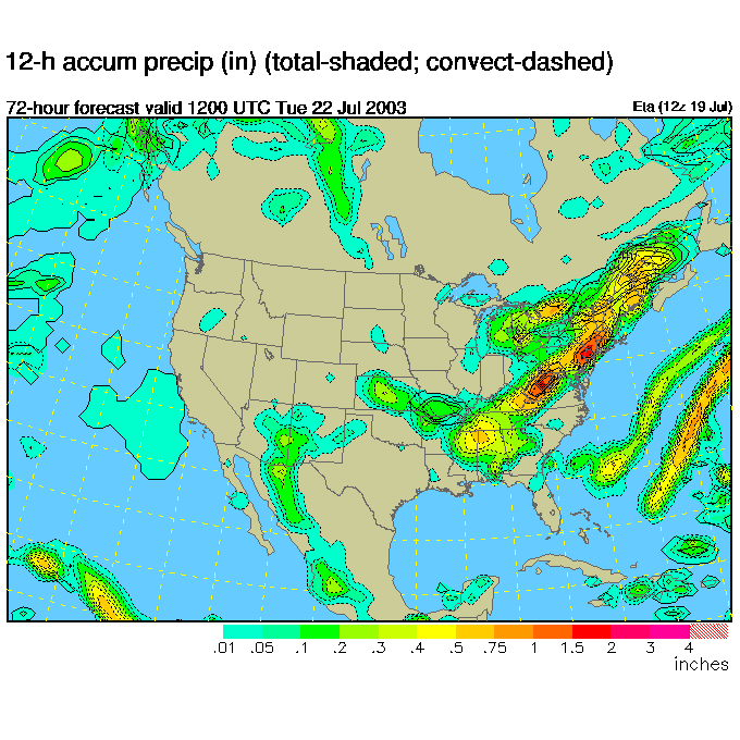
This pattern is going to change as the week begins yielding a good chance of rain every day of the week Monday through Thursday. Yuck (and it will get warmer!). This map is the forecasted 500mb map for Monday morning 8am. The trough had moved westward (retrograded) putting us in the uphill side of the flow. The air over us will be coming from the south (where there is serious levels of heat and humidity) and the rising motion in the atmosphere is stronger on the right side of a trough. We will see an increased chance of storms starting Monday.
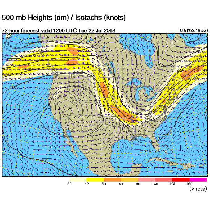
Tuesday morning shows much the same except the trough is getting stronger. More clouds, heat and storms.
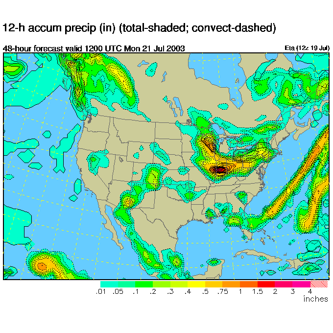
Here is the forecast surface precipitation for Monday morning. The rain is rapidly spreading across the state from the west. We should have a good morning drive to work, but a wet drive home.
Monday night... rain!
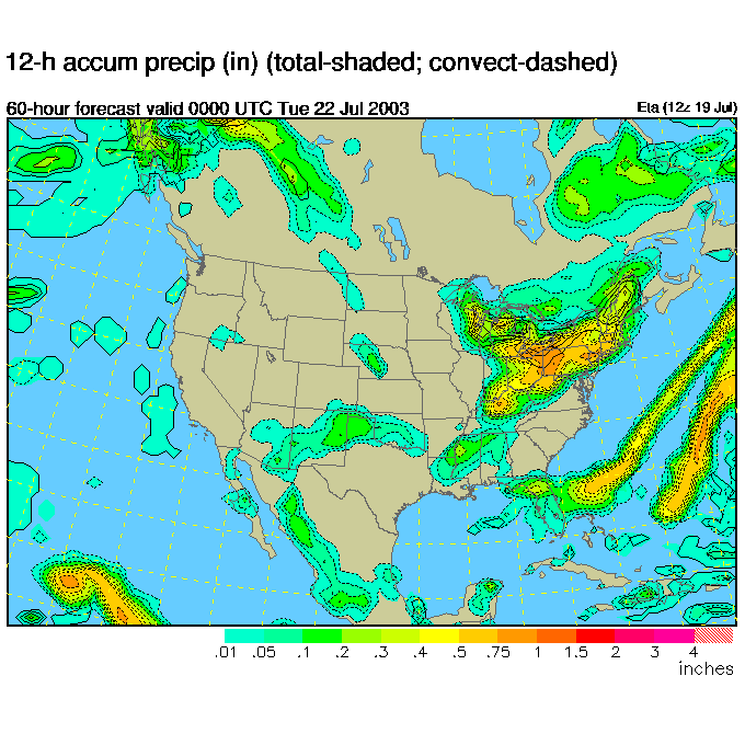
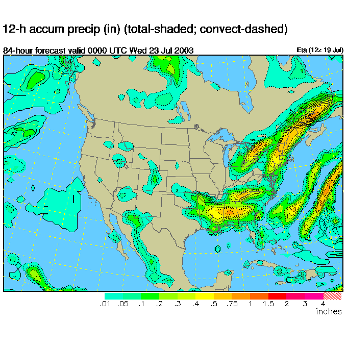
Tuesday 8am, thunderstorms and rain!
...and Tuesday night... more rain.
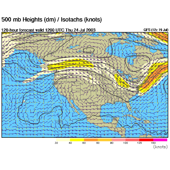
Switching to another computer model to go further into the future, Thursday morning 8am, we see the 500mb trough moves back to the east, on top of us, moving the showers off to the east again.
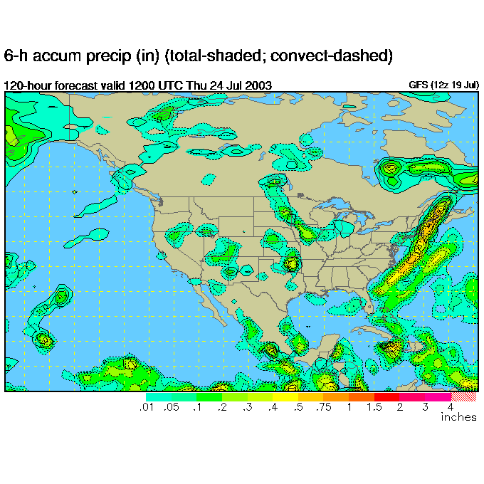
The surface precipitation forecast, 8am Thursday, shows the last of the rain still hitting Philadelphia, but on it's way out.
We should dry out again and cool down a bit in time for next weekend. We'll watch this progression live all week.
Until Monday, have a great weekend!
Meteorologist John Ensworth
Surface Station sky cover color key:
Flight category definitions:| Category | Ceiling | Visibility | |
|---|---|---|---|
| Low Instrument Flight Rules LIFR* (magenta circle) |
below 500 feet AGL | and/or | less than 1 mile |
| Instrument Flight Rules IFR (red circle) |
500 to below 1,000 feet AGL | and/or | 1 mile to less than 3 miles |
| Marginal Visual Flight Rules MVFR (blue circle) |
1,000 to 3,000 feet AGL | and/or | 3 to 5 miles |
| Visual Flight Rules VFR+ (green circle) |
greater than 3,000 feet AGL | and | greater than 5 miles |
| *By definition, IFR is ceiling less than 1,000 feet
AGL and/or visibility less than 3 miles while LIFR
is a sub-category of IFR. +By definition, VFR is ceiling greater than or equal to 1,000 feet AGL and visibility greater than or equal to 3 miles while MVFR is a sub-category of VFR. |
|||