Back To Home
The Story Behind the Weather - By Forecaster John
Ensworth M.S. -
The Discussion of Weather Events Daily for Philadelphia and Pennsylvania
Last updated: 09/14/2003 02:27 PM
Good morning everyone. Still not too bad out there. Maybe a bit humid and warm, but it has been worse. The big question on the plate today is...where will the remains of Tropical Storm Bill go?
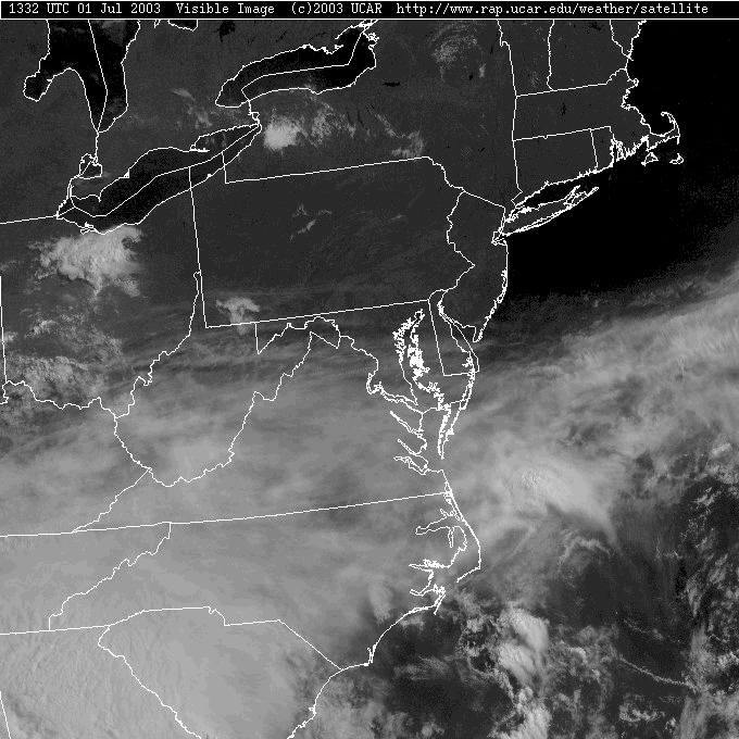
Right now, all the cirrus and lower cloudiness associated with Bill is to the south of the state. We have mostly clear skies overhead.
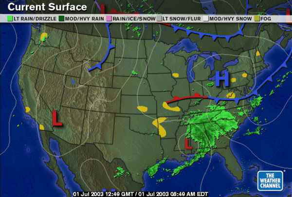
The surface map shows Bill sliding northeastward across southern Mississippi and our latest cool front acting as a buffer! The deep surface moisture will stay to the south of that boundary (for the moment).
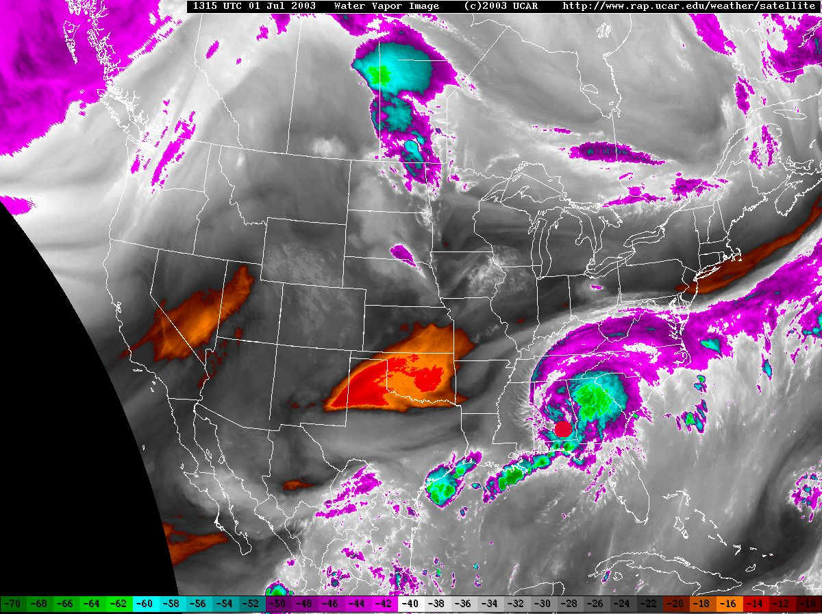
This next view is the Water Vapor Satellite image. The satellite is looking at microwave radiation that comes from water vapor in the middle of the atmosphere. Whites to purples and blues are very moist air. Darker colors to oranges and reds is very dry air. This image lets you se the huge plume of moisture over the entire southeast US ending just at our doorstep to the south.
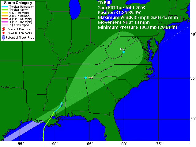
Bill is currently a Tropical Depression, meaning it has sustained winds 35mph or lighter. This does not say there aren't gusts stronger than that near thunderstorms though, and tremendous amounts of rain (5-8" in many places - especially higher elevation mountains) will fall.
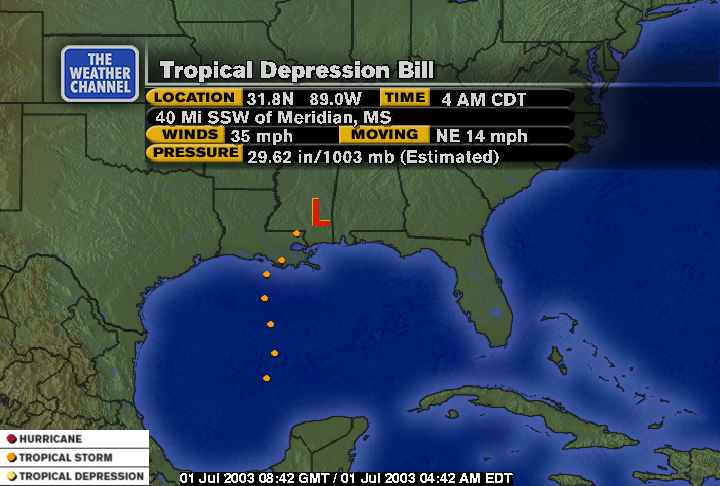
Looking at the graphic from The Weather Channel, they have it's future Tropical Depression life plotted heading right for southern Pennsylvania! Once it ceases to have a tropical nature (that is, warmer air inside it than the surrounding atmosphere...our normal lows are colder on the inside) they aren't plotting it anymore. Even AFTER it ceases to be a tropical low pressure system, it can still dump a lot of rain.
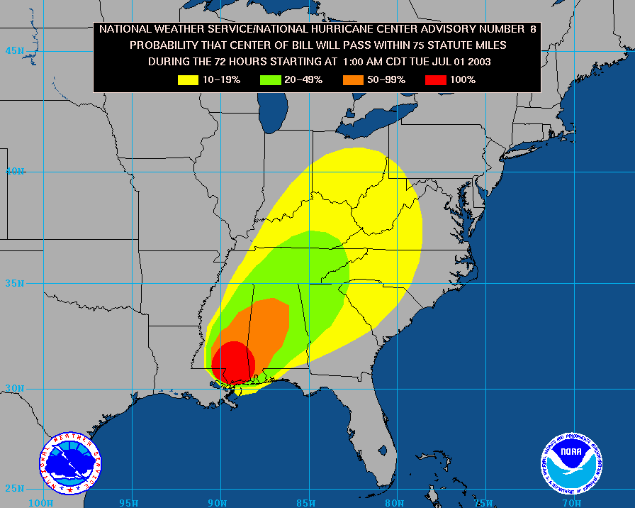
A look at the National Hurricane Center's forecast, it seems to be a bit to the west, still making a big impact on our state...
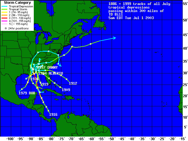
Looking historically, though, if you look at all the tropical systems in the past that have been (or passed through) the current position of this storm, you can see that few have threatened us. Climatologically, it is unlikely we will get a direct hit from the majority of the moisture. So is that the end of the story? Let's look at the models next...
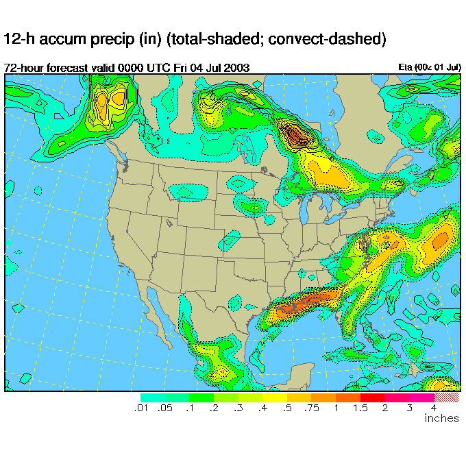
We'll look at the ETA model first. It has a bulls eye of falling rain south of the state (looking like the map above) just to our south by Wednesday night 8pm...
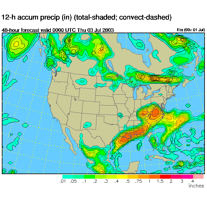
Then by Thursday night 8pm, the remains of Bill are pulling off to the east, still south of us. This would make us put a small chance of showers (mainly the southern half of the state, including here in Philadelphia) for Thrursday.
But the GFS model shows a different story. Here, by Wednesday night at 8pm, we see more rainfall over much of the eastern US, with some of it spreading into the state!
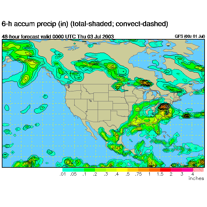
By Thursday morning 8am, we have a bunch of rain slamming the state.

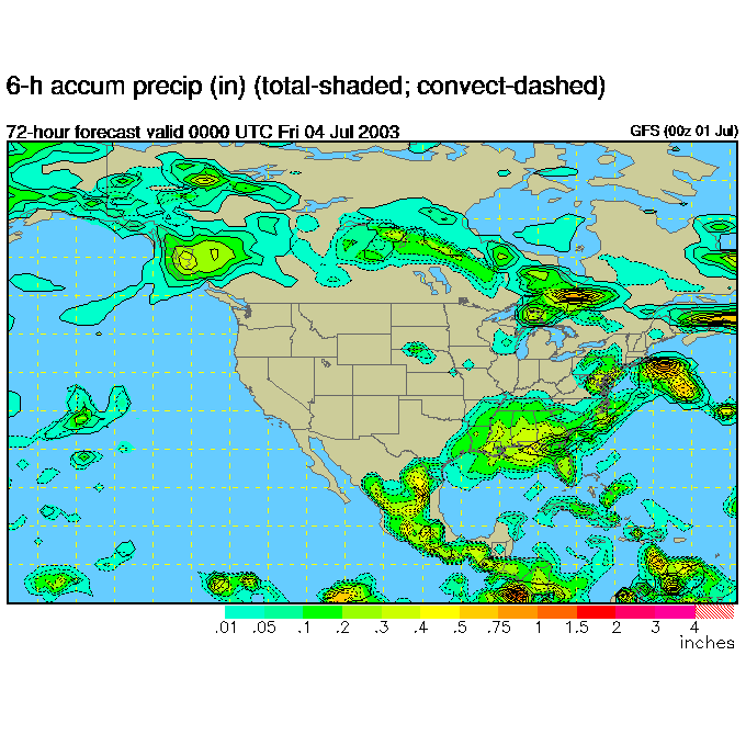
Then by 8pm Thursday, the center of the heaviest rain is pulling out to sea, but we still have showers all over the place.
The Weather Service is tending toward the ETA model and is only forecasting a 30% chance of rain for Thursday day. We'll watch it here to see what happens! Everyone seems to agree that the 4th of July and the weekend will be extremely nice though. We should have mostly clear skies with highs in the 80's and lows in the upper 60's. GREAT camping weather.
I'll be traveling Thursday through Sunday for the 4th of July, and these discussions may come in at odd times. I'll be here as my dialup connection allows!
Meteorologist John Ensworth
Surface Station sky cover color key:
Flight category definitions:| Category | Ceiling | Visibility | |
|---|---|---|---|
| Low Instrument Flight Rules LIFR* (magenta circle) |
below 500 feet AGL | and/or | less than 1 mile |
| Instrument Flight Rules IFR (red circle) |
500 to below 1,000 feet AGL | and/or | 1 mile to less than 3 miles |
| Marginal Visual Flight Rules MVFR (blue circle) |
1,000 to 3,000 feet AGL | and/or | 3 to 5 miles |
| Visual Flight Rules VFR+ (green circle) |
greater than 3,000 feet AGL | and | greater than 5 miles |
| *By definition, IFR is ceiling less than 1,000 feet
AGL and/or visibility less than 3 miles while LIFR
is a sub-category of IFR. +By definition, VFR is ceiling greater than or equal to 1,000 feet AGL and visibility greater than or equal to 3 miles while MVFR is a sub-category of VFR. |
|||