Back To Home
The Story Behind the Weather - By Forecaster John
Ensworth M.S. -
The Discussion of Weather Events Daily for Philadelphia and Pennsylvania
Last updated: 09/14/2003 02:28 PM
Good Morning! We've got a LOT to talk about... here we go...
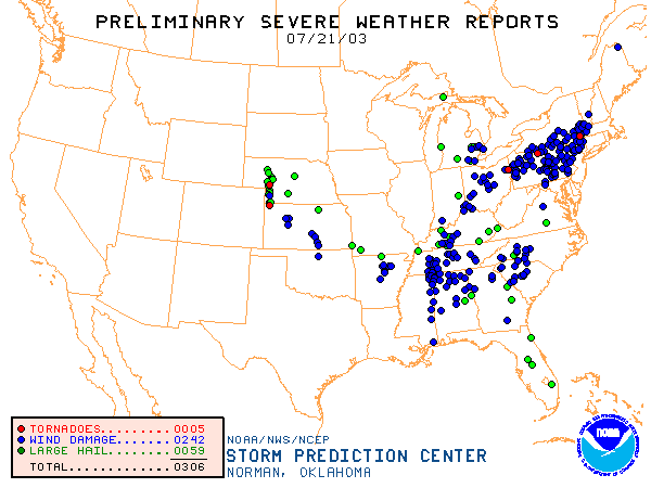
The front and a healthy shortwave (a bubble of cool air in the upper atmosphere) combined to kick off some VERY strong thunderstorms yesterday. There were numerous reports of wind damage from them across Pennsylvania including near Philadelphia. There were even three tornadoes near the state. Wow, what a system.
The thunderstorms just skirted the city last night with just a sprinkle to a light splatter of water in Philadelphia proper, but heavy rainfall hit everywhere north of us and out west with rainfall at 2" to 4" over a wide area. Amazing!
The front is stationary to our west and will help launch new thunderstorms as more short waves ripple toward us. This is a static pattern for a few days. What you see is what you're going to get.
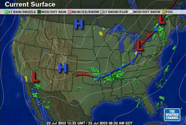
The National Weather Service surface map (and infrared satellite) shows a mish - mash of high clouds (yellows and blues) and a couple of frontal boundaries near Pennsylvania. The southern one is probably cool air that flowed out of the storms yesterday and last night. This is keeping rain and showers at bay today... the atmosphere has stabilized... for the moment.
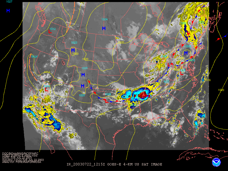
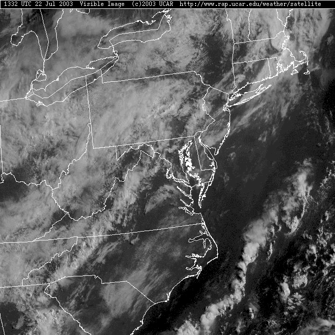
The visible satellite picture shows a brief break approaching (Philadelphia) from the west again, but thick clouds reign supreme over the eastern states with this front.
Surface winds are from the southwest and temperatures (the red numbers) are in the 70's near Philadelphia (and the 80's just to our south). Winds are out of the north over the Great Lakes behind the front, and temperatures are in the 60's back there. The warm moist (high dew points = green numbers) aren't far away and will return quickly to set us up for more rain and storms as early as this afternoon.
[A key to the sky conditions on the station circles is located at the very bottom of this web page.]
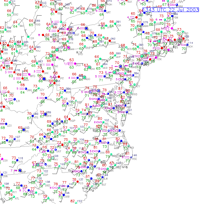
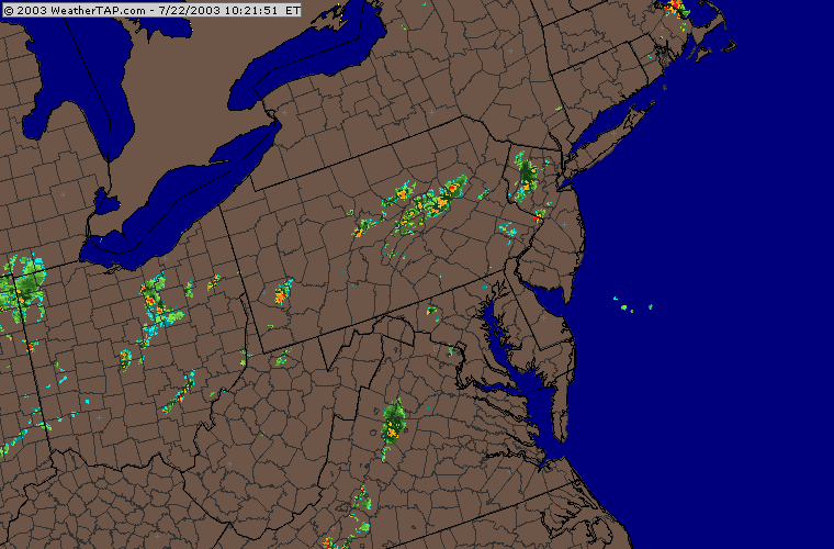
There are some showers and weak thunderstorms aligned east/west across the state with nothing threatening Philadelphia at this time. Things are MUCH more quiet today.
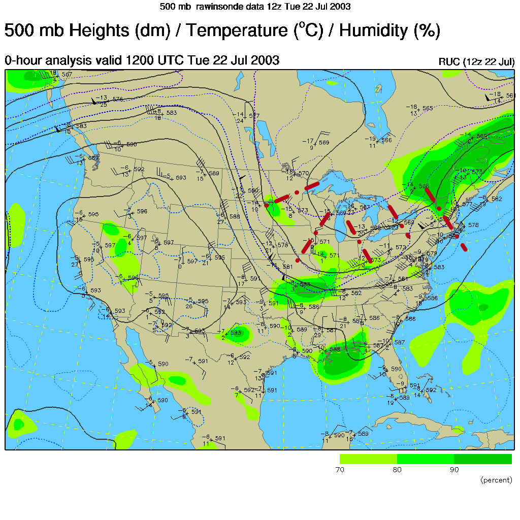
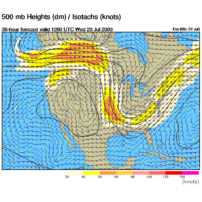
The 500mb map shows the air flow at about 18,000 feet (the steering level for storms in the atmosphere). There is a BIG trough in the eastern US that is the driving force behind the front and our storms. This is cool air and when it is located over warm air at the surface, the warm air wants to rise into it and make clouds and rain. The red dashes around the trough are hinted-at short waves. They are extra cool pieces of the atmosphere that can add even more kick to thunderstorm formation.
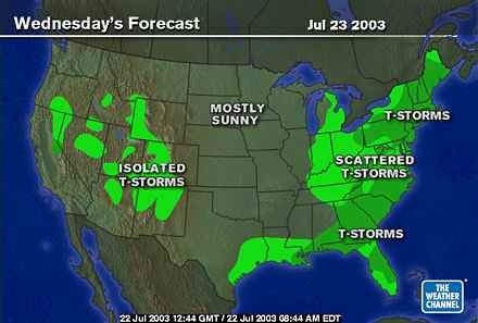
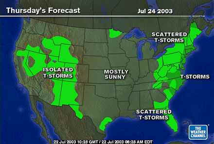
The weather channel shows rain and thunderstorms across all of the east. Period.

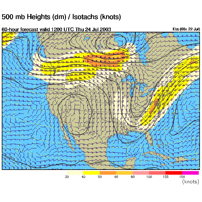
The 500mb map for Wednesday morning shows this trough even deeper, but not significantly moved. That means more of the same, waves of showers and storms.
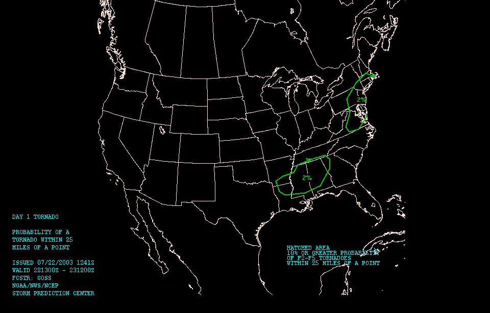
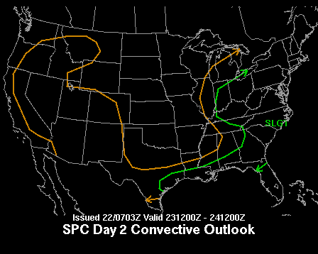
The Severe Storms Forecast Office is keeping us under a "Slight" risk of severe weather everywhere to the east of the front's location.

Specifically, for today, the green circled areas on the map below shows the slight (2% of F2-F5 tornado passing within 25 miles of a point - aka Philadelphia). But we do need to keep an eye on it.
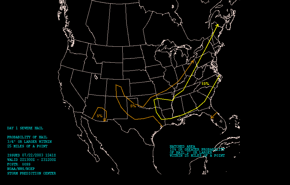
The main threat is for severe winds ( greater than about 65mph) here and...
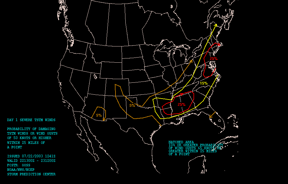
there is a risk of some hail as well. Today could be lively again.
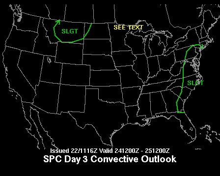
Tomorrow we are still under the slight risk and...
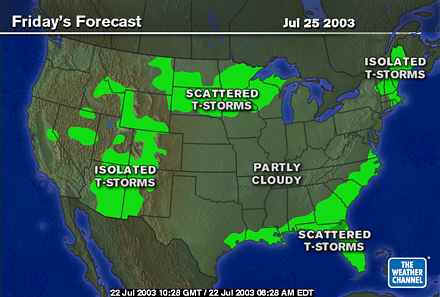
Thursday we are yet again having to watch the skies for the dark and dangerous thunderstorm.
Wednesday looks stormy (as already mentioned). Not much will have changed in the weather pattern yet by tomorrow.
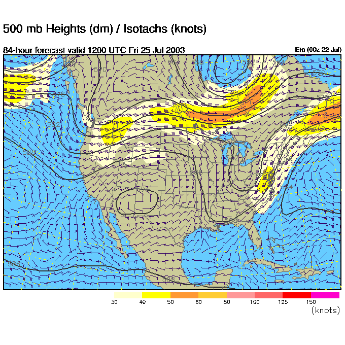
Then jumping to Thursday, we can see the 500mb pattern east coast trough even deeper (!) but it hasn't moved much to the east.
So Thursday still has showers and thunderstorms dampening our fair city.
Friday morning's 500mb map is shown below, and the trough finally begins to lift to the north and east...
And the main rain event is expected to be over with cooler and drier air flowing in.
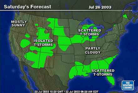
Saturday should be another WONDERFUL day, relatively cool and dry for July. Wait for it!
Then another front may be sagging down more from the north for Sunday, but we'll check on this as the week goes on.
Stay dry and take cover if the storms get wild today.
Meteorologist John Ensworth
Surface Station sky cover color key:
Flight category definitions:| Category | Ceiling | Visibility | |
|---|---|---|---|
| Low Instrument Flight Rules LIFR* (magenta circle) |
below 500 feet AGL | and/or | less than 1 mile |
| Instrument Flight Rules IFR (red circle) |
500 to below 1,000 feet AGL | and/or | 1 mile to less than 3 miles |
| Marginal Visual Flight Rules MVFR (blue circle) |
1,000 to 3,000 feet AGL | and/or | 3 to 5 miles |
| Visual Flight Rules VFR+ (green circle) |
greater than 3,000 feet AGL | and | greater than 5 miles |
| *By definition, IFR is ceiling less than 1,000 feet
AGL and/or visibility less than 3 miles while LIFR
is a sub-category of IFR. +By definition, VFR is ceiling greater than or equal to 1,000 feet AGL and visibility greater than or equal to 3 miles while MVFR is a sub-category of VFR. |
|||