Back To Home
The Story Behind the Weather - By Forecaster John
Ensworth M.S. -
The Discussion of Weather Events Daily for Philadelphia and Pennsylvania
Last updated: 09/14/2003 02:28 PM
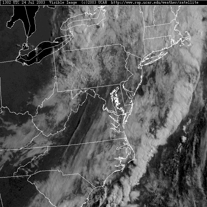
Good Morning! The skies are still mostly cloudy over Pennsylvania and the Philadelphia area. On this visible satellite picture, you can see deeper clouds lit up from the side by the rising sun in western New York State and NW PA, and again in a swath north and south out in the ocean to our east. The greatest amount of clearing is just around the southeast part of PA.
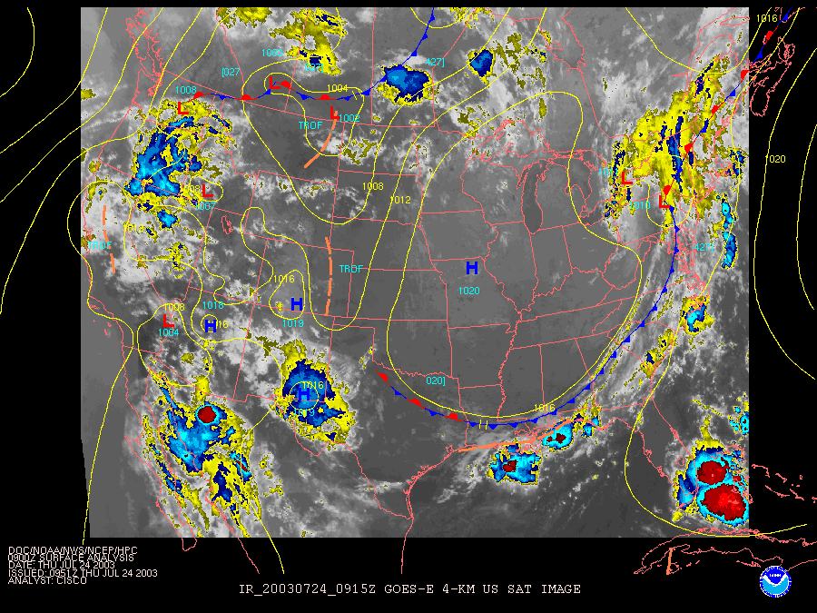
The surface map shows the front is just passing Philadelphia this morning with a Low pressure system just to our north. The yellows (and blues) on the background infrared satellite view are the coldest cloud tops and the places where the atmosphere is still getting some lift.
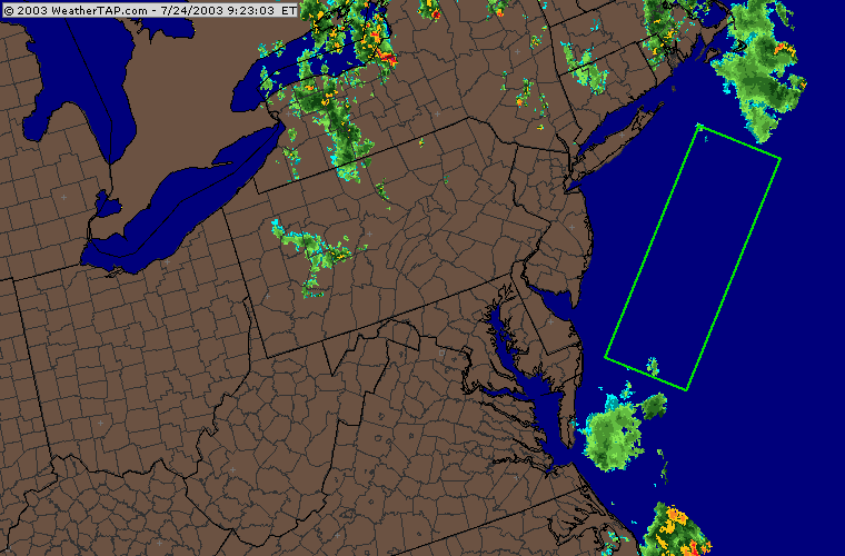
The radar image shows that rain, indeed, is occurring where the coldest cloud tops are located. The only exception seems to be the region where the green box has been drawn. There is rain north of this line and south of the line but what is happening inside the box? The answer is the limits of the radar! As the radar beam, which originates on the land, heads outward from the radar transmitter, it is passing through a higher and higher region of the atmosphere. The rainfall is just below the radar (literally) along this band. We are not normally worried about this lack of data since weather normally moves west to east and this precipitation is departing.
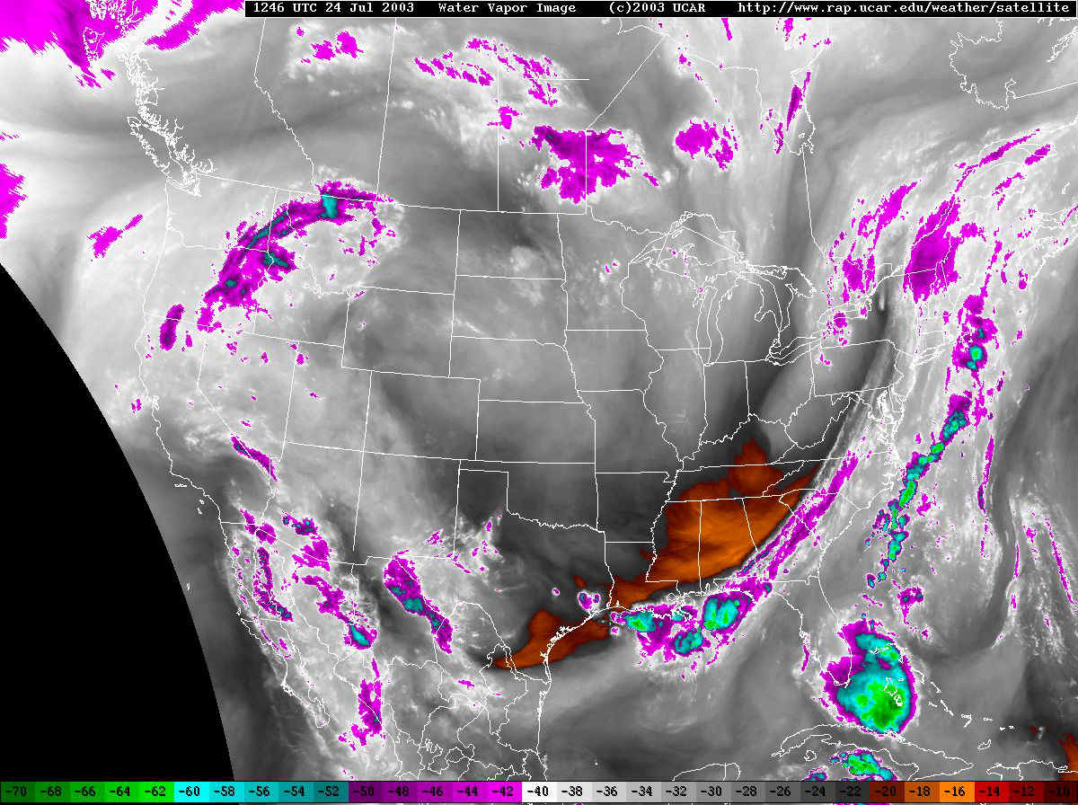
The next image is the water vapor satellite picture. It is showing us how much actual moisture is in the atmosphere. The whites are purples and blues are VERY moist air (or ice crystals and deep clouds for the blues). Blacks and reds are dry air. Pennsylvania has a good deal of water vapor still over it. With the front nearby and with moisture still around, we have a continued chance of showers today as the sun heats up the earth.
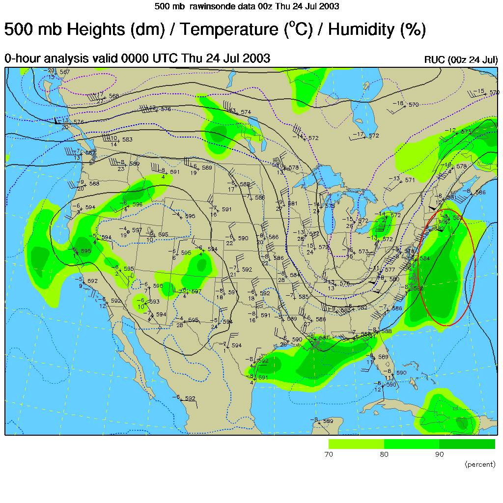
And interesting feature of the satellite picture is that it shows the flow of air at mid-levels in the atmosphere. See the big "U" in the eastern half of the US? Now go to the actual map of the winds at 500mb (or 18,000 feet) below...
Here you can see the big "U" in actual winds plotted. It is nice to have a backup in weather data. The "U" or trough is what was giving us our weather. The best lift and therefore the best place for showers and storms to form is in the area circled in red, on the right side of the trough. And that is where the offshore showers are! Nice.
Now we'll take those patterns and look into the weekend. The 500mb map for Friday morning shows the trough over the eastern US getting more shallow (marked with a blue line) and another trough moving into the northwestern US (marked in red).
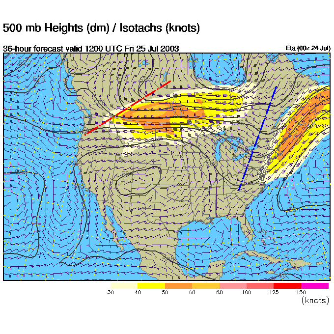
The showers expected for Friday AM are just to the right of the western trough. Our rain chances are near zero.
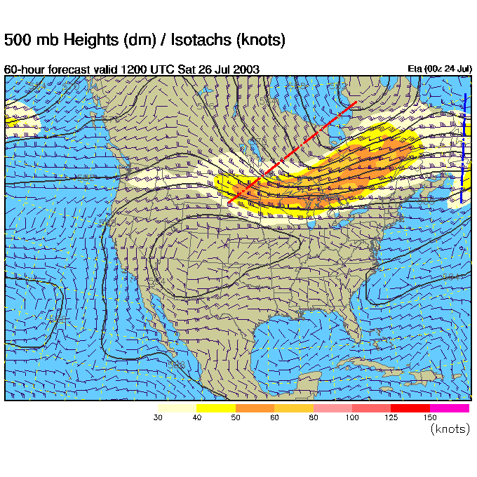
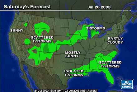
Saturday we see our eastern (blue line) trough almost off the map, and the western trough racing towards us. Ahead of this new trough are strong southwest winds from the hot and humid south. Expect a warm up!
At the surface Saturday AM we see the advancing trough moving a front forward across the US toward us.
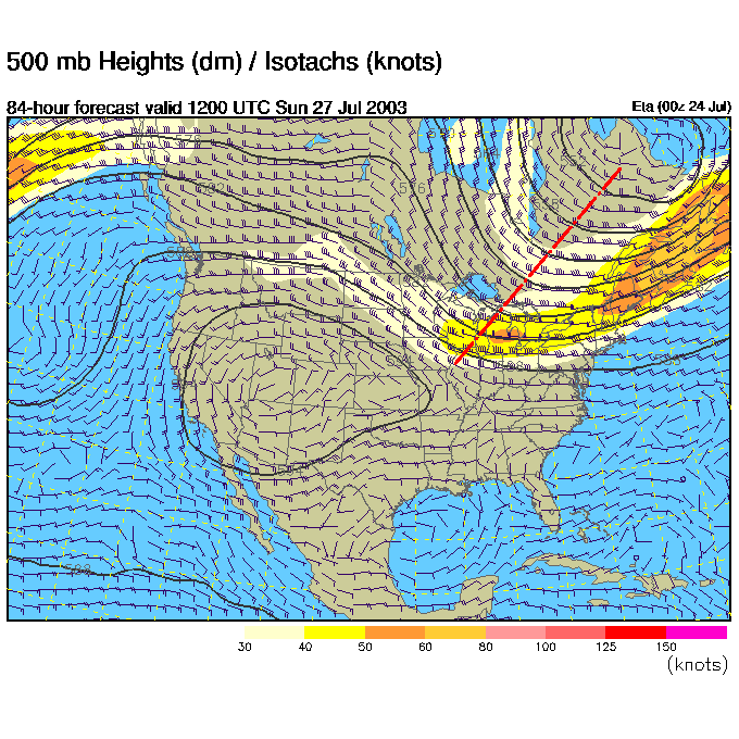
Sunday AM shows the new trough establishing itself over us (but tilted more to the southwest than the previous trough. The pumping of warm air will continue until the front arrives.
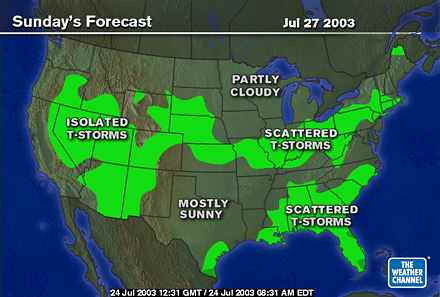
At the surface, we see the front giving us a chance of showers (in the warm and humid air).
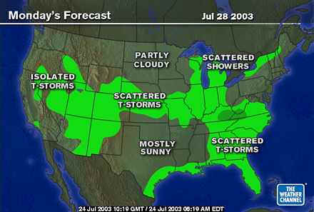
Then, on Monday, that front is to our south and slightly cooler and drier air returns.
You can't describe this weather pattern as stagnent or anything. It is FUN!
I'll see you tomorrow.
Meteorologist John Ensworth
Surface Station sky cover color key:
Flight category definitions:| Category | Ceiling | Visibility | |
|---|---|---|---|
| Low Instrument Flight Rules LIFR* (magenta circle) |
below 500 feet AGL | and/or | less than 1 mile |
| Instrument Flight Rules IFR (red circle) |
500 to below 1,000 feet AGL | and/or | 1 mile to less than 3 miles |
| Marginal Visual Flight Rules MVFR (blue circle) |
1,000 to 3,000 feet AGL | and/or | 3 to 5 miles |
| Visual Flight Rules VFR+ (green circle) |
greater than 3,000 feet AGL | and | greater than 5 miles |
| *By definition, IFR is ceiling less than 1,000 feet
AGL and/or visibility less than 3 miles while LIFR
is a sub-category of IFR. +By definition, VFR is ceiling greater than or equal to 1,000 feet AGL and visibility greater than or equal to 3 miles while MVFR is a sub-category of VFR. |
|||